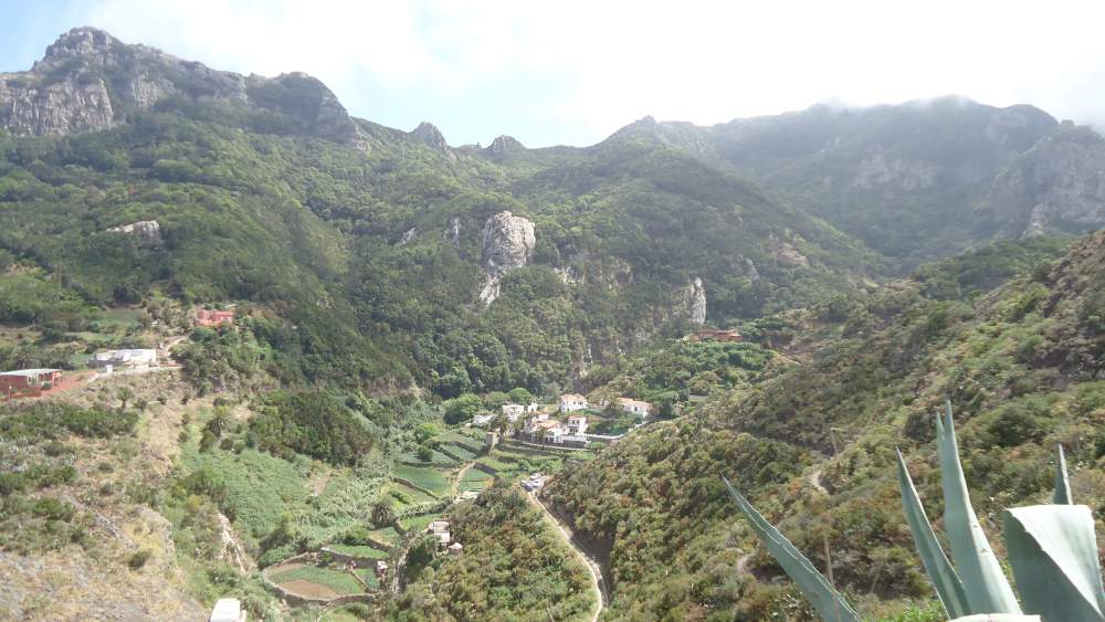
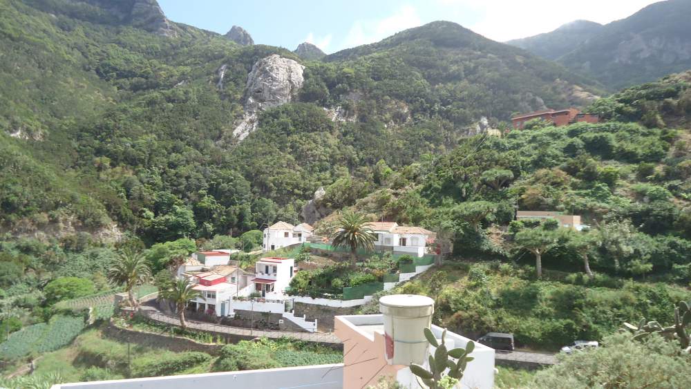
Chamorga faro de Anaga Tenerife tour is a great walk tour from Chamorga village to the Anaga lighthouse on the north-east coast of Tenerife. You will need between 3 and 5 hours for the tour. Chamorga is a tiny village on the north-east side of Tenerife Island. It is at an altitude of 470 meters above the sea, and directly below the Anaga rain forest, which only adds to its beauty. It is very remote, and probably the most tranquil place on the island. Do not miss a chance to visit it.
[Mozart Piano Concerto no 23, 2nd Movement]
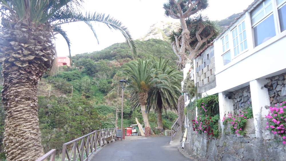
The access road to Chamorga
The road to Chamorga from Santa Cruz is one of the greatest attractions of the island, comparable to the most attractive roads I have seen in the Alps. It goes along the highest ridge of the Anaga park, reaching more than 800 meters above the sea. You may get some idea if you have a look in this map below which shows the road from the south coast to the main Anaga ridge, and then continues to the right toward Chamorga:
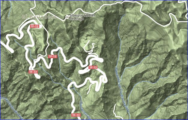
There is a public transport from Santa Cruz, a minibus line 947 which will take you from the city to the village in about 1 hours and 20 minutes. The bus goes only a few times per day, so better plan you trip carefully. The drive is breathtaking, with views sometimes toward the north and sometimes toward the south, and with many hard turns.
Chamorga – faro de Anaga tour
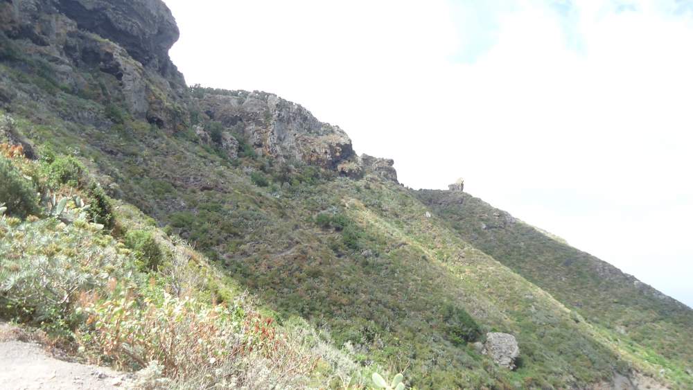
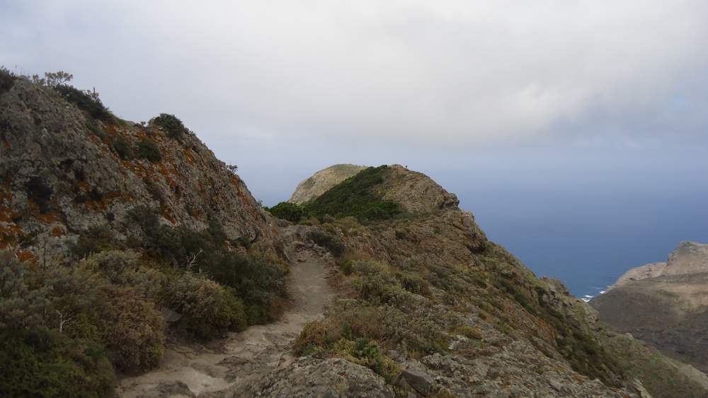
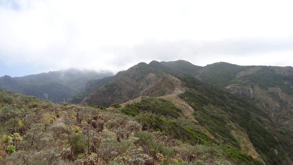
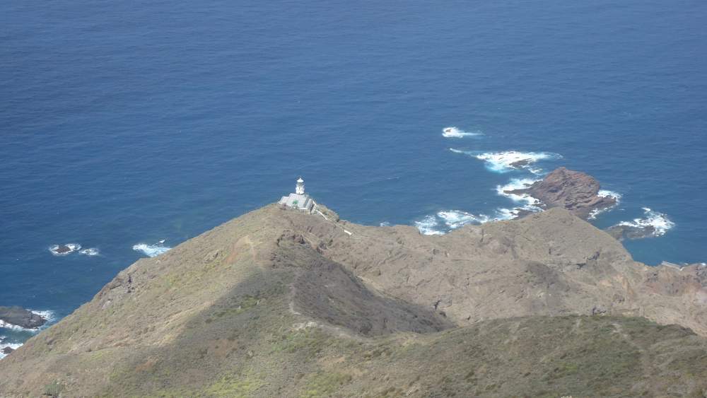
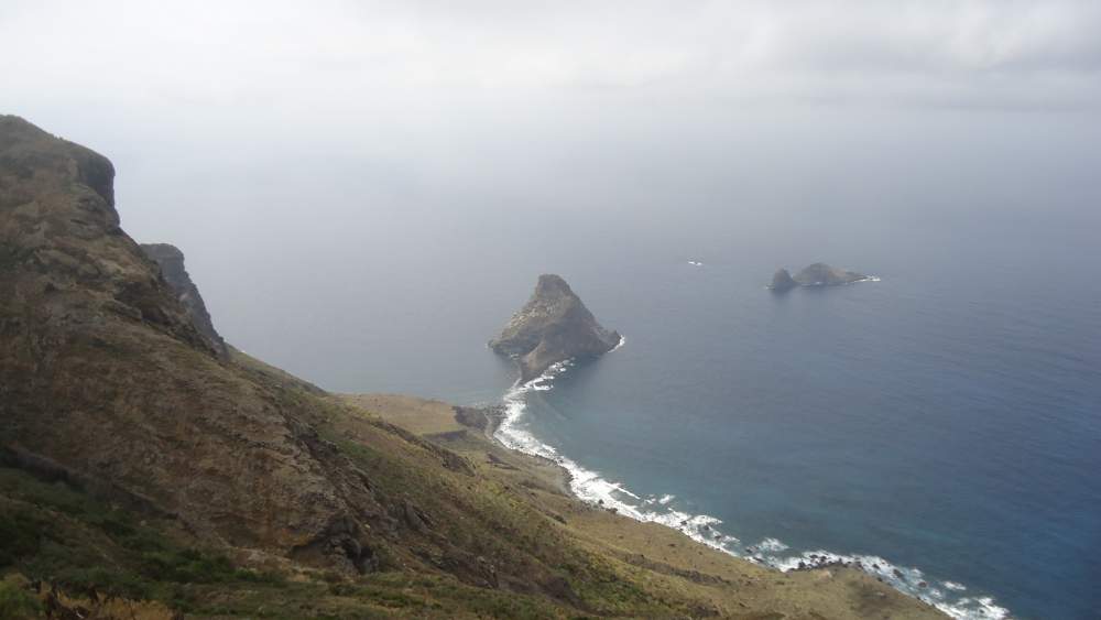
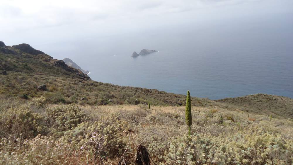
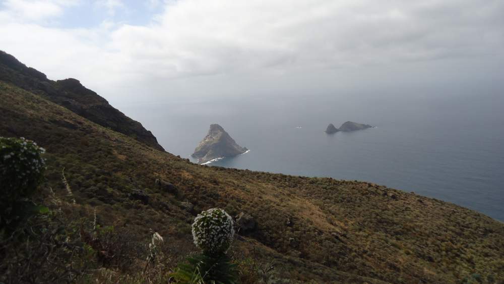
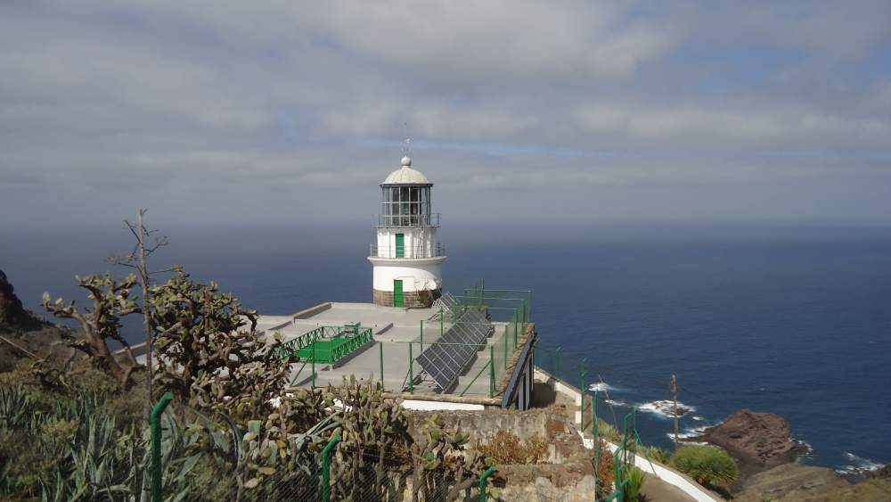
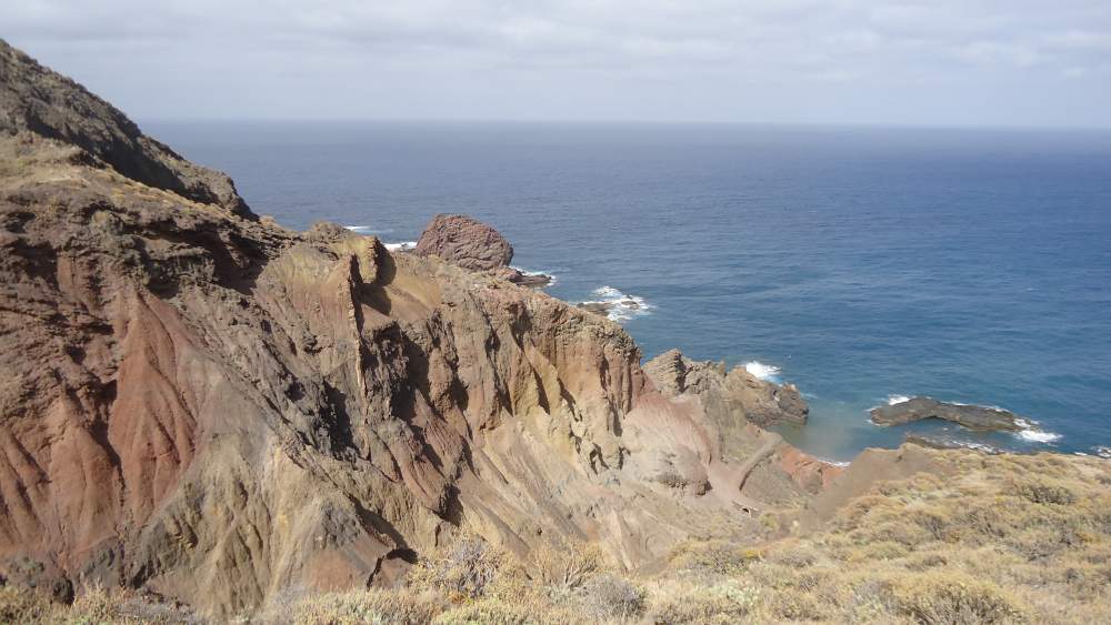
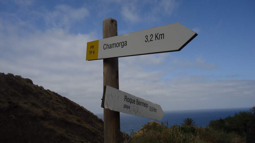
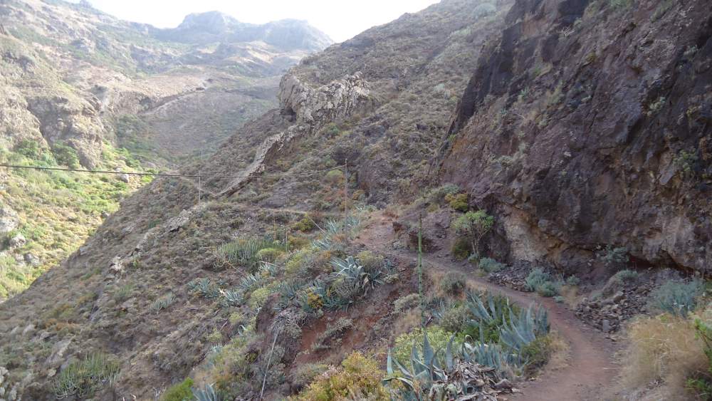
From the village, you will follow the sign toward faro de Anaga. The route starts directly from the village and it goes to Tafaga ridge. You will be gaining the height all the time and at its highest point, you will be above 600 meters of altitude. After passing ruins on Tafaga, you will arrive at a high point from where you will have your first view of the faro (lighthouse), which will be directly below you. On the left far below you will have beautiful Roques de Anaga described in my another post within this site.
I myself stayed there for some time enjoying the views. There was only a falcon making circles above and he was producing strong sounds, perhaps disturbed by my presence there.
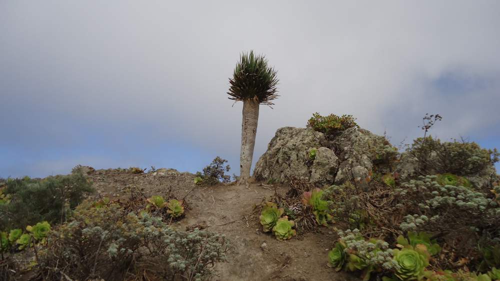
Here are some photos from this part of the tour. There are no people in photos, I was alone all the time and no other hikers around. This was probably because it was late afternoon already. I tried to get the falcon on a photo, but he did not mind being photographed, I made many shots but they were of a very bad quality.

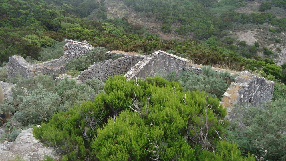
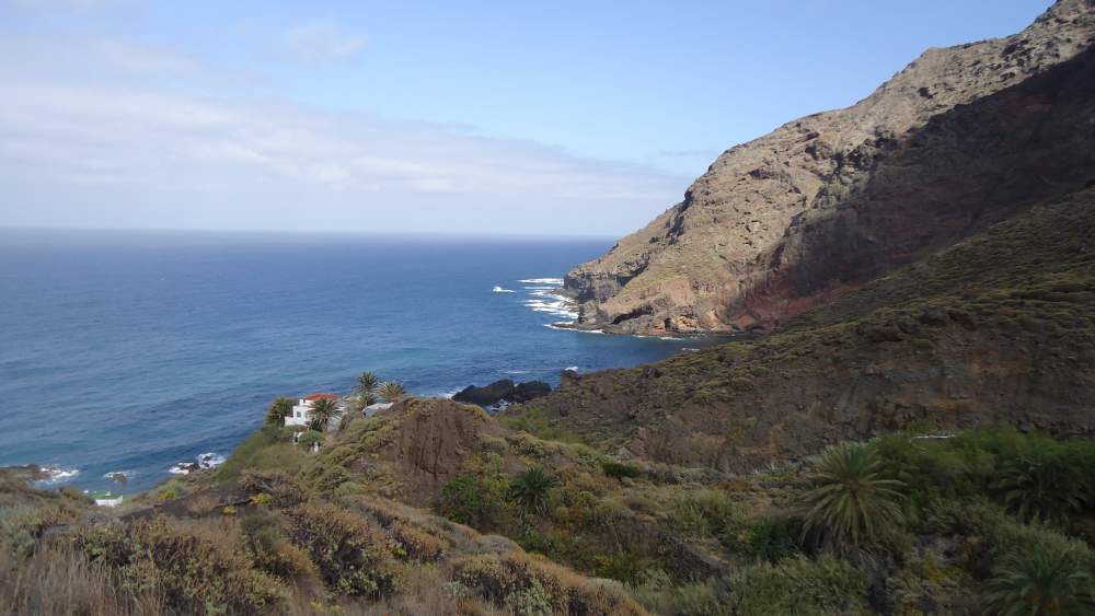
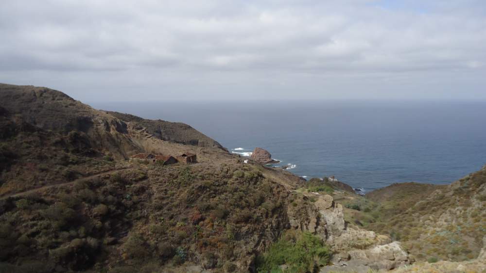
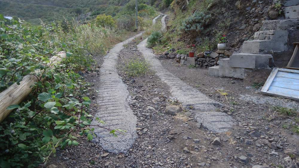
After enjoying beautiful scenery and tranquility of the east coast (only sound of the sea you will have here), I started my walk back. This was a walking path through a deep gorge and with a few abandoned old houses in the lower part of the route.
At the beginning of my walk back to Chamorga, I met 6 people carrying all equipment for sleeping in nature. I asked if it was allowed to camp, and they replied they would be ‘overnighting’ and not camping, so they were not concerned about restrictions. On the question where they would spend the night, I got the answer: “where we like the place”. I must say, I liked both the answer and the idea of staying outdoor.
Here are a few photos taken on my way back to Chamorga:

A few words about my timing. I came by bus (line 947 from Santa Cruz) and started my walk at 4:10 pm. I knew I had only one bus back to Santa Cruz, so I had to be fast. And I was indeed. After one hour I was at the Faro, although I spent some time on the peak above it. I was back in Chamorga at 6:45 pm, with plenty of time before my bus at 7:30. So this was a quick tour, 2 hours and 35 minutes, only half of the time which you will see mentioned in the WikiLoc map above.
I had 1.5 liters of water, just enough for this almost 9 kilometers tour. You will need ordinary hiking shoes, and walking poles if you have them.
Equipment
You do not need any special equipment to do this route. Here is a short summary:
| Recommended | Essential |
|
|
I hope you like my photos. Please leave some comment in the box below. And do not forget, read more about my other hiking tour on Tenerife:
If you are more for climbing, read here about my two solo tours to Teide, and in a group, and my solo climbs on Guajara, and Pico Viejo.
Here is a YouTube video which shows the same tour I described here:
Joe says
Thanks for the great info! Im looking forward to doing this hike next week. I was wondering, does this hike go through any of the rainforest area?
Jovo says
Hi Joe, you can make some variants here. So to get to the forest at least partly, from the bus station in Chamorga take the path in the direction of Draguillo and Cruz de Chamorga, you cannot miss it, it goes to the forest in the north direction. There is a hiking sign immediately at the bus stop. So go to the ridge (Cruz de Chamorga) and there you have a cross-section of the paths in several directions. So take the path which goes along the ridge in the east direction. This all is in the forest. You will have breathtaking views at some points. This will lead you to the path I described in the text.
Brigitta says
Hi Jovo,
Your photos and all your site about Tenerife is pretty inspiring. So we decided to do this hike in the middle of Feb. Would you tell us if need any permission to this area? We are staying in La Laguna. Is it worth driving to Santa Cruz first to have the fantastic route you mentioned?
Thank you for your help!
Cheers
Jovo says
Hi Brigitta, many thanks for such kind words, much appreciated. I love all those hikes and I hope it is felt in the texts. This particular tour is with nice views and you do not need any permit. Yes, definitely go to the south and then from San Andress towards Anaga and Chamorga. This all road is breathtaking and rural, you can see how ordinary people live there. I was on the island again a few weeks ago, mid-December, and passed that particular road again. Let me know if you need any further help.
Brigitta says
Thank you very much Jovo, now we’re looking forward to our hikings and climbing Pico de Teide as well.
Brigitta says
Hi Jovo and everybody,
We have done this hiking and you were absolutely right about the scenic driving. Anaga mountains are amazing humps. As we realized, people mostly climb up to Tafaga and then they disappear somehow, because we met only 3 guys at the Faro. (And several goats 🙂 On the way back to Chamorga we were completely alone and there was a huge wind, so be careful on the rocks. Anyway thanx again, for me it was a better experience, than Masca, which was too touristy.
Cheers,
Brigitta
Jovo says
Hi Brigita, great to hear that all was as you planned. Yes Anaga is a larger area than Masca and there are very different zones, with a rainforest in Pijaral and a dry area like Ijuana.
Ursula says
Hi Jovo,
We are planning our honey moon to Tenerife. Is it allowed to enter forest Anaga by rented car?
Many thanks,
Ursula
Jovo says
Hi Ursula, what a nice occasion and what a nice place for it. Yes to your question. The road to Chamorga is regular road, no restrictions. But some walking routes through the forest are restricted and I gave information about it in the site. I have described several routes in the Anaga area. Let me know if you need any help. Jovo
Alej and Marcos says
Thank you for this trip! We did it yesterday. Weather was very nice party cloudy so not too hot. The views and the nature are amazing!!! We just loved it! It took us 3h 15 min with photo breaks and 1 emergency stop (I fell down). So take water and snacks and good shoes and just go 🙂
Jovo says
Hey Alej and Marcos, great to hear from you. Reading your lines from wet and rainy Belgium, this brings nice memories back. Hopefully nothing was serious in that emergency situation. You know, there is a nice route from Chamorga to Roques de Anaga, directly from the center of the village, follow the sign to Dragillo. All the best. Jovo
Fisher says
That lighthouse and Roques de Anaga photos are truly awesome. If someone wants to be cut off from the modern world for a while (say when the WWIII explodes), this is certainly one of the places to go. Wonder if visitors are allowed to camp there.
Jovo says
Thank you Fisher. Great to read your comment. I visited Chamorga three times, and just today I was there again. Camping is not allowed on Tenerife, though there are some designated places for overnighting.
Colin says
This post brings back fond memories of some years back when I had an apartment in Playa de los Americas and used to walk some great routes on Tenerife.
I like your way of writing and the lovely photos. well done.
Jovo says
Thank you Colin, great to see your comment. I realize that you know the area so you can understand why I like it so much. Jovo
Stacey says
Hi Jovo,
Wow! This post made me want to stop what I’m doing and travel to Chamorga faro de Anaga Tenerife. I think I’m going to have to add it to my list of things to do before I die list. Absolutely breathtaking views! Thank you for sharing this post. I love to travel, and I am so glad I stumbled upon your site!
Jovo says
Hi Stacey, great to read your comment on one of my tours on Tenerife. Thanks a lot for the comment. There are so many nice spots on this island. Jovo