Ijuana Tenerife is a desolate and uninhabited area in the eastern part of Tenerife island. The region is one out of three areas on Tenerife that are under protection. Roughly speaking, it occupies several valleys to the east from the line Playa de Antequera (which is to the east of Igueste de San Andres) – Lomo de Las Casillas, all the way to the line Lomo de las Bodegas – Rogue de Bermejo in the far east of the island.
[Bach – Busoni: Toccata, Adagio & Fugue BWV 564 (II)]
The easiest approach from the land is from the road La Laguna – Chamorga. From the seaside, cliffs are very steep at many places but there are several beaches to approach by a boat. However, there are almost no paths from that side toward the Ijuana area.
Some claim that nearly 9 million people visit Tenerife throughout the year, which is a huge number for such a small island. I would say these estimates are not completely accurate, but one could speak about 5 million. So imagine such a unique desolate space like Ijuana in all this.
The map of Tenerife. The Ijuana park is roughly marked.
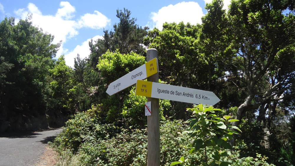
From the Chamorga road, there is only one path which leads to this area. It starts at the sharp turn to the left, which is at 3.4 kilometers from Chamorga, near the road to the cemetery. This road to the cemetery is well visible and you will not miss it. So you may park at the ‘main road’ (a funny word for such a narrow but beautiful mountain road) and follow the sign which shows the walking path to Chamorga. Walk several hundred meters till you get to the cemetery. From there just behind the corner, you will see the path to Chamorga going down the woods.
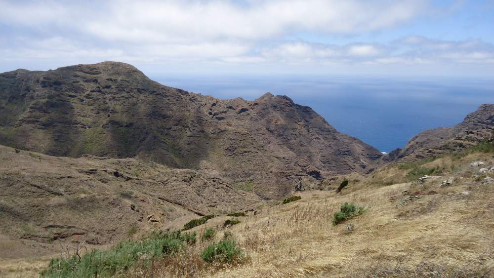
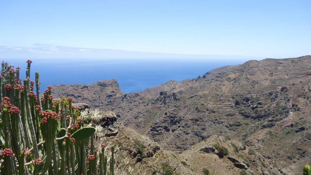
But do not follow this path. Instead, continue to your right side along a pleasant path toward the south. It continues all the way to the sea several kilometers away and it ends up at Playa de Ijuana. I did not walk all the way to the sea (simply was not interested in descending to the beach), but I have followed the path for about 1 hour and a half and stopped at the cliffs 460 meters above the sea.
Equipment
You do not need any special equipment to do this route. Here is a short summary:
| Recommended | Essential |
|
|
More about my tour to Ijuana
I started my tour at Igueste de San Andress, a small village on the south coast of Tenerife. To get there from Santa Cruz you take the bus number 945. See here more about the bus schedule.
You may go to the last stop and then walk back for a few minutes along the road through the village till the sharp turn. You will see the sign there for hiking tour toward Lomo de Las Casillas. So you follow the road (Carretera Lomo Bermejo) along the baranco (gorge) toward the north.
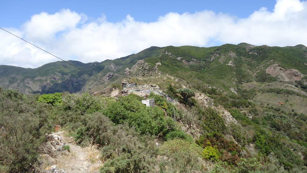
After a couple of kilometers you will see the signs on the right toward Las Casillas, so just follow it until you get there. At the altitude of 500 meters, you will be at the ridge, and there will be a sign for Antequera in the south, and for Las Casillas in the north direction. Follow the latter and soon you will pass Las Casillas. This is a group of a few houses, some of them obviously just ruins, at a very desolate place and with only footpath access from the south and from the north.
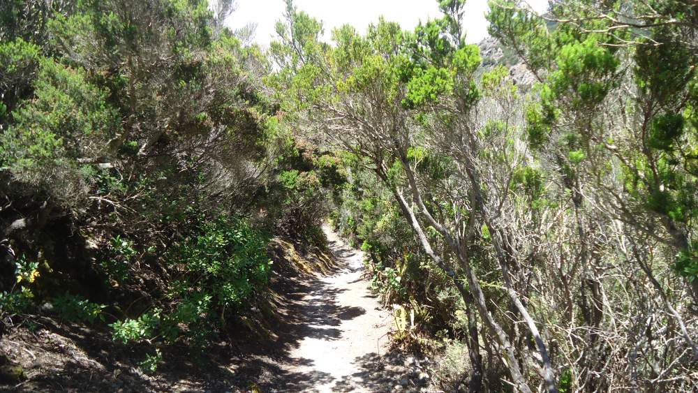
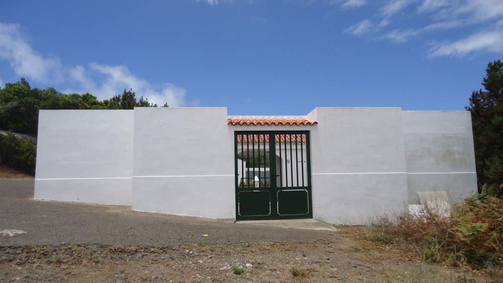
From Las Casillas the path is beautiful, you will descend for almost 100 meters and then it goes up again, and soon you will be on Chamorga road, exactly at the big turn and at the road toward cemetery mentioned above. You can see this point and the cemetery if you zoom in the map given here.
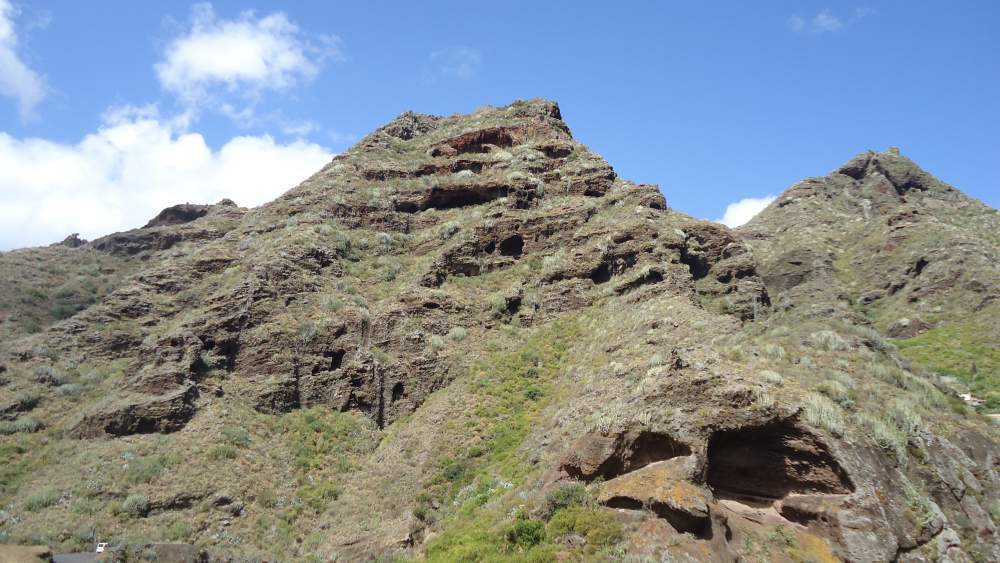
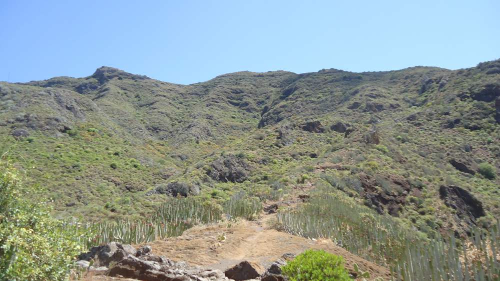
Here are a few photos from the part Igueste de San Andres – Chamorga road:
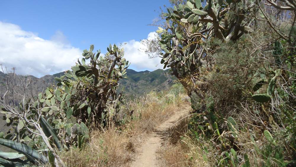

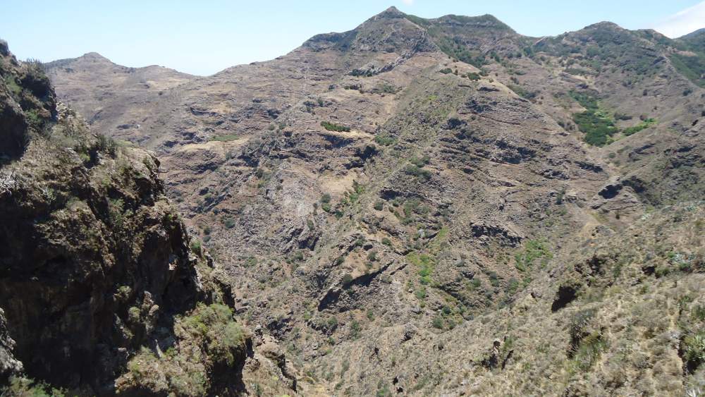
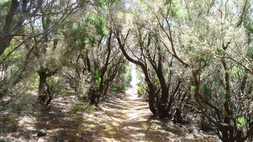
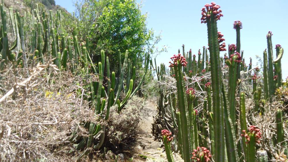
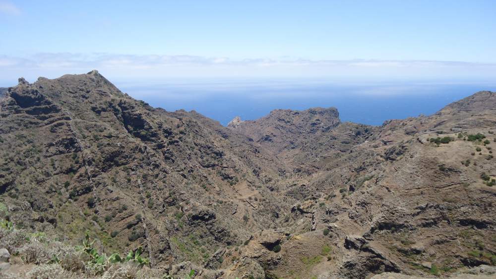
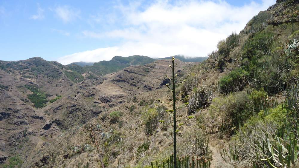
From the cemetery, I continued to the south. A long and pleasant path in the first half of the tour. Later it becomes almost invisible through the rock and cacti zones. At several sections, it is a bit exposed and hard, with a few places with a bit of scramble. Having some ankle injury or anything similar at such a place could have serious consequences, not to speak about costs of helicopter transport. In short, there are no roads around, there is no water, and going alone is not the best way.
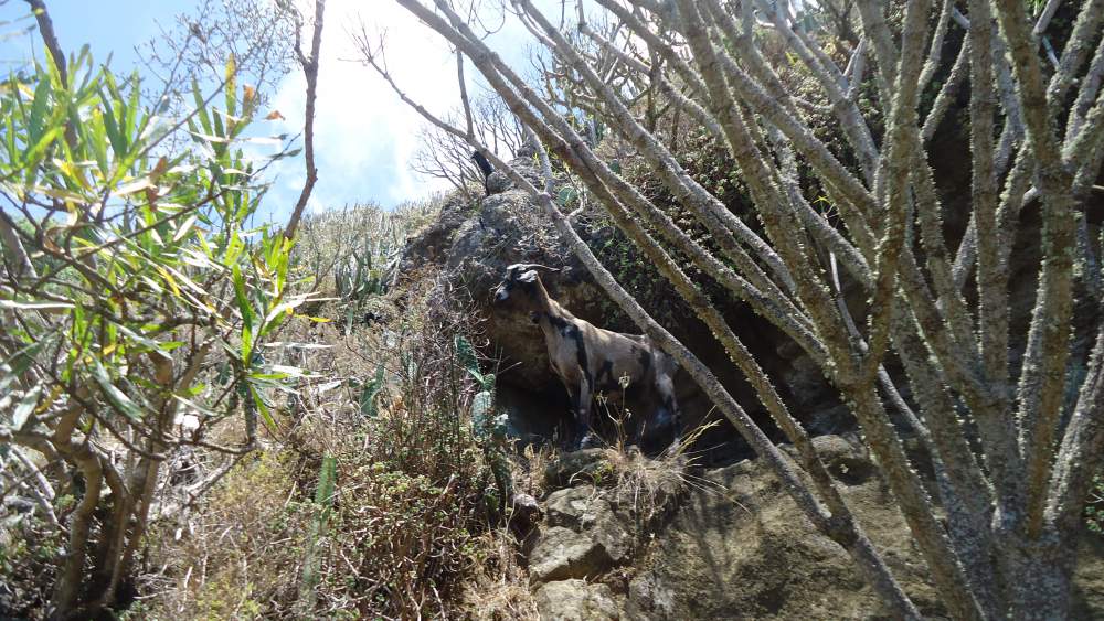
At many places on the path, you will see goat dung, and you will hear them around. I was lucky to have three of them very close to the path. The udder of one of the goat was so full that it looked it would burst, so I was wondering if anybody was taking care of them at all. It looked impossible to collect them from such rugged area, unless they themselves gather somewhere where they can get water or salt by people. Anyhow, those were the only living creatures I saw there apart from a falcon flying and making sounds above.
I continued for about 90 minutes up to a point where I realized that I had to turn back if I wanted to catch a bus from Chamorga. So I walked the same way back till the road, and then followed it to the village. Once on the bus, I had a good nap almost all the way to San Andres.
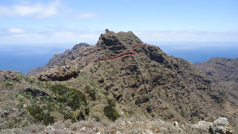
Here are a few photos from the second part of the route, from cemetery toward the south through Ijuana:


Regarding my timing, I started after getting off the bus at Igueste de San Andress, at 11:20 am, and I was just in time in Chamorga to catch the bus at 16:30.
So this was my experience in Ijuana, hopefully, you liked it and enjoyed the photos. Please leave some comments below.
Read more about Tenerife hiking here:
And here something about climbing on Tenerife:
Koda says
Wow! what a majestic site… Ijuana, you are officially on my “go to” list now. I absolutely love rockey terrain and hope to visit as much of it as I can.
These pictures really give you a sense of the isolation up there! Winding roads and random villages sounds like one heck of an adventure to me 🙂
Jovo says
Hi Koda, thank you. It is a majestic place as well, something you would not expect in a so popular touristic island. Do not miss Chamorga area, this is close to Ijuana, and the most distant village in the island. I enjoyed it, you will as well, I feel it from your lines.
Ramirez says
Looks like one of your hobbies is mountain climbing. It’s a good adventure altogether. There’s a mountain in my country called mount Cameroon and I’ve experienced mountain climbing once. The adventure was really great but it was tiring though. In my country, a race is done every January called the mountain race where you run to the summit of the mountain and back. The first wins a huge sum of money. Thanks for this awesome info.
Jovo says
Thank you Ramirez, great to read your comment.I have not heard about the mountain you mentioned, not sure in which country it is.
Paul says
Wow. So much information here along with plenty of really nice pictures. The area looks beautiful, and I would love to go there some day. I myself know a few things about Tenerife from when I researched the airport disaster in 1977 — still the deadliest accident in aviation history. This just goes to show that there is beauty to be found even in a place with a dark history.
Jovo says
Thank you Paul. So you know about the tragedy at La Laguna airport. This was indeed the deadliest one. There is indeed a lot of beauty here.
cathy says
Wow. Just reading your blog made me exhausted. The view (at least from your photos) made the hike it thought I’m sure. You mentioned that we shouldn’t take this route along, but it sounded like you were by yourself. Do you typically hike alone or with someone or a group? I’m more of a sit at home with my feet up and look at other peoples photos, but you’ve inspired me. My first excursion out will be a walk to the post box around the corner (I usually drive). I do look forward to seeing more of your travels. How often do you get to go? thanks again for sharing.
Jovo says
Hi Cathy, thank you for the comment. Yes I was alone and that is what I usually do. But I never said I was wise or clever. It is better to have somebody with you in general. I go whenever I have any chance.
Gin says
Wow, such beautiful scenery! And I must say you have fantastic photography skills too! I have not had the chance to travel much, so your site is a wonderful resource for me to experience new places. Especially the mountains, they just look so gorgeous and dreamy. Thanks so much! Keep travelling and come back with more wonderful photos! 🙂
Jovo says
Thank you Gin. You are kind but my skills in photography are not of a high level. And yes, I shall keep walking and you please keep visiting my site. Deal?
john says
Wow! You sure know a lot about mountains lol. I found this website to be informative and you sure have a lot of info on these mountains and other places. Very good job overall I enjoyed reading this and hope you check out my website as well @ magickal success. keep up the good work and keep bringing in the great visuals!
Jovo says
Many thanks John. Kind words. Best luck with your site, I shall surely have a look.
NemiraB says
Hello here. I read your page and I felt that I walked with you all way by these bushes along the road. Great colorful pictures make this journey when I read it, vivid and colorful.
I see that Ijuana Nature Reserve is located in Park protected area. When I see your pictures, it is easy to feel that is rough, craggy, not so easy to reach area.
I wonder if you need to have a permit to visit Ijuana?
Because this area is protected for conservation purposes. These halophilous ecosystems seem to be frugal. Just I wonder who is going to take advantage of salt, because these systems have high concentration of it.
I have few friends, who visit Tenerife island. They never mentioned about mountains. What I heard from them it was conversation about beaches, friendly people and food.
Did you visited third largest volcano in the world, El Teide? I need to look through your website about it. You have so much information about your passion: mountains.
Thanks for providing information about this really old island. I read that it was formed three million years ago.
Can be these volcano be active again?
All the best, happy writing, Nemira.
Jovo says
Hi Nemira, what a great comment, no words to express my gratitude. Yes permits are required to visit the place. They are available in my another page about Anaga mountains. The system is frugal indeed. Your friends who were visiting Tenerife have obviously found other things to enjoy the island, this is fine, Tenerife has much to offer. As for Teide, yes I climbed it 4 times, here is one story and here yet another. As for volcanic activity, I think it is unlikely, but I am not well informed about this issue. The last eruptions on the island were in 17th century if I remember correctly.
sc88 says
Hi Jvranjes,
I can see that you have a great passion for mountains and climbing them, your passion is contagious. And reading through your website reminded me of the time we went to the Swiss Alps with my school and did hiking and mountain biking. I live in Berlin now and il definitely make a trip to one of the mountainous areas in germany, especially with my son when his old enough, its also great to know anyone can gain something from mountaineering or climbing. Great website too, im sure alot of people who have a passion for climbing or want to start can learn alot from here!
Jovo says
Hi, thank you for the comment and for the kind words. I just hope that my passion is contagious as you nicely put it. So you are in Berlin, German Alps are no so close, I was there a few weeks ago in order to climb Alpspitze. Just to know if you ever decide to go there have a look into the page.
terry says
Hi Jovo;
Phenomenal photos! And to hear that you have taken them all yourself is simply amazing!
How long have you been climbing and exploring? You are obviously very experienced.
I saw a lot of the equipment you show. What, exactly, would you recommend for the novice climber? And is there a particular mountain you would recommend for a “first timer”?
Thanks for the inside information.
TERRY
Jovo says
Hi Terry, any mountain with walk up routes will do if you are a novice. This will give you the feeling on how it can be, and how it is when you are at some altitude and have the mountain under your feet. Do not invest any money, try it first, just some hiking shoes and good will. As for these and all other photos of mountains, yes they are all mine, I do not borrow from the Internet, this is a fixed rule for this site. Thank you for the comment.