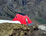
The new Bivacco Aldo Frattini was recently installed at 2300 meters in the Orobie Alps. Its design raises some serious questions.
Beyond the Emergency: The Real Spirit of Alpine Bivouacs
There is currently a debate over safety, social media, and over-tourism related to bivouacs. Before we label these shelters as ’emergency only,’ we need to look closer at the diverse roles they play across the Dolomites and beyond.
Who Really Climbed Antelao First? Grohmann’s 1863 Account
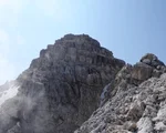
Paul Grohmann’s group ascent of Monte Antelao in 1863 lead by Matteo Ossi is often considered the mountain’s first. But Ossi claimed he had already reached the summit years before, yet according to Grohmann hesitated at the final crux.
Tofana di Mezzo: Why Lacedelli and Grohmann Didn’t Take the Simplest Ascent
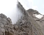
Lacedelli and Grohmann climbed Tofana di Mezzo the hard way from the south side, but nowadays there is a lesser-known walk-up route to the summit. So why did they avoid it?
Accommodation in the Dolomites (All Possible Options)
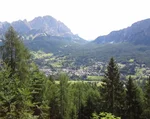
If you plant to visit Dolomites, you have the following options for accommodation: small family run hotels, hostels, apartments for rent, huts, bivouacs, and camping spots.