Here you have my report on climbing Bavski Grintavec (2347 m) from Soca village. This is a long whole-day walk-up tour because of its start point that is at a low elevation, and the elevation difference is more than 1850 meters.
Bavski Grintavec in numbers
Here are a few data:
- Latitude: 46.36887°N.
- Longitude: 13.67120°E.
- Elevation: 2347 m (7700 ft).
- Mountain range: Julian Alps, Slovenia.
- Regarding accommodation and maps, check my page about the Vrsic Pass.
About names
Just to know that original names mentioned in the text are written as Bavški Grintavec, Soča, Bavšica, Vršič, etc. This is Slovenian language and č=ch, š=sh. I omit those signs in the text because I know they can be confusing for some (have one of such letters in my own family name so I know this well). About the origin of the name Soca (hm, I mean Soča or Socha) you can read on Wikipedia.
The routes to Bavski Grintavec
There are at least three directions for normal routes to the summit from the surrounding valleys, there may be more so let me know. They are as follows:
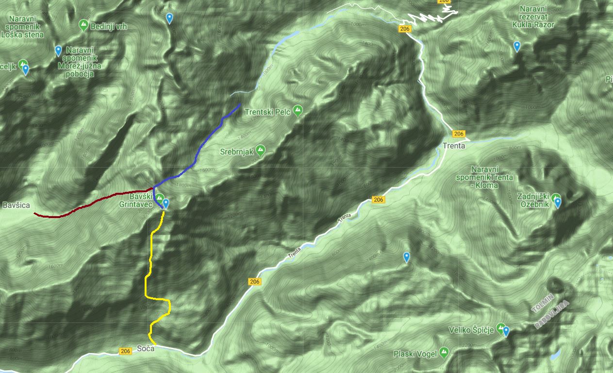
- The route from Soca village. This is a southside approach, the yellow line on the map below.
- The route from Bavsica valley. This is the west side of the mountain, the red line in the map. There seem to have two variants here, the line shows Kanja Preval (Pass) variant.
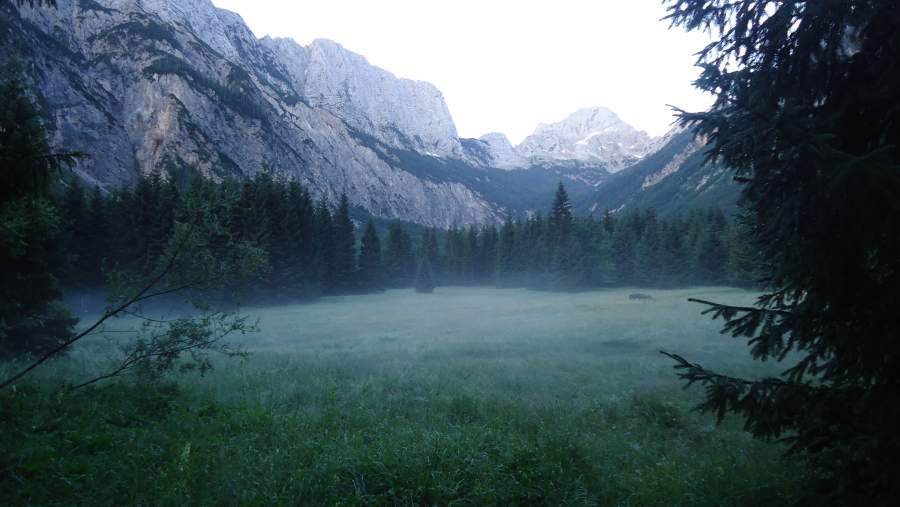
- The route from Zadnja Trenta valley which is the north-east side, the blue line. The top picture above is from this valley and I took it when climbing Jalovec. This route has some (two) variants, the option marked on the map is over Kanja Pass, and as far as I know, this is where it joins the Bavsica Route.
One comment here: Trenta valley makes a sharp U-turn under Vrsic Pass and its highest area after this turn is called Zadnja Trenta, you can see this in the map below. So this is an incredible geological formation and an area of exceptional natural beauty.
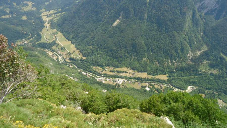
If you go from Zadnja Trenta, you can drive the car quite long into the valley. You pass Soca River Hut which will be on the right and continue along the valley floor until you get to the barrier where you can leave the car.
The sign at the parking will tell you that you have 6 hours and 45 minutes to the summit. So this is again a very long approach and this is a ferrata route, just to know. The picture below is what you will see from the parking in Zadnja Trenta valley, Bavski Grintavec in the distance. Note that not far from here you can visit the Socha river source which is just 20 minutes walk from the parking.

I have been in all three sides (valleys), but I have walked only the Soca valley route and I describe it below.
The Soca Valley route
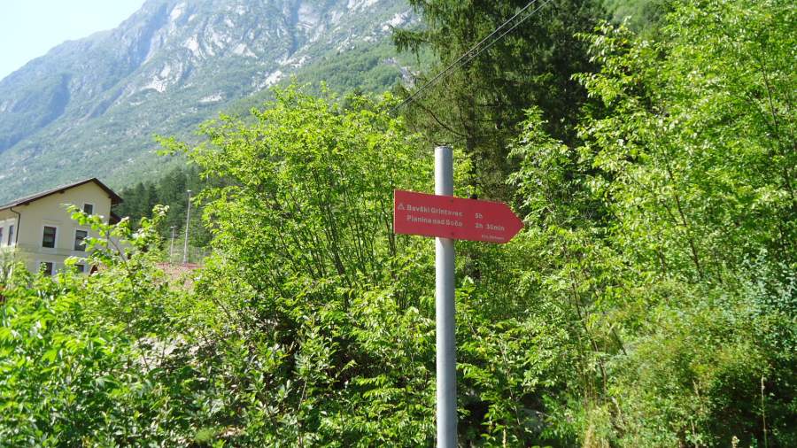
Here, the most important part is to locate the beginning of the route. So if you are coming from Bovec you will drive to Soca Village and after the church which will be on your left side, just some 200 meters along the road on the same side you will see this sign:
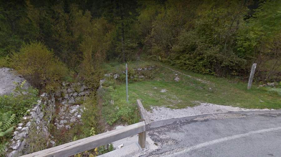
The car parking with places for two cars only is shown in the picture below. So park here and start walking up the mountain. The sign will tell you that you have 5 hours to the summit. This is a bit unrealistic, I started at 4:45 AM and I was on the summit at 11:05 AM. So plan 6 hours at least.
The start point elevation is around 492 meters, and you have seen the summit elevation. So you have 1855 meters elevation difference.
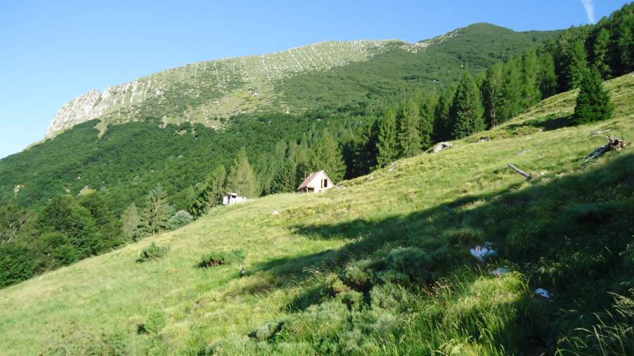
You will work through pleasant woods for a few hours. There will be an abandoned tiny village first, and after that the route goes in the west direction until you get to the hunters’ cabin shown below. From this point you will be going in the north direction.
Here are a few photos from the area. Note that I never photoshop pictures here in the site, so what you see is more or less what I have seen. In some cases though, I notice that inclination and slopes in pictures tend to look much milder than in reality. Not sure why this is happening, I am just a theoretical physicist and not a professional photographer.
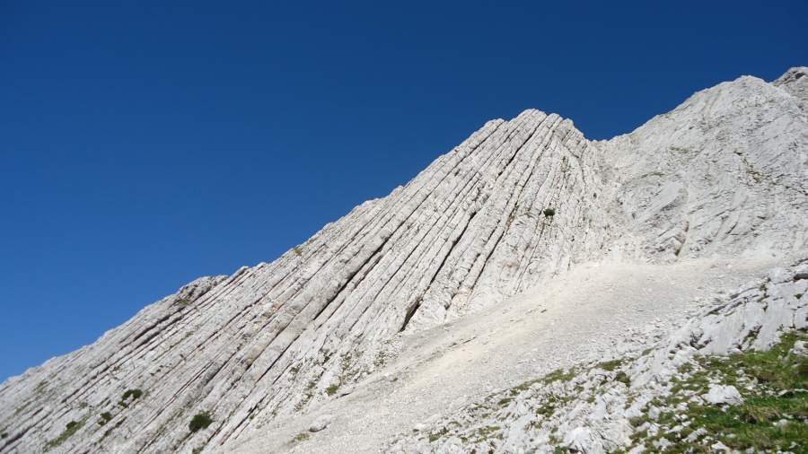
Some interesting rock formations with limestone layers:
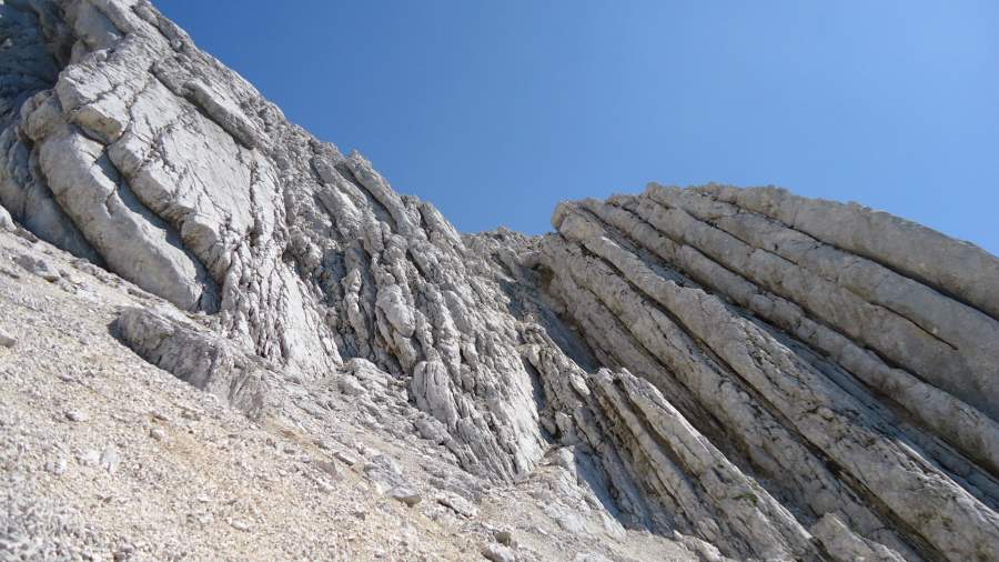
Below is the only place with some simple scramble. This is a passage of some 50 meters or so, there is no need for any equipment, but a helmet will be necessary if there are people above you. There was nobody when I was there so I did not use it at all.
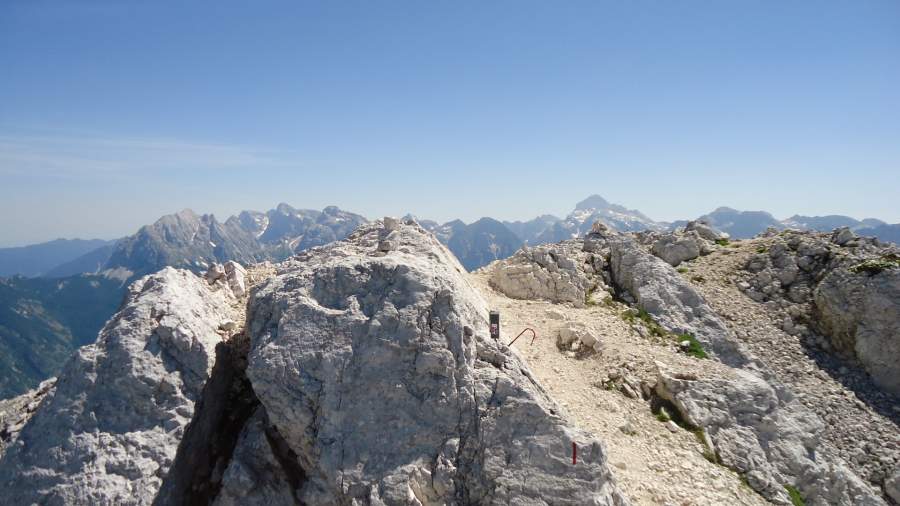
The summit
Below are a few photos from the summit. The first is the summit itself, an elongated and pleasant ridge without any cross. You can see the summit box with a memory book inside, and the rod which is with the summit stamp fixed to it, if you collect them. Triglav is far in the background and Prisojnik and Razor on the left, I have climbed them all so follow the links to read more:
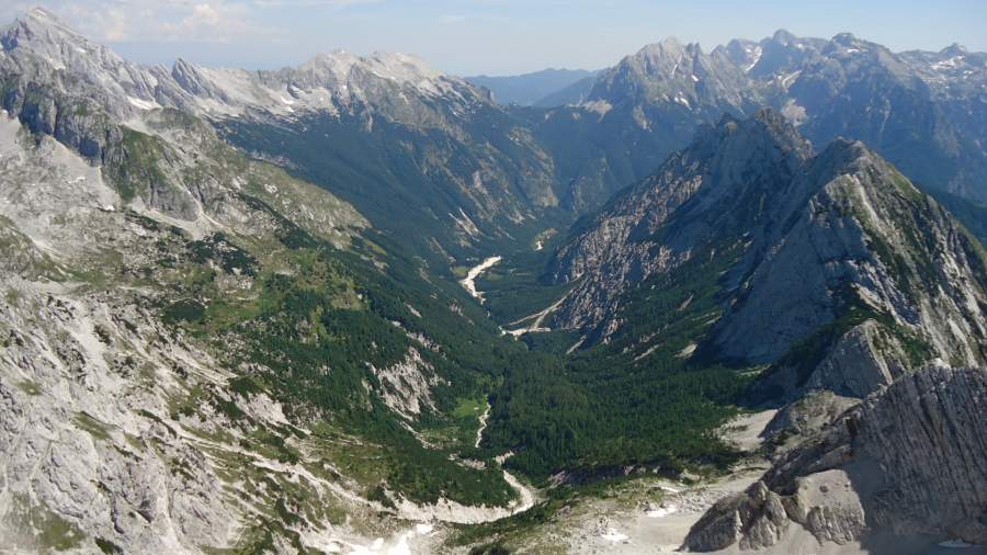
Below is the view of Zadnja Trenta Valley, Jalovec is completely on the left. Vrsic Pass is in the middle above, Mojstrovka on its left and Prisojnik on its right side:
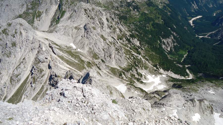
The picture below shows Kanja Preval (Pass) where one of the routes from Zadnja Trenta meets the Bavsica route:
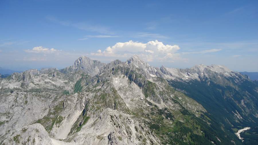
Two magnificent mountains, Jalovec and Mangart which I climbed earlier:
I stayed on the summit quite long, had my summit coffee there and breakfast. I normally carry my MSR gas burner and a Bialetti Coffee Pot, what can be better than a coffee with such views?
There were no people on the mountain that day, and I have not noticed anybody coming from the other two directions. So I had a privilege of having it for me only. Didn’t mind it at all, perhaps something is wrong with me.
Water supplies
There is no water anywhere on the route, this is the south side of the mountain and it is bone-dry. So no need to carry any water filter, but carry lots of water for such a whole-day tour. I had 4 liters and I used it all.
Equipment
You do not need anything special. This is a long day-tour, so have your regular mountaineering or hiking boots. For this occasion, I was testing my new Lowa Renegade GTX boots. You should have sunglasses, a day-pack, and a hat (I lost my own the day before so imagine). Be ready if the weather changes, see my separate text about clothes for summer in the Alps.
These are relatively low Alps and it is not cold in summer, but you can have a rain out of nowhere. You can get some shelter at the hunters’ cabin; it is locked of course but the room under the roof was without the lock.
There is also the mentioned place with several abandoned houses on the lower section of the route, you can have shelter in the case of rain.
So this was my report of climbing Bavski Grintavec, I hope you find it useful. As you realize, because of such low valleys around, the routes are long and demanding. Check also my text about Kanin, this is a very different environment as compared with lonely Bavski Grintavec, because of lift services from both sides of the border.
I love to hear from you, so do let me know if you have questions or comments, there is a comment box below.
Leave a Reply