• Home
  • ABOUT
  • HOW TO START
  • ALPS
    • Austrian Alps
    • German Alps
    • Italian Alps
    • Slovenian Alps
    • Swiss Alps
    • Huts and Shelters
    • Roads and Passes
  • TENERIFE TOURS
  • ABOUT EQUIPMENT
  • FAQs
  • WRITE FOR US

Mountains For Everybody

Site about mountaineering, climbing and equipment, for those who love mountains

  • Outdoor Sleeping
    • Tents
      • Solo tents
      • Tents for 2 People
      • Tents for 3 People
      • Tents for 4 People
      • Tents in general
    • Tarps and Shelters
    • Sleeping Bags
    • Sleeping Pads
  • Backpacks
    • Day Packs
    • Mid-Size Packs
    • Large Packs
    • Kids & Youth
    • Packs FAQs
  • Clothing
    • Men’s
    • Women’s
  • Footwear
    • Men’s
    • Women’s
    • Insulated
  • Gear
    • Camp stuff
    • Lamps
    • Poles
    • Filters
  • Newsletter subscribe

Climbing Mala Mojstrovka from Vrsic Pass – Slovenian Alps

Last Modified: 01/13/2025

If you plan climbing Mala Mojstrovka the easiest way is from the Vrsic Pass. You can get to the summit in less than 2 hours. Read more here.

Mala Mojstrovka as seen from the lower slopes of Prisojnik, from my earlier visit to the area when the weather was perfect.

Mala Mojstrovka – the location

Basic data

  • Latitude: 46.43725 °N.
  • Longitude: 13.73111 °E.
  • Elevation: 2332 m (7651 ft).
  • Prominence: 721 m (2365 ft).
  • Mountain range: Julian Alps, Slovenia.
  • Accommodation and maps: check my Vrsic Pass page.


Here is a clickable map so you can see the access roads to the Vrsic Pass from the north and from the south:


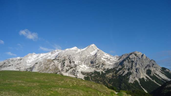
The mountain rises directly above the Vrsic Pass (1611 m) which is a car access place. It is in the north-west direction and clearly visible from the road. In principle, there is plenty of space around to park the car, but this is an incredibly popular place and the Pass can be very crowded. There are no fees here, neither for the Pass nor for the parking. The road to the pass I have described in my another text so no need to repeat it here.

Many people climb this mountain, mostly to practice their ferrata skils, or if you have no much time then this is a quick tour which you can do in several hours. There is a ferrata route indeed but also a normal route which is a simple walk up. The latter is marked and obvious and you can see it roughly marked here in the map:

The normal route to the summit from Vrsic Pass.

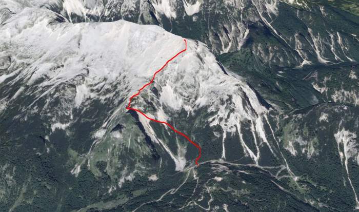
So this is a south approach and the slopes are much milder than the north side, as usual. Note that you have 721 meters (2365 ft) to climb from the pass.


My climb

In my case, this mountain was an obvious choice because of a totally unstable weather. I arrived very early and the Pass was completely empty, but it was raining so I decided to take a nap. After a few hours, I decided to go and to try. Meanwhile, have seen a few groups moving up along the ferrata route. I did not like the idea of going that way with the possibility of rain, the rock becomes slippery and unpleasant. 
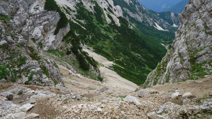
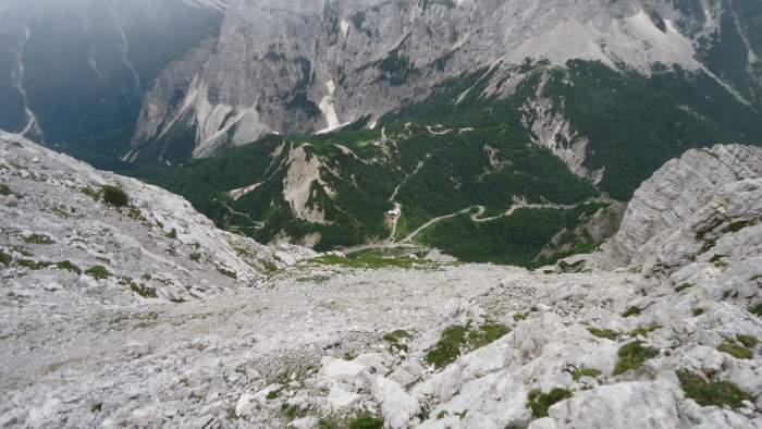
So I took the normal route. I was in clouds most of the time so unfortunately do not have many attractive photos to show. Here is one from the lower section:

This is a view back on the lower part of the route.

I started at 11:50 and was on the summit at 13:30. The signs at the road will show that you need 2 hours for the tour, so my timing was reasonable. There were a few people on the lower part, I passed them and later realized that they gave up, probably because of the unstable weather.

This is the lower section of the ridge which leads to the summit, it is somewhere in the clouds above.

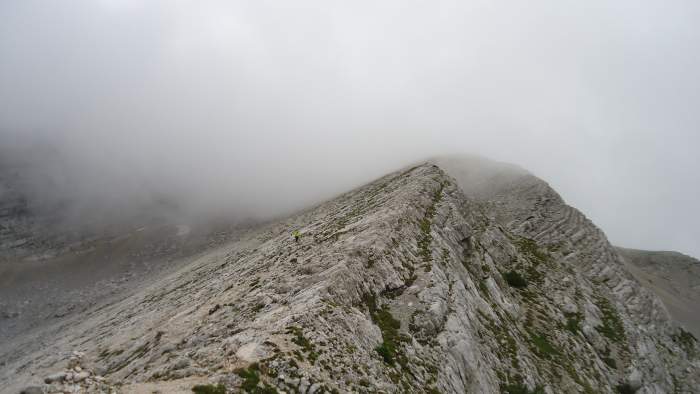
It was very windy on the summit and without views most of the time. But I have spent at least 20 minutes there, had something to eat and to rest. It was very windy and called, not a great day for the summit. I wanted to continue to Velika Mojstrovka, at one moment I was able to see something that looked like a route in that direction, but it started raining a bit and could not see anything, so reluctantly I had to call it a day and descended the same way back to the pass.

This is the actual summit, no cross here.
This is the actual summit, no cross here.  

Equipment

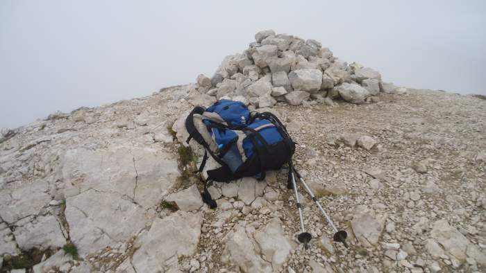
This is a walk-up tour, so you only need ordinary mountaineering boots, and the usual stuff for the Alps which I described in my another text. So as usual, I have had a waterproof layer, my usual daypack, and trekking poles.

Currently, I have a pair of Kamperdel poles. No need to carry a helmet or ice axe, in the summertime the normal route is free of snow. But the summertime is short here, if you come in June you will have plenty of snow and you will need the heavy stuff.

This was a rare moment when I was able to see Vrsic Pass from the summit.

I did not go the ferrata route and cannot provide any first-hand information here, and guessing about a route is not my habit. All I know is what I have seen on YouTube, and this looks like a hard ferrata with vertical cliffs. Also, a group of Checks arrived from the ferrata to the summit when I was there. For several of them this was the first time using the ferrata stuff, this is what they told me.

In any case, if you need something from mountaineering tools, check my page with equipment.


Final thoughts

So this was my experience of climbing Mala Mojstrovka, this is a beautiful peak and anybody can climb it in a few hours without any special equipment. If you are lucky to have a clear sky then you will be rewarded with incredible views. I shall be there again, plan to go to Velika Mojstrovka, and also the ferrata route is on my list.

If you are in the area, do not miss Prisojnik which is just on the other sides of the Vrsic Pass. Check also my texts about Mangart and Jalovec which are close, and also the text of my solo tour to Jof di Montasio which is on the other side of the border in Italy.

Please let me know if you have any detailed knowledge about Mala Mojstrovka or any other mountain around. I have an open invitation for guest authors. Otherwise, use the comment box below. Thank you for reading and have a nice day.

Spread the love

Mountains for Everybody site is reader-supported. This means that some of the links in the text are affiliate links, and when you buy products through our links we may earn some small commission to keep running the site. Filed Under: Slovenian Alps

Leave a Reply Cancel reply

Your email address will not be published. Required fields are marked *


My photo on the summit of Jalovec.Hi everybody and welcome to my site which I nurture with love and passion. Here I describe my own climbs and give reviews of equipment. I hope you will enjoy it. More about the site and about me here.

Categories


Cookies Statement

In this site we do not have any cookie tool. But we do use services by third parties that either use cookies or may be doing so, yet we do not have any control of it. This is covered in their privacy policies. For more details please check in our Privacy Policy page.


  • Contact
  • Privacy Policy
  • Affiliate Disclosure

My Most Memorable Tours

  • Magic Moments On Mount Teide Tenerife
  • Climbing Weissmies solo
  • Climbing Mount Fuji
  • Climbing Zugspitze solo
  • Lagginhorn my first 4000er

Recent Posts

Can an Overweight Person Go for a Trek featured picture.

Can an Overweight Person Go for a Trek?

The Physiological Impact of Thru-Hiking featured picture.

The Physiological Impact of Thru-Hiking: Body’s Response and Effects

Are Canvas Backpacks Good for Hiking featured picture.

Are Canvas Backpacks Good for Hiking?

Why Is There a Gap Between My Back and Backpack featured picture.

Why Is There a Gap Between My Back and Backpack?

Huts and Bivouacs in Dolomiti di Brenta Alps: Interactive Map featured picture.

24 Huts and Bivouacs in Dolomiti di Brenta Alps: Interactive Map

Affiliate Disclosure

I am a participant in the Amazon Services LLC Associates Program, an affiliate advertising program designed to provide a means for sites to earn advertising fees by advertising and linking to amazon.com. So when you buy something from this website, I may receive an affiliate commission. These are my opinions and are not representative of the companies that create these products. My reviews are based on my personal experience and research. I never recommend poor quality products, or create false reviews to make sales. It is my intention to explain products so you can make an informed decisions on which ones suit your needs best.

Categories

  • About mountains in general (33)
  • Alps (138)
    • Austrian Alps (5)
    • German Alps (3)
    • Great mountain roads and passes (10)
    • Huts and Shelters (27)
    • Italian Alps (84)
    • Slovenian Alps (25)
    • Swiss Alps (21)
  • Backpacks (248)
    • About Packs in General (76)
    • Day Packs (63)
    • Large Packs (79)
    • Mid-Size Packs (52)
    • Packs for Kids & Youth (2)
  • Clothing (22)
    • Men's Clothing (11)
    • Women's Clothing (8)
  • Equipment (61)
    • Camp stuff (37)
    • General Stuff (3)
    • Headlamps (8)
    • Trekking poles (3)
    • Water filters & purifiers (9)
  • FAQs (125)
  • Footwear (22)
    • Insulated Footwear (4)
    • Men's Footwear (17)
    • Women's Footwear (6)
  • Guest Author posts (5)
  • Hiking tours (22)
  • Sleeping Bags (109)
  • Sleeping Pads (90)
  • Tenerife (24)
  • Tents and shelters (256)
    • About tents in general (22)
    • Solo tents (23)
    • Tarps and Shelters (12)
    • Tents for 2 People (69)
    • Tents for 3 People (57)
    • Tents for 4 People (91)
    • Winter tents (25)

Copyright © 2025 · Mountains for Everybody · All Rights Reserved