If you plan climbing Razor (2601 m) in the Slovenian Alps, here you have the description of a few of the routes. This is a demanding climb and you will need this information.
Where exactly is Razor
Here are a few data:
- Latitude: 46.41206 °N.
- Longitude: 13.79175 °E.
- Elevation: 2601 m (8533 ft).
- Mountain range: Julian Alps, Slovenia.
- Regarding accommodation and maps, check my page about the Vrsic Pass.
According to Wikipedia, Razor was climbed first in 1842 by Otto Sendtner, a German botanist. Access roads and the routes described in detail in the text are visible in the map below. These are just rough sketches of the routes, for general directions only, the map is clickable so please zoom in or out to see more details:
The routes to Razor
My policy here in the site is to describe only the routes that I passed myself, so here are a few of them which lead to Razor. I have first-hand experience with these routes, and I can write about them and provide reliable information.
Note that there are several more options, so if you have passed them, please consider adding a text here. We have an open invitation for guest authors.
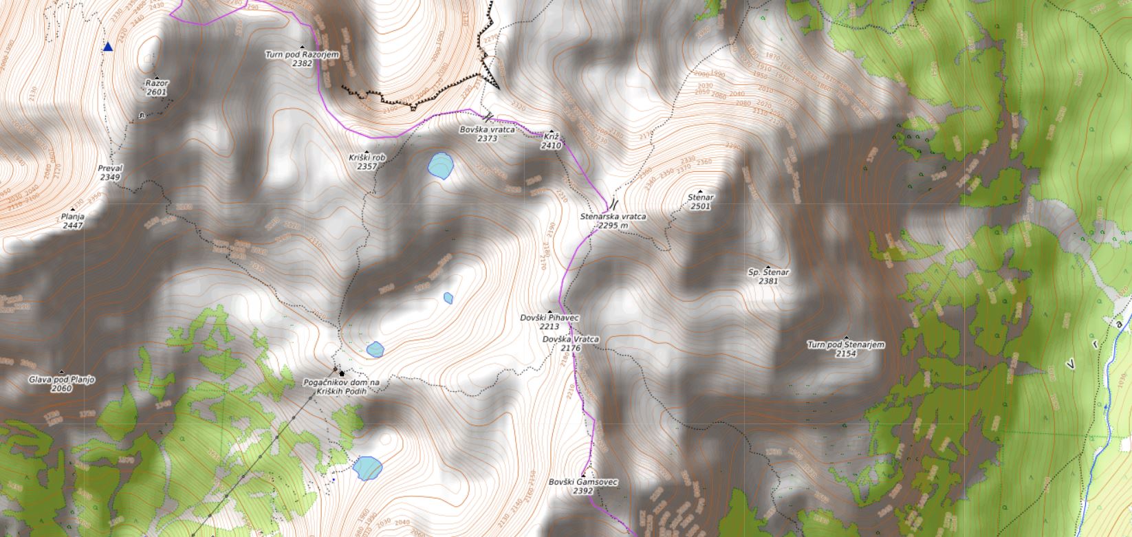
Here is a map of the area around Pogacnikov Dom hut where you can stay the night under the summit, it might be useful, it is clickable so you can see it in full screen:
1. Zadnjica Valley route
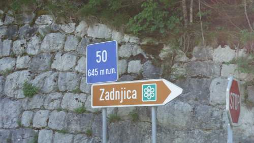
This is the orange color route in the map above, and this is the deapest valley around so the route is long and demanding. On the main road which connects Vrsic Pass and Bovec, directly above the small village Trenta, you will see a sign on a sharp bend on the right (if you are coming from Bovec), see the picture:
The car parking is just a few hundreds of meters along the gravel road, the start point is very low because you descend a bit from the main road. So this is around 640 meters above sea level. This parking position is marked in the zoomable map above.
So you have to leave the car here (there is a barrier higher up) and then continue along a beautiful and noisy water stream and follow the signs to Pogacnikov Dom (hut) which is at the altitude of 2050 meters, and the summit od Razor is at 2601 meter. So the elevation difference is huge, close to 2000 meters, and this is what makes it so difficult.
I have had bigger elevation differences in the past, and at much higher altitudes, see my tour of Weissmies to realize what I mean. But this was 12 years earlier and my shape hasn’t improved in all these years, it is just the other way around.
It is best to stay at the hut and continue to the summit in the morning. The signs at the parking will tell you that you need 4 hours to the hut. Perhaps this is so if you are a Slovenian, but in reality, be ready for 5-6 hours if you carry any bigger pack.
As for camping, it is obviously forbidden, this is a national park and they are very proud of it, I would say with all good reasons. But if you carry your tent and pitch it late in the evening (I call this overnighting) and pack it up early in the morning, nobody will be there to bother you about this.
We go to such places because we love nature and I do not see anything bad in doing this. There is plenty of space with grass around the lowest lake which is at around 1820 meters of altitude, so this is where you can pitch a tent. I did not carry it although I had it in the car. I expected to stay the night in the winter room and I carried my sleeping bag.
Water supply
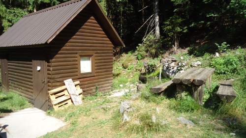
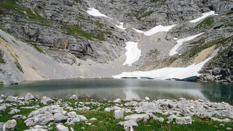
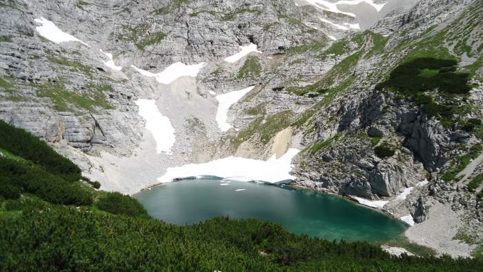
If you have a water filter, this is the place to use. There is water at the cabin for the supply lift, which is at around 800 m of elevation (see one of the pictures above). Yet another is at 1800 meters, this is water coming from the lowest glacier lake on Kriski Podi (shown above). The water in the lake looks crystal clear, but I would not use it without filtering.
Of course, you can buy water at the hut if it is open. I did not check how much they charge. I even filtered their water from the lavatory. I was using my Pure2Go filter/purifier, and have a lot of trust in this tool.
I am pretty sure that I used around 6-7 liters of water on the way up and tomorrow when descending. This was a very warm summer day, and my pack was heavy. I was not sure about the hut accommodation, this was before the official beginning of the season, the hut is normally open from July 1st. This is why I was carrying my sleeping bag and all the food for an overnight tour.
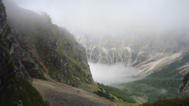
At least one half of the route to the hut is through the woods (see the picture), and this helps a lot because this is the south side and it can be very hot in those deep valleys with huge 2000 meters high walls everywhere around.
Right at the spot where you can refill your bottles, you will have the first view of the hut. This is how I saw it for the first time:
Pogacnikov Dom – Hut on Kriskih Podih:
The hut is on the elevation of 2050 m and it is in between the two lakes. It was built in 1951 and it is named after Joze Pogacnik who gave the idea for the hut. I read that he died while climbing there to the opening ceremony, a sad story indeed.
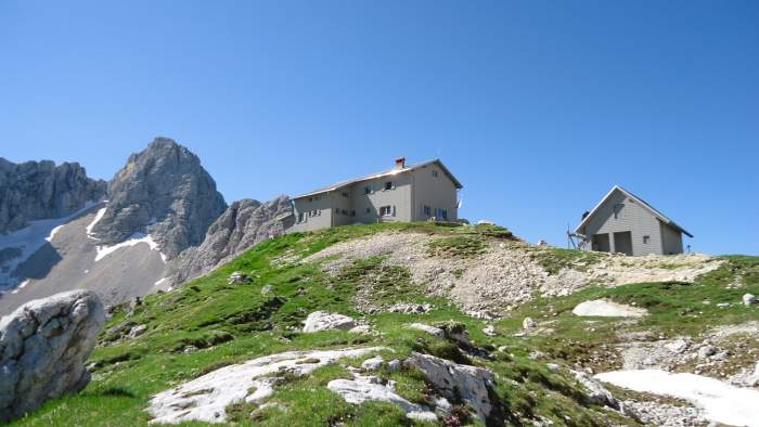
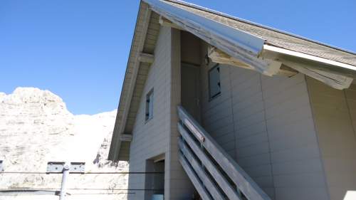
The hut has a winter room, it is under the roof of the building with the supply ropeway, see the picture below. But the winter room was locked when I was there, so I am not sure what they provide in it. There is a place for 16 people as far as I know.
The hut itself has three levels, the kitchen and dining area are on the ground level, the first floor is with rooms that have 4-6 beds or so, and the top level under the roof is a single room that has almost 30 beds. I was there completely alone, a true luxury. The hut has electricity, and you have cold water in the lavatory and in the toilet.
Note that the actual summit of Razor is not visible from the hut.
My climb
So after more than 5 hours from the valley to the hut, I got a place in the room under the roof (this they call ‘skupno’). This is a less expensive variant as compared to the rooms below where you have bunk beds and also normal beds.
There were just a few visitors in the hut, plus a few workers who were doing some repairs, and the hut’s crew. Nevertheless, the place was very noisy until well after midnight. This was a very unpleasant surprise. So, I missed to get up as planned, I set off for the summit around 5:15 AM and I was at the summit at 7:40 AM.
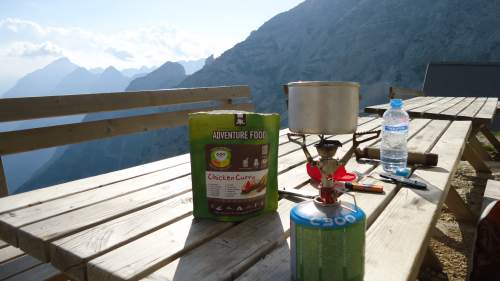
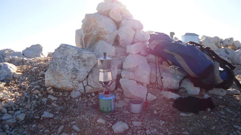
There was nobody around, none of the guests planned to go to the summit, so I had the mountain for myself. I had my breakfast and morning coffee on the summit. I carry a sport version of Bialetti coffee pot and my MSR PocketRocket 2 gas burner, see them in the picture:
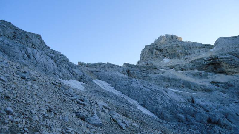
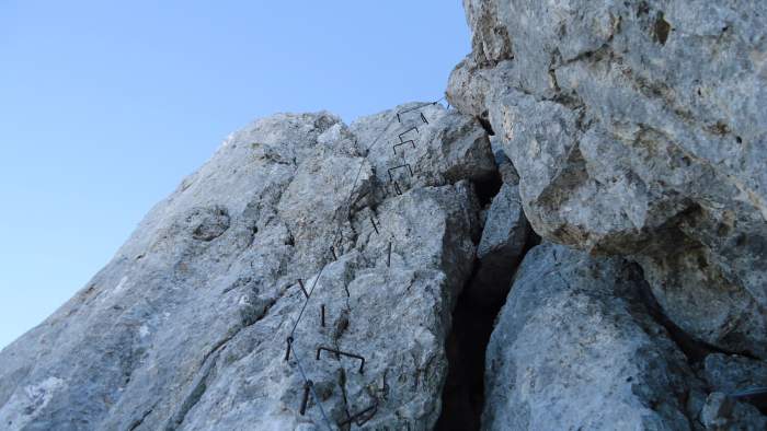
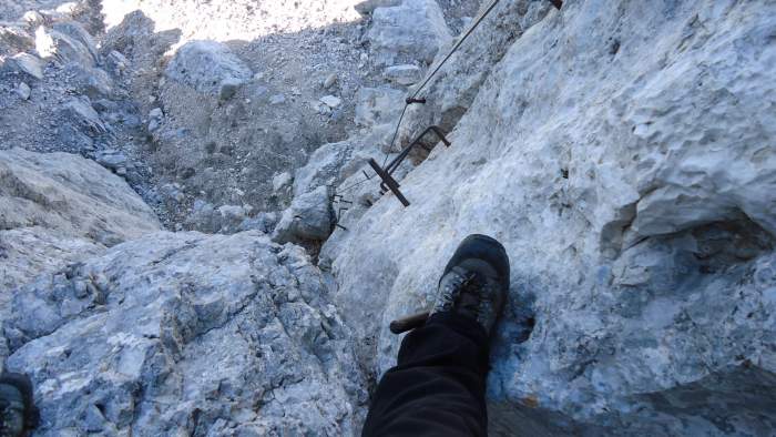
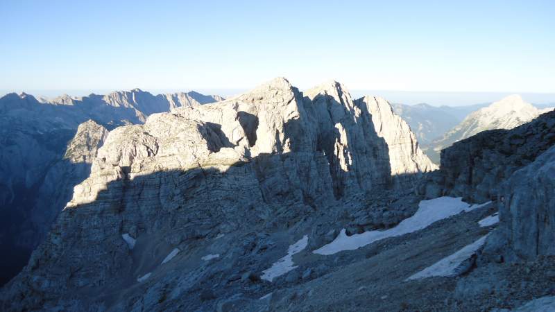
There are some 5 sections with fixed cables, all easy except the last one which is almost vertical. Not sure if the picture below shows it properly, but this is some 15 meters or so where you would want to use all your ferrata stuff.
The summit is without a cross, but you have the usual box with a memory book, and you have the option to take a stamp in your own climbing book. I do not collect the stamps, I collect memories instead, but you have such stamps on all the peaks in the Slovenian Alps.
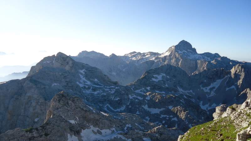
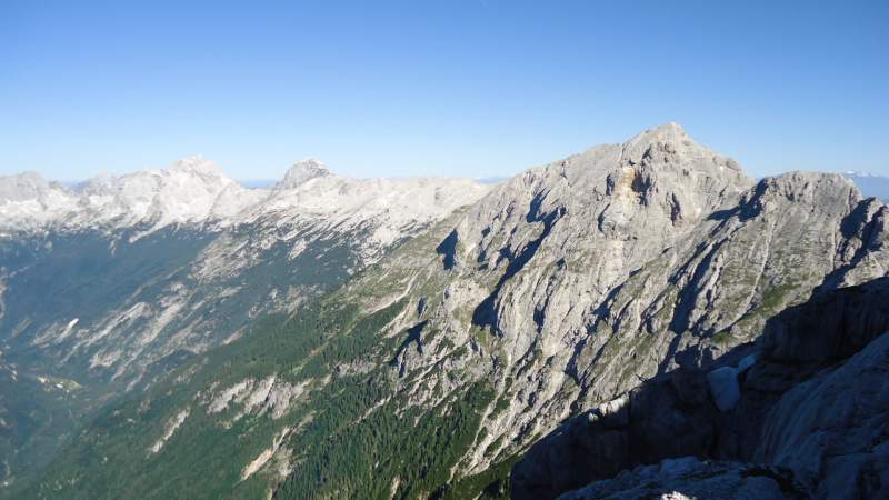
Here is a photo of Triglav as seen from the summit, I climbed it two times in the past but this was more than 3 decades ago:
The picture below shows the pass between Planja and Razor. This is called Planja Pass or Preval (2349 m). Note that this is the place where the route from Vrsic Pass joins this same route. The Planja mountain is behind, you can climb it easily when you get back from Razor.
So after some 40 minutes on the summit, I descended the same way to the hut, picked up my sleeping bag and a few other things left there, and descended to Zadnjica.
2. Sovatna route (from Vrata Valley)
This is the blue line in the map shown before. In this case, you start from the parking which is just a few hundred meters below Aljazev Dom (hut, 1015 m). This is the place from which I climbed Triglav 33 years ago, so this was an emotional moment coming back. The hut has 150 beds, it is open from the beginning of May till the end of October. There is a winter room with 8 beds.
Note that the road is macadam and it is very steep, the steepest I have seen in the Alps, 25% inclination at several places. It is well maintained and wide enough, there are no exposed sections.
The start point elevation at the parking is a bit lower than the hut, but this is around 1000 meters of altitude. Continue in the direction of the hut and follow the signs to Sovatna.
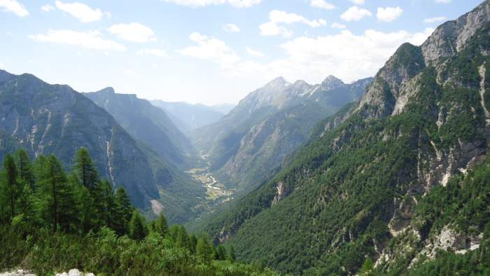
The first part of the route is through the woods and once you are above the tree line you will have a great view of the routes to Triglav on the opposite side of the valley, this if you are lucky and the weather is great, it was not so in my case. There are a few fixed cables and pegs but those are simple passages and you do not need any ferrata stuff here.
The route leads to the pass which is shown in the clickable map above, you will see it with the name Bovska Vratca (2373 m). After that point, you descend towards Pogacnikov Dom.
I walked this route one year before the climb described above in the text. But the weather was not great and I did not get to the summit. I have photos but they are useless because you cannot see much. Here is one above the tree line, this is towards the Vrata valley:
Below is a rare moment of views, the Luknja Pass (1758 m). This is yet another option to get to Pogacnikov Dom and to Razor. You can also walk over the pass to the Zadnjica valley described above.
The route leads to the mentioned Dovska Vratca (2176 m) pass, so when you get there you will descend towards Pogacnikov Dom (hut). This is the place where the route joins the one coming from Zadnjica.
So from the car parking in Vrata Valley you have to climb 1176 meters, then to descend 323 meters to the hut. This is already a lot. Then you have to climb 551 meters to the summit. This makes it 1727 m ascending from the parking. This is doable in one day if the weather is fine and you are fit. But consider staying at Pogacnikov Dom.
- Water supply: There are no water sources here, so you will have to carry all that you need at least to the Pogacnikov Dom.
- How much time: You will need around 5 hours to reach Pogacnikov Dom. Then plan another 2 – 2.5 hours to the summit.
3. The route from Vrsic Pass
I have walked only about 1/3 of the route from Vrsic. This was a few years ago, the last week in May and it was far too early. There were many passages with snow and I realized that continuing would be pointless. I was right because in my later climb of Razor I was able to see the missing part of this route from the Planja Pass. It looked very hard, so it was the right decision.
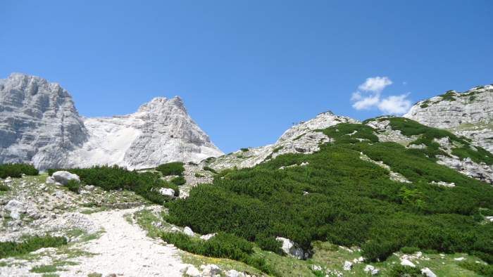
The ascent from the Vrsic Pass is “only” 990 m but this is a very long route that goes along the south slopes of Prisojnik (see the picture below) and it leads to the Planja Pass mentioned in the text above. From there you can continue to Razor and be on the summit in one hour, and then descend to Pogacnikov Dom and stay the night there.
How much time in total from the Pass? I am not sure, did not walk the route all the way to the summit, but I would say plan 6 – 7 hours to the summit, plus one hour to the hut.
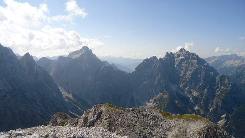
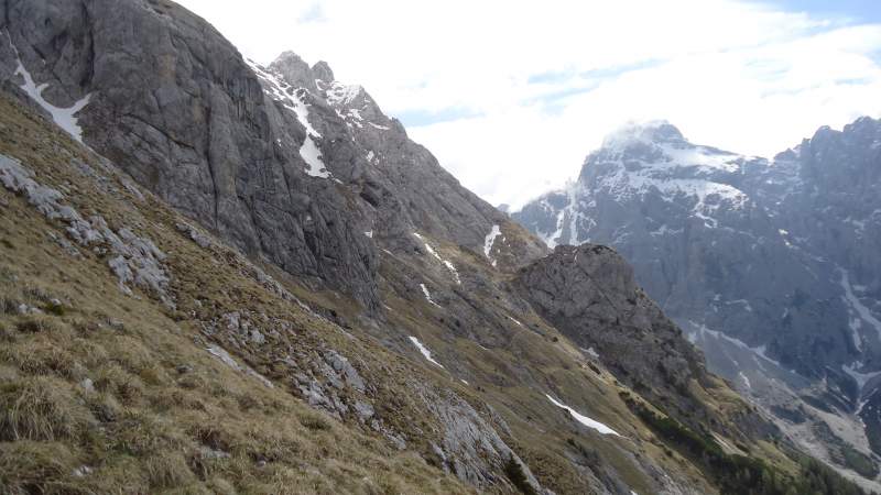
The picture below shows (from right to the left) Prisojnik, Mangart, and Jalovec. I climbed them all and described in separate texts, so please follow the links to read more. The route to Razor from Vrsic Pass (which is behind Prisojnik in the picture and it is not visible) goes above the tree line along the south slopes of Prisojnik.
The photo below shows this route from Vrsic, from my earlier attempt, Razor is visible under the snow:
Essential & recommended equipment
This is for the routes I passed:
| Recommended | (Almost) essential |
|
|
Final thoughts
The point of my story of climbing Razor mountain is that I tried it two times in the past, but I managed to climb it only in my third attempt when the weather was just perfect. You need great weather for such an exceptional mountain. I have included it in my selection of the best mountains to climb in the Slovenian Alps.
The routes are long and demanding, each longer than 7 hours. Some of the valleys around are very deep as you realize from the text above. The climate is very specific, there is a lot of evaporation in the valleys during the day and clouds are formed around the peaks in the afternoon, so you can suddenly have rain. You do not want to be on these sharp peaks when there is a chance for lightning.
I hope you find the text useful. Do let me know if I have missed something important, there is a comment box below. As mentioned in the text, there are several other routes to this mountain, so I shall be happy to have your report about them. Have a nice day and be careful and safe when/if you go there.
Vitaly Pecherskiy says
Question — do you need ropes for any parts of this climb?
Jovo says
It appears you already asked about this. There is a section in the text about the required equipment. No need for ropes.
Vitaly Pecherskiy says
Question – do you need ropes or any special equipment to climb this route?
Jovo says
Hi Vitaly, there is a section about equipment in the text, please have a look.
Paul Boudreau says
This brings great memories for me, Jovo.
Thanks.
I have climbed and experienced similar country in British Columbia, Canada.
Like you, many of my climbs and adventures are solo, not necessarily recommended, but I’m not one to wait for “hesitant” adventurers.
You prepare well. I also carry a water filter, and a coffee “machine”.
I could feel the heavy pack on my back, as I followed the trial to the peak, with you.
God bless the daypack, and filtered mountain water.
Happy Trails.
We are blessed to experience life at this level.
Paul Boudreau
Jovo says
Hey Paul, so great to see that you found my text. Thank you for your kind words. You clearly feel all this completely and understand why we are going to such places. Yes you are right, we are blessed for having such a beauty around us.
My coffee drinking on summits is becoming a ritual now, especially after buying that sport version (or better to say imitation) of the Bialetti coffee pot. I have the original at home and use it every day; this sport version is half the weight of the original, lower quality, but it works good enough for this purpose. All the best to you.
Nick Mandeville says
Really interesting write up.
We hiked through the Slovenian Alps on our thru hike of the Alps (Trieste to Menton) would love to go back one day and climb some of these peaks. Beautiful mountains, country and people.
Jovo says
Hi Nick, great to hear from you and thank you for the kind words. Yes you are right those are great mountains. My first bigger tour was there 33 years ago when I climbed Triglav solo.