If weather conditions are against you and you cannot go to the summit, you can still make a technically simple Tofana di Rozes round tour. This will be a great day spent on high elevation and in a breathtaking environment.
The most convenient place to start the Tofana di Rozes round tour is from the free parking at Angelo Dibona hut. The length of the tour is around 11-12 kilometers and it can be done in 5-6 hours without any special equipment.
Numbers & details
- Tofana di Rozes round tour maximum elevation: 2576 m (8448 ft).
- Minimum elevation: 1991 m (6532 ft).
- Start/End: Angelo Dibona hut.
- Route difficulty: walk up.
- Total length: 12 km.
- Time needed: around 5-6 hours.
- Useful map: Cortina d’Ampezzo e Dolomiti Ampezzane, Tabacco, 03, 1:25000.
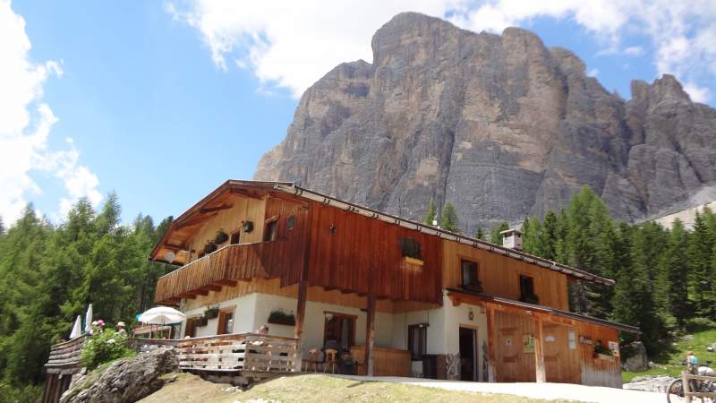
- Places to sleep: Angelo Dibona hut, Camillo Giussani hut.
- Free parking elevation at Dibona hut: 2083 m (6834 ft).
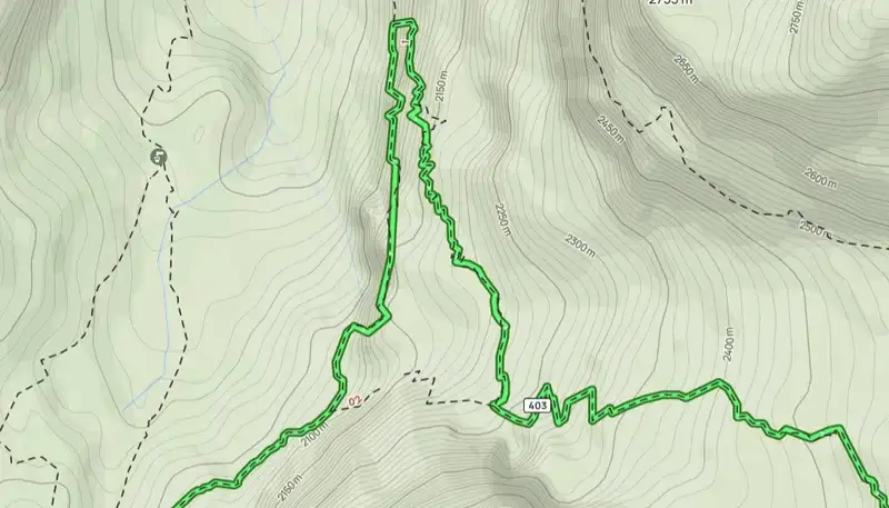
Tour of the Tofane interactive map
The map below is zoomable so you can see all access roads if you zoom out, and route details if you zoom in. This is from AllTrails site. If you follow the link you will find many more maps from the same area, and throughout the globe.
Going clockwise or anti-clockwise?
If you go clockwise, this will be a much easier start. After a short walk up from the Dibona hut parking, you will gain some elevation, and then for a few hours this will be an easy walk.
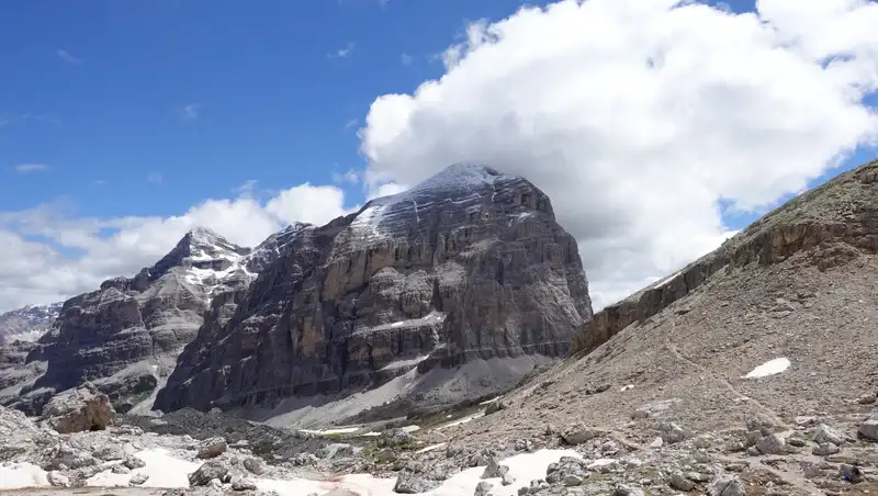
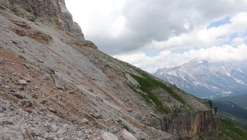
The route will first gradually go up till you get to Forcella Col dei Bos (2559 m), and the most impressive walls of Tofana di Rozes will be above you on your right side.
After that you will turn into the north direction and descend into the deep Travenanzes valley. Here you will get to the lowest point on the tour which is at 1991 meter of elevation.
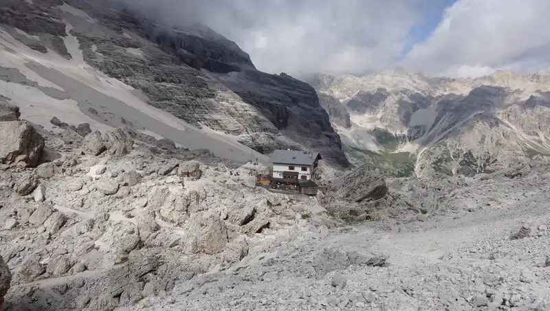
But from there, you will have to walk up to the highest point which is at Giussani hut (2576 m), so this will be a continuous climb up for 585 meters.
However, if you go anti-clockwise, your start will be much harder, and you will climb all the way up to the mentioned Giussani hut. This will be 483 meters of initial elevation difference.
From the hut, you descend to Travenanzes valley and then climb up 568 meters to Forcella Col dei Bos. This is a lot to walk up, but inclination is milder than in the beginning, and the path is on a more stable rock.
Regardless of the walk direction, you will have an elevation difference of more than 1000 meters in total, and this is quite a lot.
So the route is far from easy, but perhaps it is better to do the tour anti-clockwise simply because you will be more fresh and do the hardest part first.
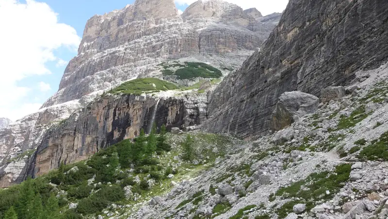
Below you can see the west side of the route above and through Travenanzes valley. This may help in better understanding the geography of the area. The picture is taken from my tour to Bivacco delle Pace.
- The yellow arrow is the position of Giussani hut.
- The blue arrow is the position of ferrata which you can avoid (more below).
- The red arrow on the right is the area of Forcella Col dei Bos.
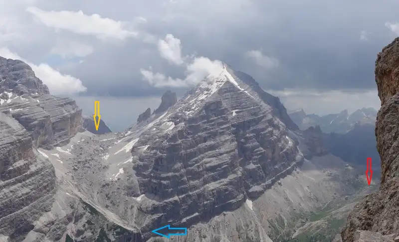
Note that the lowest point on the route is not captured in the picture, pity.
My tour description
My plan was to go to Tofana di Dentro, and the reason was that the normal route was under snow and some parts of it were difficult to pass. I described this in my text and you can follow the link and read more.
But I knew that there was a route which people use to descend from Tofana di Dentro and Tofana di Mezzo, and I thought I could use it as my ascent route. However, one part above Giussani hut is with lose rock and very steep, and it was also under snow.
In addition, I knew that there was a lake behind this steep part (there is a photo of it in my text about Tofana di Mezzo), and I had no idea about snow condition there, so I had to give up.
So, I lost some time and energy on that fruitless attempt, but decided to stay in the area and to make the round tour.
Near the hut, I met somebody and we started a conversation in English, but very soon we realized that our native language was practically the same. This was a man from Croatia (salute to Marin), and we agreed to go together and make the round tour.
Marin was roughly half my age, and a triathlete, but he was merciful enough to accommodate to my tempo. We descended along the route that is the same as the one in the map above.
Below you can see the fork point where the route splits, on the left is direction to ferrata passage, and on the right the normal walking route. Travenanzes valley is deep below. Marin did not have ferrata equipment, so we went to the right.
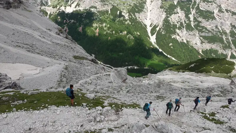
It was just a chance that we happened to be there behind that big group in the picture, but they went in a different direction. We were alone most of the time. The only people we met later were on the Forcella Col dei Bos.
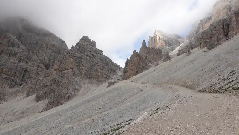
Below is the point where the route makes a sharp turn from the north to the south, you can find it easily in the map. This is the previously mentioned lowest point on the route. But even here, elevation is 1991 m, these are high elevations all the time.
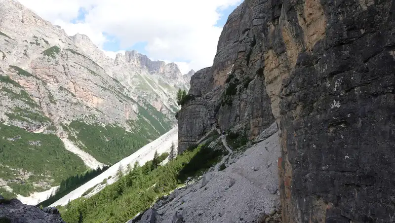
From this point, walk up again begins in the direction of Forcella Col dei Bos. Remember the mentioned remaining 568 meters of elevation to climb? This is the place where you face them.
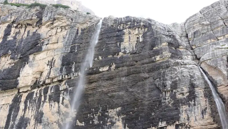
Lots of water comes from above, and you walk directly under vertical cliffs. You may not be dry after walking here, just to know. It is best not to stay long here, my guess is there may be falling rocks occasionally, the previously passed routes are somewhere above.
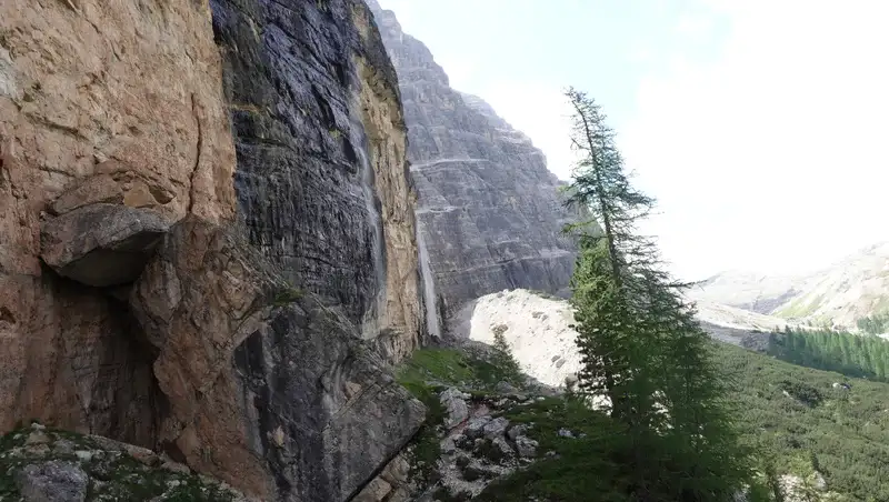
Very soon you are at two waterfalls, Pišandro del Majarié, see below how they look, and immediately after that you will see the mentioned ferrata and ladder.
Here is a view back towards the waterfalls and the ferrata wall, the path is not steep, and you are on a far more pleasant terrain with open views down the valley:
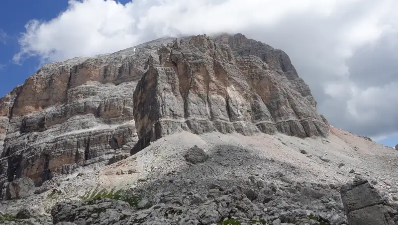
We had a rest at Forcella Col dei Bos, the picture below, this is an area where several routes converge, from Travenanzes valley, from Falzarego pass and also from Lagazuoi hut.
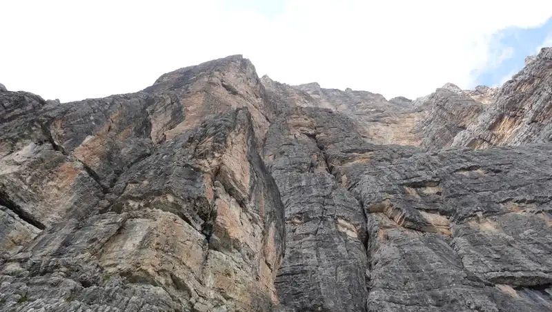
While you rest, from there you can admire cliffs of Tofana di Rozes that are above, the upper part of the mountain was in clouds:
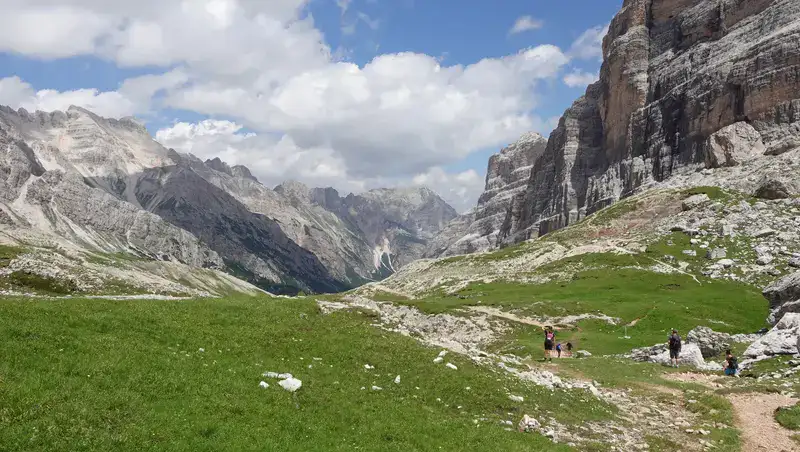
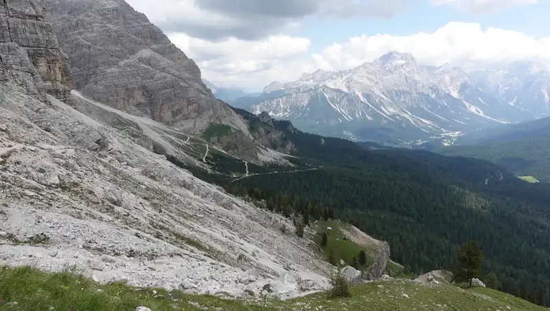
Below you can see the path in the direction we had to follow towards Dibona hut. From this point you descend all the time so this is the easiest part of the tour:
You will have the cliffs on your left side, this is the area where rock climbers come in big numbers, you will hear them high above you:
Below is the view of the last section before you get to Dibona hut, the route up which I walked in the morning is also visible on the left:
Route variant over Minighel ladder and ferrata
If you want to feel adrenaline, and also to shorten the route, you can go over the Minighel ladder (Ra Šàra del Minighèl). You have already seen a few related photos.
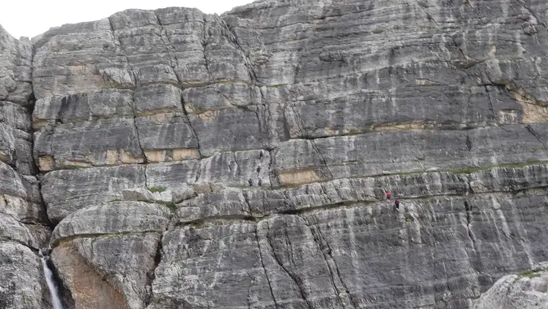
The picture below shows the part of the map where the ferrata is located, you can see it as a shortcut path, and you will find it easily on the map given above.
But, look closely on the picture below, there are two separate groups of people on this wall. You would not want to go this way if i) you have problems with vertigo, or/and, ii) without a proper ferrata equipment. The wall is scarry and almost completely vertical.
Please see more in my video:
Equipment and supplies
If you decide to do the ferrata, you will need a harness, and a Y-rope. Having a climbing helmet, may not be compulsory but if you have it better to use it.
For the rest of the route I would recommend boots like Mammut Sapuen GTX, Lowa or Salomon, or even much cheaper Nortiv 8 boots.
A day pack is enough, you have plenty of options at REI. I always use trekking poles, they add a lot to stability on such a terrain. Make sure that you have a waterproof jacket and waterproof pants, weather can change quickly in the mountains.
Regarding water, the only place where you will see it is at the mentioned waterfalls, but do not even think of refilling without purification and filtering. Up to two liters will be more than enough, so you can carry it with you.
There are two huts on this circular route, so you can have meals there and even stay overnight. Here are contact details:
- Angelo Dibona hut: Vallon di Tofana, Località Dibona, 32043 Cortina d’Ampezzo BL, Italy. Phone: +39 0436 860294.
- Camillo Giussani hut: Località Col, 8, 32043 Cortina d’Ampezzo BL, Italy. Phone: +39 0436 5740, info@rifugiogiussani.com.
Final thoughts
In summary, the Tofana di Rozes round tour offers an excellent alternative for those unable to reach the summit, providing a rewarding high-altitude hike through stunning Dolomite landscapes.
While not requiring special equipment, the route still demands endurance, with significant elevation changes and some challenging sections. Whether choosing the clockwise or anti-clockwise direction, hikers will experience a mix of gradual ascents, steep climbs, and scenic descents, all while surrounded by towering rock faces and deep valleys.
The presence of two mountain huts along the way allows for rest and refreshment, making the journey more manageable.
For those seeking an extra challenge, the Minighel ladder and ferrata provide a more technical variant, requiring proper climbing gear and experience.
Regardless of the chosen path, preparation is key; sturdy boots, trekking poles, and weatherproof clothing are highly recommended. Water sources are limited, so carrying an adequate supply is essential.
This circuit is a fantastic way to explore the rugged beauty of the Dolomites, offering a memorable and physically engaging experience.
Thank you for reading and let me know if you have questions, there is a comment box below. For more texts about mountains in this area please check under the category Italian Alps. In particular, if you want to get to the summit of Tofana di Rozes, read details in my report. For more hiking tours, read my text about Lago Sorapis and Lago Federa.
Please join us at our Facebook group Dolomites Visitors Hub. Subscribe to my weakly newsletter and stay informed, the subscription form is given below.
Leave a Reply