I climbed the Tofana di Dentro recently solo by following the Formenton route that goes by the bivacco Barraca degli Alpini. Here you have my detailed report about the climb.
There are two main normal routes to the summit of Tofana di Dentro. If you want to walk it all the way up, you will follow the route which is described here, and it starts at the Pie Tofana car parking at 1675 m (5495 ft). The other route is from the summit of Tofana di Mezzo, and you will have a long ferrata to pass the ridge between the two summits.
Tofana di Dentro – numbers & details
- Coordinates, latitude & longitude: 46.55685°N / 12.06389°E.
- Elevation: 3238 m (10623 ft).
- Normal route difficulty: ferrata & walk-up, snow on the route till August.
- Height difference to climb from the car parking: 1563 m (5128 ft).
- Useful map: Tabacco number 03, Cortina d’Ampezzo e Dolomiti Ampezzane. 1:25000.
Where is Tofana di Dentro? Access roads & location
The Tofane group raises directly above Cortina d’Ampezzo on its west side and their three main peaks are the most impressive landmark in the city area.
Below is my picture of the three mountains taken from the west, from my tour to Bivaco delle Pace. Deep below is the Travenanzes valley which I also visited recently on my round tour of Tofana di Rozes. The latter I climbed a few years ago, and if you follow the link you will see the picture of the Tofana di Dentro from that perspective as well.
Being so close to the city, and so attractive, the Tofana group mountains are very popular, so you have plenty of options here for hiking, biking, true alpine climbing, skiing in the winter, etc.
It is hard to describe the beauty of these mountains. I have climbed all three of them, and I can tell you they are quite different.
To get to the area from any side and with any transportation, your destination will always have to be Cortina d’Ampezzo. I have created the interactive map below which very roughly shows the route, and all access roads. All you have to do is to zoom in and out.
The red part of the line in the map below is the Formenton area where you will have fixed cables and some mildly exposed passages. The rest is a walk-up type route. But you may have snow here even in August, more below.
Why climbing Tofana di Dentro by the Formenton route
There are several good reasons to climb Tofana di Dentro by the Formenton route which I followed. Here are a few.
- This is a bit long and remote approach, far from popular tourist and ferrata routes although some of them in fact start from the same Pie di Tofana parking but they go in different directions. So if you really want to avoid crowd in full season, this is the route to go.
- You have the bivacco Barraca degli Alpini on the route. This is a destination worth visiting itself, even if you do want to continue to the summit.
- The route will offer a real mountaineering tour; no lifts and restaurants around, and in a breathtaking environment.
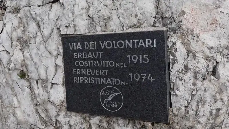
- This is also a historical route. The ferrata and the route were built by Austrians in 1915 for military purposes, so this is one of the earliest ferratas in the Dolomites. There are still many trenches, barb wire, ruins, and barracks everywhere around on the upper part of the route.
The route description
There is plenty of free space at the Pie Tofana parking which is at 1675 meters of elevation. This is also the lift station for some other directions, and from here you also walk to the Col Drusciè if you want to take the lift to Ra Vales lift station and to the Tofana di Mezzo itself.
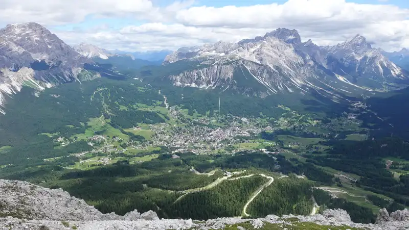
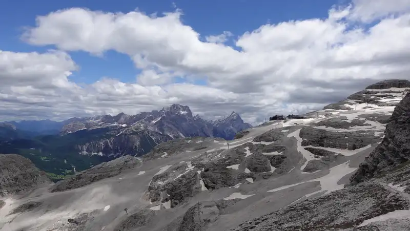
But if you plan to walk, you will follow the signs to Forcola Ra Vales, a pass which is in the north-west direction. This will be first through the forest, and soon you area above the tree line and you will have Cortina in sight as in the picture below.
At Forcola Ra Vales (2300 m) you do not have to go in the direction of the lift station, but go diagonally in the direction of the Tofana di Dentro cliffs.
The route is visible from the distance and it is easy to navigate here. The picture below is my view back to the pass and to the lift station higher above.
This part is easy and pleasant, but elevation gain is slow. You will most likely walk in silence and solitude. I was there twice and did not see any living soul around. The picture below shows how it looks.
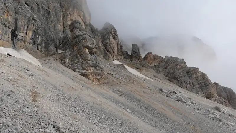
After that follows an area with front line caves and other stuff that you can see in the picture below.
This part, which I describe as couloir, is the area where first cables are located. It can be dark, cold, and unpleasant if you are in clouds and in early morning, but it is not really hard to walk and you do not have to attach yourself to the cables.
But when you get to Formenton pass, it all changes and you will feel great here even if you are in the clouds as I was. But if the sky is clear you will incredible views around.
On the Tobacco map which I mentioned previously, this area is described as ferrata Formenton.
There are indeed fixed cables, but exposure here is minimal and you do not have to use equipment. I had it with me and I put all the stuff on me simply because I did not know what I had in front of me.
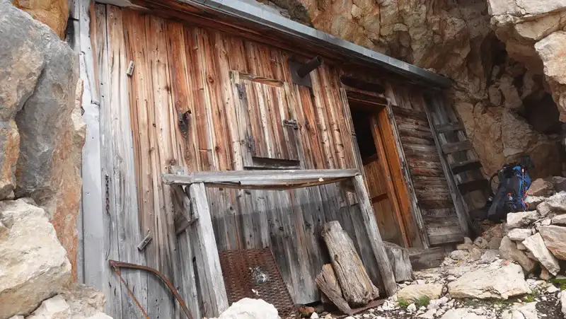
At Bivacco Baracca degli Alpini
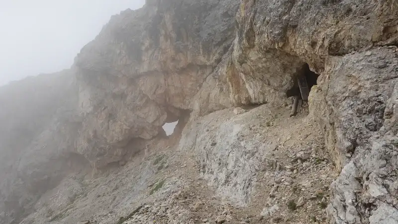
When you walk up, the Bivacco Baracca degli Alpini is nowhere in sight. It is completely hidden under a rock, built practically in a cave, and you will not see it until you are literally 5-7 meters away from it.
Note that elevation here is 2948 m, so this is a very high shelter.
The shelter is old but it is dry inside and you have mattresses, blankets, and even a stove is there. This is how it looked inside when I visited it:
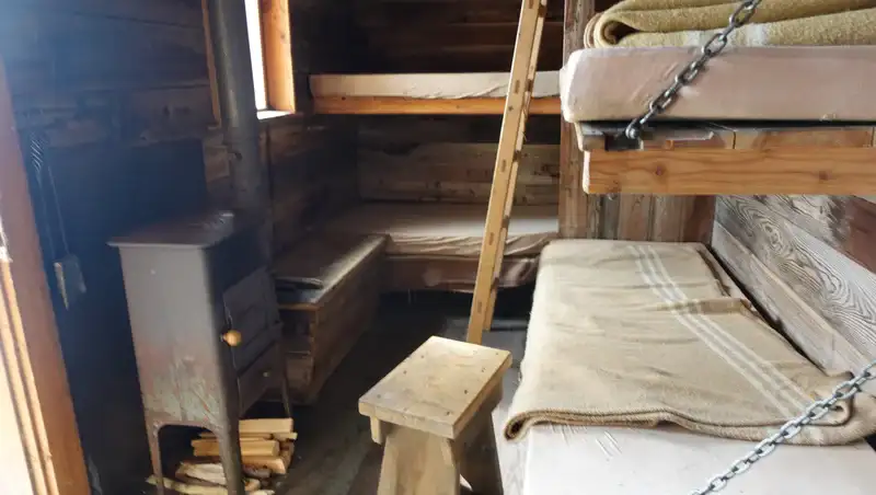
There is no water anywhere around, bear this in mind if you plan to spend a night there.
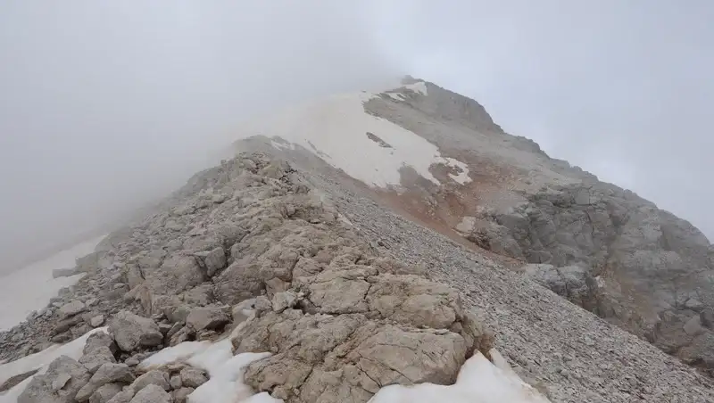
The final summit ridge part
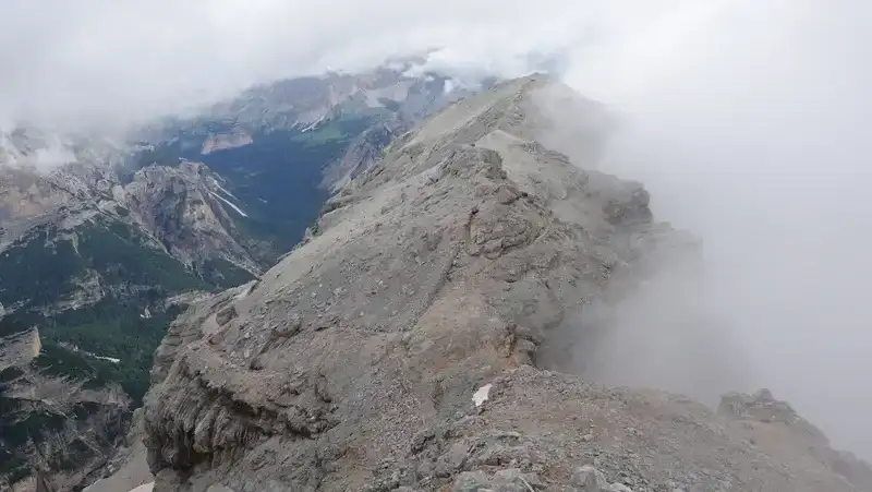
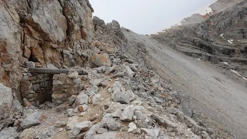
When you continue the tour, the shelter will disappear from your view equally fast as it appeared. You will have more WWI ruins around you, see the picture below, and at this point the final summit ridge will be visible.
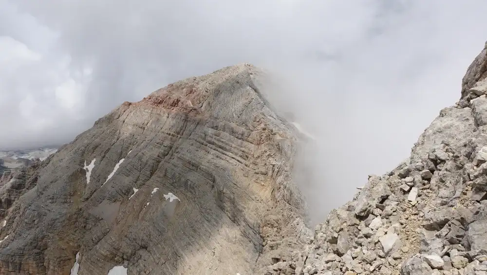
On a sunny day and without snow, this must be the most beautiful part of the route. The picture below shows how it looks. But be ready for snow here even in the beginning of August.
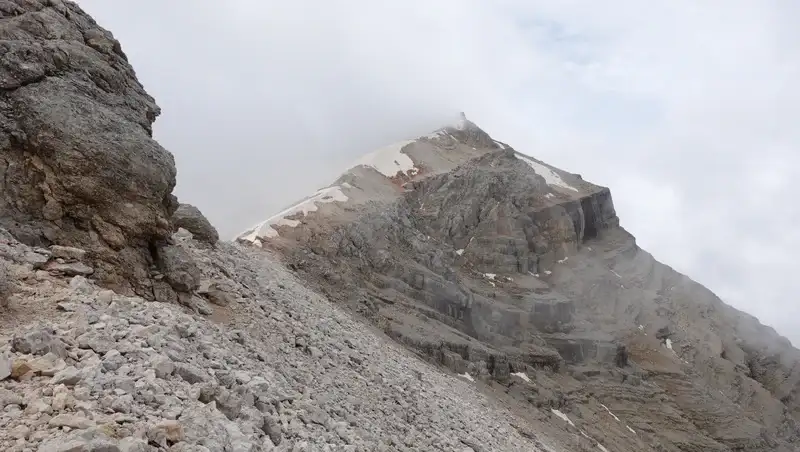
The picture below shows one of the snow areas. It looks easy and not very steep in the picture, but it is very different in reality.
The summit is without the usual pompous cross, those that you will find on the other two peaks of the group. Below you see how I have seen it.
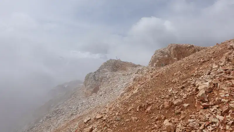
There are war caves directly under the summit rock, and other signs of front line fortifications. This will be useful if you are caught in storm when you are on the summit.
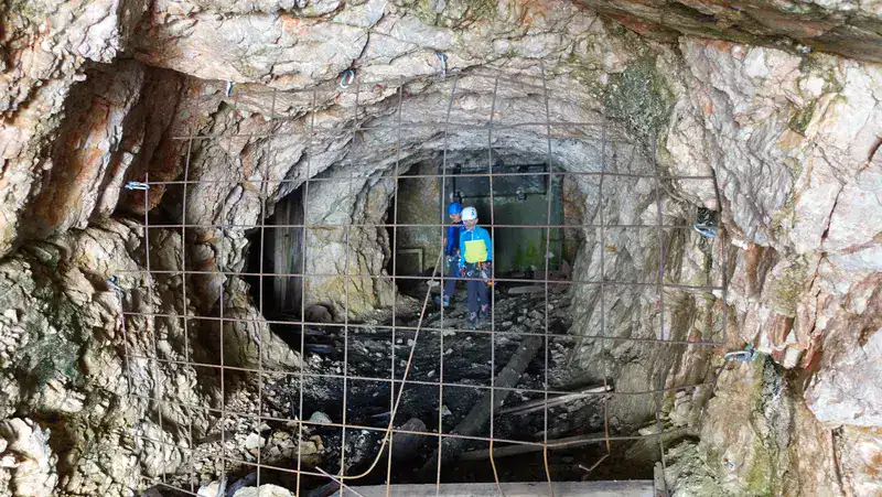
I heard voices and realized there was a father with two boys there, they came from Tofana di Mezzo where they arrived by the lift. He allowed them to enter the cave behind the fence, while he stayed outside. This cave is just a few meters under the summit.
This was a totally crazy thing to do because the ferrata from that side is far from easy (you will see a picture below), and letting kids inside the cave without knowing what may be there was simply stupid.
Is the Formenton ferrata hard? My rating
The answer is no. There are a few easy passages equipped with cables, so if you have your ferrata equipment with you, attaching may be fine, but for most people this is not really necessary.
However, if you plan to continue and traverse the ridge between Tofana di Dentro and Tofana di Mezzo, then equipment is absolutely necessary. This hold in particular on the part where you descend from Tofana di Dentro to the pass between the two peaks.
Here you can see how I rate the ferrata based on three essential criteria assuming that you walk all the way from the car parking and that the route is free of snow:
| Rating Criteria | Rating (A-E; 1-5) |
|---|---|
| Technical difficulty | A |
| Ferrata length | 3 |
| Access route difficulty | C |
| Overall Score | A3C |
My climb
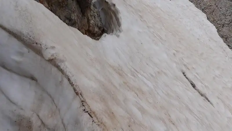
This was my second attempt within an interval of three weeks. I tried first on July 2nd and could not continue because of the snow in the couloir. Here you can see what I encountered there:
The route was marked at some Cortina sites as officially closed, and I assumed this was because of the snow.
Three weeks later, on July 22nd, I tried again, and started from the parking at 6:30 AM after sleeping in the car. The route was still officially closed, but on the way up I noticed a table where it was mentioned that the reason was “falling rocks”.
This looked like an absurd reason, all mountains are with falling rocks, so I ignored the warning and continued. After all the day walking, I have never seen or heard any falling rocks.
This time the couloir was practically without snow, and I went through it without any problem.
My initial plan was to carry sleeping equipment and to stay the night at the bivacco. In the evening I packed all in a bigger pack, the weather forecast was very good. But when I check next morning, I was shocked, and realized I had to change the plans. This is why I decided to make it a day tour.
I was at the shelter after four hours exactly. For the elevation difference of 1273 meters, this was my optimal performance as I normally make around 300 meters of elevation difference per hour.
After taking a rest in the shelter for around 15-20 minutes, and recording around, I continued. All the details you will see in the video below.
I was at the summit at noon. This means 5 hours and 30 minutes in total from the car parking.
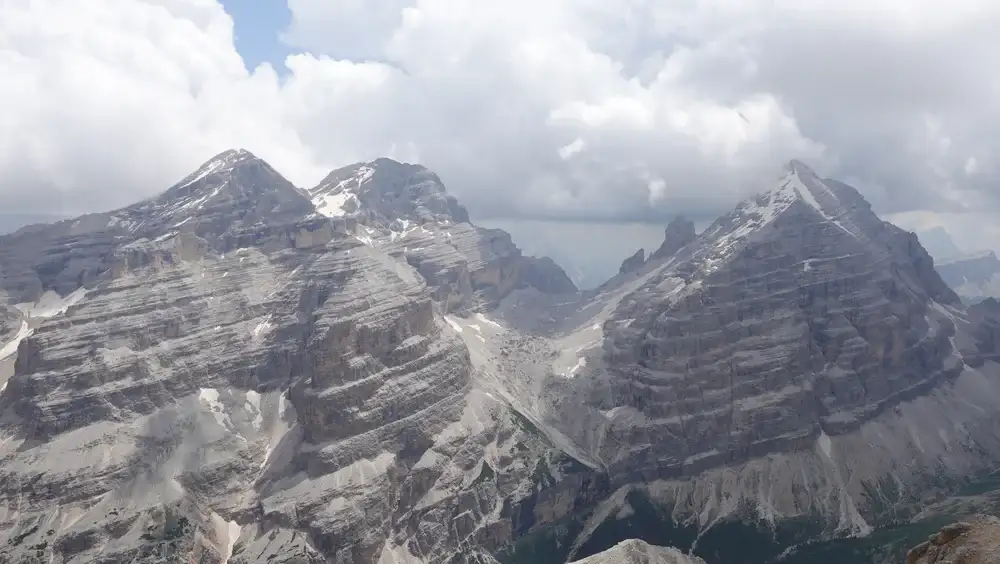
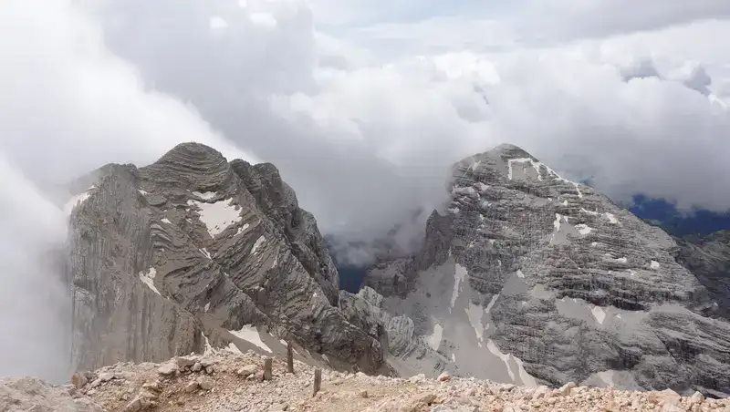
The picture below shows a rare moment with views of the other two Tofana mountains. On the left is Tofana di Mezzo and Tofana di Rozes is on the right.
At that time I knew that I would be able to continue to Tofana di Mezzo, so I was not in rush and stayed quite long on the summit, had my breakfast and rested properly.
After that I followed the ferrata, you will have a new text about this part here in the site.
In my video below you can see more about this tour, please have a look:
Equipment, supplies & accommodation
The boots I used here were my Mammut Sapuen, this is why I used simple strap-on Camp Frost crampons. I had to use my Petzl ice axe on the steep snow slopes under the summit.
For the ferrata part I had my Black Diamond harness, Petzl helmet, and a Y-lanyard. The backpack was my Mammut Lithium 40. On this occasion I had a pair of Komperdell poles.
You have already seen that Cortina d’Ampezzo is the closest place for supplies and also for accommodation.
Final thoughts
In summary, I am pretty sure that most people go to Tofana di Dentro from Tofana di Mezzo where they come by lift. From there, they then follow the ferrata over the deep ridge between the two peaks. I have seen some using ridiculous helmet cameras that distort the picture completely and give a wrong impression of the climb.
However, if you want to enjoy this mountain in solitude, then the mountaineering route described here is for you. In my view, Tofana di Dentro is equally attractive as its neighbor Tofana di Rozes which I climbed two years earlier, but my guess is that fewer people visit it. The Barraca degli Alpini is an extra jewel on the route.
I had all the necessary equipment for ferrata and snow because I did not know what to expect. Remember, the route was officially closed.
But if you go in late August, you will probably have no snow at all. Ferrata itself is this more or less just by name, no doubt most people can do it without any equipment.
For more texts related to the same area, please see in this list, in particular my text about the Bivacco Buffa di Perrero. Bookmark this site and come again.
Let me know if you have questions or comments, there is a comment box below. Please join us at our Facebook group Dolomites Visitors Hub. Subscribe to my weakly newsletter and stay informed, the subscription form is given below.
Leave a Reply