If you plan to climb Sasso Piatto from Sella Pass following its normal route, here is my first-hand report with all the details you need. Keep reading.
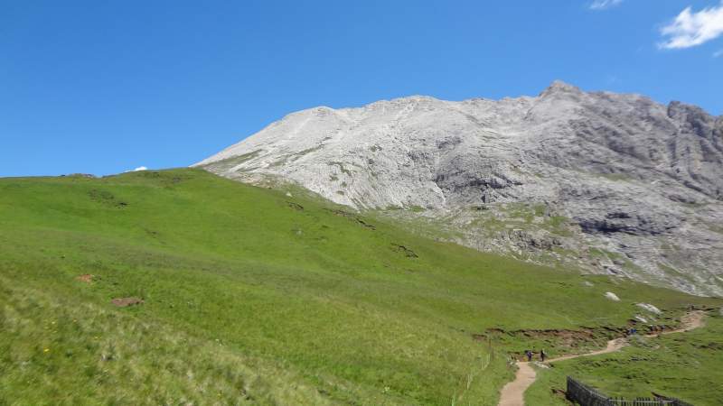
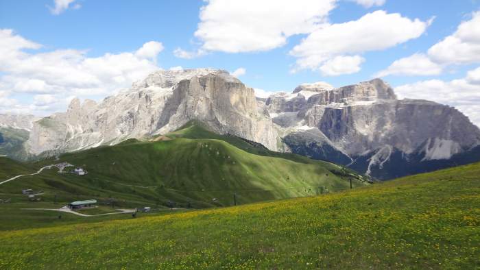
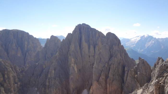
The summit of Sasso Piatto as seen from the area above the hut.
The picture above shows the summit halfway up from the Sasso Piatto hut. The actual slope looks much steeper in reality, but it is still a simple walk-up.
Sasso Piatto basic data
- The name: Sasso Piatto, Sassopiatto, Saspiat, Plattkofel.
- Elevation: 2958 m (9705 ft).
- Location, latitude and longitude: 46.51696° N, 11.71118° E.
- Normal route type: walk-up.
- The highest car access point: Sella Pass (2218 m, 7277 ft).
- Closest place for supplies and accommodation: Canazei.
- Map: Val di Fassa e Dolomiti Fassane, 06, Tabacco, 1:25000.
This mountain belongs to the Sassolungo group, which includes several peaks that form a U-shaped chain, as you can see in the interactive map below.
There are two main routes to the summit. One is the via ferrata Schuster, which starts on the north-east side of the mountain. You can climb via the ferrata route and then descend via the path that leads to the Sasso Piatto hut.
The AllTrails interactive map below shows all the details. Follow the link for more information.
About the normal route
When I climbed Piz Boè two days earlier, I thought it was the busiest mountain I had ever visited. After going to Sasso Piatto, I had to change my mind.
It is not the mountain itself, but the access route, especially the lower half, that attracts crowds. Starting from Sella Pass, you follow the Sentiero Friedrich August path. It has some ups and downs but is largely flat. The picture below shows a typical section.
This is how the lower route Friedrich August typically looks.
In this relatively flat section you pass 5–6 buildings with “rifugio” (hut) in the name. I am not sure if all of them are true huts, some appear to be mountain restaurants, and at least one is a farm offering accommodation and food.
The combination of easy high-altitude car access and numerous attractive huts/restaurants makes the area extremely popular.
On my way up there was nobody around, only one Italian passed me on the final summit slope. We crossed paths several times and he eventually reached the summit before me. Two other people were already there, they had clearly started from the hut below. So there were only four of us on the summit for more than half an hour.
On the way back, however, the lower part of the route was incredibly crowded, I would estimate close to a thousand people.
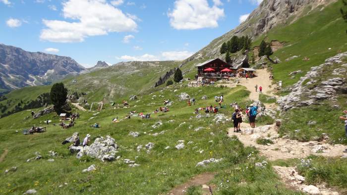
Pertini hut, the picture taken on my way back, with many people around.
The bottom line: you cannot avoid crowds in the lower section on your return, but the summit is a different story. If you start early, you can enjoy it in near solitude.
Huts
There are many places to stay, but the last hut before the summit is probably the only one worth mentioning here. It is the best place to stay if you want to reach the summit before sunrise. I am referring to Rifugio Sasso Piatto (2300 m, 7546 ft), shown in the photo below.
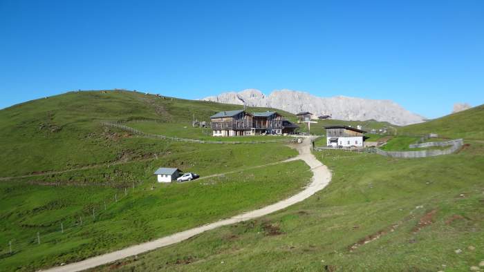
Rifugio Sasso Piatto.
There is also Rifugio Vicenza, which is the best starting point if you approach from the north-west and climb via the ferrata Schuster. I have not been there, so I cannot provide more information.
My climb
I initially considered the ferrata Oskar Schuster and a round trip, but I was unsure about possible snow on that side of the mountain.
From previous bad experiences I knew snow could ruin the day, and my time was limited. So I decided to go clockwise, following the Friedrich August route to the Sasso Piatto hut and then continuing to the summit.
I arrived at Sella Pass at 6:30 AM and parked directly at the pass, where I found free parking. There is a shortcut from there to the route, no need to walk down to the lift station area where the path officially starts.
There was no one around at all. I saw nobody until I reached the Sasso Piatto hut at 8:00 AM, 90 minutes of almost flat walking, which was a bit annoying. Still, the area is beautiful and the views of the Sella Group, including Piz Boè (climbed two days earlier), made it worthwhile.
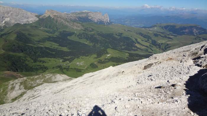
View of Sella Group.
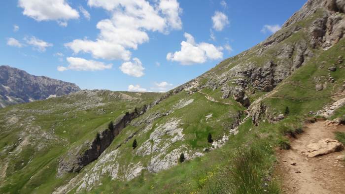
From the hut I continued straight to the summit. The path zigzags but generally heads north-east. It remains a simple walk-up the whole way, though there is quite a lot of loose rock. See how it looks below:
The route below the summit.
The summit cross appeared in front of me at 9:40 AM, 3 hours and 10 minutes from Sella Pass.
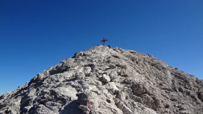
The summit.
I spent about one hour on the summit. The day was still young and there was no reason to rush. The Italian I met on the way up was preparing to descend, he came over to say goodbye and found me making coffee. You can see my gear in the picture:
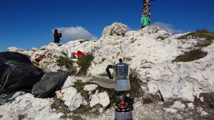
My summit coffee.
Compared with other peaks in the group, Sasso Piatto is a really mild mountain, at least from the south-west side that I climbed. The picture below shows part of the group with its vertical cliffs:
I already mentioned the ferrata route I did not take. Here is a nice video about it — they climbed it later in the season when the route was free of snow.
Essential equipment & accommodation
For the normal route described here, you do not need any special equipment. I used my Salomon Quest Prime GTX boots and Osprey Stratos 24 pack.
I was foolish enough to leave my sunglasses in the car, but fortunately I had a 19-year-old hat I bought in 2003 while climbing Mt Fuji in Japan. I also used trekking poles and carried water and food. As mentioned, you do not need to carry much — you can get everything at the huts.
This is a popular area, but there are many accommodation options, including apartments for rent.
Final thoughts
This was my experience of climbing Sasso Piatto from Sella Pass via the normal route. It is one of the easiest 3000 meter peaks in the Dolomites and does not require any technical skills or special equipment in good conditions.
The approach is long and often crowded, but the effort pays off higher up. Once you leave the busy lower paths behind, the mountain feels calm and surprisingly empty. The summit area is spacious, comfortable, and offers wide views in all directions, making it a good place to slow down and spend time.
Sasso Piatto is a good choice if you want a high summit without stress, exposure, or complicated logistics. It also works well as an acclimatization hike or as a relaxed day between more demanding climbs. Even stopping at the hut and turning back is enough for a rewarding day in the mountains.
You might also want to read my reports about climbing Tofana di Rozes (normal route), Piz La Varella from Capanna Alpina, and my comparison of the Lago Sorapis and Lago Federa hikes.
Please join our Facebook group Dolomites Visitors Hub. Thank you for reading. Feel free to leave questions or comments below. Have a nice day.
Frequently Asked Questions
Is Sasso Piatto suitable for beginners with limited mountain experience?
Yes, the normal route from Sella Pass is suitable for beginners who are used to long walks at altitude. There are no technical sections and no exposure. The main challenges are distance, loose gravel near the top, and weather changes. Good fitness and basic mountain awareness are enough.
What is the best time of year to climb Sasso Piatto?
The best period is from late June to early October, depending on snow conditions. Early summer can still bring snow on shaded sections, especially after heavy winters. July to September offers the most stable conditions, but also the highest number of visitors.
Do I need a guide to climb Sasso Piatto via the normal route?
A guide is not necessary for the normal route in good conditions. The path is well marked and easy to follow. A guide may be useful if you are unfamiliar with alpine terrain, hiking at altitude, or if you plan to combine the ascent with the via ferrata Schuster.
How does the normal route compare to the ferrata Schuster?
The normal route is a hike with no climbing equipment required. The ferrata Schuster is a protected climbing route with cables and ladders and requires ferrata gear and experience. The ferrata is more engaging and less crowded but also more demanding and weather dependent.
Leave a Reply