Spluga Pass (Splügen Pass, Spluegen Pass, Passo dello Spluga) is a mountain road pass between Italy and Switzerland with plenty of attractive hiking and mountaineering routes in particular on the Italian side.
Spluga Pass (Splugen Pass) – basic data & information
- Coordinates, latitude, longitude: 46°30′20″ N / 09°19′49″ E.
- Mountain group: Leopontine Alps & Platta Group.
- Elevation: 2115 m (6939 ft).
- Towns for supplies: Campodolcino and Madesimo on the Italian side.
- Useful map: Valchiavenna Val Bregaglia, Kompass 92, 1:50000.
The interactive map below shows the road access from the north and south. Please zoom out to see the wider area, and zoom in to see more detail.
- The Spluga pass is marked by the red marker.
- Yellow markers show positions of some attractive peaks close to the Spluga pass.
- Pink markers show huts and shelters.
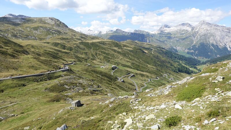
The road from the Swiss side is steeper but still accessible even for motorhomes. On the Italian side, the road continues down the valley all the way to Chiavenna, Lake Como, and the flat Lombardia area.
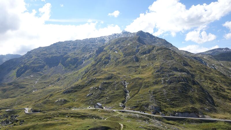
The Spluga Pass itself has no man-made attractions, so most people stop only to take pictures. There is only one old and closed building on the Italian side which was probably used as a border crossing officials building. There are no souvenir shops or restaurants.
One restaurant is a couple of kilometers below the pass on the Swiss side, see the picture below, and there is one or two in Montespluga village on the Italian side.
If you plan to stay in the area, the most convenient places with food shops are in Madesimo and Campodolcino on the Italian sides.
Peaks and hiking tours around Spluga Pass
There are several 3000ers around, and I have climbed a number of them. Most of them are exactly on the border between two countries, so you will see border stones on the routes.
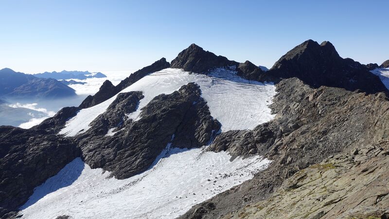
The peaks do not require special equipment, and normal routes are typically walk-up type. The only exception is Pizzo Ferre, the picture below, where you have to cross a glacier with crevasses, so you need crampons and this is not for a solo climb.
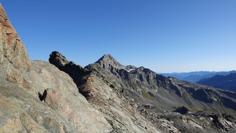
The closest to the Pass are Pizzo Suretta (Surettahorn) 3027 m (9931 ft) on the east side, and Pizo Tambo 3279 m (10757 ft) which is the highest and it is on the west side of the Pass, the picture below. The route to Pizo Tambo starts directly from the pass. There is lots of free space for parking around.
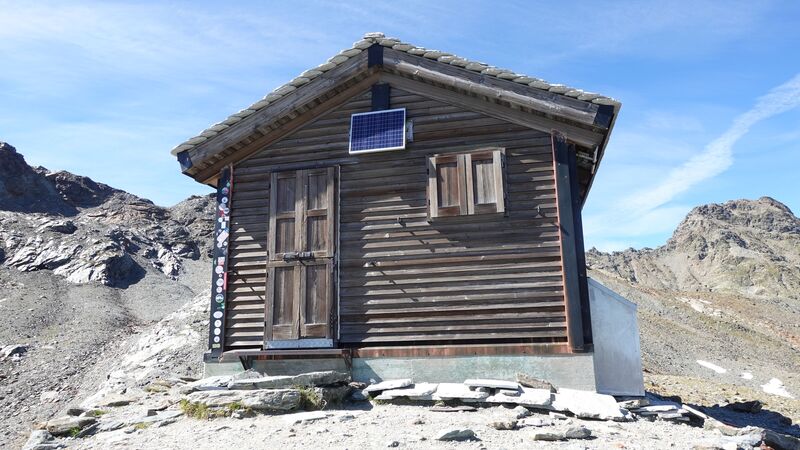
On the same west side you have Cime di Val Loga, 3004 m (9856 ft), two peaks next to each other. They are attractive also if you want to hike to Bivacco Val Loga (ex-Bivacco Cecchini) which is at 2773 m (9098 ft) where you can sleep (see the map and the picture below).
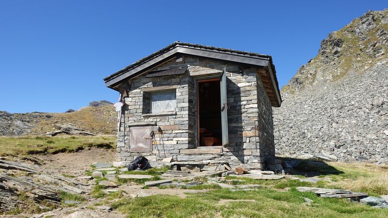
If you drive farther down the valley, you have an option to climb Pizzo Quadro (Cima de Pian Guarnei) 3015 m (9892 ft). Here too, you have some bivouacs where you can stay. This includes Bivacco Servizio (the picture below) and Bivacco Ca Bianca.
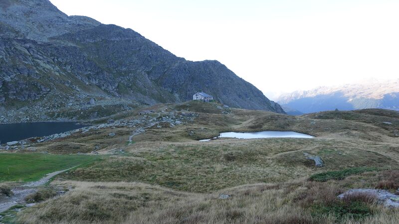
Below you see the picture of Rifugio Giovanni Bertacchi from my tour to Pizzo Emet:
Lakes in the area
There are many of them, and two are within walking distance from the pass, on its east side.
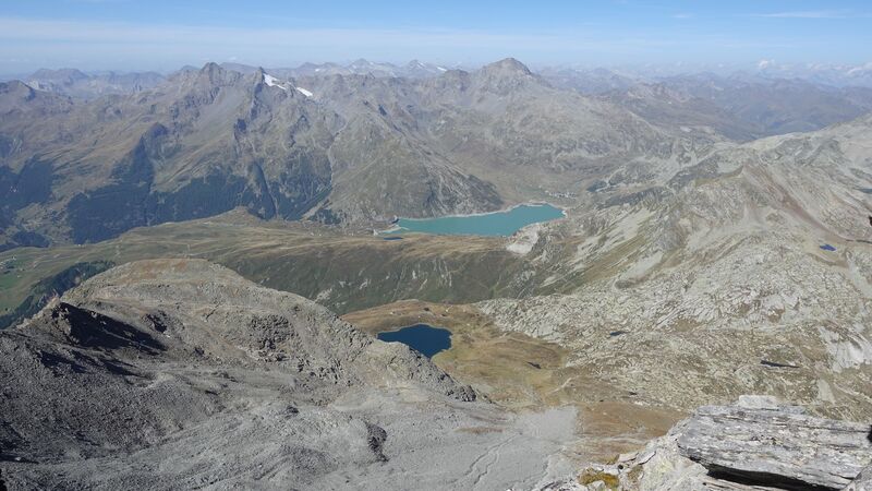
One of the lakes is partly visible in the picture above on the left, this is the Lago Emet.
The largest lake in the area is the Lago di Montespluga, which is directly by the road and very close to the pass. The picture below shows it from the summit of Pizzo Emet. Passo dello Spluga is on the right. The mentioned Lago Emet is also visible.
There are many more, some named and some without names, you will have them on every climbing route around.
Accommodation
In the valley, you have a camping in Campodolcino, this is the place where I stayed. You can also rent an apartment or hotel anywhere on the Italian side. For this It is best to check in Madesimo and Campodolcino.
Thank you for reading. Let me know if you have questions, there is a comment box below.
Spluga Pass (Splugen Pass) FAQs
1. What is Spluga Pass (Splugen Pass)?
Spluga Pass, also known as Splugen Pass, is a mountain pass in the Alps, connecting Italy and Switzerland. It is renowned for its scenic beauty and historical significance as a trade route.
2. Where is Spluga Pass located?
Spluga Pass is situated in the Rhaetian Alps, linking the town of Chiavenna in Italy with the Swiss canton of Graubünden. The pass is part of the road that connects Lake Como with the Hinterrhein valley.
3. How can I reach Spluga Pass?
Spluga Pass is accessible by car, and the road leading to the pass provides stunning views of the surrounding mountains. The nearest towns include Chiavenna in Italy and Thusis in Switzerland.
4. What activities can I enjoy at Spluga Pass?
Visitors can engage in activities such as driving or motorcycling along the scenic pass, hiking in the surrounding mountains, and exploring nearby historical sites and villages.
5. Are there accommodations near Spluga Pass?
Yes, there are accommodations available in towns near Spluga Pass, providing options for overnight stays. Chiavenna and Thusis offer a range of hotels, guesthouses, and other lodging facilities.
6. Can I visit Spluga Pass in the winter?
Spluga Pass is generally open in the summer and early fall, and it is not advisable to visit during the winter due to challenging weather conditions. The pass may be closed during snowy and icy periods.
7. Is Spluga Pass part of any long-distance routes or hiking trails?
Spluga Pass is part of historical trade routes and is also crossed by the Via Spluga, an ancient trade and pilgrimage route connecting Switzerland and Italy. Hiking enthusiasts may explore trails in the surrounding areas.
8. Are there any border controls at Spluga Pass? Both Italy and Switzerland are part of the Schengen Area, which generally means no border controls. However, it’s advisable to check for any updates, especially considering potential changes in regulations.
9. Are there restaurants or cafes at Spluga Pass?
While there may not be many facilities directly at the pass, there are restaurants and cafes in towns nearby, providing opportunities to enjoy local cuisine and refreshments.
10. What is the best time to visit Spluga Pass?
The best time to visit Spluga Pass is during the summer and early fall when the weather is more predictable, and the pass is generally open for visitors. This allows for a more enjoyable and safer experience.
Leave a Reply