The easiest way to climb Pizzo Quadro, known also as Cima de Pian Guarnei, is to start from Starleggia village which is above the Spluga road on its west side. This east ridge route is the one I followed, and it is described here.
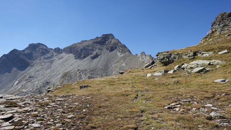
Pizzo Quadro – basic data & information
- Coordinates, latitude, longitude: 46.38860 °N / 9.29440 °E.
- Mountain group: Leopontine Alps.
- Normal route type: walk-up.
- Elevation: 3015 m (9892 ft).
- Elevation difference from the start: 1450 m (4757 ft).
- Time needed to get to the summit: up to 5 hours.
- Huts/shelters:
– Italian side: Bivacco Servizio, Rifugio Carlo Emilio, Rifugio Curti.
– Swiss side: none. - Towns for supplies: Campodolcino and Madesimo on the Italian side.
- Useful map I used: Valchiavenna Val Bregaglia, Kompass 92, 1:50000.
Access roads
You can see them all in the interactive map below. Please zoom out to see the wider area. As you realize, Pizzo Quadro (Cima de Pian Guarnei) is at the border between Italy and Switzerland.
Route description
The route starts above village Starleggia (1565 m). You get there by following an asphalt road from camping Campodolcino which is at the main road that goes up towards Spluga Pass.
The Starleggia village is very close to the camping, it is above the valley on the west side, but the access is steep so there are many bends, and the total road distance is around 7 km.
When you get to the village, do not stop there, just continue for a few hundred meters along a gravel road. There will be a barrier where you have plenty of free space to park the car. The road after the barrier is not open for public.
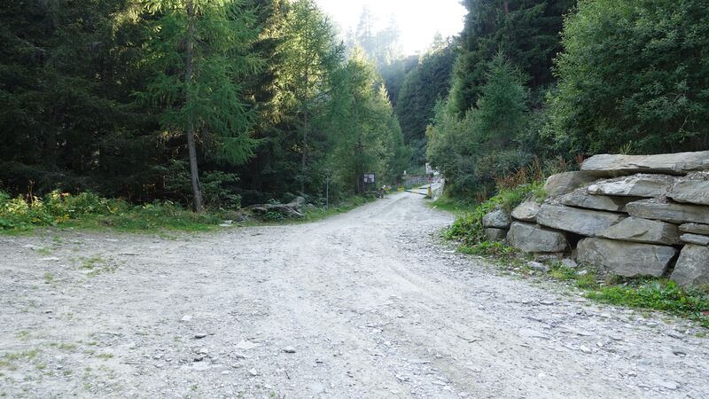
After the parking continue first along the road that goes up, and after that follow the sign to the left through the forest. The picture below shows the upper part of the Starleggia valley when I was walking through the forest.
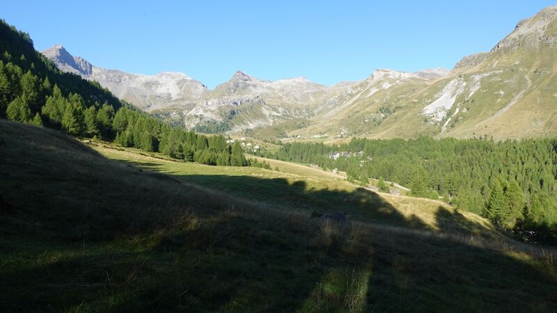
Very quickly the forest changes into meadows, see the picture below, and then a long walk follows in the direction of Bivacco Servizio.
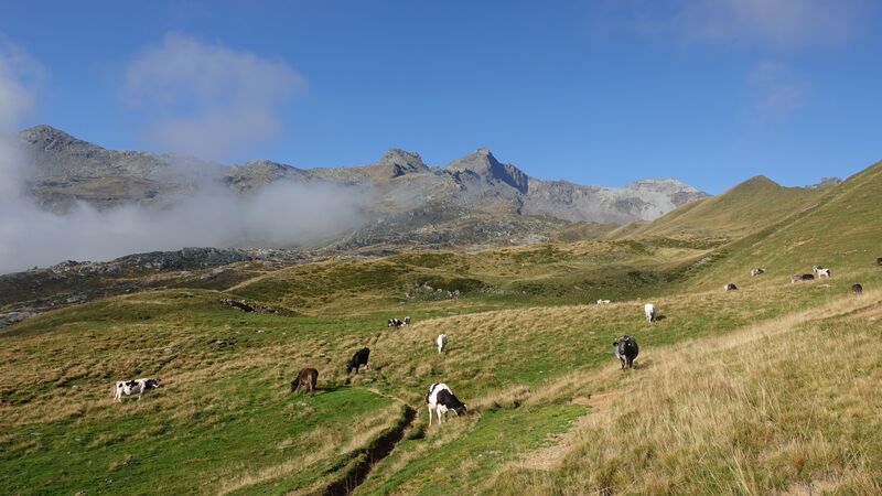
This is a wide and pleasant area, but make sure that you do not get lost. The route is not so visible at some places, and there are also many paths made by cows that are there all the time. The cows in the photo were without annoying bells, so the atmosphere was quiet and idyllic.
The route goes close to the ridge which is on the right when you go up, you can see it in the map above. At many points you will be on the ridge, and with the view of Val di Starleggia and Val della Sancia. Below, in those valleys is Rifugio Curti (1884 m). I have not visited it and cannot say what it offers.
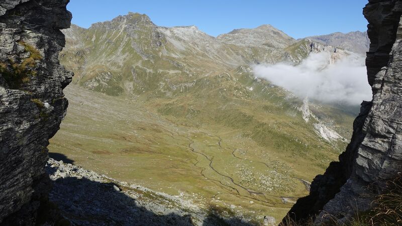
Higher up, you will have Motto Alto peak on the right and you keep walking up on its southern slopes towards Bivacco Servizio (2584 m). The refuge is shown in the picture, I took a rest there. It is very similar to Bivaco Val Loga which I visited a few days earlier.
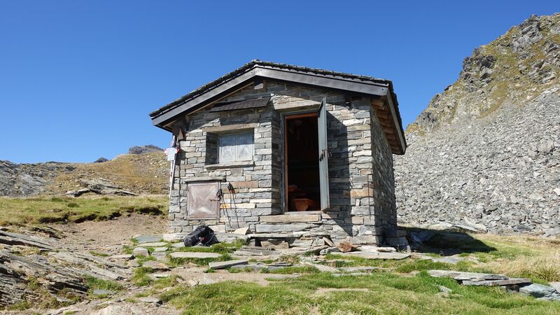
The summit will be visible if you continue a few meters above the Bivacco. But after the shelter, you will realize that it is necessary to descend first, and after that the route goes in the direction of a saddle from which the final east ridge begins. You can see these details in the picture below.
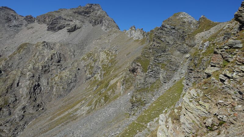
Below you can see the beginning of the east ridge route, it looks smooth and easy in the picture, but I can tell you it is different when you are there.
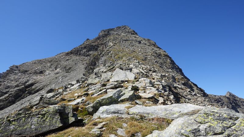
So when you continue, the view back is as shown below; the area with Bivacco is on the plateau to the right of the Motto Alto peak in the picture.
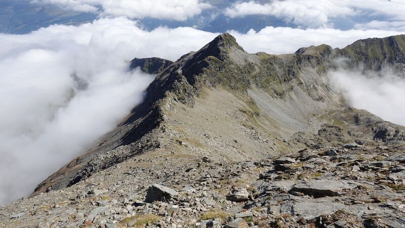
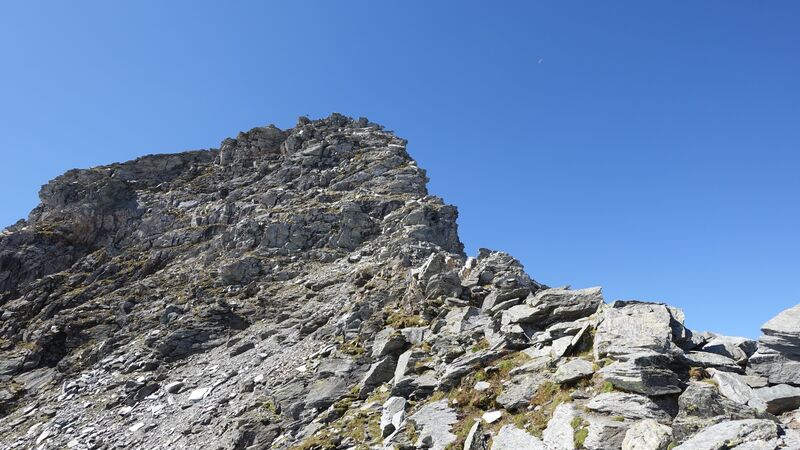
The route is not difficult to find, there are steep passages, but it is never particularly exposed. There are no fixed cables or ropes, it is always a walk-up. The final meters are steep as you see in the picture:
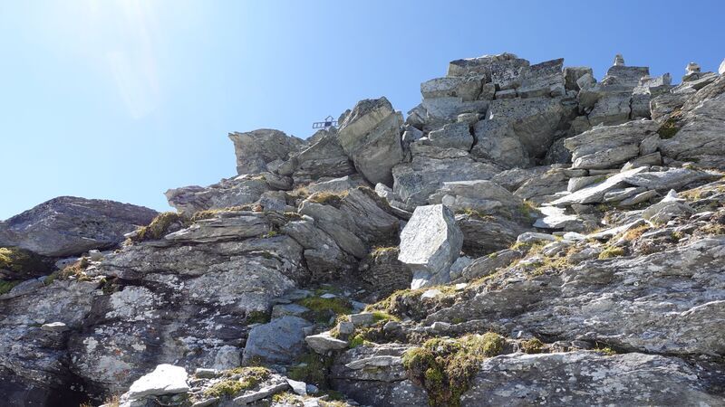
There are big boulders as you see in the picture below; the summit cross is also visible here.
Alternative routes
I cannot say much here because I walked only the east ridge route. But from what I have seen, there is an alternative approach from the south, from the lake Truzzo. This is the area where Rifugio Carlo Emilio is located. The route from this direction joins the route which I followed below the saddle under the summit.
Yet another route exists through the Val della Sancia, and this also joins the east ridge route on the mentioned saddle. This would be the route you use if you go to Rifugio Curti.
Some sources also mention access from the saddle between Pizzo Quadro and Piz Corbet. But from what I have seen from the summit, this must be a serious challenge, and I would not go that way.
It appears that there are no routes from the Swiss side, but if you know any, do let me know in the comment section below.
My climb
I was staying in camping Campodolcino, and decided to go a bit early, so I was ready before 6 am. But to my disappointment, the gate was locked. Nobody told me about this, and I did not know the numbers for the electronic lock.
So I was waiting for anybody to appear, and after more than 90 minutes I was able to leave. This almost ruined my day.
Anyhow, after passing Starleggia, I parked at the barrier and started walking immediately, it was around 8:15 am. I arrived to Bivacco at 11 am. Here I took a break and then continued towards the summit where I arrived a few minutes before 1 pm. This makes around 4 hours and 45 minutes or so, not bad for a guy of my age.
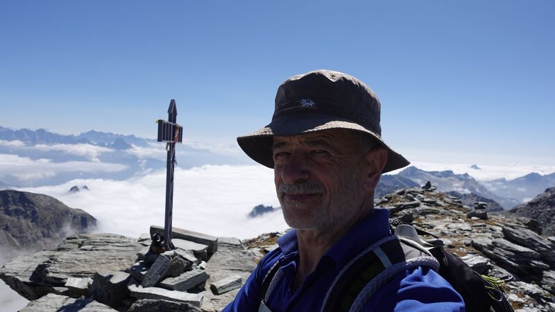
There was nobody around at all, and this was surprising because the day was perfect.
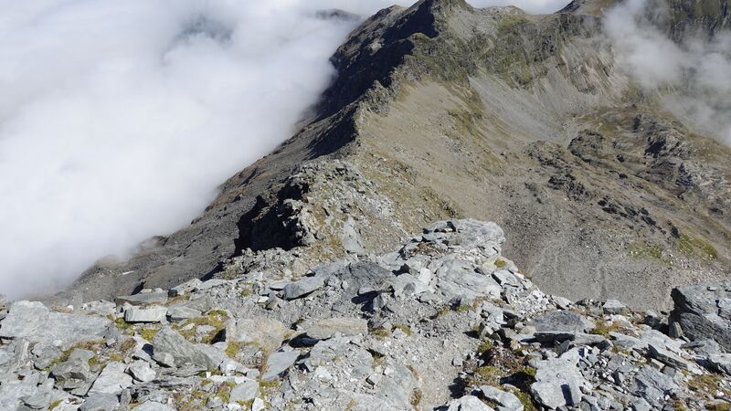
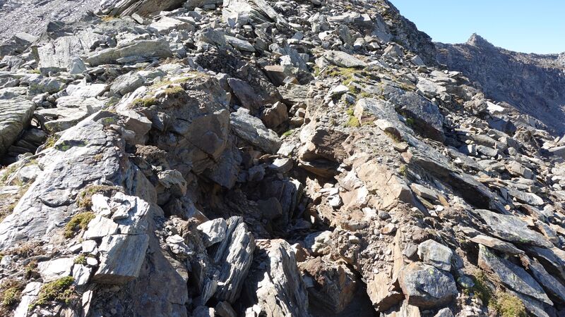
The summit ridge looks more difficult from the distance. But I must say, there are a few sections with fresh rifts, and it looks as if the mountain is splitting apart, see the picture below. No doubt, sooner or later, some big parts of it will crumble into the valleys.
On the way back, I stopped again at the Bivacco. I was willing to stay there overnight, but did not have enough water. There was a small pond/lake above the shelter with a few centimeters of water, but I was not really willing to use it, although I had my water filter with me. It was too close to the Bivacco, and you never know where people go when nature calls.
There was a family walking around, parents with a boy, the man told me he was born in Starleggia. They descended soon and I was alone again. So I took a rest using one of the beds, and later descended the same way.
Please see more in my video:
Equipment, supplies & accommodation
All in all, this is a non-technical walk-up type tour, but on a high elevation. I used my Osprey Stratos 24 day pack, and a pair of Komperdell poles.
If you need food, the only shops are in Campodolcino and Madesimo on the Italian side. Water is not available on the way up, so make sure you carry enough.
For accommodation, you have seen the huts and shelters mentioned above. From what I know, the Rifugio Carlo Emilio (2150 m) is without custodian, so you have to pick up the keys somewhere.
On the other hand, I am not sure about Rifugio Curti (1895 m); on my map it is marked as “ex Rifugio Curti”. It is on maps under the name Baita dei Fiori. But Bivacco Servizio is a nice place to stay, with 9 fully equipped beds.
There is also Bivacco Cà Bianca (2575 m) and it is marked in the map above. But this shelter is quite off the route. It has 12 beds in total, with mattresses and blankets, and it is always open.
In the valley, you have a camping in Campodolcino where I stayed. You can also rent an apartment anywhere on the Italian side. It is best to check in Madesimo and Campodolcino.
Final thoughts
So climbing Pizzo Quadro (Cima de Pian Guarnei) was a pleasant experience, and this was a long day tour. As you realize, this is a non-technical climb, and you do not need any special skills or equipment.
But it seems that the area is not so frequently visited in spite of the Bivacco which is one of the tour’s attractions. I was alone all the time, and this is not so great in such remote places because many things may go wrong.
You can make various round tours around, and the map given here with the positions of the shelters will help you if you plan to do so.
For more text about the same area please check under the category Italian Alps. Check in particular my text about Bivacco Val Loga and Cime di Val Loga where I was several days earlier.
Thank you for reading, let me know if you have questions, there is a comment box below.
Leave a Reply