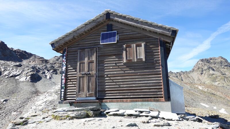
Bivacco Val Loga (ex-Bivacco Cecchini) is at 2773 m (9098 ft) of elevation, and equipped with beds and all you need for sleeping. You can visit it as a day tour or spend the night there.
Basic data
- Altitude: 2773 m (9098 ft).
- Coordinates: 46°28’33.50″N; 9°17’04.30″E.
- Area: Val Chiavenna; Leopontine Alps.
- Route type: walk up.
- Nearest towns: Campodolcino and Madesimo, Italy.
- Beds: 9.
- Inner equipment: blankets, mattresses, pillows, electric light from solar panels.
- Gas stove: no.
- Water: in a nearby stream.
- Useful map I used: Valchiavenna Val Bregaglia, Kompass 92, 1:50000.
- Nearest peaks to climb: Cime di Val Loga (3004 m; 9856 ft), Pizzo Ferre (3103 m; 10180 ft).
Access and roads
The interactive map below shows the position of the Bivacco Val Loga. You can zoom out to see the access roads. The start point is the free parking in the village of Montespluga. You get there either from the south or from Switzerland over the Spluga Pass where the border is located.
The blue line roughly shows my ascent route, and the yellow line is the route I used on descent. The red line shows the short route to Cime di Val Loga.
My hike to and from Bivacco Val Loga
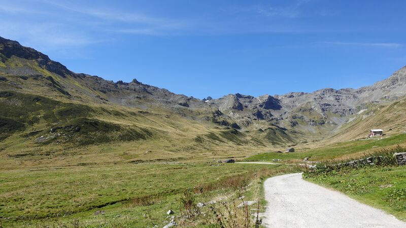
I started from Montespluga at 11:45 am, and at 15:15 pm I was at the shelter. Note that the village is at 1908 meters of elevation, so the difference is 865 meters. The picture below shows the beautiful Val Loga where the route goes.
Clearly, I was not particularly fast, but I did not have any reason to hurry. The weather was simply perfect, and I was going to stay the night in the hut, so there was no need to push.
The route I followed was the most direct one, you have seen it in the map above. It is marked and easy to follow. The view back (picture below) shows the Montespluga village which is always in sight. So orientation is never a problem if the day is as great as I had it.
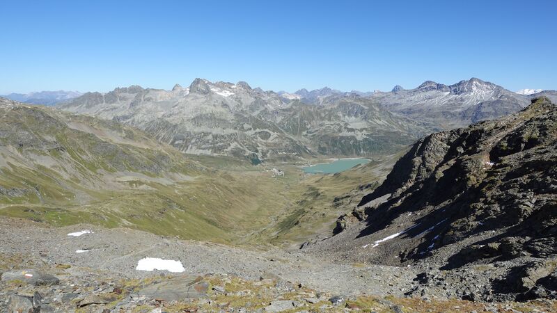
This is a beautiful surrounding, with meadows and water streams around. The path raises slowly, but it becomes steep under the refuge, and here you have only rock.
On the opposite side of the valley you can see Pizzo Emet, it is on the right in the picture above. I climbed it a few days later. You will have Pizzo Tambo visible in the north direction all the time. I was on its summit just the day before, see how it looked from the route half-way up:
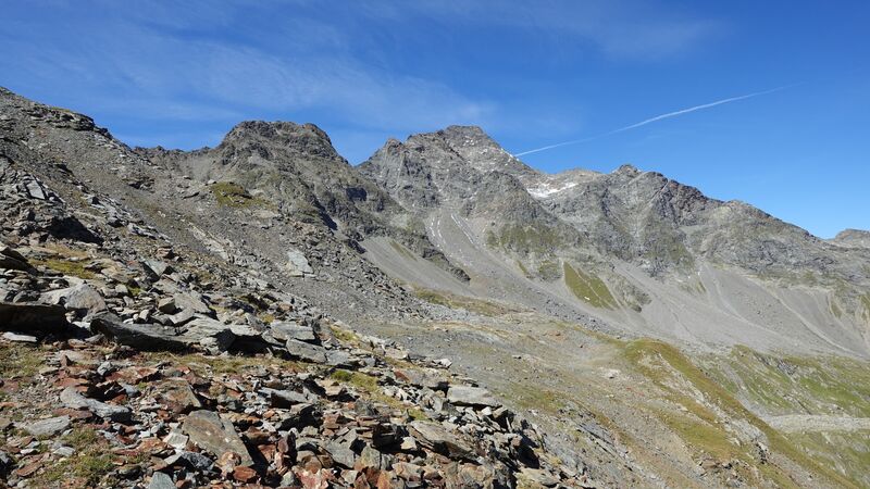
The refuge is visible almost all the time if you know where to look. But after a couple of hours, you will see it high above you as in the photo below:
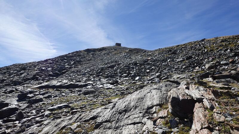
There was nobody around, and when I arrived, the door was closed as shown in the top picture above. I was hoping to be alone.
I opened the windows and the door and put my sleeping gear on one of the top beds. Then I had my lunch and a coffee, and after that I was just resting and sitting in front of the hut enjoying the views.
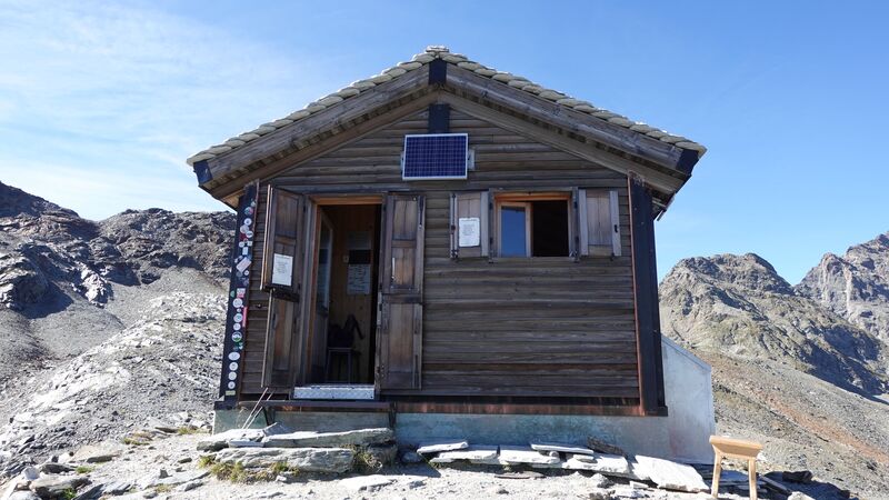
But after one hour an Italian arrived, it was Fabio, and he was on a round tour through the area. Much later, two more Italians came, I have seen them earlier off the route when I was walking up. It turned out that they were searching for precious stones.
So they had big backpacks, and with heavy hammers and stones. One of them gave a few pieces of stones to Fabio and me. Motivated with this, later I wrote a separate text here in the site about crystals in the Alps.
I always feel good among Italians, and it was the same in the refuge. They created a great atmosphere, Fabio prepared a soup for all of us, and it was a pleasant evening. During the night, well, one of them was snoring continuously, but there is nothing one can do about it. Earplugs did not help much.
In the morning, the Valchiavenna below was completely in clouds. See how this looked from above:
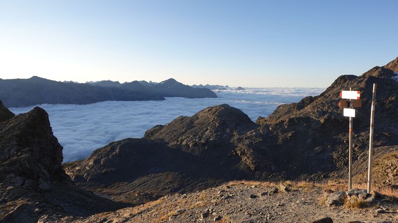
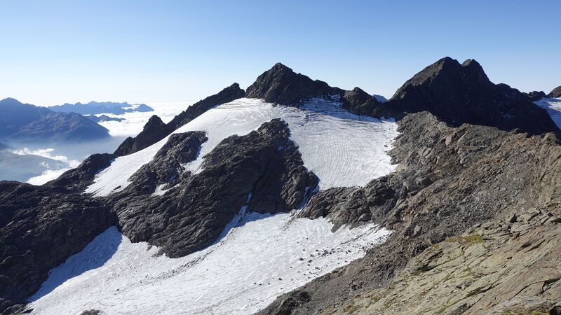
I decided to climb the nearby Cime di Val Loga before going back. It was tempting to get to Pizzo Ferre, see the picture below, but this implied passing a glacier with crevasses, so I knew it was not for a solo tour.
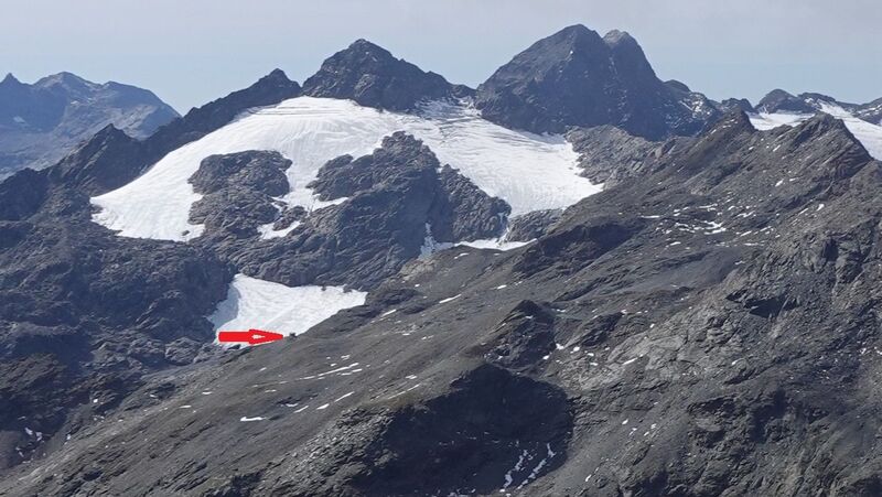
In the picture below you can see how this area looks when seen from Pizzo Tambo, this is a zoomed view of course. The position of the Bivacco Val Loga is marked. On the right above are the mentioned Cime di Val Loga:
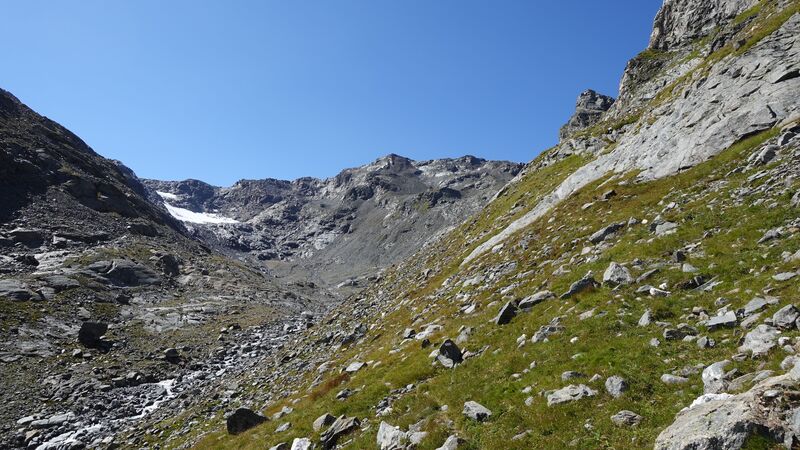
On my way back, I decided to descend trough the other valley, Valle Schisarolo, this is the yellow line in the map. There are a few steep sections below the refuge but those are easy to pass. This is how it looked:
Surprisingly, I noticed my two Italian friends, those searching for stones, they were off the route busy with their search. They noticed me, so we waved to each other and I continued.
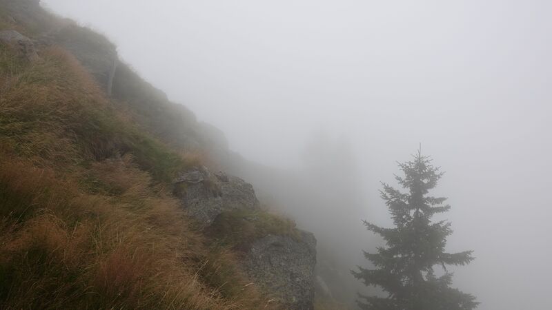
The weather was again perfect, but after one hour of walk I entered into dense clouds and could not see anything. The picture below shows the clouds into which I was descending. Pizzo Emet is visible in the distance on the left.
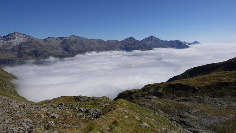
Here you can see how it was moments before getting into clouds:
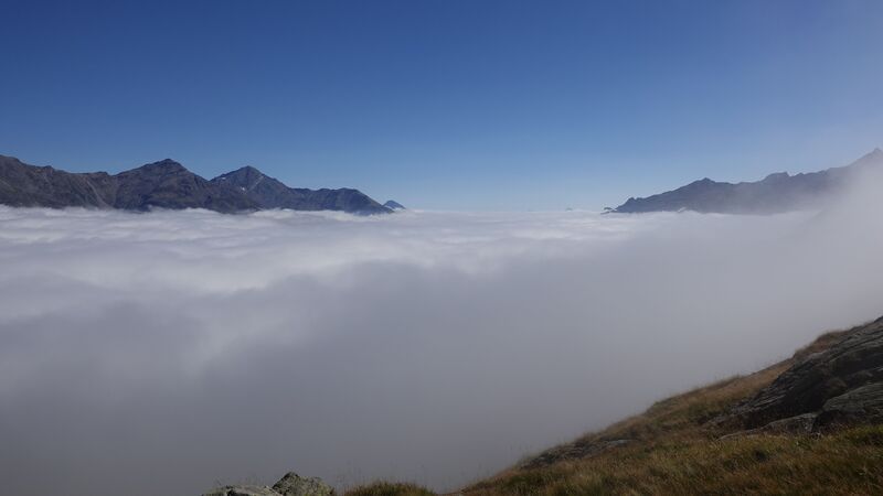
The path was not easy to find, everything was wet and slippery, so generally, this was not a great experience. Getting lost in such an environment would be bad.
The route is also much longer than the one I used the previous day. But I wanted to explore this valley and this was the only reason for going there.
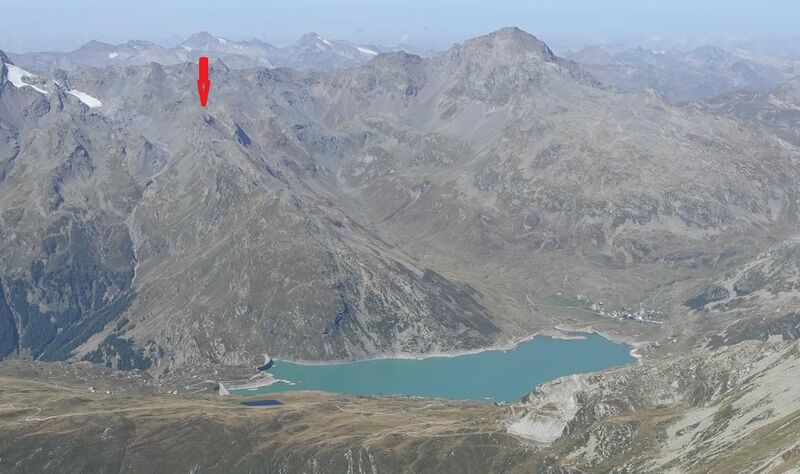
Later, I was able to watch this same area from my tour to Pizzo Emet (Piz Timun), see the picture below, and realized that the experience would be far different without clouds. The position of the Bivacco Val Loga is marked by the arrow. Montepluga village is by the lake on the right, Pizzo Tambo is above on the right.
Equipment, Water & Supplies
I was carrying my Crua Graphene sleeping bag, this was a part of testing which I planned for it. So I was warm in the bed although it was very cold outside. I also had my inflatable pillow.
In the hut, there are three triple bunk beds, with mattresses, blankets, pillows, and bedding. So even if you do not carry your stuff, you will be fine.
As for the rest, I used my Deuter Futura Vario 50+10 pack, and a pair of Komperdell trekking poles. The boots were the same I used the day before on my tour to Pizzo Tambo, the Nortiv 8 Mid Top boots.
There is no water in the hut, but there is a stream some 50 meters away. I was there late in the season and it was going strong, so I assume you can have water all the time. A plastic 10-liters canister is available in the hut. I had my water filter with me, I never directly drink water in the mountains, no matter how clean it may look.
Note that there is no stove, but there are plenty of pots for cooking. Therefore, bring your own gas stove. I had my MSR Pocket Rocket.
For food, the nearest places with food shops are Madesimo and Campodolcino on the Italian side.
The refuge is always open, and you can visit it any time. There is an “offerte” box on the wall, so you can show your appreciation if you stay there overnight.
Please see more about the tour in this video:
Summary
To conclude, if you plan hiking to Bivacco Val Loga you do not need any special equipment, this is a simple walk-up tour on a high elevation which you will surely feel. The refuge is visible almost all the time and orientation is not a problem.
But these are high altitudes, so make sure you have proper clothing if the weather suddenly turns bad. You can make this a day tour, or stay in the refuge overnight and enjoy the sunrise next day as I did.
Let me know if you have questions, there is a comment box below. Check also my text about the Spluga pass area. Bookmark this site and keep as a reference, there are far more than 1000 texts here. Thank you for reading and have a nice day.
Leave a Reply