Cime di Val Loga can be climbed in 4-5 hours directly from Montespluga village as a day tour, or you can stay overnight in Bivacco Val Loga as I did.
Cime di Val Loga – basic data & information
- Coordinates, latitude, longitude: 46°28′29″N; 9°16′34″E (46.47472°N; 9.27611°E).
- Normal route type: walk-up.
- Elevation: 3004 m (9856 ft).
- Elevation difference from the start: 1096 m (3596 ft).
- Time needed to get to the summit: 4-5 hours.
- Huts/shelters:
– Italian side: Bivacco Val Loga.
– Swiss side: none. - Towns for supplies: Campodolcino and Madesimo on the Italian side.
- Useful map I used: Valchiavenna Val Bregaglia, Kompass 92, 1:50000.
Access and roads
In the interactive map below you can see access roads from the north and from the south. The route to the summit is also roughly marked.
The blue line is my access route to Bivacco Val Loga, and the red line is the remaining part to the summit. I descended by following the yellow line. More about this you can read also in my text about Bivacco Val Loga.
Route description
This is about two non-prominent summits on a long ridge, separated a few hundred meters from each other. The height difference appears to be one meter only, so it is up to you which one you will climb. You can climb them both, there is a clear spot between them where you switch from one to another.
Both peaks are overshadowed by their higher neighbor Pizzo Ferre. When you are there, you might want to climb this peak as well, but note that its route goes over a glacier, so this is not for a solo climb, and you need crampons as well.
Anyway, you start from Montespluga, where you have a free parking directly in the village. I slept two nights there in the car. The AllTrails map below shows the route, and if you follow the link you will find more details:
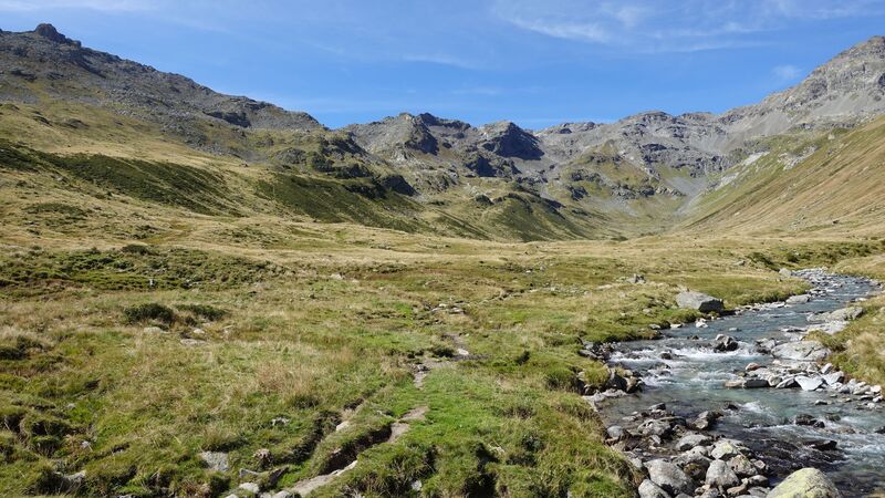
You will remain on the left (south) side of the water stream that you see in the picture. There are no exposed places anywhere on the route, so it is always a non-technical but demanding walk-up.
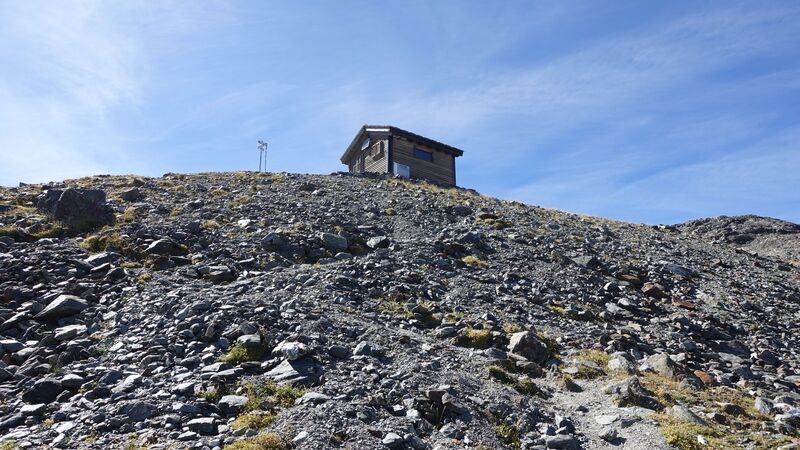
The village is always in sight and the route is marked, your direction is Bivacco Val Loga shown in the picture below.
After more than three hours you will get to Bivacco Val Loga. This is a nice shelter on a great location where I spent one night.
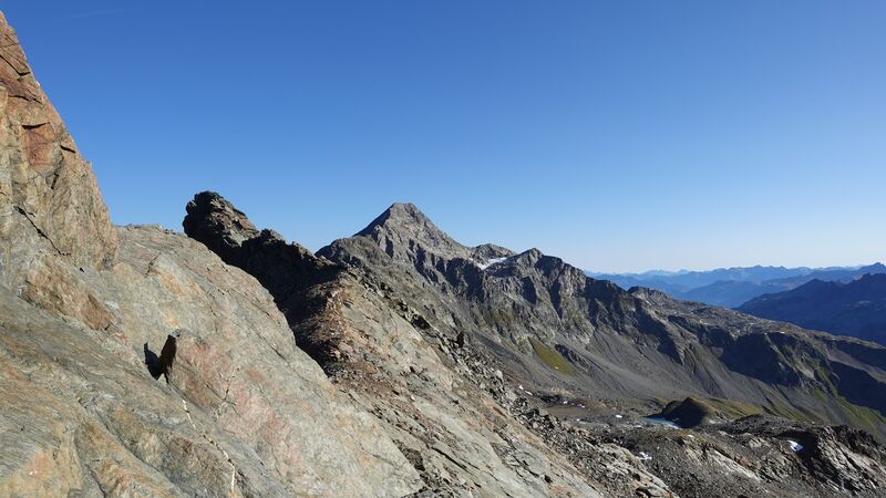
Next morning I continued the tour, the weather was excellent. In the first 10 minutes the route is the same that people use for Pizzo Ferre, but soon after that you have to turn up the mountain, and only a few cairns will show where to go. Pizzo Tambo looked magnificent under the early sunlight, see the picture.
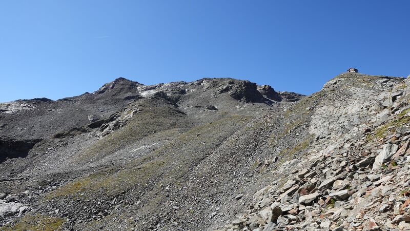
This is the spot close to the split where you have to decide which peak to climb. The north peak is visible.
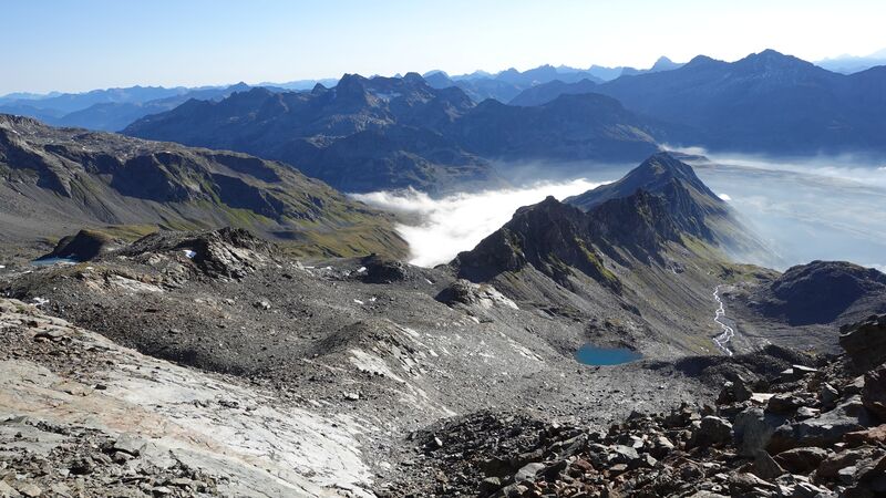
I decided to continue to the south peak, it looked more beautiful. The picture below shows the view back, with the Bivacco and Val Spluga below under clouds.
I lost some time trying to find the route which is far from obvious. Tried over the slabs that you see in the picture, but they are steeper in reality and not easy to pass.
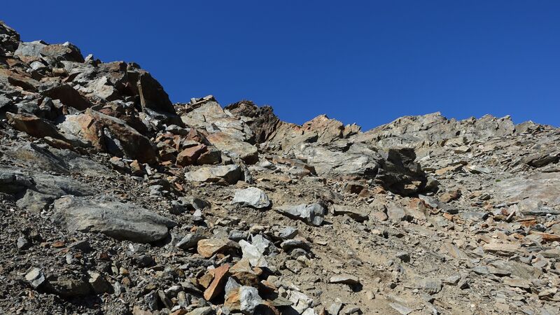
There are no marks anywhere, and the picture below shows how the actual route looks, loose stones everywhere, and very steep.
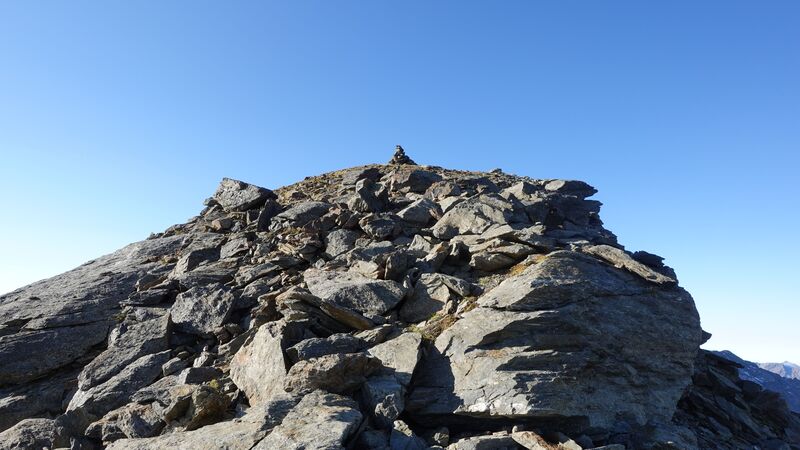
So I was really happy when the summit cairn appeared in sight. This final part is mild, and the summit is pleasant.
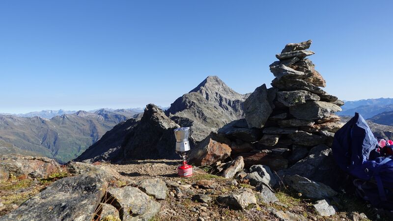
I spent almost one hour on the summit, and had my morning coffee there enjoying the views, see the picture. It shows my coffee pot and the north summit on the left to it, plus Pizzo Tambo far away in the background.
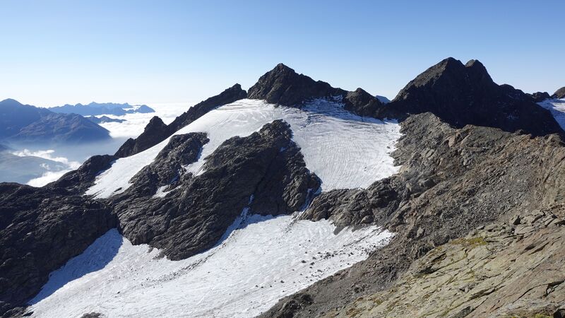
The picture below is the view in the opposite direction with Pizzo Ferre and its glacier. There was nobody around, the mountain was completely empty. Well, I did not mind really.
Later, I descended the same way in the direction of the Bivacco, and stayed there for a couple of hours and prepared my lunch. After that I descended through Valle Schisarolo towards Montespluga.
Please see more about the tour in this video:
Equipment, Water & Supplies
Because of carrying my Crua Graphene sleeping bag and an inflatable pillow, I used my Deuter Futura Vario 50+10 pack. As usual, I had my old Komperdell trekking poles with me, and the boots were the Nortiv 8 Mid Top.
I also had a water filter with me, and my MSR Pocket Rocket stove.
Regarding food supplies, the nearest places are Madesimo and Campodolcino on the Italian side.
For accommodation, you have a camping in Campodolcino where I stayed later. You can also rent an apartment anywhere on the Italian side. It is best to check in Madesimo and Campodolcino, or even in Chiavenna which is a much larger city in the south.
Summary
In conclusion, Cime di Val Loga are high peaks, but the route to the summit does not require any special equipment. There are no exposed passages anywhere on the route.
Only the last a few hundred meters below the summit are a bit hard because of loose and unstable rocks and the fact that the route is not marked. It may be difficult to find the right direction, so make sure not to make mistakes there and navigate the slope carefully.
Let me know if you have questions, there is a comment box below. Read also about my tour to Pizzo Emet which is on the opposite side of the same Spluga valley.
Bookmark this site and keep as a reference. Thank you for reading and have a nice day.
Leave a Reply