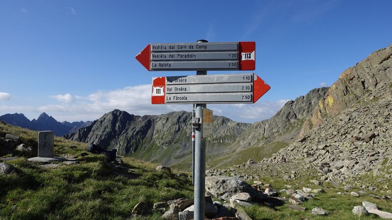
If you are at Forcola Pass, you might want to climb Pizzo Orsera, the route starts directly at the pass, and you will need two hours and a half to get to the summit.
Pizo Orsera (Piz Orsera, Piz Ursera): quick facts
- Coordinates, latitude, longitude: 46° 25′ 31″ N, 10° 04′ 48″ E.
- Normal route type: walk-up.
- Elevation: 3032 m (9947 ft).
- Huts: Tridentina Refuge at the Forcola pass.
- Town for supplies: Livigno.
Access, roads & routes
You can get to the Forcola pass from both Italian and Swiss side. The pass is exactly on the border, and the route itself follows the border line in the lower part. You will see several border stones on the way up.
On the Italian side, you have Livigno several kilometers down the road. From the Swiss side, you will drive over Bernina pass to get to the border.
The map below is zoomable so you can see access roads in the broader view, but zoom in to see more details.
- The blue and green lines are the route I walked from the Forcola Pass.
- The orange line is the route I walked when climbing Pizzo Paradisino, and you can follow the same route for Pizzo Orsera.
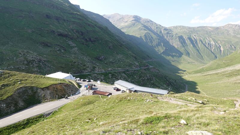
There is plenty of free space to park your car at the Pass. Observe how beautiful is the valley below with the road that goes in the direction of Livigno.
So you have to walk 709 meters (2326 ft) of elevation difference. The sign at the Pass tells you that you need 2.5 hours to the summit, and this is very realistic.
From the pass you will walk on the path with border stones on your way, with one leg in Italy and one in Switzerland. At some point, the route splits, and its left branch goes to Monte Vago which I climbed many years ago. So you follow the branch up-right which goes along the valley with a water stream. You will be making a loop in the south-east direction.
The elevation gain here is slow, this is still an area with meadows. So keep going and you will get to a rocky terrain and your direction will be a saddle in the east direction, which separates Punta Orsera on the left and Piz Orsera on the right. You are now on the Swiss side completely, the border goes over the two peaks.
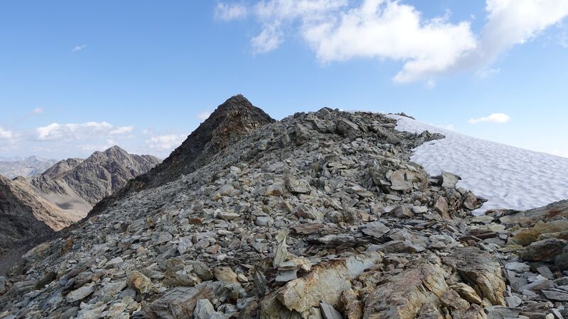
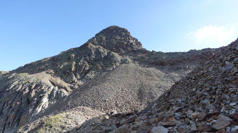
When you get to the saddle which is at over 2900 meters of elevation, your direction will be the ridge on the right shown in the picture. So here you are again on the border between the two countries.
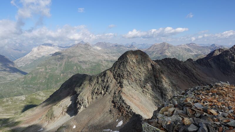
At the descent you can return the same way or make a loop and continue to the south, and then to the north-west. This variant I have marked with the green line in the map above.
The top picture above shows the summit as seen from that green line area when I was descending the summit. So if you follow the green line, soon you will be back on the (blue) route you followed on your way up.
The summit is with something that used to be a cross, but one part is broken and this is now a metal pole with the plate with the summit name and elevation. So this is about the route which I followed.
Val Mera Pass access
But there is yet another long and attractive route from the Italian side. You would start from the main road at the parking 8 that is close to Al Vach valley (Alpe Vago), and follow the same route that goes to Piz Paradisin. This is the orange line in the map.
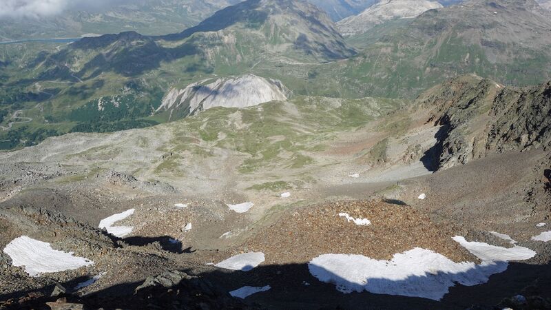
The picture below shows the two Valetta lakes that you have at the upper part of the valley. I have walked this route all the way to the pass, and then I went to Piz Paradisin. So you walk along the lakes towards the Val Mera Pass which is named after a valley that is on the Swiss side.
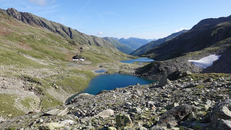
At the Val Mera Pass (2660 m; 8727 ft) above lake Valetta, the picture below, the route to Piz Orsera splits to the right (north direction), and you actually can see the summit from there. This short 70-minutes section I did not walk myself, so cannot say more about it. If somebody can provide details, please use the comment section below.
Observe the border stone in the picture above, so this is the border between two countries, and you can see this also in the interactive map given above.
Note that the Val Mera pass is the point where you go when you climb Paradisin from Swiss side. So the same route from Swiss side can be used if you climb Piz Orsera from Switzerland. This would make the third approach route to Piz Orsera.
My climb
I started at 6:55 am, and I was on the summit at 9:15 am. This makes around two hours and twenty minutes. I made a mistake and at some point took the route to Punta Orsera (3019 m; 9905 ft). This peak should always be on your left side, and it is closer to the pass. The route is 101, so this is not the one you should follow.
So I lost a bit of time, but soon I realized that I was on the wrong route and made a shortcut to the correct one.
There were no other people around, except a young couple from Switzerland. They were behind me initially but when I missed the route, they were ahead of me. Later, I met them on the summit. They did not stay long, so I had the mountain for myself.
I had my breakfast and coffee, and stayed on the summit at least 45 minutes or so. On the way back, I met a few other people going up.
In the lower part of the route, there were more people, but they were going in the direction of Monte Vago. There is a beautiful lake there, so most of them were going in that direction.
Please see a bit more in this video:
Equipment & accommodation
This is a relatively short walk-up type route, so you do not need any special equipment. A pair of hiking boots or even shoes will be fine. I had my mid-cut Salomon boots.
I always use trekking poles, and I can warmly recommend them. I also had my Osprey Stratos 24 pack with me, you do not need any larger for such a short day tour.
These are high elevations and the weather can change quickly, so it is important to have warm layers and also waterproof layers. This is something I always have in the backpack.
Regarding accommodation, Livigno is a popular area, so make sure to book your accommodation in advance. But note that there are free shelters relatively close to the main roads where you can sleep as well.
Final thoughts
In summary, if you plan climbing Pizzo Orsera the easiest and shortest approach is from Forcola pass. You do not need a guide for this, the route is marked and easy to follow. The only thing is to avoid my mistake, so make sure that you do not turn to Punta Orsera unless this is your destination.
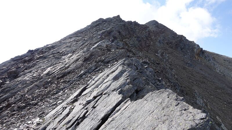
The route to Pizzo Orsera is without any exposed sections, only at one place on the final ridge there is a short passage where you should be careful, one of the pictures above shows this part. There are no fixed cables or anything similar anywhere on the route.
There is a free parking at the pass, which is also the official border crossing point between Italy and Switzerland. But there is nobody there to check your passport.
When you are in the area, you might want to climb also the mentioned Monte Vago and Monte Breva. For both mountains, the start point is at the same Forcola Pass. I climbed them both so let me know if you need help. But see also my report about Pizzo Cassana which is in the same Livigno area.
Thank you for reading. If you have questions about this mountain or any other in the Livigno area, please use the comment box below. Have a nice day.
Leave a Reply