Last summer when I was in the Dolomites and the weather was simply unpredictable. But I accepted it as it was and decided to make a tour in the Fanes-Senes-Braies Nature Park. It did not really work, so here is my report about the tour.
About my initial plan
In short, my plan was to walk all the way up from Sant Uberto parking on the road that goes from Cortina d’Ampezzo to the north. You will easily find it easily on the maps because the road makes a huge U-turn there as you can see in the picture below which is from AllTrails:

The idea was to make this a 2-day tour and to get to the area of Rifugio Fanes and Rifugio Lavarella, and to sleep in the tent and then climb the peaks L’Ciaval (Cavallo, Sas dla Crusc 2907 m), Zehner (Sasso delle Dieci, Sas dales Diesc, 3026 m), and Neuner (Sasso delle Nove, Sas dales Nu, 2968).
Now, why these peaks?
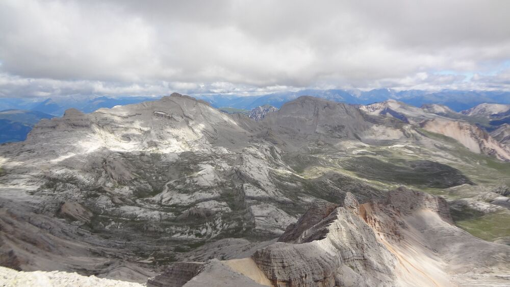
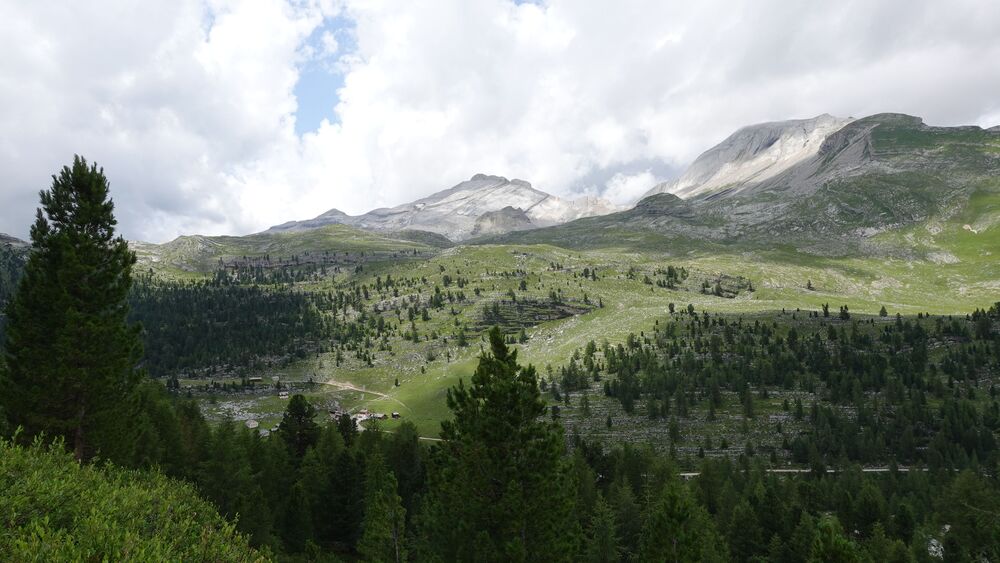
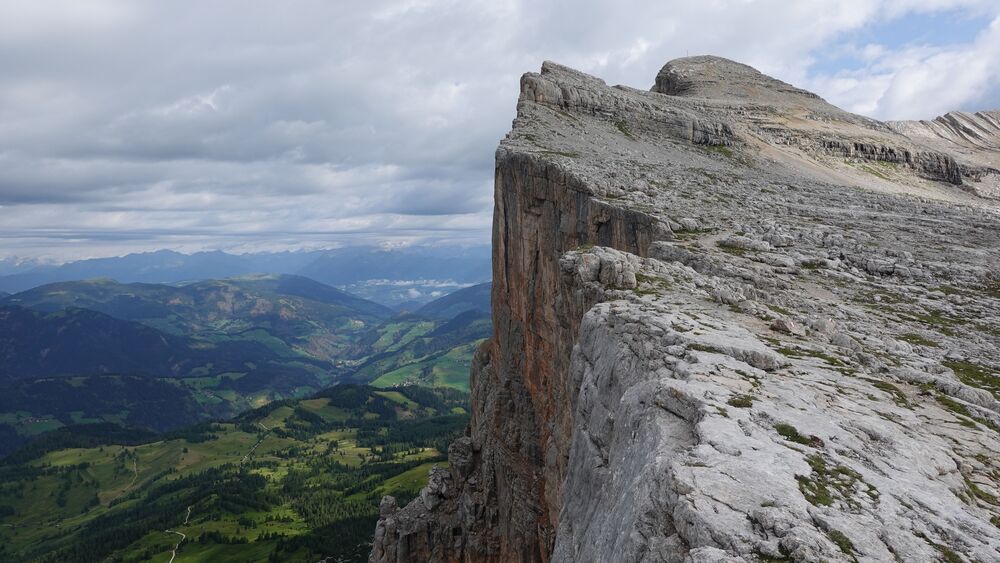
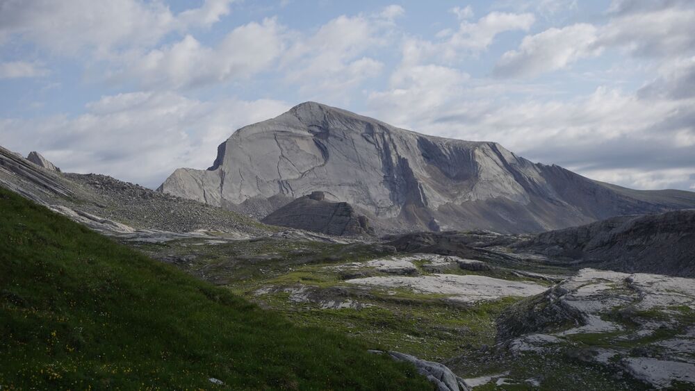
Well, a year before, I was admiring the area from the summit of Piz Lavarella, and I promised myself to get there some day. See the top picture above and you will understand, this is what I was watching.
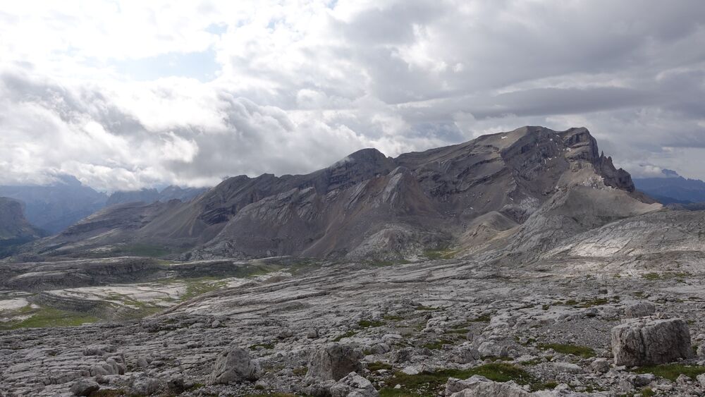
But see also the picture below, it shows these three peaks from a closer perspective, from a place on the Fanes plateau, after some two hours walk from Lavarella hut:
Note that the Fanes-Senes-Braies Nature Park is a large area, but my focus was on its western part with the highest peaks shown in the picture above.
On maps, it look like a giant amphitheater that opens towards the huts that are in the north-east direction, and with the mentioned peaks making its western boundary.
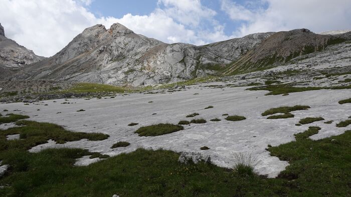
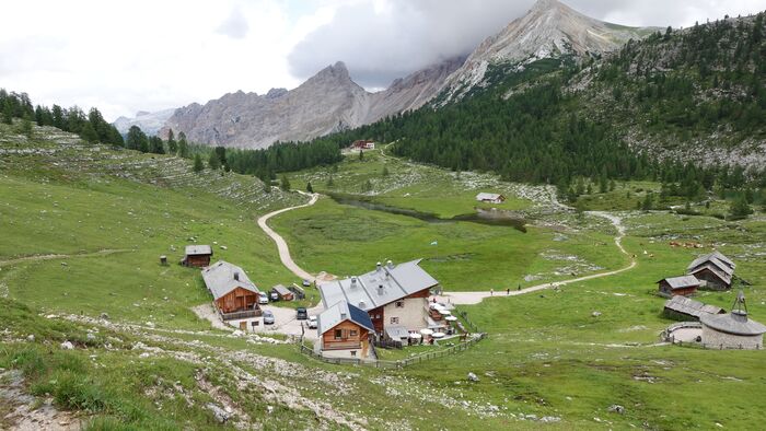
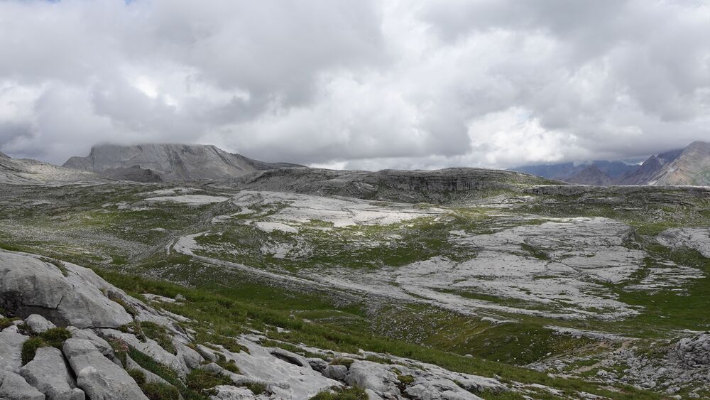
This is a large high altitude area, the two huts are roughly at 2000 meters, and the plateau raises slowly and its highest points are La Varella and Zehner (Sasso delle Dieci), both higher than 3000 meters. This is all rock with a bit of grass, some trees you have only around the huts.
The area is also dry, bear this in mind. But there are lakes around the huts and also along the Alta Via 1 route. The rock is an interesting combination of pure limestone that appears to make the base of the plateau, see the picture, while the peaks sitting on it are a completely different material.
The park is also known under the name Fanes-Senes-Prags, and in some sources you will also see Sennes instead of Senes. The confusion with names you can see also in the peaks, they are with multiple names. This is because of several local dialects used in the area.
Below I give an AllTrails map which contains the tour that I did not follow. The map is only for you to have it at hand and to see the details of the area.
If you follow the link above, you can find various routes in that area and in many others of course. The map is zoomable so you can see a lot of details. Zoom out to see access roads, and also my start point, it will be on the right, you will see the road, and the path which I followed will also be visible.
So how was it?
Short answer again: I managed only partly. Climbed only Sas dla Crusc, the other peaks are for an another occasion. The weather was against me. But let me give you the details.
First day
It was raining in the morning so I did not rush, the first day was planned only to get to the plateau where the two huts are located. So I had plenty of time and decided to take it easy. The weather forecast was telling me that there would be some hours without the rain.
Therefore, I packed all needed for sleeping outdoors. This included my old (but rarely used) Ferrino solo tent, one self-inflating sleeping pad, and a sleeping bag. I also had an inflatable pillow, and I cannot stress enough how useful this is for me. I carried this all in my Deuter Futura Vario pack.
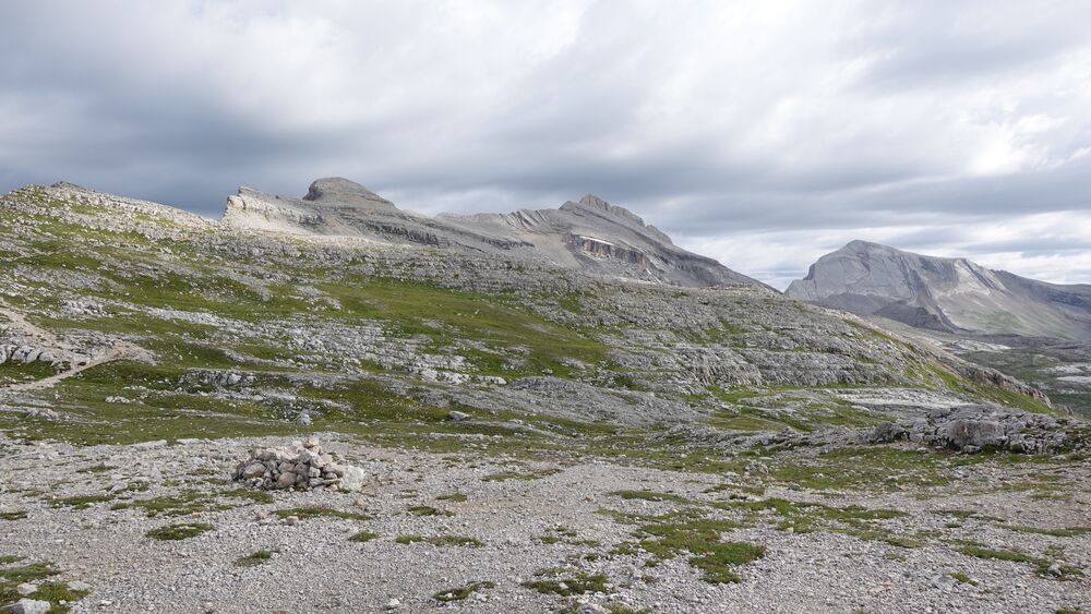
This was a long but pleasant walk, the surrounding was such that I did not really mind my heavy pack. See the picture from one spot:

After several hours of walk and short rain showers, I had the two huts in sight as in the picture below. But the picture was taken one day layer, just to know.
I arrived at the Fannes hut (Ucia de Gran Fanes, the picture below) when it was already getting dark. So after having a short break there, I continued in the direction of the Lavarella hut, trying to find a place to put the tent.
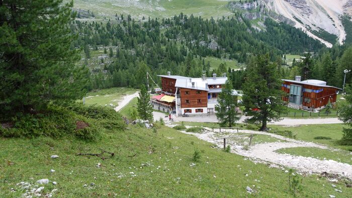
Both huts are visible in the picture below, this was taken the day after, when I was descending the mountains. My camp the night before was among the trees on the right, between the two huts.
Just to know that this is the part of the Alta Via 1 route, so people stay in these huts and they are always full. This is why I did not even try to find a place and was carrying my camping stuff.
But then it started raining heavily, so I did not have a choice and had to put the tent at the first possible place that was flat enough. The picture shows it, but you cannot imagine how wet the ground was, totally soaked with water. The elevation at this place is 2000 meters.

Namely, there is a lake above, so water runs everywhere. If you zoom in the map given previously, you will see the two lakes, so I was in the middle, and water is there all the time, not much to do with the rain.
Before I managed to pitch the tent (which is a two-layer type), all inner became wet. But all in all, it was not bad except that it was not really flat, and I could feel and hear water underneath the tent as I was turning on the pad. It was raining many times during the night.
Second day
I got up relatively early, around 6 am, and this was only because I was on a spot where people could see me if they walk from one hut to another.
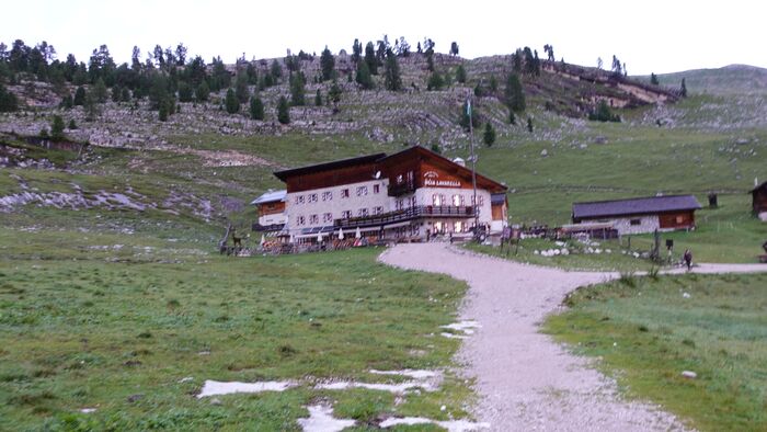
This is a national park so overnighting, as I did, may be tolerated but perhaps not so close to the huts, so I did not feel pleasant and wanted to get away quickly. So I collected my wet stuff and continued in the direction of Lavarella hut shown below.
The tent did not leak, but due to condensation on the underside of the fly it was wet as well. So when I was getting the things out of the tent, they would become wet by touching the fly. Also, as you know, you have to roll it all, this was not possible inside the tent because it was so low, and outside the ground was soaked with water.
The pictures which I show here are taken in the intervals without the rain, so you cannot get the true feeling of how wet and cold it really was.
Later, above the hut, I stashed my tent, pad, and bag under a tree, wrapped in the poncho that I had in the pack. But both pad and the bag were quite wet already.
Anyhow, after that my backpack was much lighter and I continued walking. There was nobody around. Finding the route was not a problem. It was a very mild but long walk.
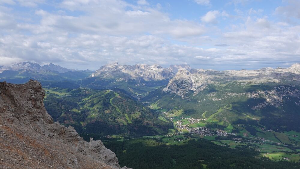
It was very windy when I was walking on the edge of the cliffs shown in the picture. But I was rewarded with the view of Piz Boe group shown below. I climbed those mountains one year earlier. As you see, the weather in that area looked good. Note that Marmolada is also visible on the left.
The wind was only getting stronger as I was approaching the summit of Sas dla Crusc which is visible in one of the pictures above.
I arrived at the summit 3 hours and 30 minutes later, so I was surprisingly slow. It started raining just before I got to the summit. So I had to put all my stuff from the pack, I had a jacket and pants that were supposed to be waterproof.
Sasso delle Dieci was in storm already as you see from the picture below, and my estimate was that I needed one hour more to get there. But the wind was strong and it looked like a real storm coming.
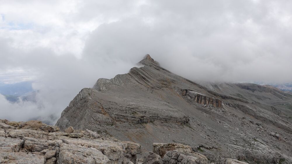
So reluctantly, I had to admit that the peak was off my limits for the day. Below you can see my view back as I descended from Cavallo peak (Sas dla Crusc). The picture shows Sasso dele Nove in the clouds.
In the area where I took the picture from, the rain was not so strong, and I was angry with myself for giving up so easily. But it was not only about rain, I was even more concerned about lightning, this was the main reason for giving up.
Oh yes, I met a few people walking up, they were clearly coming from the huts. This made me even more unhappy regarding my previous decision to descend before getting to Sasso dele Dieci.
Later I collected my camping stuff and descended to Lavarella hut. The day was still young, and I was undecided what to do.
Clearly, the weather was not going to improve, and staying till next day did not look as a great option. I also did not like the idea of sleeping in my already wet equipment which I could not put anywhere to dry.
So I decided to call it a day and started walking back. It was a long walk, with several rain intervals before I arrived to the parking. Wet equipment and low mood made my pack heavier, so I was quite tired.
In the raw video below you can see more details. Observe that the sky was sometimes completely clear in the intervals when I was recording, but this was all changing rapidly:
Equipment & accommodation
I already mentioned my sleeping equipment. Apart from that I used my Salomon Quest Prime GTX boots, I had a water filter with me, and a pair of Komperdell trekking poles. This is a walk-up tour, no need for anything special.
As for accommodation, that time I was staying in a camping below Cortina d’Ampezzo and I was also sleeping in the car.
Final thoughts
In conclusion, my planned 2-day tour of the Fanes-Senes-Braies Nature Park in the Dolomites faced challenges due to unpredictable weather.
But I also made mistakes. I should have chosen my camp spot on a drier place, and this was my initial plan. I wanted to camp above the Lavarella hut where there is plenty of good areas, but I was a bit late and it started raining strongly.
Despite the initial goal of reaching the peaks L’Ciaval, Zehner, and Neuner, I only managed to climb Sas dla Crusc. The first day involved a wet but scenic walk to the Fannes and Lavarella huts, where I set up my tent in heavy rain.
The second day, though windy, offered breathtaking views as I approached Sas dla Crusc. However, rain and concerns about lightning forced me to abandon my quest for Sasso delle Dieci.
Reflecting on my decisions and writing these lines several months later, I feel a sense of disappointment with my decisions, and this is not the first time.
I still think I should have persisted and stayed there yet another night and day, and even climb Zehner peak when I was so close. The reason is simple, I live very far from the mountains, have no many opportunities to visit them during a year, so every day there is precious.
Note that one year later I have climbed the mountain in my another attempt from Val Badia, and you can read about that in this text.
On a positive note, the most attractive peak there is Sasso dele Nove (the picture above), so I have good reasons to go to the area again. I shall climb that peak from the north side, there is a very direct route from Wengen.
Let me know if you have questions and if you have to share anything similar. There is a comment box below.
Check under Italian Alps if you want to read more texts about this area. Read also my comparison text about Lago Sorapis and Lago Federa hikes. I was recently in the area again and climbed Cima delle Nove, so please follow the link to read my report.
Please join us at our Facebook group Dolomites Visitors Hub.
Fanes-Senes-Braies Nature Park FAQs
1. What is Fanes-Senes-Braies Nature Park?
Fanes-Senes-Braies Nature Park is a protected natural area located in the Dolomites, a mountain range in northern Italy. It encompasses diverse ecosystems, wildlife, and cultural heritage, offering visitors a unique experience in the heart of the Alps.
2. Where is the Fanes-Senes-Braies Nature Park located?
The nature park is situated in the province of South Tyrol, Italy. It spans across several municipalities, including Mareo, Badia, and Dobbiaco.
3. What makes Fanes-Senes-Braies Nature Park special?
The park is renowned for its stunning landscapes, including high-altitude plateaus, deep valleys, and rugged peaks. It is home to a rich variety of flora and fauna, and its cultural significance is reflected in the presence of ancient Ladin traditions.
4. How can I reach Fanes-Senes-Braies Nature Park?
The park is accessible by car and public transportation. The nearest airports are in Innsbruck and Venice. Local buses and taxis are available to reach the park from nearby towns.
5. What activities can I enjoy in the park?
Visitors can engage in a range of activities, including hiking, mountain biking, and nature walks. There are also opportunities for bird watching, photography, and winter sports like cross-country skiing and snowshoeing.
6. Are there guided tours available in the park?
Yes, guided tours are offered, providing visitors with insights into the park’s natural and cultural features. Knowledgeable guides share information about the local flora, fauna, and the history of the area.
7. Is camping allowed in Fanes-Senes-Braies Nature Park?
Camping is generally not permitted within the park to preserve its delicate ecosystems. However, there are designated areas for camping outside the park boundaries.
8. What is the best time to visit Fanes-Senes-Braies Nature Park?
The park is open year-round, but the best time to visit depends on your interests. Summer is ideal for hiking and exploring alpine meadows, while winter offers opportunities for snow sports and a serene snowy landscape.
9. Are there any restrictions in the park?
Visitors are expected to follow designated trails and respect the park’s rules and regulations. Some areas may have seasonal restrictions to protect wildlife during sensitive periods. It’s important to check for any specific guidelines before visiting.
Leave a Reply