During my recent long stay in the Dolomites, I visited several of the most attractive bivouacs in these mountains. Bivacco della Pace is one of them, and here you have my detailed report about the tour.
The easiest way to climb to Monte Ciaval and Bivacco della Pace is to start from the main road above San Cassiano in Alta Badia valley. This is a simple but long walk-up route in a beautiful environment, without any exposed passages. You do not need any special equipment for this tour. Plan around 6 hours to get to the summit.
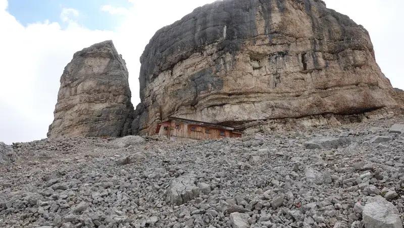
This area is not visible from the surrounding valleys, so you will have to actually go there to enjoy its beauty. The Bivacco is directly under the cliffs of Monte Castello, and this makes it even more hidden.
Coordinates, numbers & details
- Coordinates Bivacco della Pace, latitude & longitude: 46.5683028N, 12.0288231E.
- Coordinates Monte Ciaval: 46.5624861N, 12.0250753E
- Elevation Monte Ciaval: 2912 m (9554 ft).
- Normal route difficulty: walk-up.
- Height difference to climb from the car parking at the main road: 1252 m (4108 ft).
- Useful map: Tabacco number 03, Cortina d’Ampezzo e Dolomiti Ampezzane. 1:25000.
- Official parking: at Capana Alpina 1720 m (5643 ft).
Access roads & location
The interactive map below shows the complete route from the main road. The number 1 gives the location of a tiny parking area directly at the road. This is not an official parking, but people leave their cars there for free. There are just a few places, just to know.
The number 2 marks the location of Capana Alpina, and next to it you have an official parking where you have to pay to leave the car.
The number 3 marks the position of Bivacco della Pace. Finally, the number 4 is the position of the Monte Ciaval summit.
The map is zoomable, so zoom out to see all access roads, and zoom in to see details. Note that you may use the same map and the route to get to the nearby Bivacco Baccon-Barborka.
The route description
If you park at the main road, you will walk in the direction of Capanna Alpina, and in 15-17 minutes you will be there. It was early when I passed it and there was nobody around as you realize from the picture below.
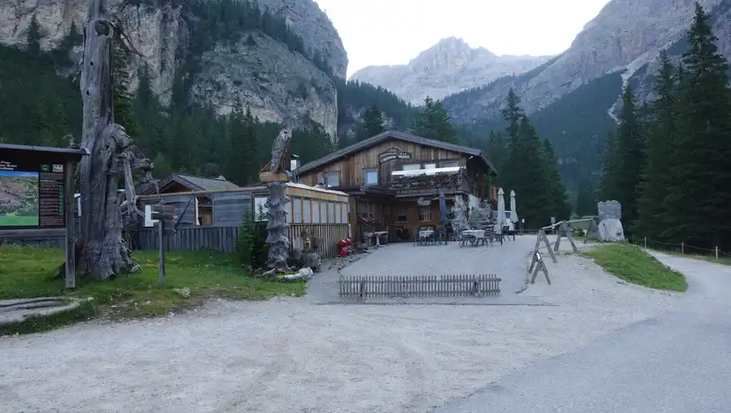
There is a toilet in the park behind it, and this is also the place where you can refill your water bottles, bear this in mind.
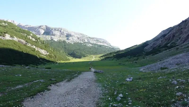
You will then continue through the forest into the Fanes National Park and after a steep climb area you will get to a pleasant plateau which is at around 2000 meters of elevation, see the picture below.
Note that the same route you will walk if you plan to go to Piz La Varela and Conturines. I have climbed them both.
This is also a part of the Alta Via 1, so in this particular part you may see many hikers coming in your direction because most of them start it from its north end. There are two important huts which they use, they are very close in the area, the Fanes hut and Lavarella hut. You can see them in my another text.
But the AV1 route does not go to the Capanna Alpina, it separates to the right in the direction of Lagazuoi area, you can see this in the map above.
You keep walking in the north direction and at some point you will also pass the place where the route to Piz Lavarella separates to the left.
It is a long walk over the pleasant plateau, almost all the way to (Malga) Utia de Gran Fanes. But before getting to the Malga, you will see the sign to the right. This is your direction, and at this point you leave the AV1 part of the route.
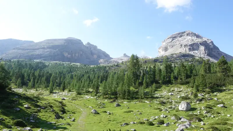
The tiny peak in the middle of the picture below is Monte Castello (2817 m). This is the view you have after you turn to the right in the south-east direction from the main AV1 route on the Fanes plateau, very close to (Malga) Utia de Gran Fanes.
On my way up, I passed two people working on the route maintenance. The route is indeed nicely marked and they clearly do their job properly.
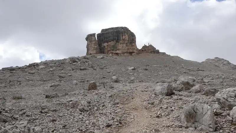
Most of the time Monte Castello will be in sight. It looks indeed like a castello (castle) with its vertical cliffs, but later you will realize also that it is full of fortifications from one century ago. So its name is very appropriate.
At Bivacco della Pace
The Bivacco della Pace blends in the environment and it is not easily visible, you can see it in the picture below. The last part of the route is a bit steep but not very hard in spite of all the rocks that you see.
Just below the shelter, I met three girls that were coming from above. They told me that they stayed there the night before, and they were warm and comfortable.
There are places for 8 people on the beds inside, with mattrasses and blankets, plus two mattrasses on the floor, so bring your pillow and a sleeping bag only.
There is also an empty attic area, its opening is visible in the picture together with the ladder. This means that many more people can sleep there if necessary.
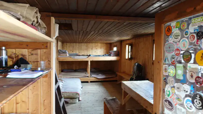
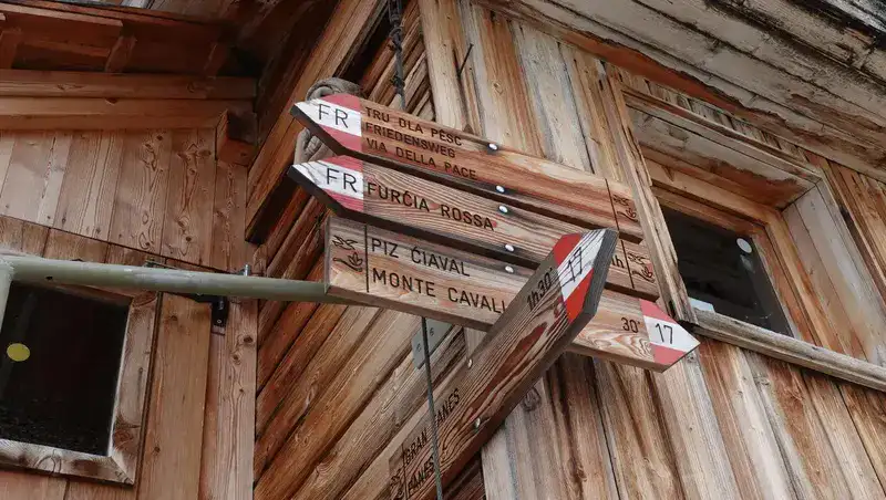
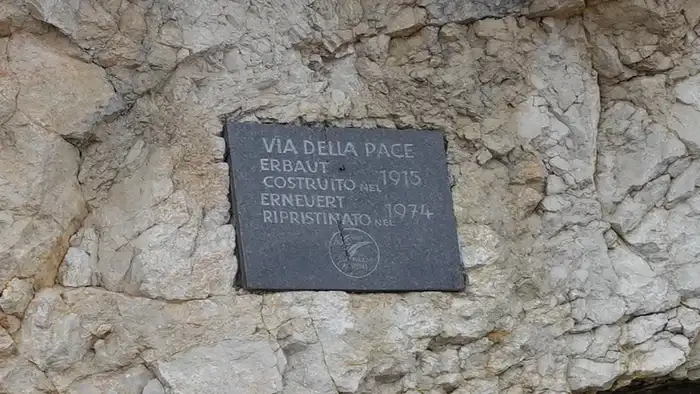
Note that there is no stove here, and water is not available anywhere around. The shelter is pleasant and dry, no bad smells or anything similar. Below you see the signs at the shelter, with some useful information.
Two summits: Monte Casale and Monte Ciaval
After taking a rest of around 15 minutes, I continued towards the summits, first to Monte Casale (2894 m) and then Monte Ciaval (2911 m). On some maps, the latter is with the elevation of 2912 m, just to know.
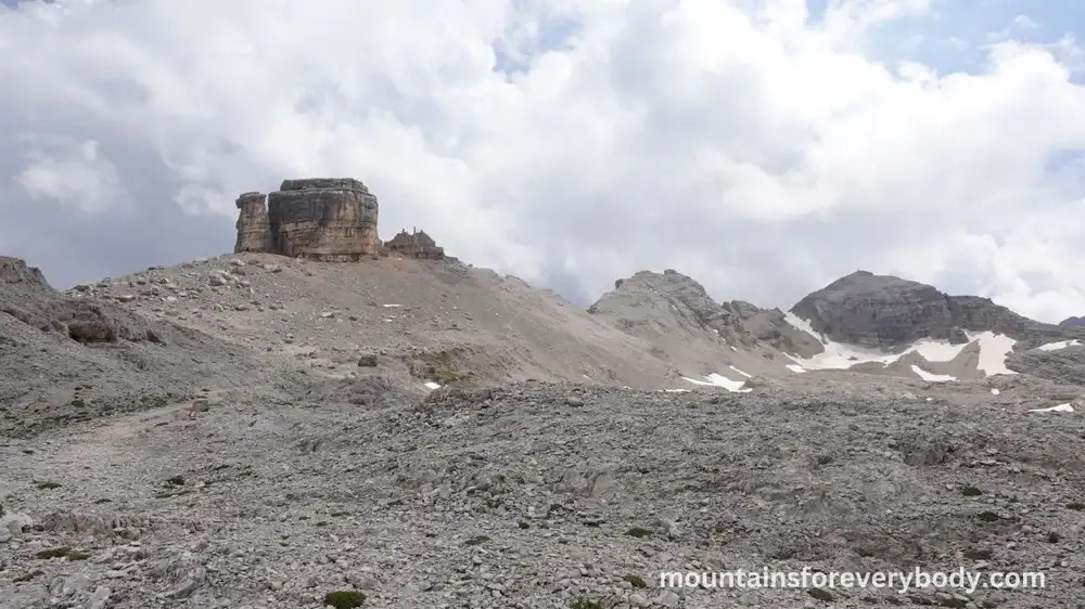
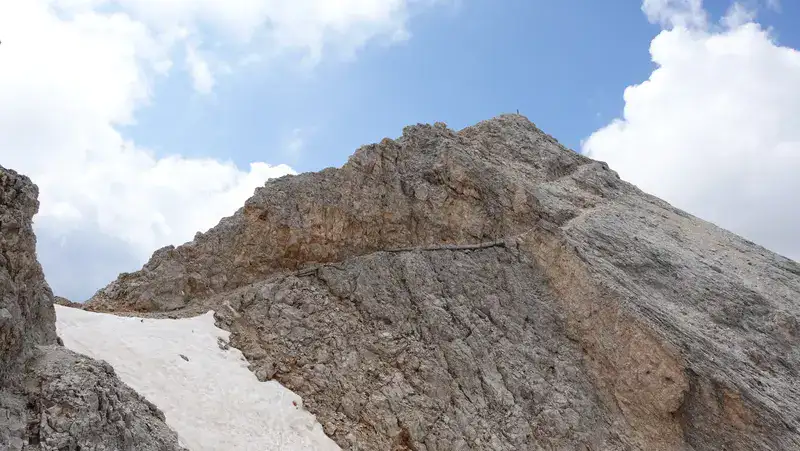
The picture below is what you see when you are above the Bivacco. There is a very easy route to both peaks, the Monte Casale is the first on the left.
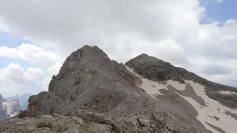
After getting to M. Casale, I continued to Monte Ciaval. As you see, there was a snow area, but the route was above it.
Note that on the saddle between the two peaks there is a place from where you can descend to Travenanzes valley which is deep below on the east side. This valley separates this area from the Tofane group. But this route is incredibly steep and all in unstable rocks and gravel.
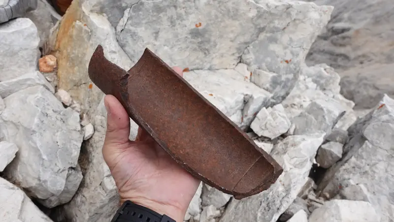
Front line
On the summit of Monte Ciaval there are some items from the WW1, like this piece of artillery in the picture below.
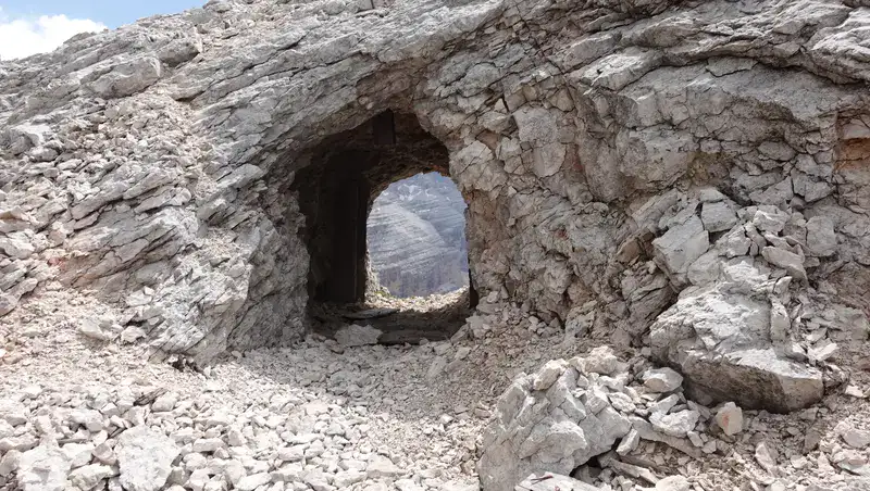
Fortifications, stone ruins, barracks, caves, barb wire, and trenches from the WW1 are everywhere. The picture below shows just one detail out of many.
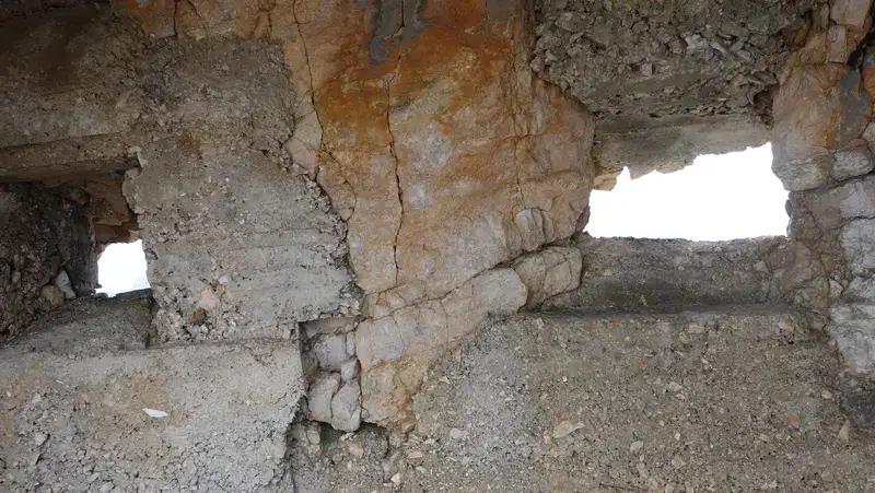
Through these holes you will see the Tofane group in the east, here is one example:
Thi route was created for military purposes in 1915, there is a table which tells you the sad story which is behind all that you see around. Clearly, this had nothing to do with “pace” (peace).
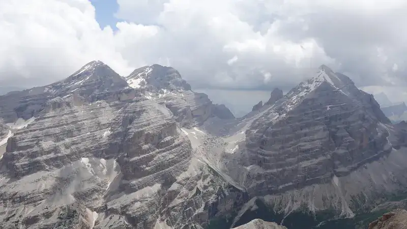
Below you can see the incredible Tofana peaks which I climbed all, this is how they look from the route. Tofana di Dentro (3238 m) is on the left, Tofana di Rozes on the right, and Tofana di Mezzo in the middle.
My climb
I started from the road at 6:40 AM, and there was nobody around for a couple of hours. Only on the AV1 part, I met a few people coming from the two huts that are farther on the Fanes plateau area.
I was at the refuge at 11:10, and after a short rest I continued. The second summit cross was in front of me at 12:10.
So it took me more time than expected for the elevation difference of 1252 meters. My guess is this was because of the length of the route, if you check the map above you will realize that it makes a long loop around the mountain.
There was nobody there, the weather looked stable, and I did not rush to go back. I had my lunch at the second summit and stayed there for a while.
Later at the refuge, I took a nap on one of the beds, and after that descended the same way back. I had a little of rain on the AW1 part of the route, but nothing serious.
Please see more in my video:
Equipment, supplies & accommodation
This was a long day tour but without any equipment, so my Osprey Stratos 24 pack was perfect. On this occasion I had a pair of trekking poles, and I used my Nortiv8 boots.
It is essential to have a full rain protection set, and I had it with me. This includes a poncho, rain pants, and a rain jacket.
For food, there are a few very good supermarkets in the villages below. As for accommodation, one camp is at a walking distance from the parking.
Alternative routes
1. I already mentioned the route to-and-from Travenanzes valley. If you zoom into the map given above you will see it marked.
But there is no car access to Travenanzes, bear this in mind. You can get there from Falzarego pass and Lagazuoi area, or by walking from Cortina d’Ampezzo.
I have been in the valley on my tour around Tofana di Rozes, so I know it is very deep and you have a very steep and hard climb from that side.
2. Yet another route exists from the Fanes area. This is a ferrata from Friedensweg (Via della Pace). You can see it clearly on the map. Yeah, everything is about “pace” (peace) here.
I have been at the point where the Friedensweg separates from the route which I walked, but did not go there and cannot say anything about it. Those who are familiar may add a few words in the comments.
Final thoughts
In summary, I really enjoyed this Monte Ciaval and Bivacco della Pace tour. It is long but technically simple, and anybody in normal physical condition can do it. I only regret that I did not bring my sleeping equipment and stayed the night there.
This tour was a part of my recent series of visiting historic routes in the Dolomites. The series includes also places like Buffa di Perrero, Bivacco Barraca degli Alpini, and Bivacco Latemar and Bivacco Rigatti.
Let me know if you have questions or comments, there is a comment box below. Please join us at our Facebook group Dolomites Visitors Hub.
Leave a Reply