I climbed Sas Rigais by walking from Daunëi parking and approached the summit from the west side ferrata and descended by the south side ferrata. After that I hiked to Seceda and walked back to the parking. This was a day in clouds, and here is my report.
The west and south sides normal routes to Sas Rigais are ferratas, and their technical rating is the same. These are easy ferratas but the access to the summit is long and hard. So plan 5 hours if you walk from Daunëi parking, and one hour less if you start from Col Raiser. Ferrata equipment is highly recommended, but it can be doable even without that.

Sas Rigais (Sass Rigais): quick facts
- Elevation: 3025 m (9924 ft).
- Nearest places for supplies: Selva di Val Gardena and Santa Cristina.
- Mountain group: Odle/Geisler Group, Dolomites, Italian Alps.
- Summit coordinates: 46.6092875 N, 11.7668194 E.
- Route difficulty: easy/moderate ferrata.
- Elevation difference from the car parking Daunei: 1315 m (4314 ft).
- Parking coordinates: 46.5638022 N, 11.7535753 E.
- Time needed from the parking to the summit: 5 hours.
- Shelters & huts: Rifugio Firenze.
- Useful map: Val Gardena – Alpe di Siusi, Tabacco 05, 1:25000.
- Included in my map of best known ferratas in the Dolomites.
About the name: if you search around you will find the mountain under the name Sas Rigais and also Sass Rigais. So it is not a typo when I write Sas Rigais here in the text.
In case you didn’t know, Reinhold Messner climbed Sass Rigas in 1949 with his father. It was his first 3000-meter peak, and Reinhold was only 5 years old. It was on these peaks in the Villnöss Valley that he developed the “instinctive” climbing style he later took to Everest.

Access roads and map
I have prepared for you the interactive map below. The markers show the following:
- Marker 1: Parking Daunëi.
- Marker 2: Rifugio Firenze.
- Marker 3: Forcella di Mesde.
- Marker 4: West side ferrata
- Marker 5: Sas Rigais summit.
- Marker 6: South side ferrata.
- Marker 7: Seceda.
If you zoom in, you can see lots of details regarding the route. Zoom out to see access roads to the area.
Note that there is also an east side ferrata access, and you can have a look at it in this AllTrails map, and you will see that the west side ferrata is suggested as the descent route.
Route description: west and south side ferratas
Car parking Daunei is always open and the fee was moderate when I was there. So you can start the tour whenever this is suitable to you. From there, you follow the route 3 in the direction of Rifugio Firenze. All the way up to rifugio this is an easy and mild walk in a beautiful environment.
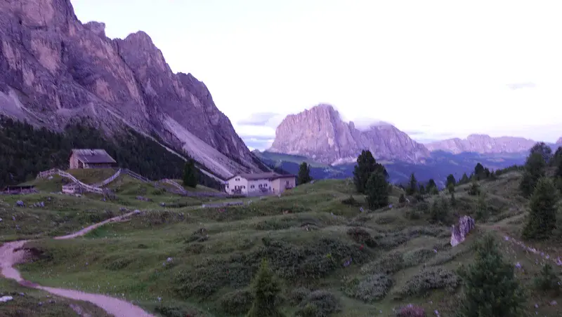
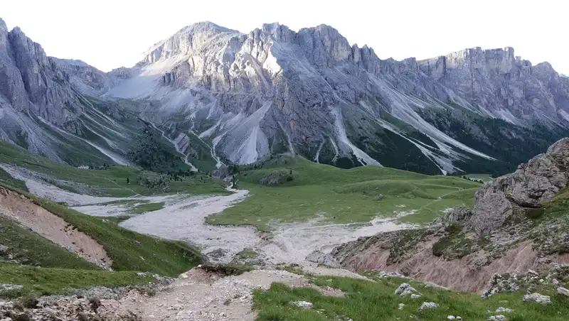
After rifugio you are on the route 13 and the direction is obvious, to the north. If you decide to approach the summit from the west side, you will switch to route 29 that goes to Forcella di Mesde (2597 m).
The point where you do this is shown in the picture below. You can see the path going around the mountain, so this is the east side ferrata.

The path towards Forcella is steep, but it is maintained (some logs in place) and with frequent switchbacks. At some point there is a route for south side ferrata to the right, so ignore it and keep going up all the way to the pass.
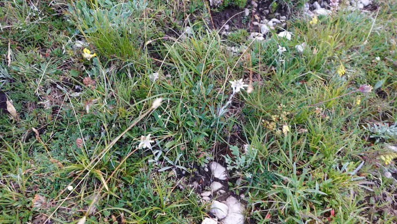
If you look around you will notice Edelweiss (Stella Alpina) growing, this is a flower hard to find.
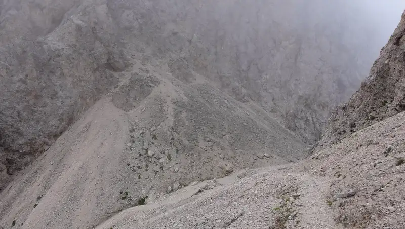
Forcella di Mesdi (Mittagsscharte) is a sharp and narrow passage through this mountain range, so it is a windy place where you do not want to stay long. This is the only point to which you can get from the north side of the mountain and join the normal route to the summit.

So here you turn to the right, i.e., to the east, and this is the west ferrata direction. Below is my view back when I was above the pass, the routes to it from both sides are steep and demanding.
Strictly speaking this is a south-west and not west side, just to know, you can realize this from the map. The term ‘west’ is used to avoid confusion because of yet another south-west lower route mentioned earlier, and which I used for descent.
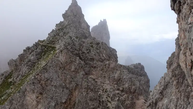
In any case, this upper route sometimes follows ledges close to the south-west side ridge. Cables are in place at some places but most of the time this is an easy climb with sharp peaks around as in the picture.
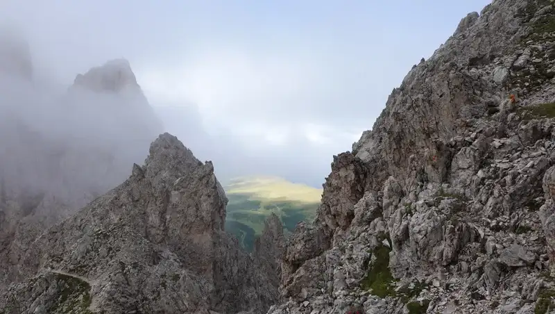
Without clouds, occasionally you will have views of Seceda area as shown below:
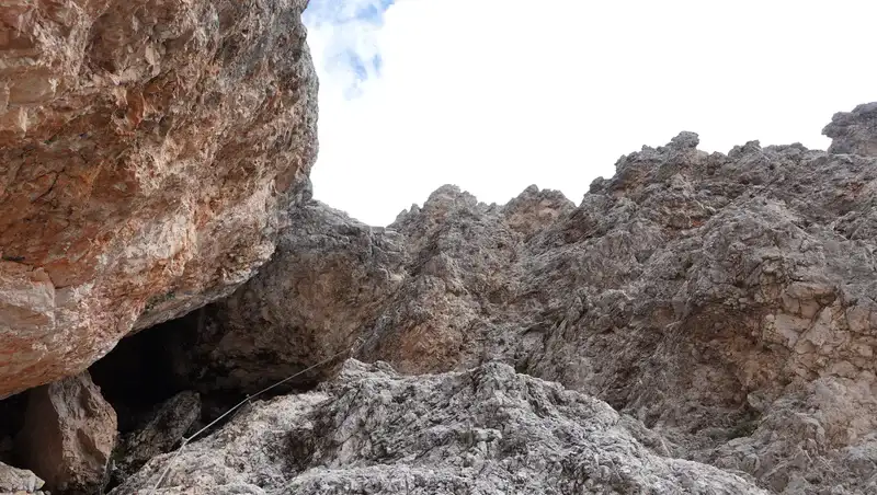
There is one point on the route where you will see the lower south route joining it, this is shown in the video. From that point there is only one route to the summit. The remaining part is very rugged at some places, see the photo below.
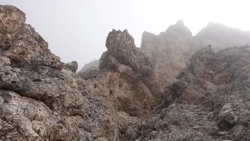
The final 50 meters of the summit ridge are easy, but on the summit the space is quite limited. This photo below shows what to expect.
Descent route
Here I describe the route which I used, and this is the south side ferrata route. So walk back the same route described above, and at elevation of around 2760 m you will see the route that splits to the left. This is the south side ferrata. Most of the time it is very easy and with few cables.
But keep your ferrata equipment on, the last two cables are a bit exposed and you will need it, see the photo below. After that you are again on the route that goes up to Forcella di Mesdi (Mittagsscharte).
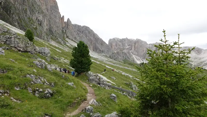
When you are on the grassy area again, you can continue in the direction of Rifugio Firenze and back to the parking. But if you have stamina, do as described below:
Hike to Seceda
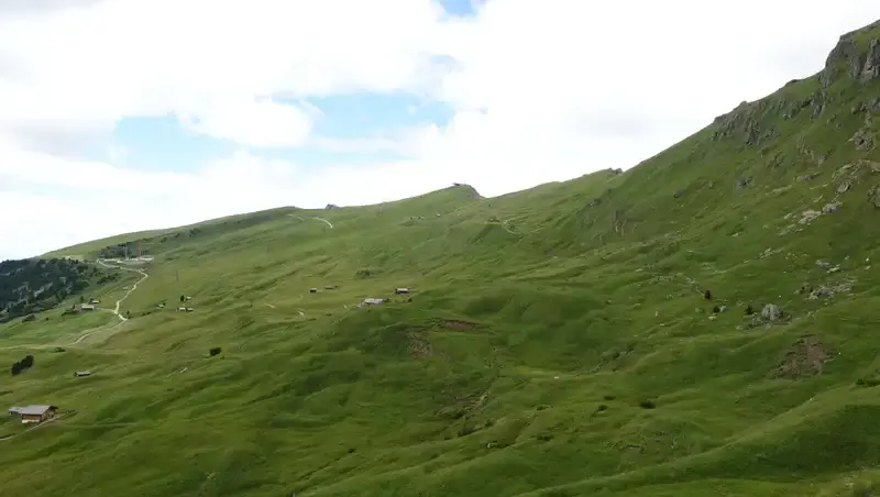
There is a route to the west below cliffs, it is on maps marked as 2B, and it leads to Seceda. Elevation is around 2270 m. Below is a view back after descending and when I was walking on that route in Seceda direction.
Very soon, all beauty of Seceda will appear in front of you, and the route gradually goes up to the summit which is at 2519 m of elevation.
When you get to Seceda summit, you will realize why so many people come here, have a look at the picture below. The massif in the distance is Sassolungo, and Piz Boe group is on the left.
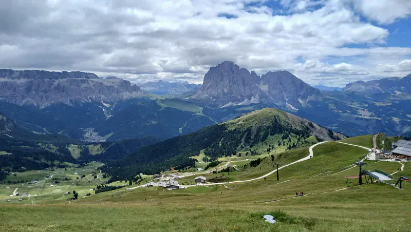
From this place I was able to see Sas Rigais and all smaller sharp peaks in between shown in the top photo above.
All the tour is presented in my video, please have a look:
My rating of Via Ferrata Sas Rigais (west access route from Forcella di Mesdì and south-west descent route )
I use my own grading system based on three essential criteria, assuming that you walk all the way up from the car parking. The result is as follows:
| Rating Criteria | Rating (A-E; 1-5) |
|---|---|
| Technical difficulty | B |
| Ferrata length | 3 |
| Access route difficulty | D |
| Overall Score | B3D |
The west Via Ferrata Sas Rigais (Sass Rigais) is an intermediate secured climbing route. The west route is also known as Villnösser Einstieg, and it starts directly from Forcella di Mesdì (Forcella de Mesdì or Mittagsscharte), and ascends ~410 m to the summit at 3025 m.
It is with intermittent equipped sections and with many cables used sparingly for safety on steeper or exposed parts, with abundant natural holds on low-angle rock.
Total cable lengths for this route are not explicitly documented in standard via ferrata guides, as the route emphasizes natural climbing over heavy fixed protection. However, based on detailed route descriptions, equipped length is probably up to 150 m of cables and fixed aids (brackets, nails, and short steel rope sections. These are concentrated in 3-4 key spots.
The rest (~80% of the route) is unequipped hiking on easy rocks (1st degree difficulty), scree, and gullies, where cables are absent or minimal for self-belay only.
Total route length from Forcella di Mesdì to summit is around 1 km, and climbing time for this part is up to 2 hours, with elevation gain of 410 m.
Exposure is low-medium, cables provide security but aren’t essential for progression. The route joins the main south ferrata ridge near the top.
The access from the Daunei parking till first cables is long, plan more than three hours, hence my rating.
The descent south-west route is also mostly without cables, and it can be done without technical ferrata equipment.
If you want to compare it with some other ferratas, it is in the same group as ferrata Kesselkogel, but it is definitely less exposed.
My tour to Sas Rigais
I started at 4:30 am, it was completely dark but finding the route was not complicated. About 80 minutes later I was above Rifugio Firenze, nobody around all the time. At Forcella di Mesdi I was at 7:40, and at the summit at 9:40. This makes it 5 hours and 10 minutes in total.
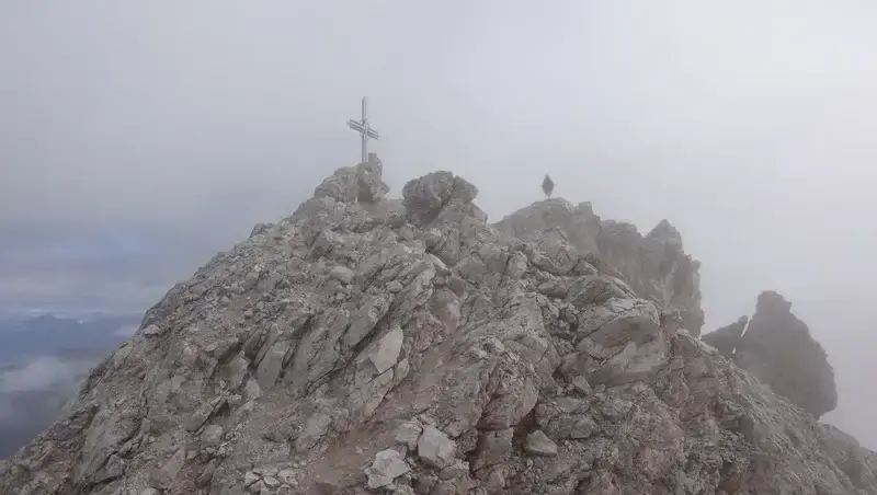
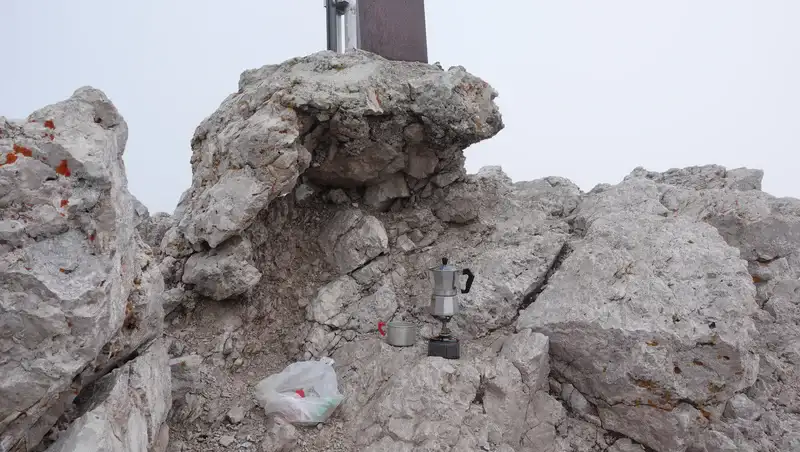
There was nobody on the summit and I had it for myself for half an hour or so before two Italians arrived. No views, and complete silence before Italians. I had my coffee there when they arrived, and they were clearly surprised by seeing my coffee pot as in the picture below.
Later, two young men from Slovenia arrived. The weather was not improving, so it was time to go. I descended a part of the route the same way and then switched to the south route.
By mistake, I packed my ferrata stuff and this was not smart. There are steeper cables at the very end of the route before it joins the route to Forcella di Mesde. At the grassland below, I decided to go to Seceda, a really crowded area but with good reasons.
After more than 11 hours of walk, I was back at the car. And yes, at that time, Sas Rigais was completely free from clouds. My bad luck.
What gear to use for this tour?
Both routes are ferratas, so you need a full ferrata set, and this means a harness, a Y-rope, and a helmet. In principle, it is doable even without equipment, but it is better to play safe. For early starts a headlamp is needed.
I used Mammut Sapuen GTX boots, a pair of trekking poles, and my Mammut Lithium 40 backpack. Gloves for cables are definitely necessary, and I used them.
In the backpack, as usual, I had a rain poncho and rain pants, plus a rain jacket. If you do not have any jacket and not sure what to choose, think about the Mammut Crater Pro HS which I use myself.
Do you want to climb this mountain?
As you realize, I go solo, but I have been in this for 40 years already. If you have some mountaineering experience, you can do this tour too.
But safety first: conditions change quickly, and I strongly recommend a certified guide if it is new to you or you want peace of mind. So connect with 57hours, and get certified local guides for climbing trips worldwide (including this and routes similar to this one).
Final thoughts
In summary, Sas Rigais west ferrata from Daunëi is a solid day out: long access, moderate technical sections, low exposure, big elevation gain (1300 m+).
Summit views are hit-or-miss because of frequent clouds, but the ridge and the peaks around are worth it even in milk. Add Seceda loop if you still have legs; it turns the tour into 11+ hours but closes the day with proper Dolomites scenery.
Bring full ferrata kit even if most people skip it; the last cables on the south descent are no joke when tired or wet. Start very early to have the mountain empty. 4:30–5:00 am from parking works well.
Overall: recommended if you want a quieter 3000er with real mountain feel and don’t need constant steel cable under your hands. Just accept you might see nothing from the top and still call it a good day.
Thank you for reading. Let me know if you have questions or comments, there is a comment section below. Please join us at our Facebook group Dolomites Visitors Hub.
FAQ: Sas Rigais West and South Ferratas & Seceda
Is the west ferrata really harder than the south one?
No. Both normal routes (west from Forcella di Mesdì and south/south-west) have the same official rating (easy-moderate). The west route feels more sustained because you climb it fresh and the rock is rougher, but it has fewer truly exposed cable sections than the last two pitches on the south descent.
Can I do Sas Rigais as a half-day trip if I take the lifts?
Yes, if you use Col Raiser gondola (from Santa Cristina) or Seceda cable car (from Ortisei) you cut the elevation gain to ~900–1000 m and the approach time drops to 3-4 h to the summit. Round trip from the top station can be done in 6-7 hours including Seceda visit. Still start early, the lifts open around 8:30 am and the summit gets crowded after 10 am.
Is it safe to climb without ferrata equipment?
Technically possible for experienced scramblers with good footing; 80 % of the route is UIAA I/II terrain with only short cable sections. However, the last two cables on the south descent are vertical/exposed and the rock can be polished or wet.
In 2023 and 2024 there were several rescue calls exactly because people without kit slipped there. A light ferrata set (Mammut Skywalker Classic Via Ferrata Set or similar) removes almost all objective danger and is worth carrying.
When is the best month and what time to start to avoid clouds?
Statistically, late June to mid-July and September give the most stable weather. August has frequent afternoon thunderstorms. To beat the cloud cap that often sits exactly at 3000 m, start from Daunëi parking no later than 4:30–5:00 am (headlamp needed).
If using lifts, be on the first gondola. Most clear summit windows are before 9–10 am; after that the Odle group often disappears in cloud even on otherwise perfect days.
Leave a Reply