The Ferrata Anita Goitan on Jof Fuart is a round tour that may include also getting to the summit, but you do not have to do this. In my view, this is a medium-to-hard ferrata, with many exposed places, not for people with vertigo.
Access roads & routes
The Google map below is the same I used in my text about Rifugio Corsi. This hut should be your destination in any case. So please zoom in to see more details, and zoom out to see the larger area and access roads.
- The yellow marker is the start point from a car parking close to the Predil lake. Coming from the Tarvisio direction, the parking is on the left side, around 2 km after the lake. On the opposite side of the road there is a sign for the path that goes to Rifugio Corsi.
- The blue marker is the start point for the route that passes Malga Gratnagar. This is a good and very steep private road, not open for public. The steepest sections are concrete and the rest is macadam.
- The red marker is the start point from Sella Nevea Pass.
- The pink marker denotes the position of the Guido Corsi hut.
Here are a few tips before I continue:
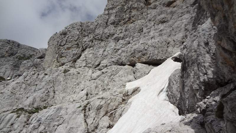
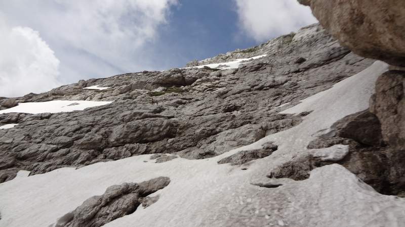
- If you plan to go there in early season, as I did, then my advice is not to go. The reason is that there are many narrow, steep, and dangerous gullies full of snow. The picture below shows one out of several. It may look simple on the picture, but trust me this is not so. I had all necessary stuff (crampons, piolet) but at some point I almost had an accident.
- At some place I even had to crawl through some passage underneath the snow to get to the opposite side of a gully.
- If you still want to go, then make sure you have any sort of crampons. I had my Camp Frost simple crampons because I wanted to use them with my Salomon Quest Prime GTX boots. The crampons were good enough for this purpose.
- Definitely take a piolet with you. I used my standard Petzl piolet, it was critical to have it on one of the gullies where I lost balance and was sliding down the snow. Only due to the piolet, I was able to stop before crushing on the boulders below.
- As for the rest, you will have to have the usual ferrata equipment (a helmet, a harness, a Y-rope, gloves).
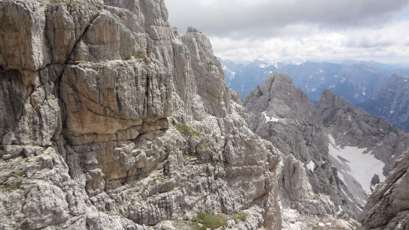
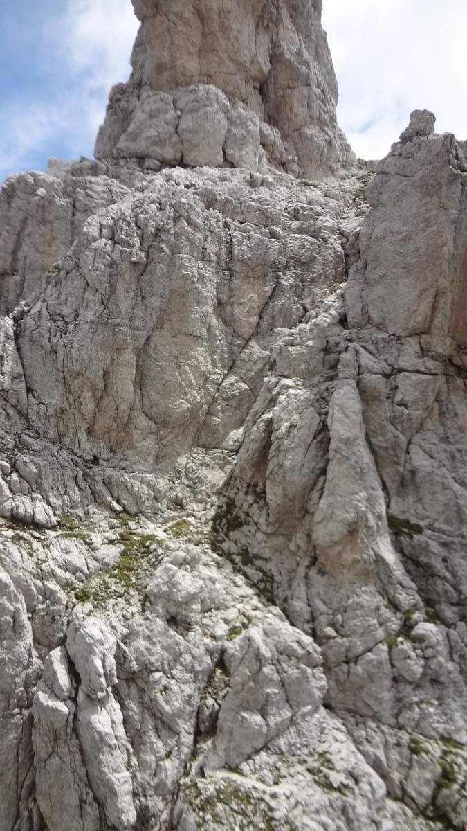
The picture below shows what you see from the rifugio Guido Corsi, several peaks of Jof Fuart. In the lower part the Goitan ferrata route goes to the right and then to the left under all these peaks. It crosses many couloirs and steep gullies between the peaks.
If you did not do your home work properly, it will be difficult to know which route to follow. This was my case. It will be even more difficult if the area is more under the snow, you will not be able to see the signs that are on the rocks most of the time.
But, I had two options, to go clockwise or anti-clockwise. Knowing that this is a round tour and being clever as I am, I concluded that any would do. It turned out that none would do, I mean to get to the summit.
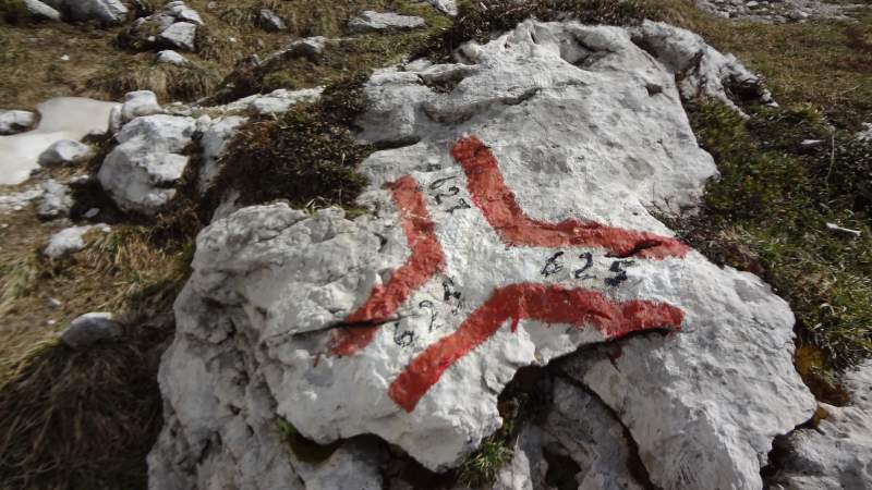
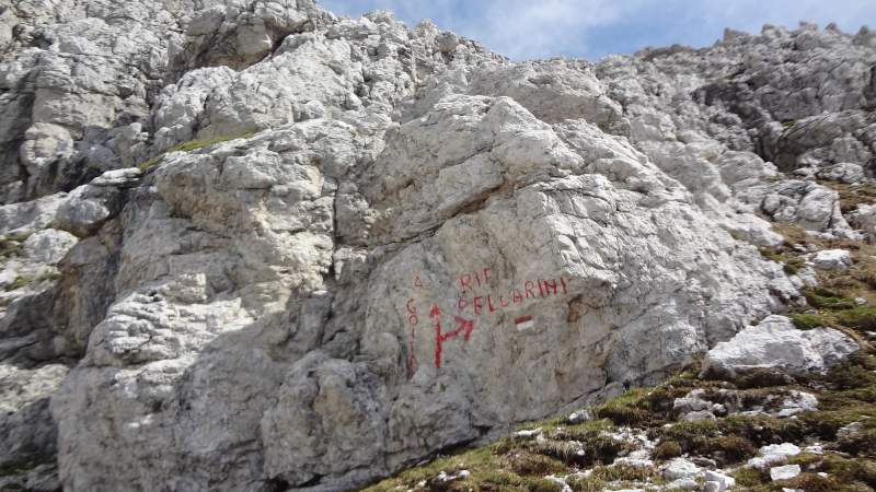
So I went anti-clockwise, for some reason it looked more natural, no idea why. Directly above the hut, you will follow the route 625 but very soon you will switch to the route 627 shown in the picture. Note, if this stone was under snow there was no way to know where to go. At this stage, the walls of Jof Fuart will be on the left above you.
At some point you will see the sign shown below, so go up and follow A. Goitan route.
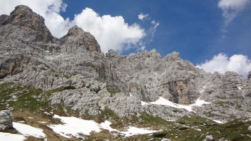
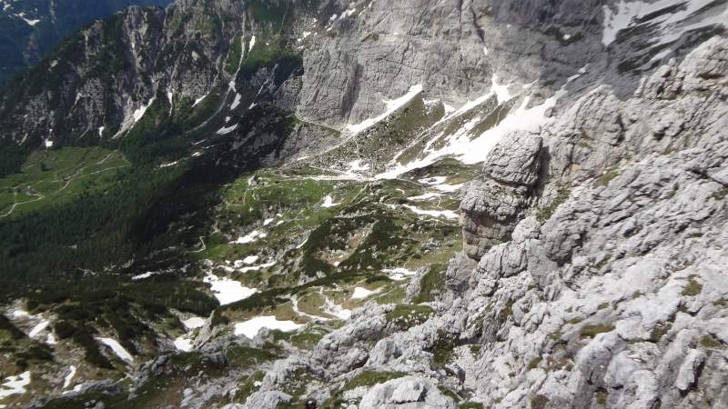
Most of the time, rifugio Corsi and Malga Gratnagar below it will be in sight, see how this looks from the first part of the route:
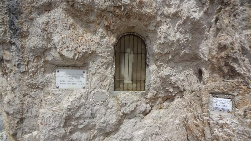
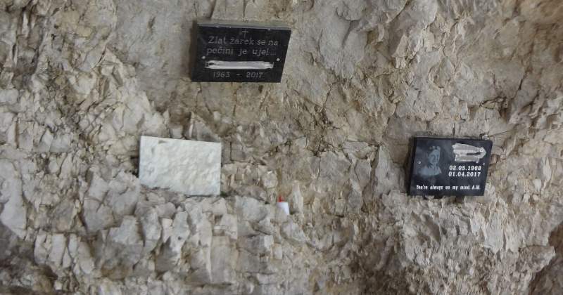
Then this is what I saw, Madonna and commemorative plates that are related to WWI when this area was a front line:
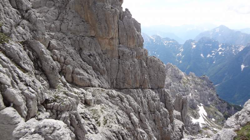
After this point you continue left in the northwest direction along exposed ledges, some aided (with cables) and some not. You will have them many. The picture below is view back and it shows one of more pleasant sections.
At one point the route descends for some 30-40 meters to a narrow and not so pleasant couloir. This is a very steep section with a couple of cables. The part after that is again a pleasant ledge.
The picture below shows the point where I could not find the route to the summit any longer. The gully was full of snow. The summit was not very far from this point, but I had to give up.
There is a goat in the picture, perhaps you will be able to see it. This was the only creature in that area of the mountain. So I descended directly from here, the descend route was just across the gully. But I had to cross the snow first, and this is the place where I lost balance. I was saved only due to the axe which I used to slow down my sliding towards the boulders below.
After descending several fixed cables, this is what I saw on the rock. So if you would go clockwise, this is what you would see as a reminder of what may happen in such a place.
In conclusion, the climb did not go as I wanted. There are two reasons, first, I was there too early in the season, and second, I did not do my homework properly.
I use ferrata routes only when this is really necessary, I rather use alternative options if I have them. The Anita Goitan ferrata is the longest approach and it goes below all the summits of the mountain. This approach is described also as Forcella di Riofreddo route. For those who love ferratas, this is an incredibly attractive route.
My reason to climb A. Goitan ferrata was to eventually get to the summit. But as mentioned, I made a mistake by going there too early. As I learned later, the winter before was with more snow than in a couple of decades before. This is why the gullies where so full of snow even in the last week of June.
To get to the summit, it is much faster to start this ferrata route clokwise, and at the point shown above, you can continue to the summit even without doing the whole ferrata loop. This would be the most direct access to the summit.
But at the place shown previously in one the pictures, I could not find the route any longer. So I would have failed in any case. All in all, this was a disappointment. If I get a chance to be in the area again, I shall do my best to do this properly and then perhaps I shall add a few photos from the summit.
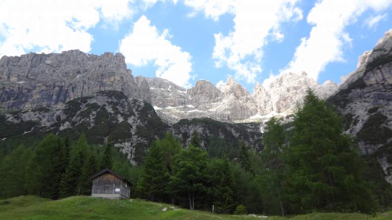
I came to the area from the Sella Nevea pass (the red marker in the Google map above). Then I descended towards Malga Gratnagar, and walked down to the main road (the blue marker). After that I had to walk up to the car at the Sella Nevea again, so this was also a round long route. The picture below is my view back towards Jof Fuart from Malga Gratnagar, this is the place where you can have a meal and drink.
You can see a bit more in this video, please have a look:
You might want also to read about my tour to the nearby Bivacco Luca Vuerich which I did just a day later. About a decade earlier I also climbed Jof di Montasio which is in the same mountain range, so have a look there as well.
Thank you for reading. Let me know if you have questions or comments. Subscribe to my weekly newsletter and stay informed you have a subscription form below.
Leave a Reply