If you plan climbing Pizzo Filone (3133 m, 10279 ft) from Livigno side, a convenient start point is the parking 6 at Tresenda. Here is my report about the climb.
Basic data
- Coordinates, latitude, longitude: 46.45489° N, 10.16441° E.
- Normal route type: walk-up.
- Elevation: 3133 m (10279 ft).
- Huts: none.
- Restaurant on the way up.
- Town for supplies: Livigno.
Access & roads
Pizzo Filone can be climbed:
- From the north side, and this means from Livigno area.
- From the south side, which means driving into the Viola valley from the road that connects Livigno and Bormio.
If you want to enter the Viola valley, you will have to pay a fee. There is a payment spot with a barrier very close to the main road. In this case, you will want to drive to the last and highest parking along the valley, to have the highest start point of your tour. Note that the road is incredibly narrow. I know this from my earlier climb of Cima Piazzi which I climbed from that side.
But my climb of Pizzo Filone was from the Livigno side. In this case, you use the free parking on the right side of the road from Livigno to Forcola pass.
This is the Parking 6 in the area with the name Tresenda, easy to see, you cannot miss it. As you see from the picture below, it was empty because it was early. The church in the picture is what you will see on the opposite side of the parking, so this is your start point.
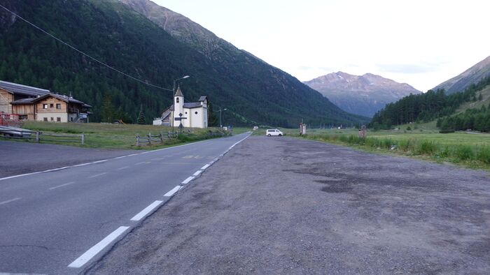
The elevation here is around 1900 meters, and the summit is at 3133 meters, so you have around 1230 meters to climb.
The interactive Google map below will show you all access roads in the wider area, but zoom in to see the details. I have only added the short orange line in the area where the map itself is without the route, so this is roughly the direction to the summit.
Route description
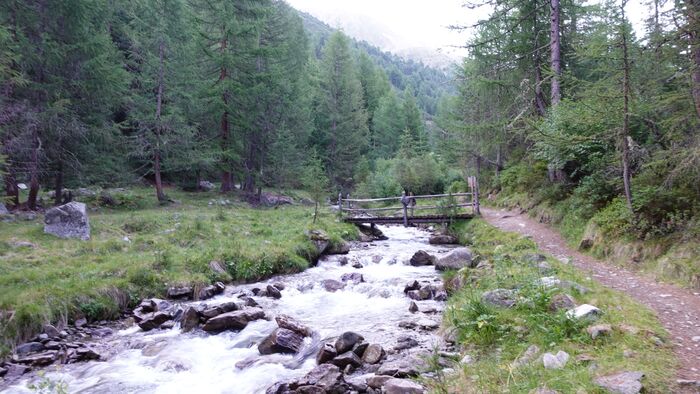
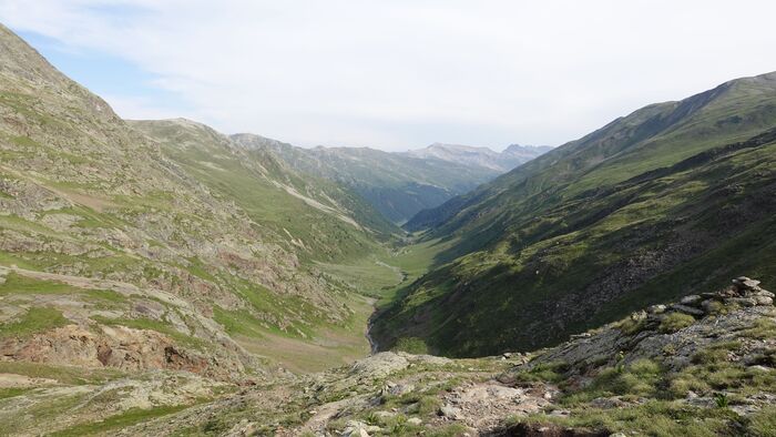
After parking the car, you will walk in the direction of the Val delle Mine. Note that you can walk along any side of the water flow that will be next to you for another two hours or more. I decided to walk on the right side, and the picture below shows how it looks, this is the view in the direction of the mountain.
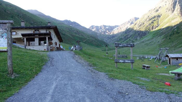
At some point you will see a farm on the opposite side of the spring, so simply continue, the path will take you to the restaurant shown in the picture below. On the maps, this place is called Cheseira dal Gras di Agnei, and elevation is 2188 m (7178 ft).
From this point you continue along the valley. Very soon you will come to the point where the route splits, so make sure to go to the right along the valley. The route number is 116. You are now well above the forest line, and the picture below shows view back:
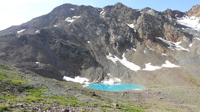
Here the route becomes steeper and more demanding, but you will be rewarded with the view of the beautiful lake shown in the picture. Note that this is the real color, the same what you can see in the much more famous Lago Sorapis in the Dolomites.
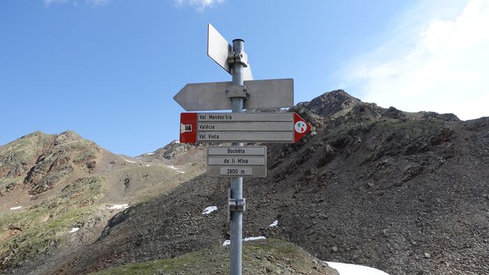
You continue in the direction of the pass above you, this is Bocheta da li Mina (2800 m, 9186 ft). You will pass yet another lake, and at the pass you will see the sign shown below:
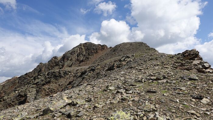
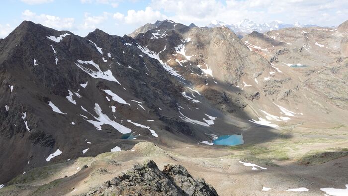
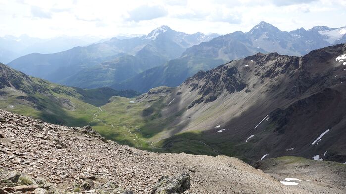
From here, continue along the ridge in the north-east direction. Below you see what you have behind you:
On the remaining part to the summit, there is only one place with a fixed steel cable. But this is a simple passage and you do not need any ferrata equipment. On the south side, you will have Val Viola and Cima Piazzi is visible all the time, see the picture:
My climb
I started at 6 am, and I was on the summit at 11 am. So it took me more time than expected for the elevation difference of those 1230 meters or so. Typically, I need around one hour for every 300 meters, so my progress was rather slow.
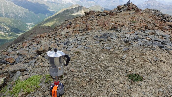
I carried my water filter, so did not have much water with me. The backpack was not so heavy. There was nobody around all the way up. So I stayed on the summit one full hour, and as usual, I had my morning coffee there:
On the way back, I decided to follow the route that is supposed to be there from the other side. You remember, I mentioned earlier that the route splits after the restaurant. Indeed, on the summit itself you will see that this direction is marked, so I decided to go that way.
But very soon, on a boulder area with lots of loose rocks, the route simply vanished and I could not find it. I was able to see the valley which I followed on the way up, so decided to descend in that direction without any route.
This is never a smart decision because you do not know if you really can manage it. Eventually, I managed to descend and was on my morning route again. So my advise would be not to do the same, it is better to go back the same way you came up.
In this video you can see more:
Equipment & accommodation
You have already seen in the text above what kind of route this is. So you do not need anything special, just a pair of good hiking boots.
I was using Salomon boots with a good ankle support, and I also had a pair of Komperdell trekking poles. The backpack I had was my Osprey Stratos 24.
As for accommodation, you should know that Livigno is a popular area, so make sure to book your accommodation in advance.
Final thoughts
So, climbing Pizzo Filone does not require any special equipment, this is a simple walk-up tour but at a high elevation. I was lucky for having such a great weather, but things can become very different in the case of a storm.
This is why it is important to have a waterproof protection for all your body. In other words, have waterproof jacket and pants, plus an old fashioned waterproof poncho, I had them all in my backpack. If there is any chance of storm and lightning, do not even think of going to the summit.
Check also my text about free shelters in this area, and read as well about my climbs to the nearby Pizzo Orsera and Piz Paradisin. You might want to have a look also at my book Livigno Peaks with the collection of my tours in that area.
Thank you for reading. Let me know if you have questions, there is a comment box below.
Leave a Reply