A few months ago I was passing through the Dolomites and did a round tour of the Tre Cime di Lavaredo (Drei Zinnen), so here is a short report about it.

How to get there
Here I give the AllTrails map of the area, it is zoomable so you can see all the details mentioned in the text below. Zoom it out to get some idea of access roads and the geography of the area.
Tre Cime di Lavaredo entrance fee
I start with this because this was the only unpleasant experience. You will have to pay 30 Euros if you go by car. You pay the fee at some point above the lake. The picture below shows the prices in 2019:
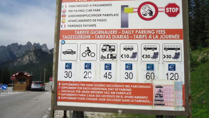
One could walk from the lake, but there is no way to leave the car below, this is not allowed overnight. I have seen later that some people leave their vehicles in a wild parking area below the lake but this is probably a bad idea.
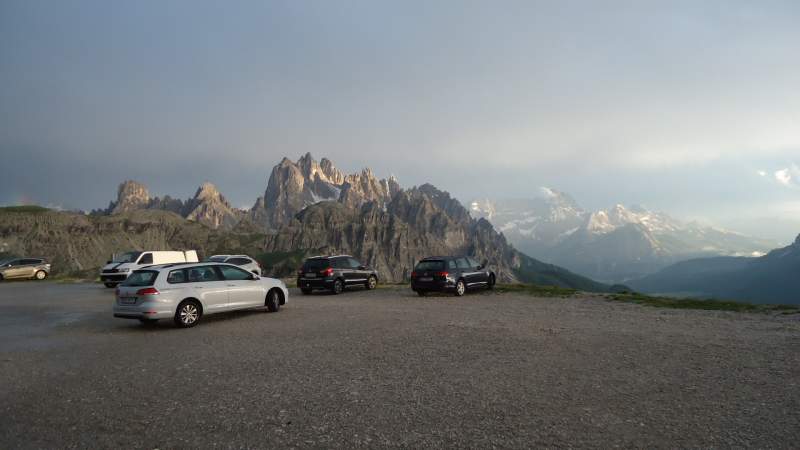
In any case, in summer this is a very popular destination and even when you get in, finding a parking space at the end of the road can be difficult in spite of multiple parking areas there. This changes in the evening when tourists’ busses and many cars leave. The picture below shows the views from the parking, I had a surreal experience with a thunderstorm and a sunset after that, the views were simply breathtaking:
Tre Cime di Lavaredo round tour data
You can walk the route in any direction, I did it counter-clockwise and the pictures below show this order. Have seen many people coming in my direction so obviously there is no preferred way of doing the hike.
- Length: around 9.5 km. There are some shortcuts and alternative paths so you can see different numbers in some sources. The route includes the following stages:
- From Rifugio Auronzo to Rifugio Lavaredo 1.7 km.
- From Rifugio Lavaredo to Forcella (Pass) Lavaredo 1 km.
- From Forcella Lavaredo to Rifugio Locatelli 1.9 km.
- From Rifugio Locatelli to Malga dei Pastori (Langalm) 2.8 km.
- From Malga dei Pastori to Rifugio Auronzo 2.1 km.
- Time: This is totally up to you. I did it in around 4 hours, did not rush. I am sure it is doable in well below 3 hours.
- Ascent height difference: around 400 m. This includes several sections where you climb: from the car parking to the Auronzo hut, from Rifugio Lavaredo to Forcella Lavaredo, and then from the lowest point between the Locatelli and Langalm huts.
- Descent height difference: around 400 m. The most important is after the Locatelli hut.
You can read about the Tre Cime on Wikipedia, no need to repeat the stuff here. I just want to stress that the three peaks are Cima Piccola (2857 m), Cima Grande (2999 m), and Cima Ovest (2973 m). In fact, there are a few more peaks in the group, but those three are the most prominent.
The Cima Grande was climbed for the first time 150 years ago. It is interesting that recently Reinhold Messner made a film about this, see a bit more in my separate text.
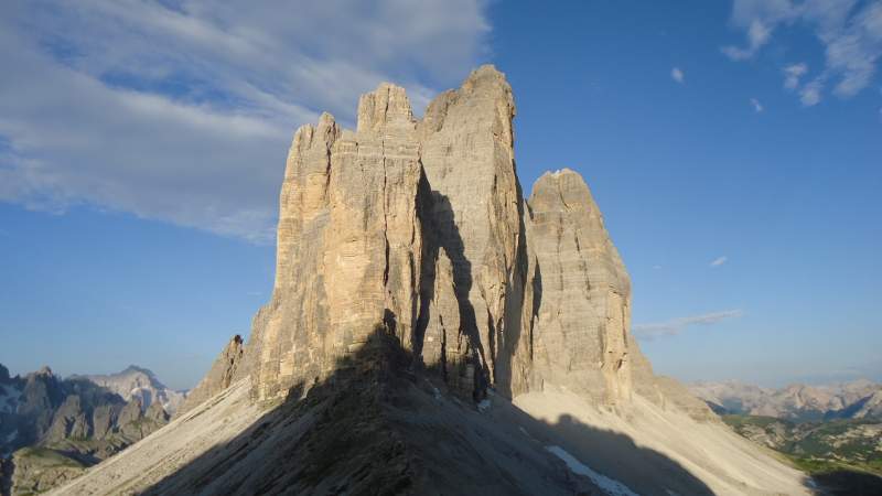
When you get to the Forcella Lavaredo, you will see the peaks from the side. The picture below shows this, and you realize that the central Cima Grande is overhanging in its bigger lower part. Now, imagine Alexander Huber climbing it free solo. There is a video of him in my separate text.
The huts
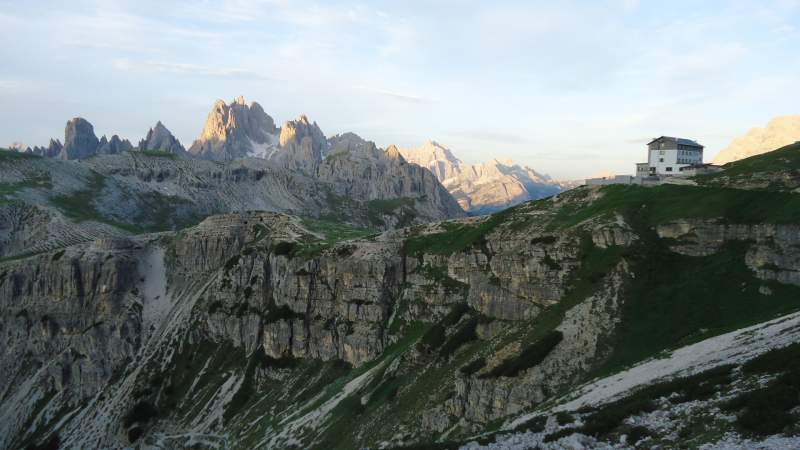
There are 4 huts along the route, more or less at a similar elevation. When you start from the car parking and go counter-clockwise, the first is the Auronzo Hut shown in the picture below. This is how you see it once you pass it and you are on the way to the next hut. Its elevation is 2320 m.
From Rifugio Auronzo you continue along a pleasant path and you will pass a small church Capella degli Alpini. Tre Cime will be on your left side all the time. In less than half an hour you will be at Rifugio Lavaredo which is the closest to the normal route to Cima Grande and it is at the altitude of 2344 m. Here is how it looks:
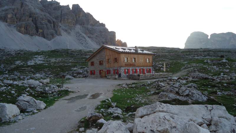
After the Lavaredo hut you will climb up to one of the highest points on the route, the Forcella Lavaredo (pass). Then you have two options, one is to descend and continue towards the Rifugio Locatelli (there are two routes in this direction, see the picture below) or to shorten your tour and continue immediately in the direction of the Langalm Hut.
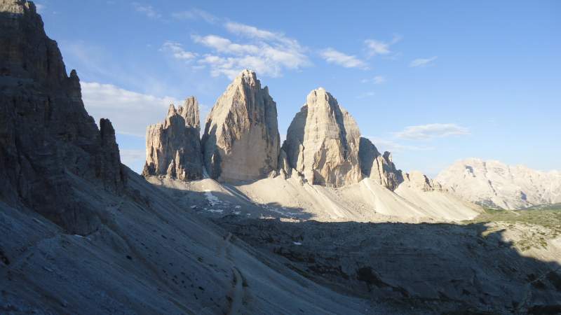
Note that you can continue towards Locatelli hut by following a route directly under Monte Paterno (Paternkofel) which will be above you on the right side. This mountain seems to be like Swiss cheese, full of man-made caves carved out during WWI.
This was a front line at that time. One of the caves will be directly on the route when you get closer to Locatelli hut. This hut is at 2405 meters above sea level.
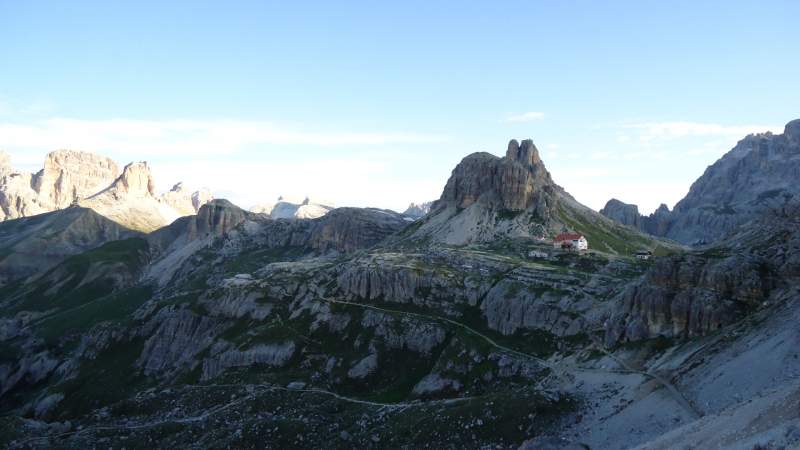
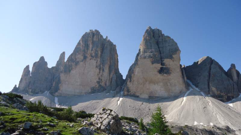
When you continue the tour, you will descend and this will be the lowest point of the route. Then you start climbing in the direction of Langalm Hut (2283 m) which is your last hut on the route. The Tre Cime will be on your left side and this will be the best view of all of them. Their north faces are shown below, this is where Alexander Huber climbed free solo. When you see this you start asking yourself if there is any limit for human achievements.
The picture below shows the Langalm Hut. After you pass it, there is a small lake on the left and after that you will arrive at the pass Col de Medo and then descend towards the Auronzo hut and the car parking.
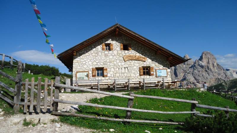
Equipment
This is an easy walking tour but on a high elevation, you are all the time above 2000 meters. So have something for UV protection, a good sun hat, and glasses. Other than that there is nothing essential to recommend for the tour, any walking/hiking shoes or boots will do the job. I was using my Lowa Renegade boots but you can do this even in some low-cut hiking shoes. I had a small daypack, plus a pair of Komperdell trekking poles.
If the weather is unstable, I warmly suggest reading my separate text about clothing for summer in the Alps. This is high elevation and the weather can turn bad out of nowhere. I experienced this the day before in the evening when there was a storm with hail and rain although the sky was clear just minutes before that. Needless to say, I had my usual waterproof stuff in the pack. You should have it as well, do not rely on huts.
So as you realize, this was my walking tour. I did not go to the summits because I was not ready for this, but I would love to. The normal route to Cima Grande seems to be doable for ordinary mortals like me. But I would need a partner. Anybody?
As for the accommodation in the surrounding valleys, Dolomites are a popular destination.
Please let me know if you have been in the area, and in particular if you have climbed Cima Grande. There is a comment box below. You might want to join us at our Facebook group Dolomites Visitors Hub.
Leave a Reply