Bivacco Rifugio Tiziano and Bivacco Toso are separated by only a few meters; the former is locked and the keys may be collected in Auronzo di Cadore, but the latter is always open. I visited them recently and here is my report. Keep reading.
The easiest access to Bivacco Rifugio Tiziano and Bivacco Toso is from the north. You start from the car parking at the main road in Valle Ansiei and follow route 260. Plan at least three hours to get there.
About names and buildings
Rifugio Tiziano is a stone shelter built in 1899, and it is not a rifugio in the usual terms. Namely, it is always locked, and there is no guardian present. The keys can be collected from Mr. Nicola Pais Bianco, tel. 329 336 7122, at the Hotel Serena, Via Reane 38, Auronzo di Cadore.
This is why you will see it sometimes mentioned as Bivacco Rifugio Tiziano; it is indeed a locked bivouac. Note that there is a fee of 10 € per person per night.
By name, it is dedicated to the great painter Tiziano Vecellio (Titian, 1488) who was born in the nearby Pieve di Cadore.
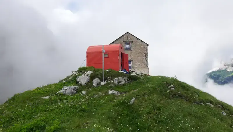
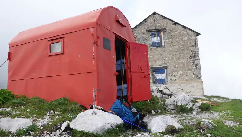
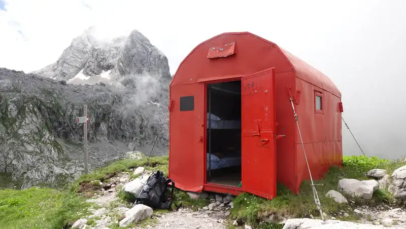
On the other hand, Bivacco Toso is a true alpinist bivouac in its formal shape, purpose, and inner organization. It is always open and free to use.
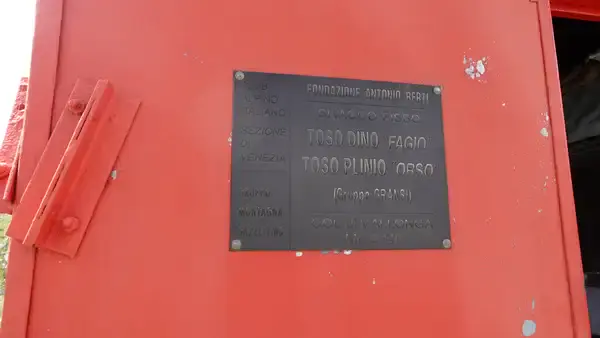
This is a metal red container, typical for the Italian Alps. In various sources it is called Bivacco Fratelli Toso, and also Bivacco Toso Dino e Plinio. The picture below shows what you can read on its wall:
Coordinates, numbers & details
- Elevation: 2246 m (7369 ft).
- Location: Col di Vallonga.
- Mountain group: Marmarole, Dolomites.
- Coordinates: 46.5148019, 12.3141964.
- Route difficulty: walk-up.
- Elevation difference from the car parking: 1200 m (3937 ft).
- Places to sleep: 8 in Rifugio Tiziano and 9 in Bivacco Fratelli Toso.
- Parking coordinates: 46.5437797, 12.3229139.
- Time needed to the bivouac: around 4 hours.
These two bivouacs are on the Alta Via 5 and people on this route use them, so bear this in mind because it may be crowded.
Below you have the interactive map with the position of the parking (marker 1) and the bivouacs (marker 2). If you zoom in, you will see the details of the route. Zoom out to see the access roads.
Route description
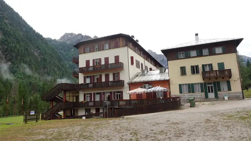
The route number 260 starts from the main road between Auronzo di Cadore and Misurina. You can park for free at the building in the photo below; this is Casa Alpina Domenico Savio. I was pleasantly surprised when a person from the building told me this.
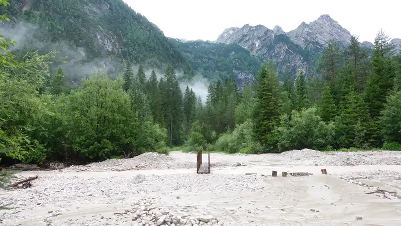
From here, cross the water stream shown below, and follow the path through the forest. There is a simple bridge; you cannot miss it. The bivouacs are visible from here, just so you know.
After a flat valley floor, you are on the steep path that goes through the forest. Below you can see how it looks:
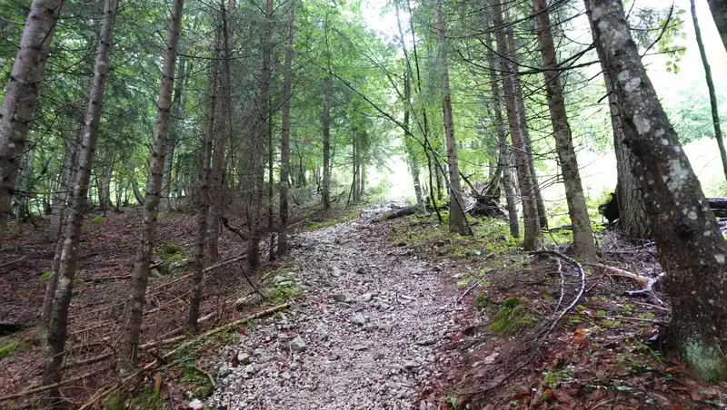
All the time this is a pleasant but demanding walk up; there are no exposed passages. At several places you will have water streams close to the path.
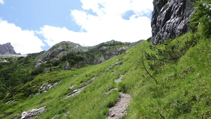
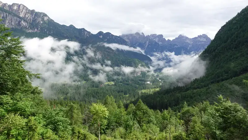
When you are above the tree line, you will have great views over the valley, and Tre Cime di Lavaredo will also be in sight.
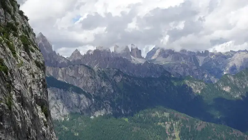
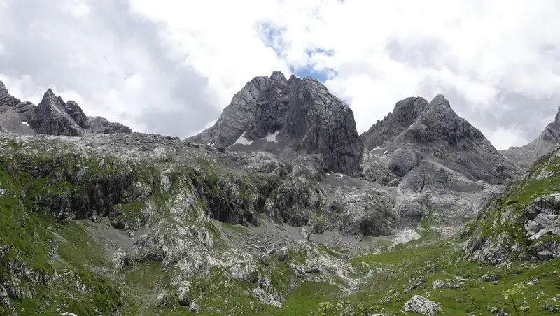
Below you can see how the bivouacs look when you see them for the first time, surrounded by the peaks that create a beautiful cirque around the elevated position of the shelters. This is the beautiful Val Longa.
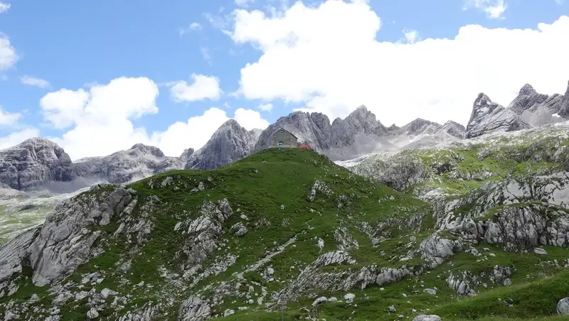
The AV 5 route comes here over the passes on the left and on the right. Below you have a close view of the shelters:
The beds in the Toso bivouac are very comfortable, with thick mattresses, pillows, and blankets. As for the interior of the Tiziano bivouac, I cannot say anything as I did not enter it; I did not need the key for such a day tour.
Now, why did I not sleep here? The reason is almost always the same. I love bivouacs, but my time in the mountains is always limited while my list of places I want to see is long. Staying overnight means spending two days on one target, and I cannot afford it, all in spite of the fact that I stayed in the Dolomites for 52 days during this trip in 2025.
Please see more in my video:
My tour
When I started, an old woman was at the door of Casa Savio; she greeted me warmly and wished me a successful tour. This was really kind and made my day.
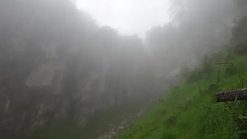
It was cloudy after a couple of days with rain, so everything was wet but the weather was stable. In some moments I was in clouds and this made the whole atmosphere even better.
There was nobody around and this remained so all the time. Only at the bivouacs did three young men come from the AV5 direction in the moment when I was already preparing to go back.
The descent was on the same route in stable weather. This was a beautiful day in solitude.
Equipment
For this hiking tour you do not need any special equipment; there are no exposed passages, so it is doable by anybody in normal physical condition.
I used Mammut Sapuen GTX boots, and had a pair of trekking poles. The backpack was Mammut Lithium 40.
You should always have a rain protection layer or at least a rain poncho. My hardcopy map for the tour: Dolomiti di Auronzo e del Comelico, Tabacco 017, 1:25000.
Final thoughts
In summary, the hike to Rifugio Tiziano and Bivacco Toso in the Marmarole Mountains offers a straightforward yet rewarding day trip for those exploring the Dolomites.
The route, starting from Casa Alpina Domenico Savio, is a steady climb along path 260, taking about four hours to cover the 1200-meter elevation gain.
With no technical challenges or exposed sections, it is accessible to most hikers in decent shape, and the views of Val Longa and Tre Cime di Lavaredo make the effort worthwhile.
Bivacco Toso is an open, free shelter and a reliable stop, while Rifugio Tiziano’s locked setup requires planning ahead for keys.
This trail delivers solitude and stunning alpine scenery, especially on quieter weekdays. My 2025 visit was marked by stable weather and a serene atmosphere, with only a brief encounter with other hikers on the Alta Via 5.
For those with limited time, like me, it’s a perfect day hike to check off the list without committing to an overnight stay. Pack light, bring rain gear, and enjoy the raw beauty of this Dolomite gem.
Thank you for reading. Let me know if you have questions or comments; there is a comment section below. For more texts from the same area please follow the link for Dolomites, and in particular check the text about the nearby Bivacco Fanton and Bivacco Musatti.
These bivouacs, together with more than 120 others, are included in my interactive map available here on the site, see it below. Note that I also have a book titled Dolomites Solo, so have a look if you plan to do some mountaineering tours in the area.

Please join us at our Facebook group Dolomites Visitors Hub.
FAQs
How challenging is the hike to Rifugio Tiziano and Bivacco Toso compared to other Marmarole trails?
The hike to Rifugio Tiziano and Bivacco Toso via route 260 is moderately demanding due to the 1200-meter elevation gain over four hours, but it lacks technical difficulties or exposed sections, making it accessible for most hikers with decent fitness.
Compared to other Marmarole trails, such as the strenuous ascent to Cima Bel Pra or the multi-day Alta Via 5, this route is less technical but still requires endurance.
The path’s clear signage and lack of climbing make it a good introduction to the rugged Marmarole range, known for its wild, less-traveled terrain compared to busier Dolomite areas like Cortina.
What should I know about the Marmarole Mountains’ weather and best hiking season?
The Marmarole Mountains, part of the Dolomites, experience unpredictable alpine weather, with sudden changes possible even in summer. July to September offers the most stable conditions, with milder temperatures and less snow on trails, though rain showers are common.
Always check local forecasts, like those from Meteo Veneto, and carry rain gear, as clouds and fog can reduce visibility, as experienced during my hike.
Early autumn (late September) can be ideal for fewer crowds and vibrant landscapes, but snow may start appearing at higher elevations like the 2246-meter bivouacs by October.
Are there other nearby attractions or hikes in the Marmarole area worth exploring?
Beyond Rifugio Tiziano and Bivacco Toso, the Marmarole Mountains offer several attractions. The nearby Antelao massif, the Dolomites’ second-highest peak, has challenging routes for experienced hikers, like the via ferrata to its summit.
For a less intense option, the trail to Rifugio Galassi from San Vito di Cadore provides stunning views of the Marmarole’s jagged peaks and access to Alta Via 5.
Auronzo di Cadore, the starting point for many hikes, also has cultural sites like the Palazzo Corte Metto Museum, showcasing local history, making it a great base for exploring the region’s natural and cultural offerings.
Leave a Reply