Pigne de la Lé (3396 m) is a mountain in the Moiry valley, in the Grimentz area of Wallis province in Switzerland. It raises in the southeast end of the valley above Moiry lake. Compared to other mountains in the region, this is the only one that offers possibilities to choose between a glacier climb or a rock scramble.
[Francisco Tárrega: Tango]
Within this page, I am going to give you some details about both of these normal routes. I passed them both, one ascending the mountain and another descending it.
All other mountains south of it imply long glacier walks first, followed eventually by rock sections, like Pointes de Mourti (3564), Pointe de Bricola (3658), Grand Cornier (3962), Dent Blanche (4357).
On the other hand, mountains to the north of Pigne de la Le, like Sasseneire (3254), Garde de Bordon (3310), Becs de Bosson (3149), Pointe de la Tsevalire (3026) are normally free of snow and glaciers in the summertime. So if you traverse this mountain you may experience both glacier and rock routes.


The access road from Sierre in the Rhone valley to Grimentz is rather good. When you are in Grimentz you will look for the sign towards the Moiry lake (2249 m). There is a rather narrow tunnel at the lake and when you pass it you will arrive at the dam with a restaurant.
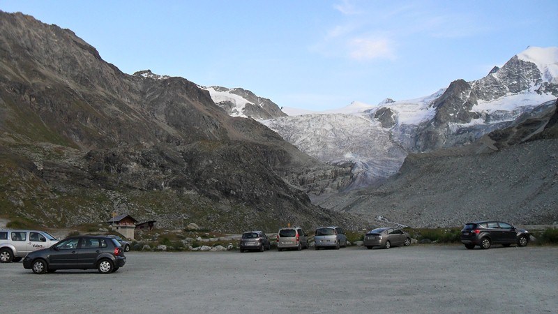
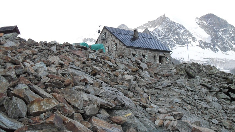
From there just continue along the lake and you will arrive at parking which is next to a glacier lake. The altitude at this point is 2350 m. You will be surprised to see that there is a post-bus service to this same spot. Many tourists come there every day to enjoy views of the Moiry glacier, or to walk up all the way up to the Moiry hut (2825 m).
From the car parking, you may directly climb Pigne de la Lé, or stay the night in the hut and continue in the morning. The hut is on your way in any case.

The route
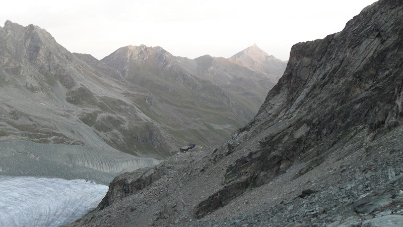
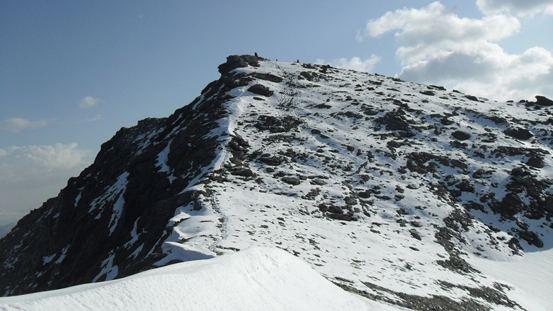
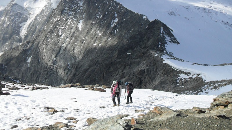
It will take about one and a half hour to walk from the parking to the hut. This is a popular touristic route. Above the hut, you will walk toward the beginning of the glacier, and there you may choose any of the two routes, the rocky ridge on your left, or the glacier route on the right. The former is much shorter and direct.
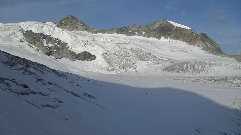
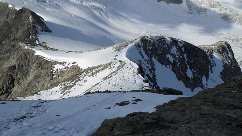
The glacier route is longer, the first part is flat and over an area with crevasses. You go practically around the mountain and approach it from the south. After this flat part, you will have a steep glacier slope in front of you, some 45 degrees, where you must have Bishorn, Weisshorn, Ober Gabelhorn, Zinalrothorn, and then Besso (3668), Blanc de Moming (3651), Trifthorn (3728).
About the necessary equipment
This is a glacier climb, so here is the list with some items you will need:
| Recommended | Essential |
|
Regarding the boots for crampons, please read more in my separate text.
My climb to Pigne de la Le
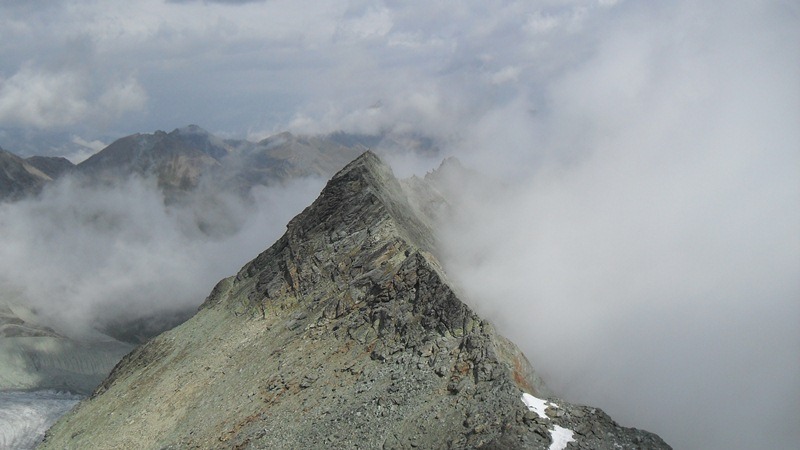
I started at the car parking at 2350 m at 4:50 am, walked toward the hut and arrived there at 6:20 am. Then I took the glacier route for the ascent, forgot to check the time when I was at the summit (too excited), but I think it was around 9 am. There were many people at the beginning of the glacier, but very soon I realized that nobody was going to the Pigne. They all went to Pointes de Mourti.
There was a guide with a woman on the rope in front of me in the beginning (they also went the other way soon). In one moment the women fell into a crevasse and only half of her body was above the ice. This made me rather nervous, in particular when they went other way and I started the steep section alone.
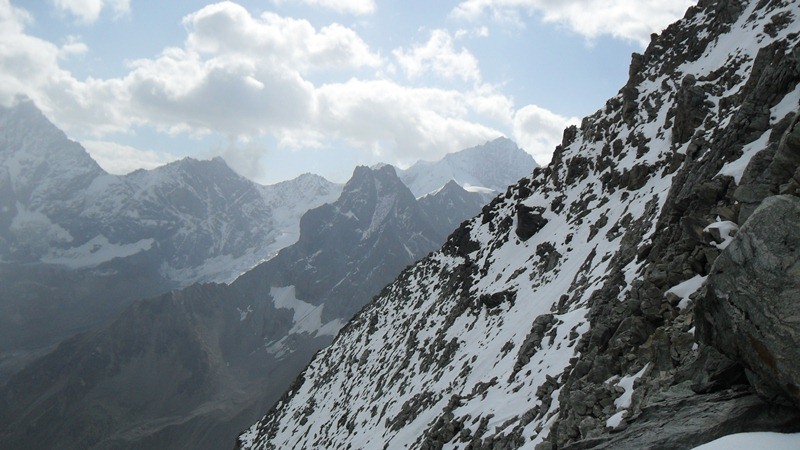
I spent about 45 minutes on the summit before a guide arrived with one person on the rope. Soon I descended along the ridge and met several groups coming up. They were roped and I think this just made their progress slow and did not serve any purpose.
Very soon the scenery changed and clouds came. I was below the hut when there was a strong rain which followed me till the parking.
To summarize, the glacier route to Pigne de la Le is not particularly long, but there are crevasses and as always on glaciers going solo is not the best option. Otherwise, it is not complicated, orientation is obvious and you will do it without problems. The ridge route is a much shorter scramble, and I would recommend it for a solo climb.
If you are in the area and want to play it safe and hire a guide, please follow this link, they will find you somebody from the local area who will take you safely to any of the summits around.
I shall be happy to have your comments below.
Stephen says
Hi Jvranjes,
Great post on the different mountains. I find your post very informative and helpful. I took the liberty to read other posts on your site and find it very interesting. I will be bookmarking your site to refer back to for future cases. I wish you the best in your future endeavors.
Happy Blogging
Jovo says
Thank you Stephen, great to read your comment. I hope you will be visiting my site in the future as well.
Rick says
Sounds exciting, especially going “the road less traveled” while the group goes another.
Not fun to be soaked in rain though! But what an adventure. The pictures are priceless.
How long were you in Switzerland? I’ve been up some mountains in China in Yunnan province. You might enjoy climbing in LiJiang.
Jovo says
Hi Rick, I would definitely like to visit Yunnan and Lijiang. As for Switzerland, I have been there many times for climbing, sometimes a few weeks. Thank you for the comment.
Edmund says
This is a great journal of your climb up Pigne-de-la-le! With the amazing pictures you took there, I almost can feel that I am here personally!
I used to track mountains when I was younger, Annapurna base camp in Nepal, Mount Fuji in Tokyo and Mount Kinabalu in Borneo are the few mountains I have conquered with my friends.
Would love to try Pigne-de-la-le someday. Thanks for sharing!
Jovo says
Hi Edmund, great to read your text. But what do you mean with when you were younger? You are probably half of my age. I also climbed Mount Fuji, this is described in a separate post. Back to Pigne de la Le, if you have chance do not miss it.
Edmund says
Hi, Jovo.
I am in my early 40s and by younger I meant in the college days. 🙂
Wishing you the best!
Jovo says
Hi Edmund, you look younger indeed, but in any case I think you are in the best age now. Best to you from my side.
Jeff says
Hi,
Great article on your climb to Pigne de la Le. The pictures are excellent
Jovo says
Thanks a lot Jeff. I must accept that photos show all the beauty of Swiss mountains. I appreciate your comment. Jovo
booklover2 says
Wow! These mountains are gorgeous and hiking them would be fun! I live in the Ozark Mountains in Arkansas and have done quite alot of hiking there. But the Ozarks are only hills compared to these! Will have to add these to my hiking bucket list! Thanks for sharing!
Jovo says
It is great to read your comment booklover2. Indeed these mountains are some of the most attractive in the Alps. Thanks for visiting my site. Jovo
Rob says
Wow, you really love those mountains? I’m in North America and have never seen such beautiful pictures that you have from Switzerland!! Great job sir!! 🙂
Jovo says
Hi Rob, thanks, Swiss mountains are indeed great. I know for sure that you have many great places in America as well. Jovo
Gregory says
Hi Jovo,
Indeed a great review of Switzerland. It is like going with winter vacation.
Seems like a very beautiful country to spend some time.
Thanks for sharing it and the effort you put in it.
Regards,
~Gregory~
Jovo says
Thank you Gregory. In fact it was summer time, but the altitude is high. Jovo