• Home
  • ABOUT
  • HOW TO START
  • ALPS
    • Austrian Alps
    • German Alps
    • Italian Alps
    • Slovenian Alps
    • Swiss Alps
    • Huts and Shelters
    • Roads and Passes
  • TENERIFE TOURS
  • ABOUT EQUIPMENT
  • FAQs
  • WRITE FOR US

Mountains For Everybody

Site about mountaineering, climbing and equipment, for those who love mountains

  • Outdoor Sleeping
    • Tents
      • Solo tents
      • Tents for 2 People
      • Tents for 3 People
      • Tents for 4 People
      • Tents in general
    • Tarps and Shelters
    • Sleeping Bags
    • Sleeping Pads
  • Backpacks
    • Day Packs
    • Mid-Size Packs
    • Large Packs
    • Kids & Youth
    • Packs FAQs
  • Clothing
    • Men’s
    • Women’s
  • Footwear
    • Men’s
    • Women’s
    • Insulated
  • Gear
    • Camp stuff
    • Lamps
    • Poles
    • Filters
  • Newsletter subscribe

Becs de Bosson and Pointe de la Tsevalire

Last Modified: 01/13/2025

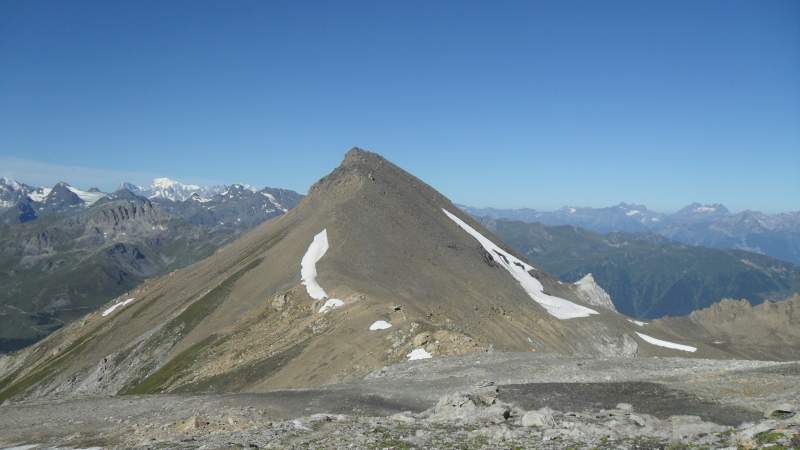
Becs de Bosson (3149 m) and Pointe de la Tsevalire (3026) are two 3000-ers in the mountain range between Val d’Hérens and Val d’Anniverse in the Valais (Wallis) canton of Switzerland. The peaks are separated by the Col de la Tsevalire and there is little over one kilometer distance between them.

https://mountainsforeverybody.com/wp-content/uploads/2015/10/Gluck-Melodie-Arnaud-Sussmann-violin-Ilan-Rechtman-Piano.mp3

[Gluck – Melodie (Dance of Blessed Spirits)]

Becs de Bosson right and Pointe de la Tsevalire left seen from Lona pass (2787) m.
Becs de Bosson right and Pointe de la Tsevalire left seen from Lona pass (2787) m. The hut is there as well but hardly visible.

These two peaks are the northernmost ones in a long chain of high peaks over 3000 meters, in total 14 of them, that raise almost in one line on the western side of the Moiry lake valley, with Dent Blanche (4357 m) being the highest and the southernmost.

The chain contains  also Sasseneire (3253 m), Pointe du Prelet (3000 m), Pointe du Tsate (3078 m), Pointe du Brandon (3074 m), Couronne de Breona (3159 m), Clocher de la Couronne (3101 m), Pointe de Moiry (3303 m), Tsa de l’Ano (3368 m), Pointes de Mourti (3564 m), Dent des Rosses (3613 m), Pointe de Bricola (3658 m), and Grand Cornier (3962 m).


Becs de Bosson hut

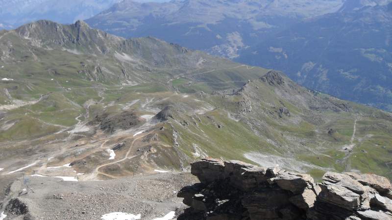
The area is very popular due to Cabane de Becs de Bosson (cabane = hut) which is situated between them on the Col. The hut is a hub of 5 different and obviously very popular and attractive routes from the surrounding valleys. It is at a high altitude and many hikers and families with children visit the hut and spend a night there. On my way up. I met a group of families descending from the hut with 9 children.


Routes to the hut

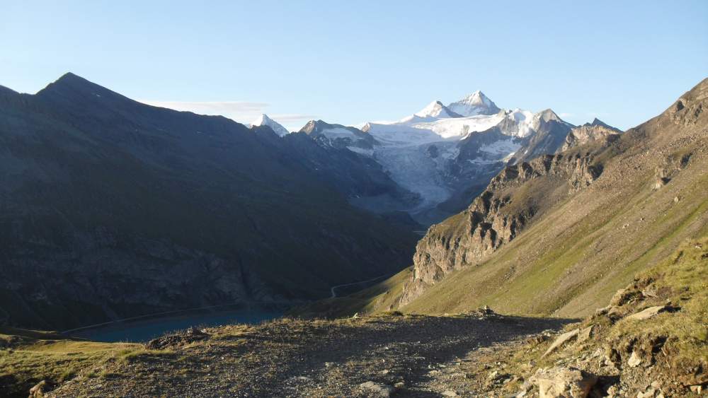
From the southeast side, the route starts from the dam of Moiry lake, with both car access and the bus service from Grimentz. You can read about the area also in my other texts here in the site: Sasseneire,  Garde de Bordon, and Pigne de la Lé.

From the north-east, if you are not a purist, you can use the advantage of the lift from Grimentz to the Bendolla plateau (2130 m). From there either take the route to Lac de Lona and join the previous route or continue towards La Tsarva and approach the Col des Becs de Bosson and then continue to the summit.

There is an access from the north as well, with the path which leads toward Col de la Tsevalire.

Finally, there is an access from the west, from Val d’Hérens along the route toward Pass de Lona, from where you will have the hut in sight in the north direction.

On my way up, below Basset de Lona and view toward the south.
On my way up in early morning, below Basset de Lona and view toward the south. Dent Blanche (4357 m) in the distance. The Moiry lake still in the dark below.
At Basset de Lona (2792 m) and some useful signs.
View toward the two peaks from the lake.
View toward the two peaks from the lake. The route goes to Col de Lona which is on the left.
Signs at the hut, 2985 m.
View in the north-east direction over Bendola plateau.

Access from Moiry lake

Becs de Bosson can most conveniently be climbed from the dam of the Moiry lake (2249 m), where a free parking area and a restaurant exist. This place is accessible by car from Grimentz (no tax), and by the post bus which has a station at the dam parking.

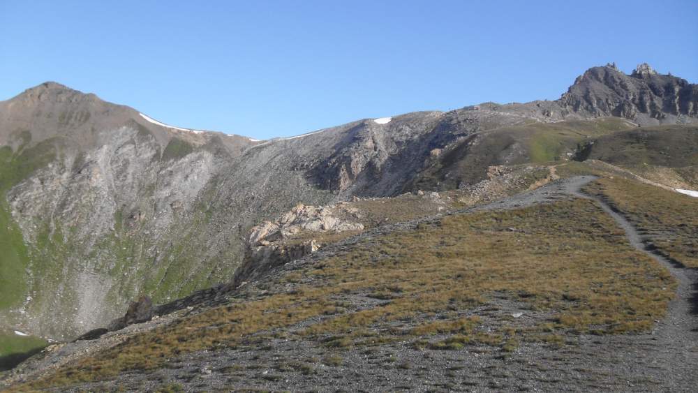
From the parking, go over the dam in the western direction and following the signs towards the Col de Torrent, which is the same direction as for climbing Sasseneire. At Alpage de Moiry (at a farm house) the route splits, and you should take the dirt road in the north-east direction toward the pass Basset de Lona (2792 m).

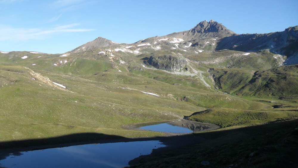
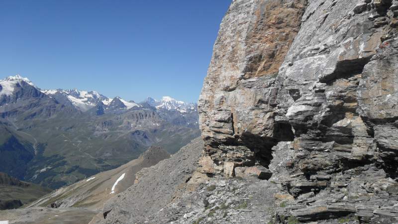
After the pass, descending to around 2640 m, and passing the beautiful lake Lac de Lona you will climb up to the Pass de Lona (2787 m). From there you will have the hut in sight.  The remaining part is pleasant, see the first photo above, and the route will lead you to the Becs de Bosson hut at 2985 m altitude.

Timing: it will take you about 4 hours from the Moiry dam to the hut. So the walk is long but pleasant, and I am sure you will enjoy it.

A step section on Becs de Bosson.
Below the summit.
Below the summit.
Before entering the cave. Mont Blanc far in the distance.
Pointe de la Tsevalire seen from the hut.
Pointe de la Tsevalire seen from the hut. Mont Blanc far in the background.

Climbing Becs de Bosson

Coordinates of the peak: lat. 46.167895, long. 7.518366.

View toward the summit of Becs de Bosson, with unstable rock everywhere.

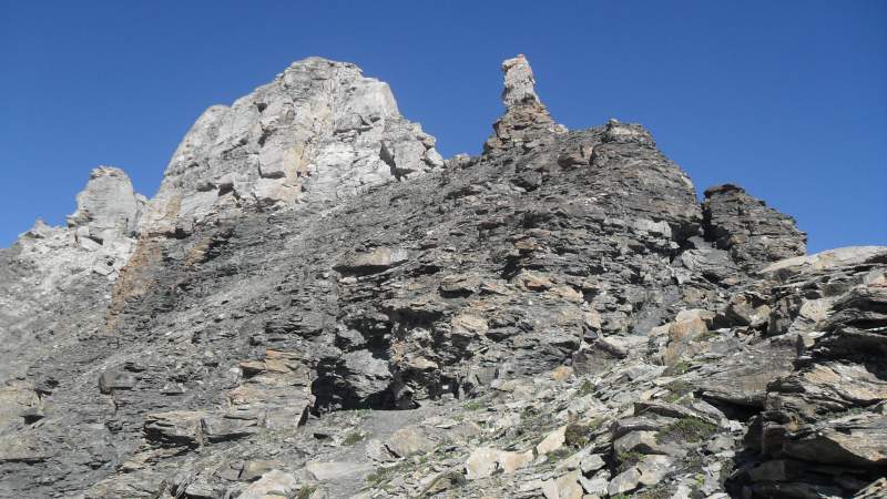
In order to climb Becs de Bosson, from the hut you should descend a bit in the east direction and continue towards Col des Becs de Bosson (2942 m), and from there to the summit.

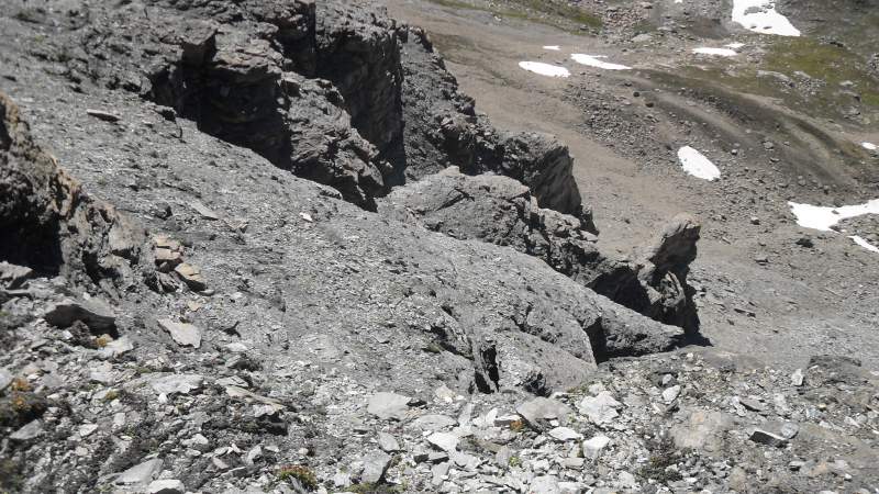
There are several rather exposed sections with deep drops below, so do not go without some experience in rock scramble or if you have a problem with vertigo.

At two places, if I remember correctly, there are some fixed ropes to cross some obstacles, nothing complicated. Everything looks unstable around, and the peak itself looks like a very unstable structure.

One of the tricky parts is when you reach a small cave through which the route goes, and you have to descend a few meters. This is again because of unstable rock and you will have to be careful there.


About necessary equipment

  Recommended   Essential
  • Good hiking boots.
  • A day-hiking pack.
  • Trekking poles.
  • Sunglasses.
  • A sun protection hat.
  • A 10-20 meters rope.

Climbing Pointe de la Tsevalire 

Coordinates: lat. 46.16236, long. 7.50924.

This is completely different as compared to the previous peak, just a simple walk from the hut, more or less following the ridge toward the summit. You will be there in 20 minutes from the hut.


I hope you have enjoyed reading the text, so please leave some comments in the box below. 

Spread the love

Mountains for Everybody site is reader-supported. This means that some of the links in the text are affiliate links, and when you buy products through our links we may earn some small commission to keep running the site. Filed Under: Swiss Alps Tagged With: Basset de Lona, Cabane de Becs de Bosson, Grimentz, Moiry lake, Pass de Lona, Pointe de la Tsevalire

Comments

  1. dannyboy says

    10/08/2015 at

    Really nice, you really know your stuff, I checked your page and its looking good, also your site and I willl be coming back, to see your latest posts, keep up the good work and remember that the content is the best you can make for people to find your website just like I did.

    Reply
    • Jovo says

      10/08/2015 at

      Thank you dannyboy, great to see your comment. Much appreciated.

  2. Franchesca says

    10/08/2015 at

    Pretty cool and quiet place to go climbing, even alone you could have a wonderful time there. Is it needed a guide or you can go just with a map? It seems that it is not necessary to have special equipment like a helmet or ropes, is it? Thank you for the article it was really helpful

    Reply
    • Jovo says

      10/08/2015 at

      Hi Franchesca, thank you for the comment. No for this tour you do not need special equipment most of the time. But the summit of Becs de Bosson is a bit hard rock scramble. It is good to have a partner with rope at a few places.

Leave a Reply Cancel reply

Your email address will not be published. Required fields are marked *


My photo on the summit of Jalovec.Hi everybody and welcome to my site which I nurture with love and passion. Here I describe my own climbs and give reviews of equipment. I hope you will enjoy it. More about the site and about me here.

Categories


Cookies Statement

In this site we do not have any cookie tool. But we do use services by third parties that either use cookies or may be doing so, yet we do not have any control of it. This is covered in their privacy policies. For more details please check in our Privacy Policy page.


  • Contact
  • Privacy Policy
  • Affiliate Disclosure

My Most Memorable Tours

  • Magic Moments On Mount Teide Tenerife
  • Climbing Weissmies solo
  • Climbing Mount Fuji
  • Climbing Zugspitze solo
  • Lagginhorn my first 4000er

Recent Posts

Can an Overweight Person Go for a Trek featured picture.

Can an Overweight Person Go for a Trek?

The Physiological Impact of Thru-Hiking featured picture.

The Physiological Impact of Thru-Hiking: Body’s Response and Effects

Are Canvas Backpacks Good for Hiking featured picture.

Are Canvas Backpacks Good for Hiking?

Why Is There a Gap Between My Back and Backpack featured picture.

Why Is There a Gap Between My Back and Backpack?

Huts and Bivouacs in Dolomiti di Brenta Alps: Interactive Map featured picture.

24 Huts and Bivouacs in Dolomiti di Brenta Alps: Interactive Map

Affiliate Disclosure

I am a participant in the Amazon Services LLC Associates Program, an affiliate advertising program designed to provide a means for sites to earn advertising fees by advertising and linking to amazon.com. So when you buy something from this website, I may receive an affiliate commission. These are my opinions and are not representative of the companies that create these products. My reviews are based on my personal experience and research. I never recommend poor quality products, or create false reviews to make sales. It is my intention to explain products so you can make an informed decisions on which ones suit your needs best.

Categories

  • About mountains in general (33)
  • Alps (138)
    • Austrian Alps (5)
    • German Alps (3)
    • Great mountain roads and passes (10)
    • Huts and Shelters (27)
    • Italian Alps (84)
    • Slovenian Alps (25)
    • Swiss Alps (21)
  • Backpacks (248)
    • About Packs in General (76)
    • Day Packs (63)
    • Large Packs (79)
    • Mid-Size Packs (52)
    • Packs for Kids & Youth (2)
  • Clothing (22)
    • Men's Clothing (11)
    • Women's Clothing (8)
  • Equipment (61)
    • Camp stuff (37)
    • General Stuff (3)
    • Headlamps (8)
    • Trekking poles (3)
    • Water filters & purifiers (9)
  • FAQs (125)
  • Footwear (22)
    • Insulated Footwear (4)
    • Men's Footwear (17)
    • Women's Footwear (6)
  • Guest Author posts (5)
  • Hiking tours (22)
  • Sleeping Bags (109)
  • Sleeping Pads (90)
  • Tenerife (24)
  • Tents and shelters (256)
    • About tents in general (22)
    • Solo tents (23)
    • Tarps and Shelters (12)
    • Tents for 2 People (69)
    • Tents for 3 People (57)
    • Tents for 4 People (91)
    • Winter tents (25)

Copyright © 2025 · Mountains for Everybody · All Rights Reserved