If you are in the Slovenian Alps, in particular in the Kranjska Gora area, and you have a few hours extra time, you would not want to miss visiting Tamar Hut (Planinski Dom Tamar).
I was there the day after climbing Skrlatica which was a long tour, so I had to take a break and used it to visit Tamar valley.
I knew about the place from a very inspiring source. This is about the book Ka Visinama i Ćutanju (Towards Heights and Silence) by Raško Dimitrijević, which I read 5 times. The story is about his climb of Jalovec with the legendary Slovenian alpinist Joža Čop.
They stayed the night before the climb in the Tamar hut. This was in the period between the two World Wars, a true alpinist tour with a serious accident, but they survived. If you are able to read in Serbian, I would warmly recommended it.
After reading the book so many times, for me this was just like coming to a place that I visited before. Unfortunately, the two guys were not there…
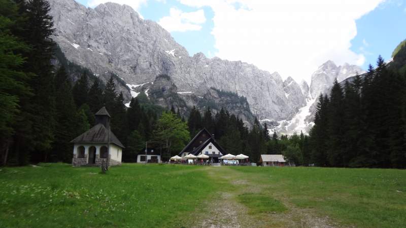
The top picture above shows what you will see. The hut may look like a restaurant, but this is still a real mountain hut with the usual dormitories and separate rooms. Several normal routes start there, not to speak about true alpinist routes that you have around.
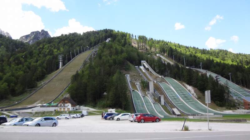
The place is at the end of the valley, easily accessible by walking for around one hour from the car parking at Planica ski jumping center shown below. The parking fee was 3 Euro when I was there.
Position & contact details
- Coordinates: 46.446045 N / 13.713407 E.
- Elevation: 3635 ft (1108 m).
- Accommodation:
– Beds in rooms: 31.
– Dormitories: 20. - No winter room.
- Phone: +386 4 587 60 55.
- GSM: +386 41 378 077.
- Email: bernikmartina@gmail.com
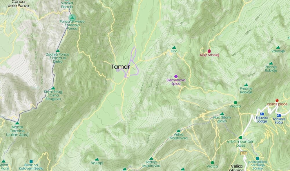
The map below shows the close area around the hut, and some routes are marked. Observe that the Italian border (the blue line) is on the left, it follows the ridge of the Ponca mountains group.
The Tamar valley is the upper part of the Planica valley. The only road approach is from Planica. The first hut was formally established there in 1936, but there was a building there already in the 19th century.
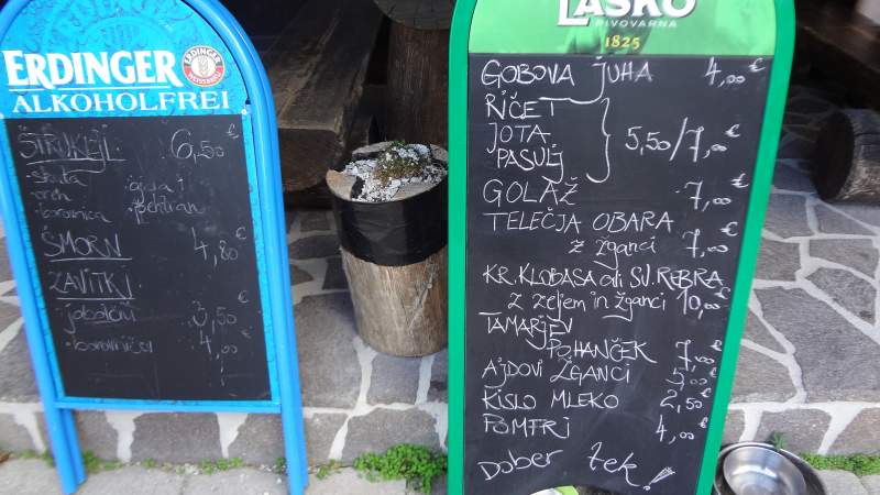
The hut was renovated several times after WWII. It is constantly open. It is equipped with showers with hot and cold water. The picture below shows what they had on the menu when I was there, I could not resist.
Access
I have prepared for you the zoomable Google map shown below, so zoom out to see access roads and wider area, and zoom in to see details. The blue marker is the position of the car parking at Planica.
The closest town is Kranjska Gora. The nearest village is Rateče where I was staying. You can walk all the way from the village to the hut, it will take less than two hours, the distance is around 6-7 km.
Note that the Italian border is just a few hundred meters from Rateče. On the other hand, the Austrian border is just a few kilometers in the north direction where you have Podkoren pass (Wurzenpass). You can see this all in the interactive map above.
So when you park the car, just keep walking along the flat valley floor in the southwest direction, you cannot miss the direction. From what I have seen, there are at least two macadam roads (closed for public).
You will be walking through a pleasant forest. Any walking shoes will do. From time to time you will be able to see Jalovec far above you. The picture below shows a zoomed view, the picture is taken from the access road well before Tamar hut.
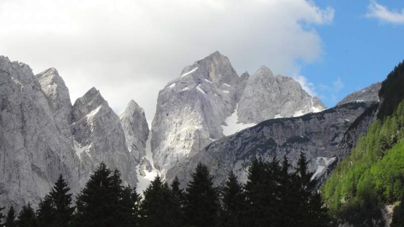
Did you notice the narrow gully full of snow left of the Jalovec summit? This is Jalovcev Ozebnik, there is a route through that gap, but when I was there, I saw a sign that it was officially closed.
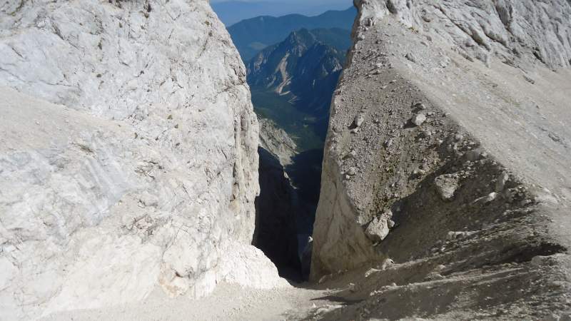
The gully alone is more than 300 meters high and probably more than 40 degree steep. The picture below shows Tamar valley through this gully, this is from my climb to Jalovec:
But see how Tamar valley looks from above, this is the view from the summit of Jalovec, this was early morning and the valley was still in the shade.

Nadiza (Nadiža) river source
This is one of attraction of the place, when you arrive at the hut, you will see it in the wall on the right. In fact, you will probably hear it before you see it.
The river just appears from the steep wall of Zadnja Ponca mountain which is on the west side of the valley. You will need around 25 minutes walk to get there. The elevation of the source is 3947 ft (1203 m), see how this looks from the hut:
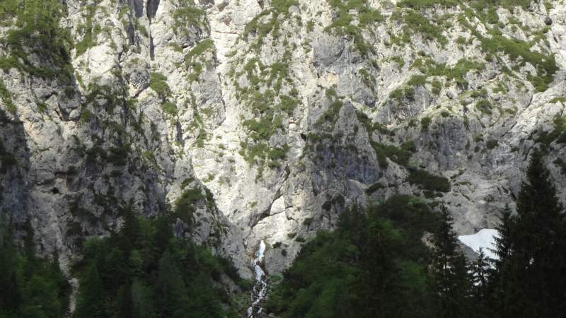
There are a few cables in place, and a few a bit exposed places, you can take your ferrata equipment but it is easily doable without it. This all is very similar to the Soca (Soča) river source which is just on the other side of Jalovec. The picture below shows how it looks when you get there:

Here is how it looks from above:

Routes from the Tamar hut
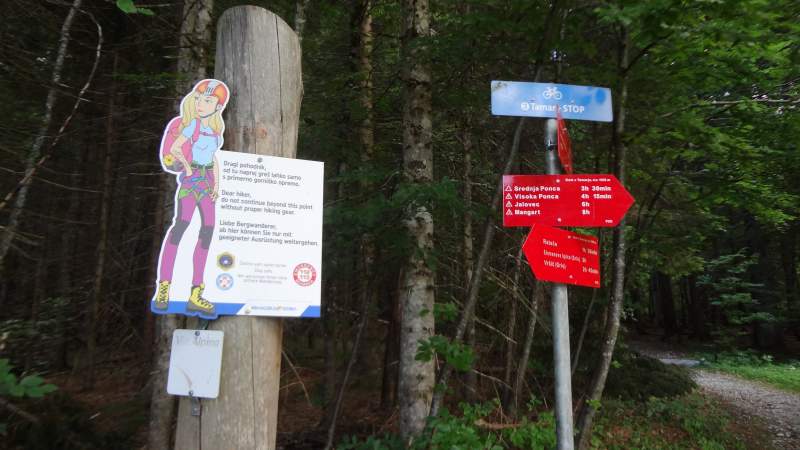
You have see some routes already in the map above. Below you have a place with signs for directions and timing, this is directly behind the hut:
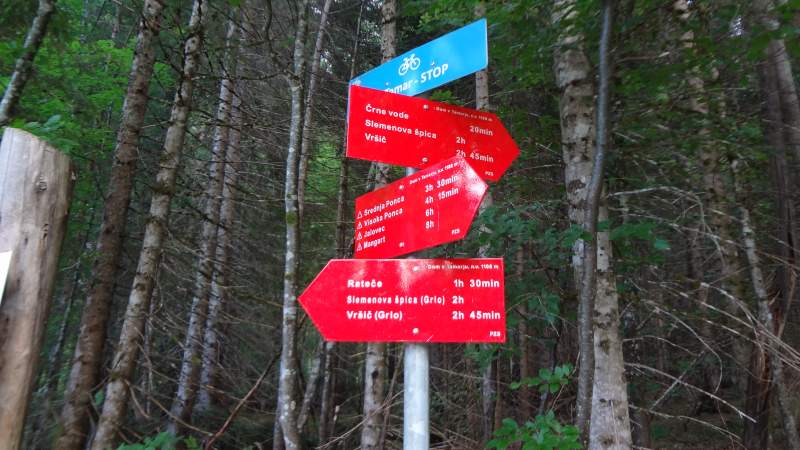
But do not overlook this warning, these are steep mountains where you can have places with fixed cables and bolts. So do not go without equipment, I feel I cannot stress this strong enough.
Here are a few tours and routes you can do from the Tamar hut:
- Jalovec via Jalovcev Ozebnik couloir. Check if this route is really open. The time needed is 6-8 hours or so.
- Jalovec via Jalovska Skrbina pass. Time needed 6-8 hours. Note that both routes join the route that comes from Vrsic Pass which I used to climb Jalovec. This may be useful to know if you plan a round tour.
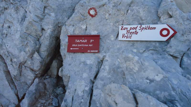
- Jalovec via Kotovo Sedlo pass. Time needed 6-8 hours. There is only one final normal route to the summit of Jalovec, so this route joins all the others when you are on the final summit ridge. The sign below shows the place of this junction. Note that it says in Slovenian something that can be translated as ‘very demanding route’. All these routes are only for experienced mountaineers.
- Ponca mountain route. The route starts behind the hut. Go first to Srednja Ponca and then follow the ridge north to Visoka Ponca. Time needed around 5 hours.
- From Tamar to Vrsic Pass through Grlo and Sleme (Slemenova Spica). This is just a walk up but the terrain is hard. The route is marked in the map shown in the text above.
So this was my report about Tamar valley and Tamar hut (Tamar Planinski Dom in Slovenian). This is a beautiful place and the same holds for the whole area. Yes, I admit I am biased, but you will realize this if you ever come there. I have presented it a bit from below and a bit from above, this was a pleasure for me, this is an area where I have been many times in the past.
You do not need any equipment to get to the hut, just walk and have a great day in a breathtaking surrounding. But if you want to go beyond, make sure you are properly equipped. Let me know if you have questions. Thank you for reading and have a nice day.
Leave a Reply