If you plan to climb Adamello and Presanella from any side, you will need this interactive map with all huts and bivouacs in the area. You can use it to plan where to sleep at high elevation before getting to the summit, and to plan your meals when you are in these mountains.
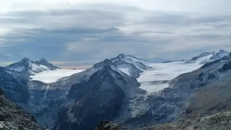
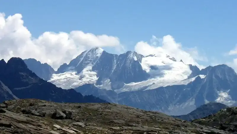
The Adamello and Presanella group, nestled in northern Italy’s Alps, forms a breathtaking mountain range straddling the provinces of Trentino and Brescia.
Renowned for its dramatic granite peaks and expansive glaciers, this region boasts Cima Presanella as its highest summit at 3558 meters (11673 feet), making it Trentino’s tallest peak. Monte Adamello rises to 3539 meters (11611 feet).
The area is a paradise of ice and water, home to Italy’s largest glacier, the Adamello Glacier, and a network of 24 glaciers, 17 in the Adamello subgroup and 7 in Presanella.
Beyond its natural splendor, the range carries a rich history, having served as the highest front of World War I during the “White War,” where remnants of trenches and tunnels still whisper tales of the past.
This rugged landscape, part of the Adamello-Brenta Nature Park, offers more than just scenic beauty. It is a real haven for adventurers.
The huts and shelters scattered across these mountains, from rifugios like Mandron and Lobbia Alta to bivouacs like Orobica, provide essential bases for hikers, climbers, and skiers exploring the high alpine terrain.
Whether tackling the challenging Alta Via dell’Adamello, tracing the Peace Path of WWI history, or ascending glaciated peaks, these shelters offer respite amid the wild, rocky expanses and glacial vistas.
For those eyeing the summits, normal routes to Monte Adamello and Cima Presanella demand preparation and respect for alpine conditions.
The classic ascent of Monte Adamello often begins at Rifugio Mandron, following the glacier’s edge via the Pian di Neve, a vast snowfield requiring crampons, ice axes, and ropes for safe passage, especially in late summer when crevasses widen. The route, graded PD (peu difficile), is a moderate mountaineering challenge, but glacier travel experience is essential.
Cima Presanella’s standard route, typically from Rifugio Stavel Francesco Denza, climbs the Vedretta di Nardis glacier to the summit ridge, a steeper, AD (assez difficile) endeavor where climbers need harnesses, helmets, and crevasse rescue gear alongside the usual ice tools.
Both peaks call for sturdy mountaineering boots, layered clothing for volatile weather, and navigation aids like maps or GPS, given the remote, high-altitude setting.
The huts and shelters dotting the range, such as Lobbia Alta or Orobica bivouac, serve as vital waypoints, offering shelter for multi-day treks like the Alta Via dell’Adamello or historical Peace Path routes.
The interactive map given below is a game-changer, it will help adventurers plot these ascents with precision and confidence. Zoom in to see more details, and zoom out to get a picture of access roads to the area.
You will realize that the area can be approached from Lombardia, Alto Adige and Trentino regions. When you are close, you can get to Adamello from around 15 different valleys of various sizes, and you have numerous bivouacs and huts from all of them.

Unlock the Full Premium Interactive Map of Adamello-Presanella Huts & Bivouacs
The overview and list of locations above are free for everyone. For the complete experience, get instant lifetime access to the full interactive map featuring all 47 curated huts and bivouacs in the Adamello and Presanella Alps.
- All 47 carefully selected huts and bivouacs with precise markers (blue for guarded huts, red for bivouacs)
- Clickable pins linking to detailed descriptions, photos, access routes, and booking info where available
- Fully zoomable, searchable, with terrain/satellite views, and mobile-friendly
- Regular updates as new locations are verified or changes occur
- One-time payment – no subscriptions or recurring fees
- Bonus: Special markers including the historic WWI cannon at Cresta Croce (3276 m) and key access points from surrounding valleys
Instant access after payment • Supports independent Adamello-Presanella hiking & climbing content
The red markers are bivouacs, and blue markers are regular huts. All of them are clickable and linked to various sources where you can read more about them.
The yellow marker shows something incredible, the position of the cannon from WWI, the cannon of Adamello. It was transferred there on the night of 6 June 1917. It is on Cresta Croce at an elevation of 3276 m (10748 ft).
I am hopeful that this interactive map will unlock this world, guiding visitors through a region where nature’s grandeur meets human endurance, making it an invaluable tool for planning unforgettable journeys.
It is always a good idea to have a hardcopy map with you as well, so follow the link and have a look. Those with 1:25000 will give more details, while those with 1:50000 cover more area.
Note that we have also a separate map with all bivouacs in the Italian Alps.
Thank you for reading. Subscribe to my weakly newsletter and stay informed, the subscription form is given below.
Leave a Reply