There is quite a confusion regarding the name of this mountain. It is on maps sometimes called Piz Cotschen, Monte Cotschen, and Munt Cotschen. In addition, there are at least three peaks in the Alps with the same name.
Piz Cotschen described here is exactly on the border between Italy and Switzerland. It can be conveniently climbed from the Italian side. You start from the parking at the beginning of Val Federia which is very close to Livigno. Plan up to four hours to get to the summit. There are no exposed sections on the route.
Piz Cotschen: quick facts
- Piz Cotschen elevation: 3103 m (10180 ft).
- Coordinates: 46.51015°N / 10.04236°E.
- Route difficulty: walk-up.
- Free parking in Val Federia 1850 m (6070 ft).
- Elevation difference from the parking: 1253 m (4111 ft).
- Time needed to the summit: up to 4 hours.
- Huts/shelters on the route: only a small stone cabin low below in Fedaria valley.
Access and map
As mentioned, there are several mountains in the Alps with the same name Piz Cotschen. One is in Silvretta group, and yet another which I also climbed is above Stelvio pass and it is also known as Punta Rosa (Roetlspitz).
From what I can find around, the name may originate from Latin and also from a dialect because the word “coccinus” in Latin is an adjective that means “scarlet” or “bright red”. More precisely, it is derived from coccus, referring to the kermes insect, which was historically used to produce red dye.
I have been on two of the peaks with that name, and I realize that this is due to the color of the ground and rock close to the summit.
In any case, the peak presented here is in the interactive map below. If you zoom out you will see all access roads to Livigno area.
The marker 1 in the map is the parking. Note that the same parking is used if you want to climb Pizzo Cassana which I climbed and described here in the site.
I include this mountain in my list of Italian Alps, and this is only because I climbed it from the Italian side. But it is on the border, and you can climb it from St Moritz area on the Swiss side.
Route description
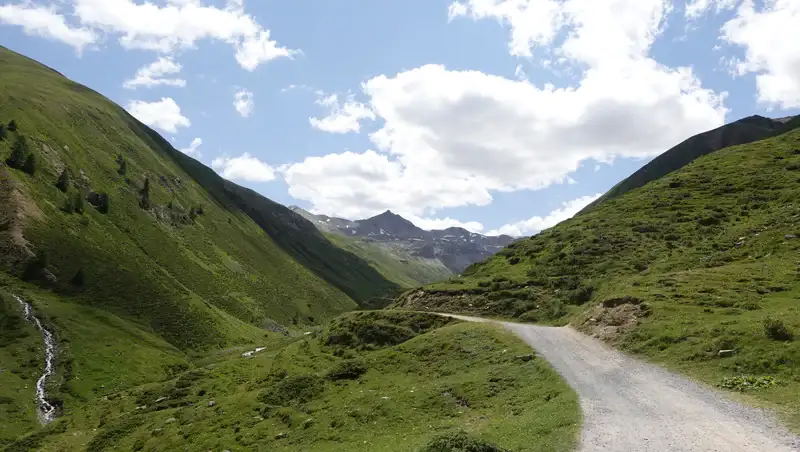
The valley where you start from is with name Federia and also Fedaria, just to know, so I am using both and this is not a typo. Below is the part where you are already above tree level, a pleasant gravel road that follows the valley floor up.
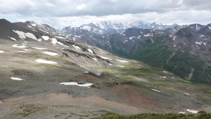
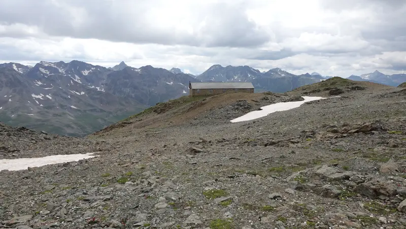
The valley is long, so if you are caught in rain it will be good to know that there is a simple stone cabin by the road, with a few chairs inside, a table, and a wood burning stove. But wood was not available when I was there.
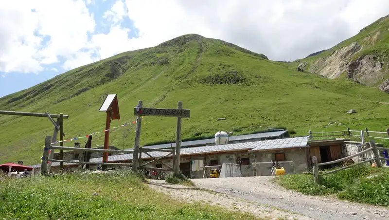
After a long walk where you gain elevation very slowly, you get to Alpe Federia, a restaurant, and this is the last building which you will see on the route.
Observe that you should not cross the bridge here, so continue on the same (west) side, and the water stream will be on your left side. If you make mistake as I did, it will be quite an adventure to cross the water stream and to get back to the route.
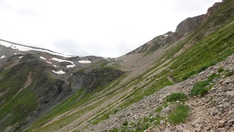
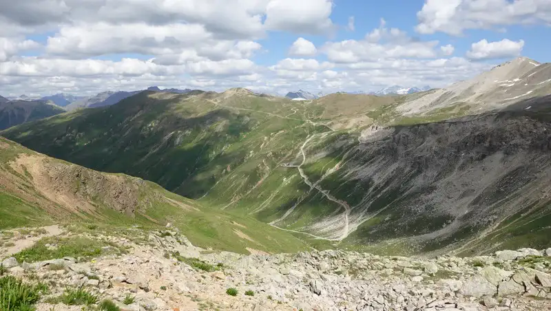
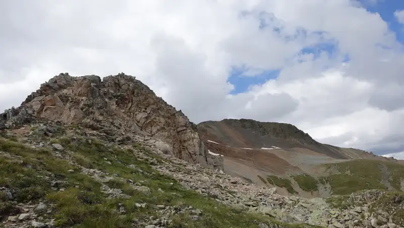
After the restaurant, the route becomes steeper, but this is always a simple walk on a high elevation. When you get to the point shown below, you will be close to 3000 meters.
Below is view back towards the valley. Livigno is directly behind the mountain, and you can walk back that way to the city if you wish.
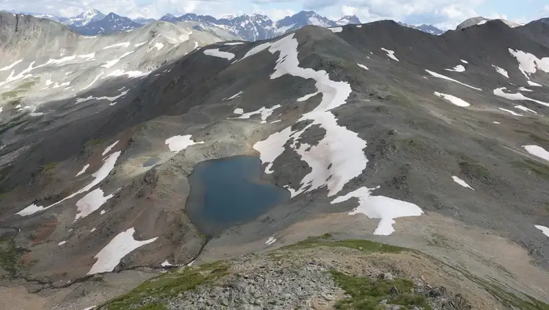
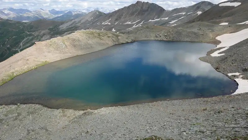
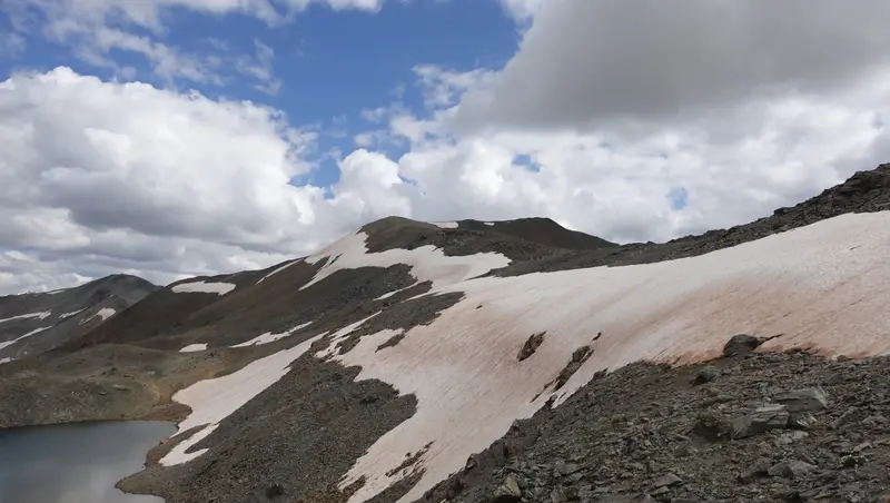
The Lago Fedaria (2878 m), the picture below, is a real gem and the main attraction on the route. From what I could see, it is a natural lake, not man made.
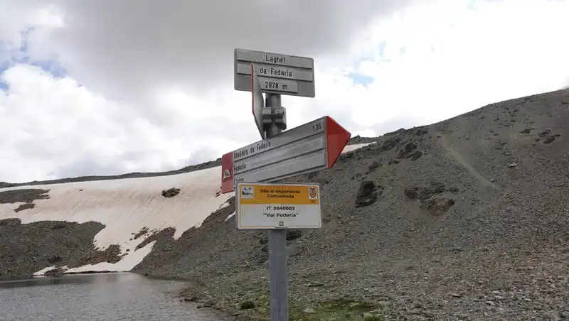
At the lake you have the signs shown below, the pass and the border are directly above it, just 10 minutes walk from the lake.
When you get to Passo Federia (2899 m), you are at the Swiss-Italian border, the border stone in the picture below will remind you of that.
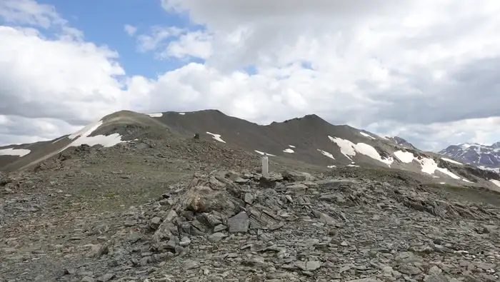
You will see an abandoned and locked military cabin made of stone on the Swiss side. From the pass just follow the ridge in the direction of the summit. This is the border line so you will be in both countries all the way to the summit. Here is my view back to the Swiss side:
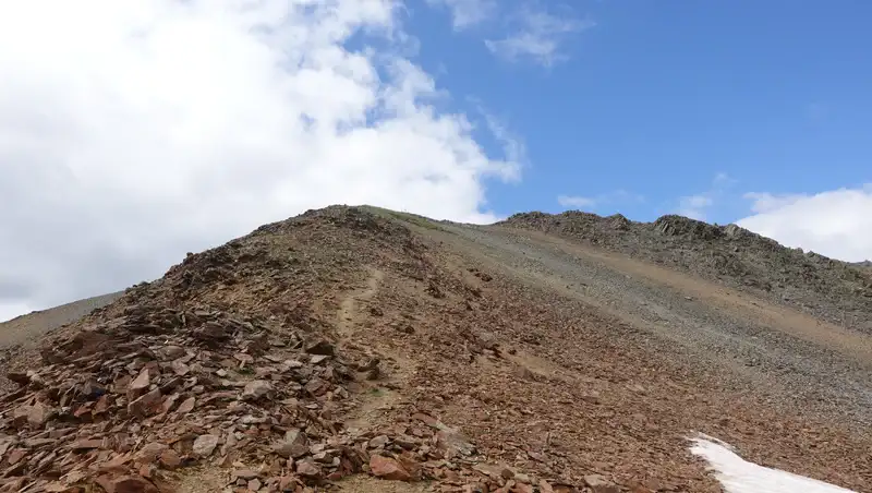
There is an easy boulder passage below the summit, but without any really exposed sections, you can see it here:
Observe the color of the rock and ground below, now you understand the meaning of the name, this is the last part below the summit.
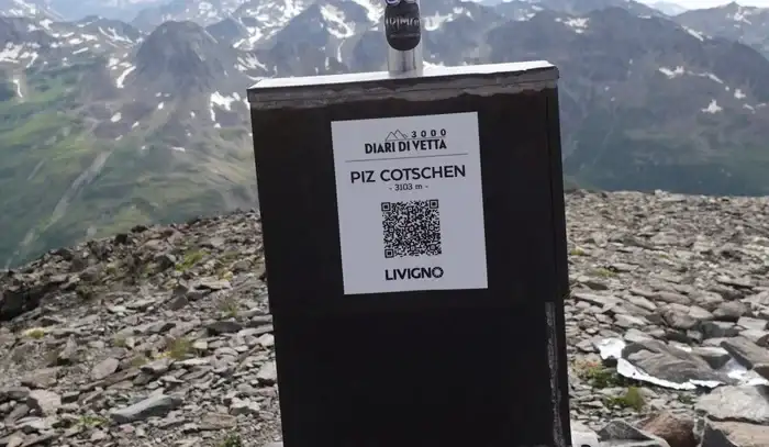
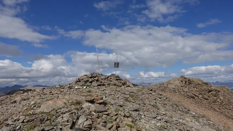
Here is the summit with a simple pole and the usual box with a stamp.
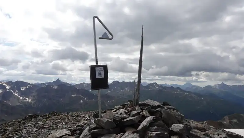
I notice that the elevation is everywhere with a wrong number. But the picture below shows what you see on the summit, and this is 3103 meters. I take this as a correct number. Observe also the name they use here.
The whole summit area is wide and pleasant, very similar to the summit of the nearby Monte Breva (Piz la Stretta) which I climbed earlier and which is of the same height.
My climb
I came to Livigno from Dolomites, after sleeping in the car on Gavia pass, and after taking a bath in Leonardo da Vinci terme near Bormio.
Never heard of it? Well, there is a free pool with water 30-35 degrees Celsius. It is just a few hundred meters from the Bormio-Livigno road. Apparently, Leonardo used to come here to cure and refresh, hence the name of the place.
My plan was to climb Piz Cotschen, but not the same day. However, I realized that the day was still young, and the weather was perfect, so I started from the parking quite late, at 12:50.
After I passed Alpe Federia, there was nobody around any more, and this remained so all the way up and back. I had the mountain completely for myself, what a luxury.
I was at the summit at 16:40. I guess I could do it faster, but at Alpe Federia I missed the route, crossed the bridge and continued along the river on the wrong side.
The summit was quite windy, but this was the only noise. No other sounds in those a few hours of going up and down. I stayed there as long as I could, there was no need to rush.
Later, I descended the same way back and made a walk around the Swiss military building, locked and forgotten, without paths around and without any recent signs of human activity, a silent witness of earlier times.
This was not the only building of that type I have seen in decades of my mountaineering life. I have visited them many and walked over and along many borders similar to this. But no one had touched me like that one. It looked so out of place and redundant. English is not my native, it is hard to find the right words, sorry.
Then followed my long but pleasant walk back to the parking where I arrived when it was almost dark. Before getting there, in the Federia valley I passed by a property with Italians collecting dry hay with simple hand-made wood pitchforks and rakes.
I could feel its pleasant and forgotten smell which I have not experienced from my childhood in a village and a country that do not exist any longer. Lots of memories came back, a few tears as well.
Do I hear you asking: Man, how can a country disappear? Trust me, it can, you are probably too young to remember. And village, how it can vanish? It can’t, but it can be destroyed, by people who are normally normal just like you and me, until they are not…
Please see more in my video:
Equipment, supplies & accommodation
Mountains around Livigno are high, you have seen the pictures, this was beginning of August and yet a bit of snow at some places. But they are very mild and you do not need any special equipment. I have climbed almost all of them, so I am sure about this.
This was a day tour, so I used my Osprey Stratos 24 backpack. The boots I used were Mammut Sapuen GTX, but you can do the tour even in some hiking shoes like Nortiv 8.
I also had a pair of Komperdell trekking poles.
Regarding water, there are a few places on the way up to refill. If you have a filter/purifier, you can certainly use the water from the lake as well.
Livigno is a busy tourist area, so accommodation is very expensive. But there are several camp spots, two in the city itself and three more on the road towards Forcola pass. I stayed in one of them myself and it was very affordable.
Just to know that Livigno is a duty-free zone, so you might be able to buy things at a very good price, and fuel is also the most affordable in all EU.
There are several well-equipped food shops around, and shops with outdoor equipment as well. So if you plan to go to the nearby Switzerland, you might want to come here first for fuel and other supplies.
Final thoughts
In summary, Piz Cotschen, perched on the Italy-Switzerland border, offers a straightforward yet rewarding hike with no exposed sections, making it accessible for many.
Starting from Val Federia, the route takes you through scenic landscapes, past the charming Alpe Federia, and up to the gem-like Lago Fedaria. Remember, don’t cross the bridge at Alpe Federia unless you’re aiming for an unplanned adventure.
The summit provides stunning views and a peaceful solitude, especially if you time your hike right. With its elevation at 3103 meters, it’s a day trip that demands only basic hiking gear, showcasing the beauty of the Livigno Alps.
Thank you for reading and let me know if you have questions, there is a comment box below. For more texts about mountains in this area please check under the category Italian Alps. In particular, check my book Livigno Peaks with the collection of my tours in that area.
Leave a Reply