If you plan climbing Monte Cristallo di Mezzo by normal route, then via ferrata Marino Bianchi will be your only option. The route is described here in detail, so keep reading.
Cristallo di Mezzo (Cima di Mezzo) is the second highest peak in Monte Cristallo group in the Dolomites. It can be climbed directly from the main road, and the route starts at Passo Tre Croci above Cortina d’Ampezzo. The final part is a demanding ferrata Marino Bianchi, with many exposed passages, so make sure that you go there prepared and with a proper equipment.
Coordinates, numbers & details
- Cristallo di Mezzo coordinates: 46.5780878 N, 12.1959408 E.
- Elevation: 3154 m (10348 ft).
- Normal route difficulty: hard ferrata.
- Height difference to climb from the car parking at the main road: 1349 m (4426 ft).
- Useful map: Tabacco number 03, Cortina d’Ampezzo e Dolomiti Ampezzane. 1:25000.
- Official parking: at Passo Tre Croci 1805 m (5922 ft).
- Time needed to the summit: around 4 hours and 30 minutes.
Access roads & location
Monte Cristallo is a mountain group in the north-east direction from Cortina d’Ampezzo in the Italian Dolomites region.
There are several sharp peaks in the group, four of them are above 3000 meters of elevation, and the highest raises to 3221 m (10568 ft).
The interactive map below is from AllTrails map so you can download it if you follow the link. If you zoom out you will see all access roads.
The map shows a lift line, but this has not been in service for many years. In fact, it is without any cables, just its towers are in place. The only operating lift line goes up to Rifugio Son Forca that is shown in the map.
You might want to know that this area is also a part of the Alta Via 3.
Route description
Although Cristallo di Mezzo is not the highest peak in the group, this is a severe climbing environment. It is only because of numerous fixed cables, pegs, and ladders that the peak is accessible by ordinary mortals.
The route to Cristallo di Mezzo has three very different parts.
The first part is a simple walk from Passo Tre Croci up to Rifugio Son Forca (2235 m). If you do not want to walk, you can avoid this by taking the lift from the lift station Rio Gere which is down the road in the direction of Cortina. This all is described in my text about Buffa di Perrero.
The second part is a very steep and unpleasant couloir to Forcella di Staunies (2918 m), see the picture. It ends up at the abandoned Lorenzi hut, and this is also the point where you will see the former lift station.
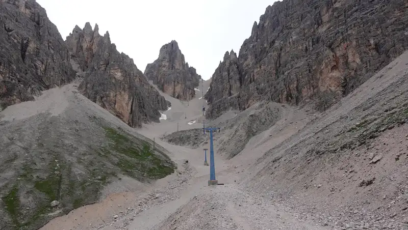
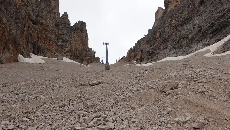
This narrow couloir can be under snow till late July. Note that this is all lose and unstable rock, and every step here is hard. The picture below shows its upper part. There was a lift line here in the past, built for Olympics in 1956; all you have now are those ugly towers.
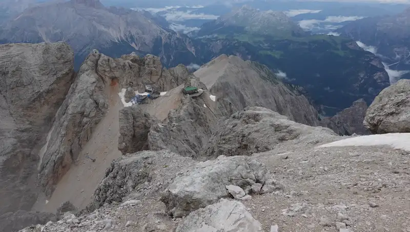
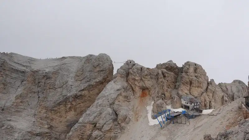
When you add to the picture the decaying and rotting lift station on the top, together with the abandoned Lorenzi hut next to it (both visible below), you get a really bad feeling about everything.
They have managed to ruin properly this beautiful mountain, and this all for a few weeks of a winter sports competition 70 years ago.
Note the following: The big part of the route is the same as the route to the tourist attractions that are on the Cristallino d’Ampezzo (3008 m) cliffs west of the Lorenzi hut and the former lift station.
Those include hanging bridges and other similar stuff; see the picture it shows the 27 meter long Ponte Cristallo suspension bridge, an excellent place for trophy pictures. But that part is the popular Ivano Dibona ferrata.
This is why the route up to that point may be very crowded. I am sure that close to a hundred of people were in that area when I was on my way back from the summit.
On the other hand, some of them decide also to go to the Bianchi ferrata, and from what I have seen, without any mountaineering experience.
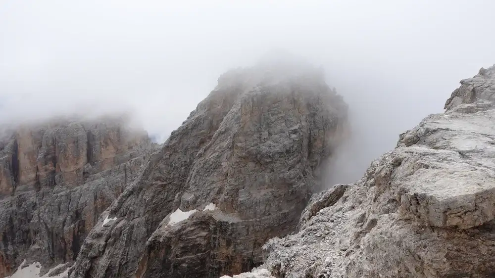
The final third part is a demanding ferrata Marino Bianchi. You will realize this as soon as you turn to it from the Lorenzi hut, the picture below is from close to the beginning:
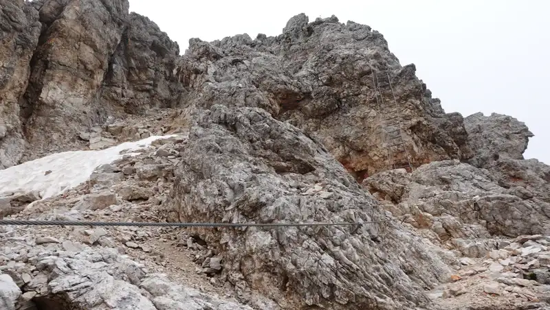
There are many ups and downs on the route, with several ladders and numerous cables. You will have plenty of snow if you go early in season so better do not go.
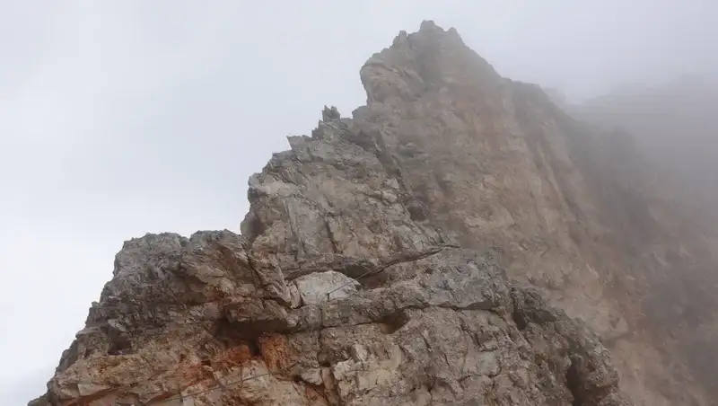
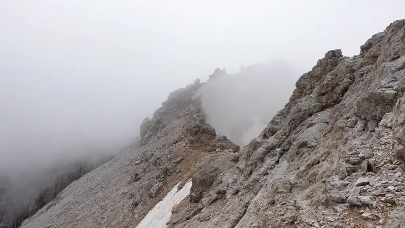
Below you can see one passage with very steep cliffs and the ridge above it, and yes the route goes there, the cables are partly visible:
Here is one detail from the summit ridge, with plenty of exposed passages:
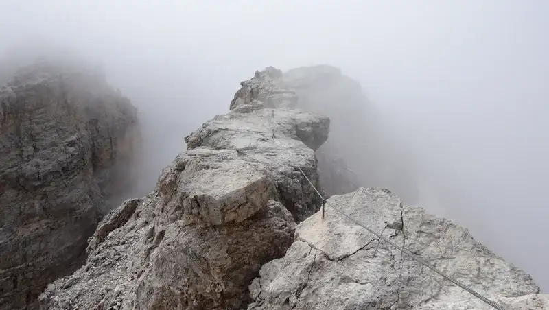
There are also a few less demanding passages, here is one, but the cliffs are vertical on the east side:
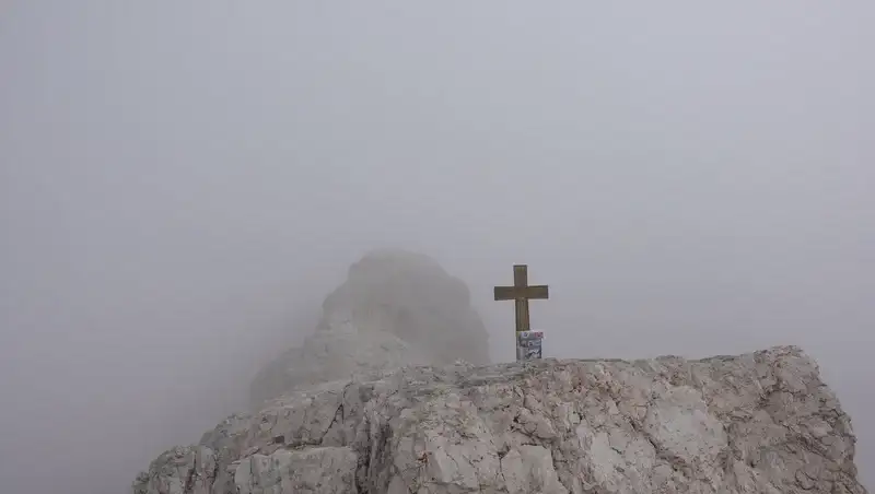
But you would not want to be caught in a storm here, so plan your tour accordingly. The summit cross is not so prominent, and this is even not the highest point on the route, see how it looks:
My rating of the ferrata Bianchi
Here you have my rating of the ferrata based on three essential criteria that I use:
| Rating Criteria | Rating (A-E; 1-5) |
|---|---|
| Technical difficulty | C |
| Ferrata length | 4 |
| Access route difficulty | D |
| Overall Score | C4D |
The length grading is based on the total length of cables which are probably around 300-350 meters or so, but I do not have completely reliable data.
Regarding access route difficulty, you need around three hours from the road to the cables, and this includes an enormously hard scree slope and a substantial elevation gain.
Do let me know if you disagree with some of my rating, there is a comment box below.
My climb
I started from the road at Tre Croci hotel at 6:40 AM. The weather was far from good, but the forecast was not bad. It was supposed to remain stable and dry. However, I had rain half an hour later, but decided to keep going up to Lorenzi hut, and then to decide.
It was quite early, and there was nobody around. But at some moment I realized that I lost my microphone, this was at the point where I put my poncho on me. So I had to walk back, and then I met two people going in the same direction.
Luckily, I found the microphone and then continued the tour. The couple was in front of me, and this remained so all the way up to the summit.
The weather did not look great when I arrived at Lorenzi hut, but it looked stable, so I decided to continue. I arrived at the summit at 11:10 AM, and this makes four and a half hours from the road.
Note that the route was still officially closed, no idea why. But it was free of snow, and I was carrying my crampons without reason.
Please see more in my video:
Equipment, supplies & accommodation
For this occasion I used my Mammut Lithium 40 backpack. The boots were Mammut Sapuen GTX, though I must say that the environment was a bit too harsh for them.
You have seen about the weather, so I had a full rain protection set, and this includes a poncho, rain pants, and a rain jacket. As usual, I also had a pir of trekking poles.
There is the lift station in the lower part of the route, so this is where you can have meal and drinks. I did not enter and cannot say much, all I needed I had in my backpack.
As for accommodation, there are several camps in Cortina.
Final thoughts
In summary, Monte Cristallo di Mezzo is a beautiful mountain, and its ferrata Marino Bianchi is quite demanding. It is far harder than the nearby ferrata Ivano Dibona and ferrata Tofana di Dentro (ferrata Lamon).
However, I have seen in some sources that all three ferratas are rated the same 2B according to the Fletcher/Smith rating system. This makes no sense to me at all.
At some places I have seen the Bianchi ferrata rated as D with respect to Hofler/Werner scale, while Ivano Dibona is C.
But I would describe it as less hard than Pössnecker ferrata (Pößnecker, also known as Mesules) in the Sella Massif, just to know if you are familiar with it.
In a good weather, you can climb Cima Cristallo di Mezzo as a day tour, just make sure you have all needed for such an environment. Bear in mind also that some parts of the route may be under snow till late July, and if so you will see online that it remains officially closed.
This tour was a part of my recent series of visiting historic routes in the Dolomites. The series includes also places like Buffa di Perrero and Bivacco Barraca degli Alpini.
Let me know if you have questions or comments, there is a comment box below. Please join us at our Facebook group Dolomites Visitors Hub.
Leave a Reply