Here you have my report from climbing Mount Canin (Visoki Kanin). The Slovenian-Italian border goes over it, and I approached it from the Slovenian side.
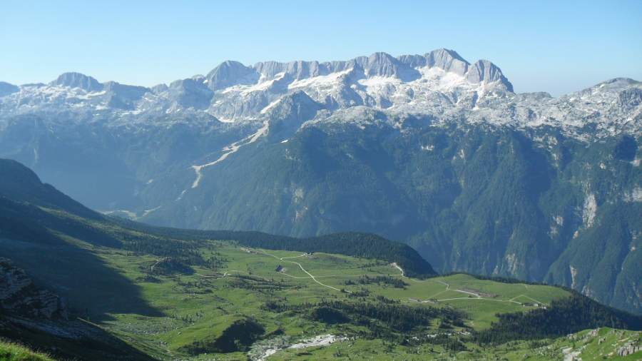
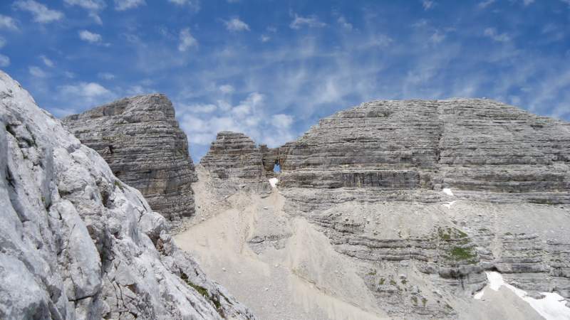
If you check about Canin on Wikipedia, you will notice that they use the plural so you have Kanin Mountains. Most likely this is because of the size of this massive. When you look at it from the distance, its distinctive feature is very high plateau which is over 2000 meters of elevation, and then several separate peaks sitting on it.
The picture above shows it from the Italian side and you can see multiple peaks. But check the pictures below to see how it looks from the Slovenian side.
You will see a variety of names used. Slovenians use the name Visoki Kanin (which means “high” or “tall” Kanin), or simply Kanin. Italians use the name Monte Canin. There is also the phrase Canin Group, etc. The border between Italy and Slovenia goes over it, so you have routes from both sides.
Because of those several peaks, it can be difficult to realize which the main peak is. This happened to me when I was there, and I met a couple who were asking “Which is the main summit?”. I did not know. But eventually, it became clear because of the route which I followed.
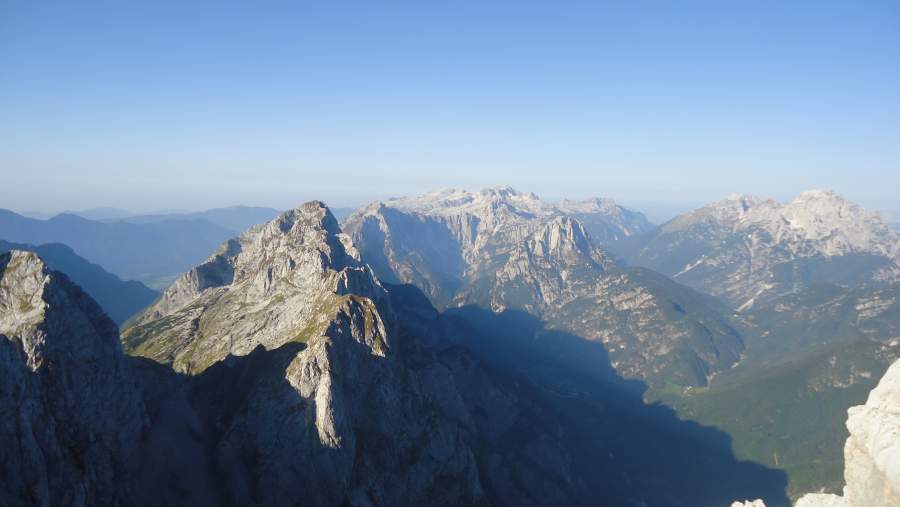
Basic data
Here are a few numbers and details you might want to know:
- Latitude: 46.36020°N.
- Longitude: 13.43881°E.
- Elevation: 2587 m (8487 ft).
- Mountain range: Julian Alps, Slovenia.
My route
There are several routes from the Italian and Slovenian sides, but I have only walked the route from Bovec (Slovenia), and this only partly. This is why my text is restricted on this route alone. I cannot provide any first-hand information about the other routes.
The Google map below shows the area and a few important points on the route which I passed. You can zoom in and out and you will see all the access roads to this part of the Alps. The Italian-Slovenian borderline is also visible.
The markers in the map above denote the following:
- Red: the Station C.
- Green: the pass mentioned in the text below.
- Orange: the cabin/refuge.
- Blue: the hut (Dom Petra Skalarja na Kaninu, 2260 m).
The blue line is my route to the summit, and the red line is a detour on the way back when I visited the refuge.
The Station C area is shown in the middle of the picture below. The picture is taken on my way back as I was coming from the hut, so this is not from the route to the summit.
So from the Station C you go to the left towards the pass (left in the picture below); this is more or less in the west direction. What you see in the picture below is also a lift station from the Italian side. This is a ski area and ski runs from both sides connect there.
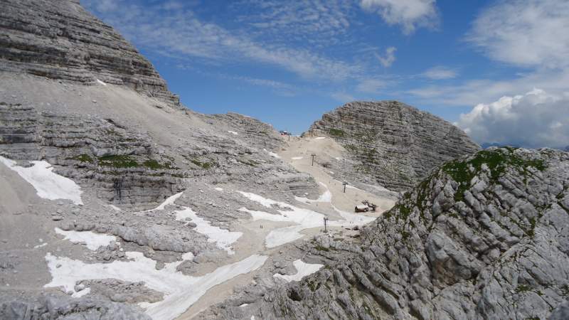
It is embarrassing to admit but I climbed the mountain from the last lift station. The reason is that the weather forecast for the afternoon was bad so I did not have enough time, and this was my last day in Slovenia. But this was a chance for me to test my new Scarpa boots, and this is what I did.
To understand my decision, a note about the elevation and time. This is not so high mountain, but the starting point, if you climb directly from Bovec, is only 453 meters above sea level. This means 2134 meters elevation difference. This would be a whole day tour, hard but doable in one day and I have done such climbs many times in the past. But for this, one needs stable weather.
The day before the tour I checked the road. My initial plan was to drive as far as possible and then to walk. This would be roughly from the Station B. But the beginning of the macadam road above Pluzna village did not look great and I was concerned about damaging tires. Later from the cable car, I was able to see the road which was zig-zagging under the lift line. It looked quite good, so it seems only the beginning was in not so great state.
In any case, after taking the lift I was up on the mountain in half an hour or so. When you are out of the lift station, there are no obvious signs where to go, so I followed what I remembered from a map studied before. This means when you leave the Station C, go to the left and in the west direction. There are paths around, but you should go towards a pass (this is the green marker in the map above).
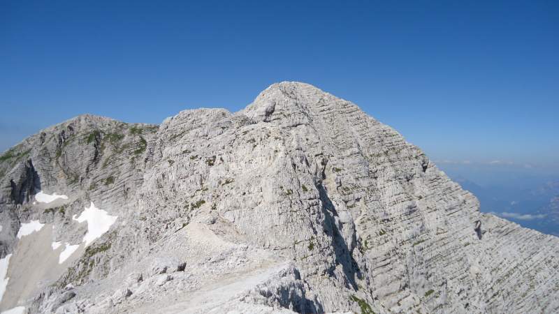
Once you get to the pass, you will see several peaks and it will not be obvious which one is the main summit. So here is a picture from the pass, which roughly shows the direction and the main summit.
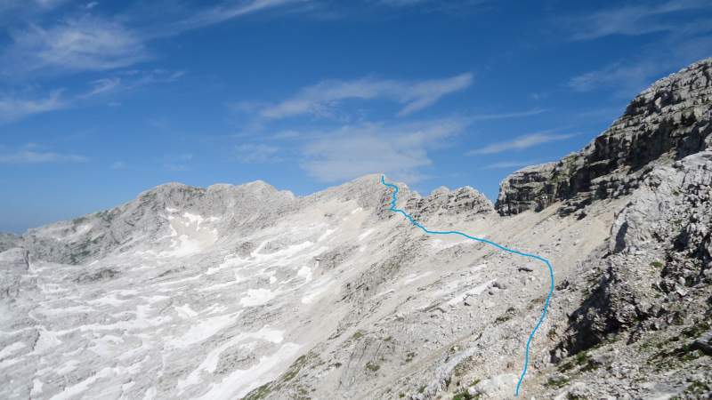
As you realize, the bigger part is easy and flat. But the final part is steep and with several ferrata sections and a few exposed passages. When you continue and look back, this is what you will see:
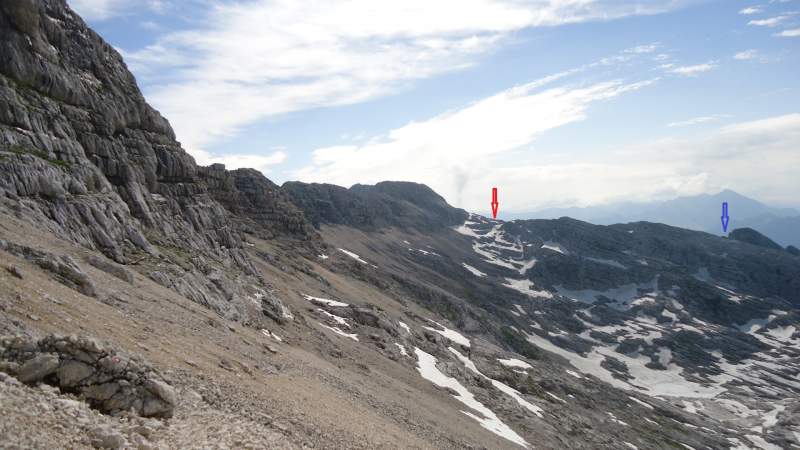
So you will not pass the hut if you go directly to the summit. Later after the summit, I descended the same way but made a detour to visit the hut. This is the red line in the map above.
Here is a photo I took descending, a family that was in trouble in the ferrata section. They all had full ferrata equipment and helmets, but this is not a kids’ playground. I was praying in myself that they give up, and eventually that is what they did, it was the right choice.
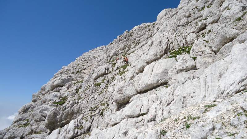
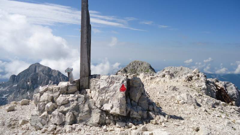
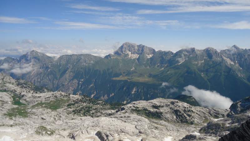
So here are a few photos from the upper part and from the summit:
As I mentioned earlier, I decided to visit the hut (Dom Petra Skalarja na Kaninu). It turned out it was closed, not sure why. This is a picture of it as I was approaching it, only the roof is visible:
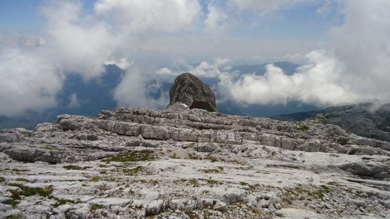
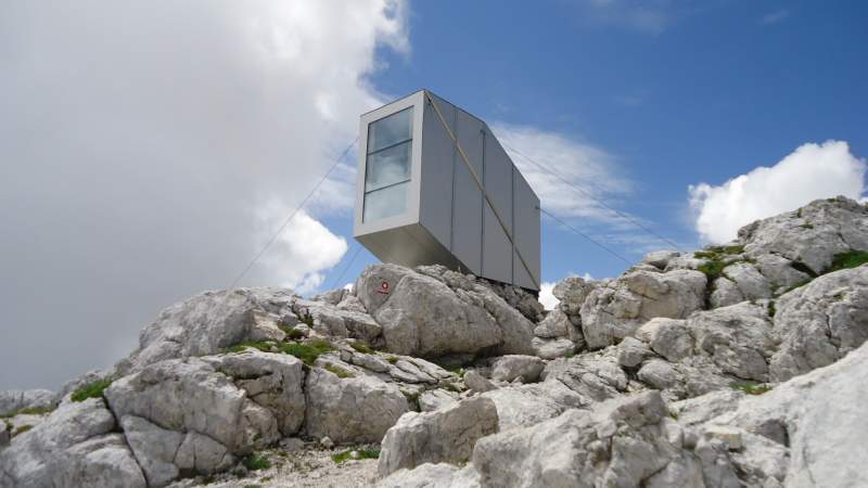
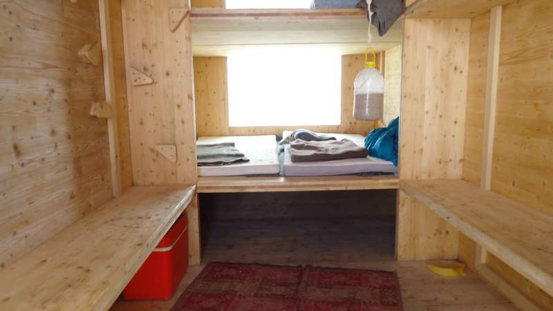
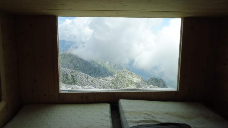
But surprisingly the cabin (refuge) was open. Earlier I read that you are supposed to pick up the keys somewhere in Bovec. Therefore I am not sure if it is always open or not. See how it looks from outside and inside:
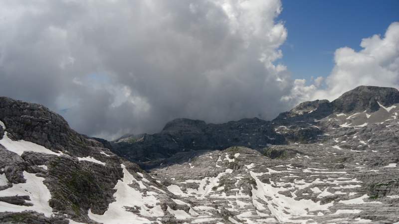
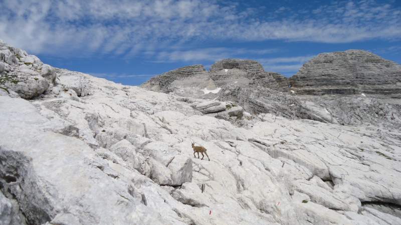
The weather was changing rapidly, so after all the forecast was correct. I did not waste time and continued towards the lift station. Here are a few photos from this part:
Timing & equipment
For this described here you will need at least 4 hours in both directions. I took the first lift in the morning and was up on the route at 8:40 am, and I was back at the lift station at around 1:20 pm. If you have time, do spend the night in the cabin, it must be a great experience.
As for the equipment here is a short summary:
| Recommended | (Almost) essential |
|
|
I was testing my new Scarpa Triolet GTX boots, perhaps an overkill for such a tour but note that this is a pure rock so make sure you are protected and have strong boots.
Water supplies
This is a bone-dry area, the rock is like a Swiss cheese, all water goes inside. This is why you have a complete river running out from the rock, just a few hundreds of meters below, see the picture below. This is Slap Boka (Waterfall Boka) as seen from the road below Bovec.
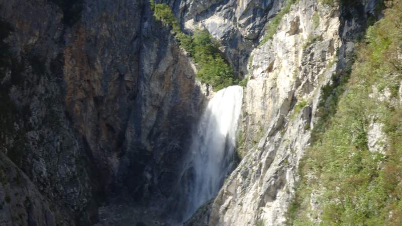
The area has 4-5 meters of snow in winter but this all melts in summer. I was there in late June and there were a few passages with snow which you can melt and filter if needed. But I have noticed a building close to the station where it is possible to have food and drink.
So this was my report from climbing Mount Canin (Visoki Kanin). Let me know if you have questions and comments, there is a comment box below. If you are in the area, you might also want to climb Bavski Grintavec, Jalovec, Krn, Razor, these are all very attractive mountains on the Slovenian side which you can climb from the Socha (Soča) valley. But see also my texts about climbing Jof di Montasio and Mangart.
Did you climb Kanin from the Italian side? If so, it would be great to have a report here, we have an invitation for guest authors.
Leave a Reply