In the past, during my various tours in Triglav area, I have seen Bivak pod Luknjo only from the distance. But this time, I decided to visit it, so here is my report.
Bivak pod Luknjo coordinates, numbers & details
- Elevation: 1494 m (4902 ft).
- Coordinates: 46.391217°N / 13.837009°E.
- Route difficulty: walk-up.
- Places to sleep: 8-10 people.
- Equipment: none.
- Elevation difference from the parking: 544 m (1785 ft).
- Time needed to the bivouac: 2 hours.
Access and map
The interactive map below shows the access roads to the area, and the road from Mojstrana to Vrata valley. The marker 1 is the position of Aljaz hut with a parking close to it, the marker 2 shows the position of the bivouac, and the marker 3 gives the place of Luknja pass.
On the official link of Slovenia Alpine Association, you will see a statement that the bivouac is closed when Aljaz hut operates.
But on my way up I have been in the hut, so it was open, and the winter room in the bivouac was also open. Just to know that it might be closed, but I cannot say more.
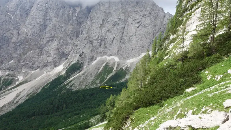
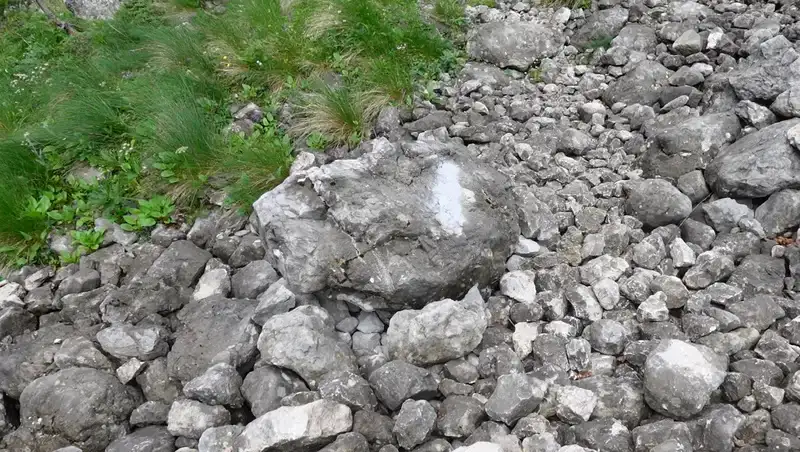
When you are close, the bivouac is not easy to spot, it is hidden in the forest. The arrow in picture below shows its location. Luknja pass is not visible, but it is on the right up.
Route description
From the car parking it is a short walk to Aljaz hut. And here you have plenty of information, this is a hub for numerous routes to Triglav and other highest peaks in the country.
There is even a bus line to the parking, and from what I remember, it is free. With this, they want to reduce car traffic in Vrata valley. When I was there, car parking was 25 E per day.
In principle, you can park for free a few hundred meters before, but it is not allowed to leave the car there overnight. However, they were building a barrier and toll point far below at the entrance to the valley, so whatever I wrote above may already be obsolete.
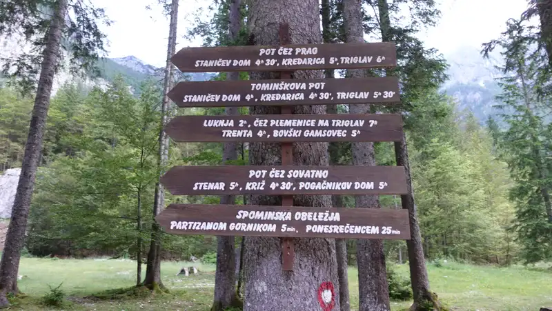
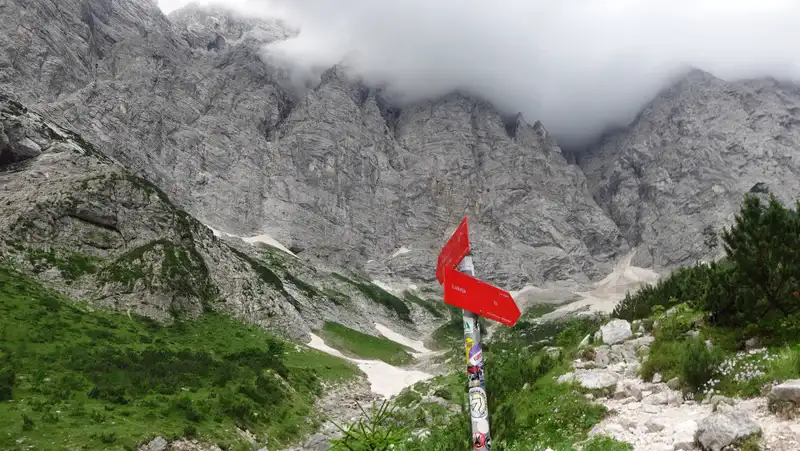
Back to Aljaz hut; the picture below tells you that you need two hours to Luknja pass (1766 m, 5794 ft), but in my view this is too optimistic, unless you are a Slovenian or a mountain goat.
The bivouac is around 600 meters below the pass, but its elevation is 1494 m (4902 ft). It is best to plan two hours to the bivouac alone.
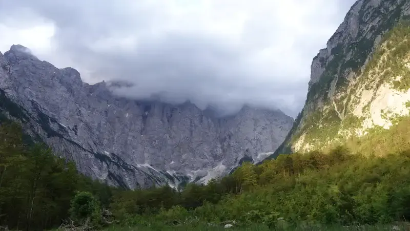
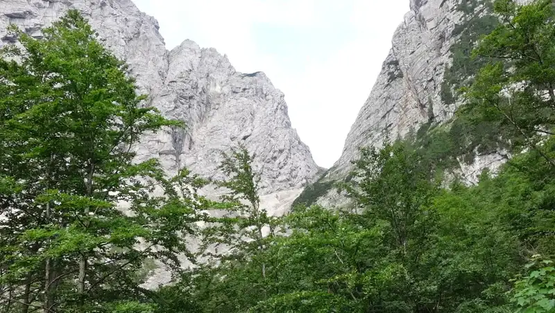
From Aljaz hut you continue along the valley floor which is here very flat and pleasant, and almost without any elevation gain for quite some time. You will have Triglav north face all the time in front of view as in the picture below.
This is direction for three routes to Triglav from Vrata valley, I have climbed them all several decades ago. In fact, Triglav was my first higher mountain I climbed in 1986. Now you may realize that coming to this place again brings lots of memories back.
When you are in Vrata valley, to get to the bivouac, there are two options:
• You can walk in the direction of Luknja pass, but at some point you have to leave the route and walk through the forest in the direction of the bivouac. It is hard to find the path that goes there. I could not see it.
• Yet another option is to walk in the direction which is Pot cez Sovatno, you can see it in the picture above. It is indicated in the map as well. Then at some point, you will have a tiny path that goes to the left in the direction of Bivak, but it is not marked.
In fact, in the past, there were red markers on that path, but they are now covered with a gray paint (see the picture below), so that you cannot see them or to understand them as invalid. My understanding is that they simply do not want ordinary mortals to go there.
Anyhow, I have walked both ways just to know. The picture above is from Sovatna direction, and the picture below is from the first mentioned option in the direction of Luknja pass.
Note that from Luknja pass you have the Bamberg (Plemenice) route to Triglav, which is the most attractive normal route to Triglav. I climbed it in 1987.
I knew roughly where the shelter was, so at some point I left the Luknja pass route and walked blindly through the forest. The area is full of large boulders and thick bushes, so such a walk is far from pleasant. In addition, it was raining so I became instantly wet from branches and leaves.
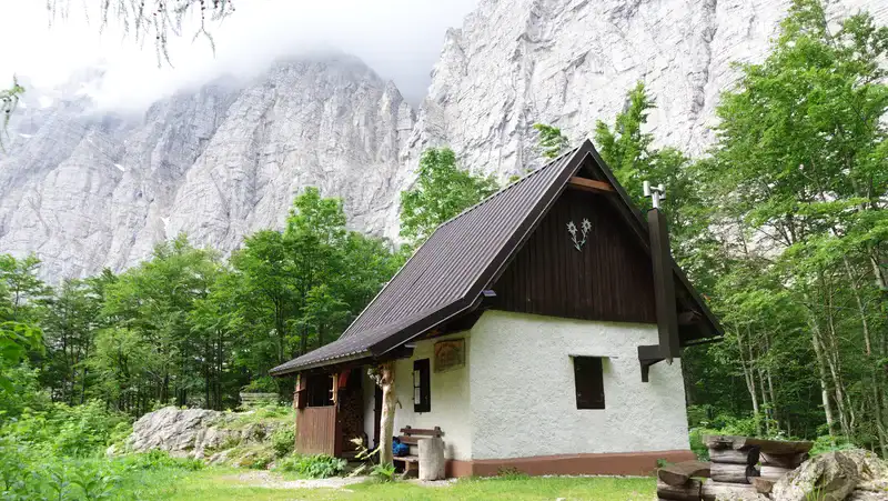
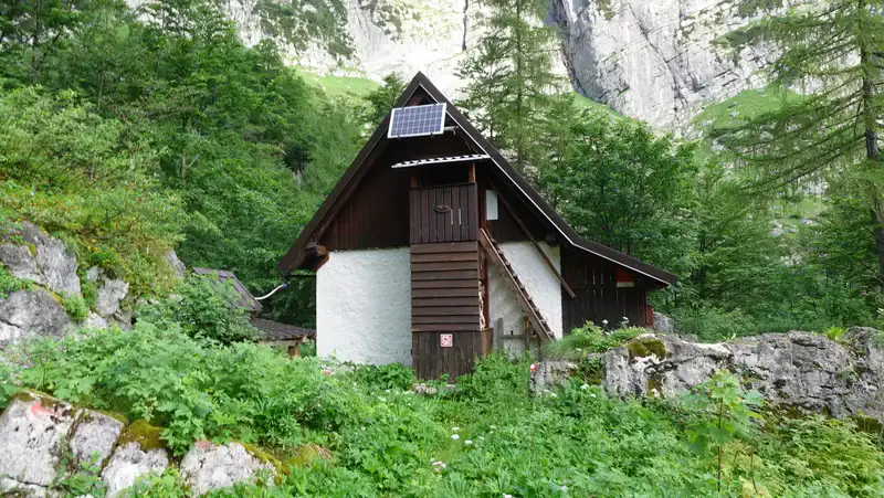
But I found the shelter, and the picture below shows how it appeared in front of me. You see the side with stairs to the attic which is always open. On the front is a pleasant porch with a bench where you can see and be protected from the rain.
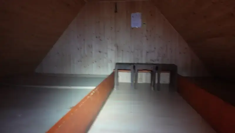
I went to the attic to see what it offers, and below you can see it. There are two wood platforms on the sides, each can accommodate up to four people. There are no mattresses. The picture on the official site suggests something else, but this was my reality.
Below is the view from the Bivak to Luknja pass. The pass is 272 meters of elevation higher. The air-distance is around 600-700 meters or so.
Please see more in my video:
Equipment
This is a technically simple tour so you do need anything special. I used my Mammut Lithium 40 pack because I was carrying more stuff, with the idea to get to Stenar.
For the same reason, I used Mammut Sapuen GTX boots, and had a pair of Komperdell trekking poles. You should always have a rain protection layer or at least a rain poncho.
If you plan to sleep there, bring a sleeping bag and a sleeping pad. I always carry an inflatable pillow as well. There is no water around, bear this in mind, so make sure you refill at Aljaz hut.
For food and other supplies, there is a good food shop in Mojstrana which is at the entrance of Vrata valley, and much more in Kranjska Gora. I stayed in a camping in Gozd Martuljek, but there is one also in Mojstrana-Dovje area.
Final thoughts
In summary, the Bivak pod Luknjo is a shelter tucked under Triglav’s north face near Luknja pass. Built in 1947, it is a two-hour hike from Aljaz hut in Vrata valley, with a locked ground floor and an open attic that sleeps 8-10.
The shelter’s attic has wooden platforms, nothing else, no mattresses, no gear, just a basic roof. The route’s a straightforward walk-up, gaining 544 meters from the parking lot, though finding it means navigating a forest with faded or hidden markers. I had spotted it from afar on past Triglav trips, but this time I went for it.
Getting there starts easy, flat valley floor from Aljaz hut, Triglav looming ahead, but the bivouac itself isn’t obvious.
Two paths work: one veers off the Luknja pass route, the other splits from Pot cez Sovatno. Both lack clear signs; old red markers are painted gray, likely to deter casual hikers.
I tried both, bushwhacking through boulders and wet branches. Luknja pass, 272 meters higher, stays out of sight but close.
For more shelters in this area please check my texts about Bivak pod Spikom, Bivak III za Akom, and Bivak IV na Rusju. All of them and many more you will find also in my map of shelters in Julian Alps.
Thank you for reading and let me know if you have questions, there is a comment box below.
Leave a Reply