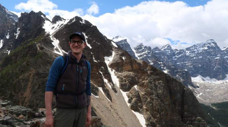
This Little Lougheed report is submitted by our guest author Yannick Griep (picture below) who did the tour in the group of four people.
Little Lougheed: Information
- Summit latitude: 50.9620° N.
- Summit longitude: 115.2944° W.
- Summit elevation: 2494 m (8182 ft).
- Elevation gain: 736 m (2415 ft).
- Peak prominence: 1544 m (5066 ft).
- Base elevation: 1879 m (6165 ft).
- Travel distance: 5.5 km (3.42 miles).
- Time from base to summit: just under 2 hours
- Round-trip time: 4 hours.
- Mountain range: Canadian Rockies.
Access roads to the Little Lougheed area can be seen in this zoomable map from Google:
Basic trail information
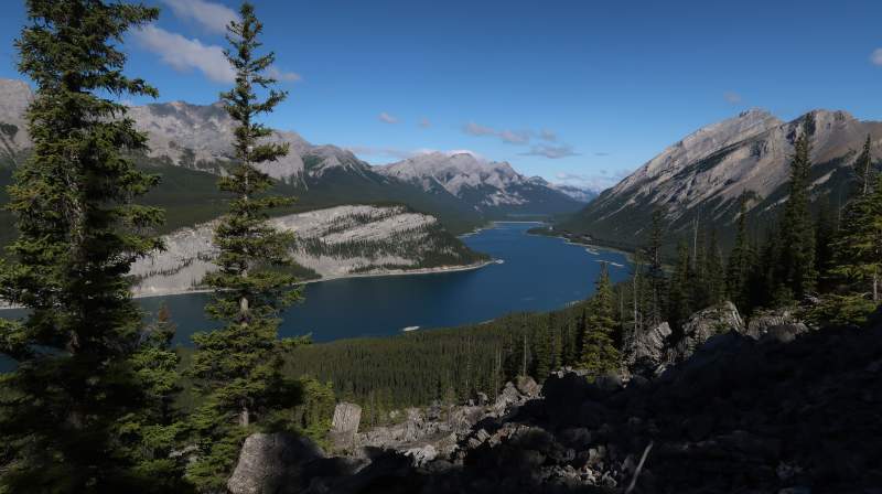
Little Lougheed is a 5.5 kilometer lightly trafficked out and back trail located near Canmore, Alberta, Canada that offers scenic views over the Spray Lakes Reservoir and is rated as difficult. The trail is best used from March until November.
Mount Lougheed has several summits, one of which is the “smaller” peak known as “Little Lougheed”. Little Lougheed is a fabulous hike with very few hands-on moments (you may encounter the odd part where you have to scramble up some boulders, but nothing too scary or wild) and is completely off the grid (Little Lougheed is not mentioned in most hiking books).
Reaching the trailhead
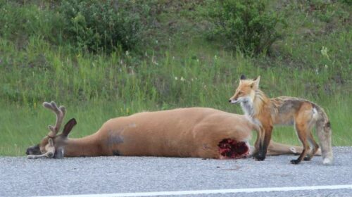
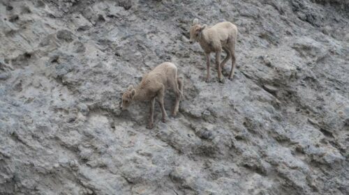
The trailhead is located near the Spray Lakes West Campground in Spray Valley Provincial Park off of Highway 742 (Smith-Dorrien Spray Lakes Trail) out of Canmore. This highway is probably one of my favorite roads to drive in Kananaskis Provincial Park because it is always a great spot to see wildlife. This time we saw a fox feasting on a white-tailed deer, as well as some baby Rocky Mountain sheep.
The trailhead starts at Spencer Creek and is 2.8 km south of Spurling Creek. The trailhead is hard to locate on maps. Tip: download the offline maps of Alltrails to locate the trailhead or locate the trailhead for West Wind Pass (the trail leading up to the summit of Windtower) on Google Maps and park your car alongside the road.
From here you will see a trail heading into the trees. There are some indicators for West Wind Pass and the High Rockies Trail. This is where your hike starts towards stunning views of the Spray Lakes Reservoir.
Part I: Hiking from the highway to the boulder field
The first part of the hike follows an easy to follow and well-maintained trail through a magical forest where moss covers most of the ground and you constantly hear the murmuring sound of a meandering creek. After a short walk, you reach an intersection where you will follow the indicators towards the High Rockies Trail for about fifteen minutes or until you reach another intersection.
This intersection is not as well indicated but you will notice a small marker (keep an eye out for a small rock cairn with orange flagging on the right-hand side of the trail) and follow the trail upwards into the trees.
So far, so good; the trail is still well-maintained and easy to follow but after a while, the trail becomes far less trafficked and finding the route becomes a bit of a challenge. Keep your eyes peeled for orange flagging on the side of the trail (often you will find orange flagging on small rocks or trees).
Keep working your way up through the forest until you notice a very large boulder field (I promise you, you cannot miss this boulder field). Once you reached the boulder field, you have two choices: either work your way up through the boulders (for those of you looking for a more challenging hike) or stay to the right of the boulder field and continue your hike up through the forest (we opted for the latter option).
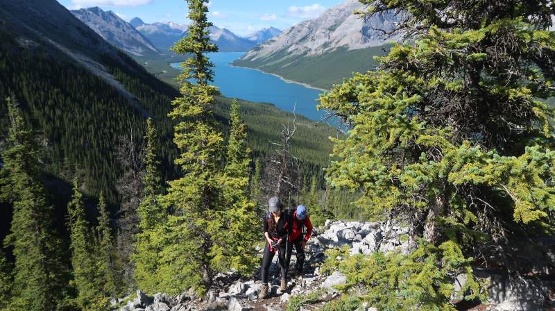
Part II: Hiking from the boulder field to the ridge and up the ridge
We bypassed the boulder field by following the trail through the forest. At this point the trail starts to pick up some incline and you will start to accumulate that elevation gain. Although this part is a bit more tenacious, you will soon reach the ridge where you can take a mid-way
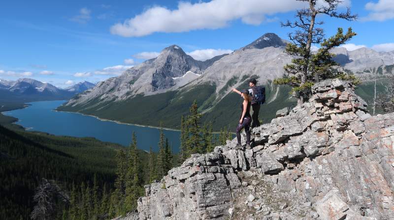
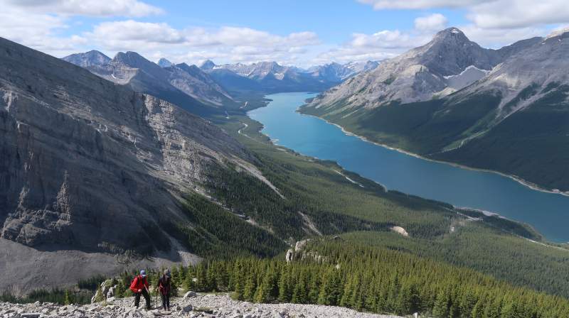
break and enjoy the stellar views down to the Spray Lakes Reservoir.
From the ridge, you continue upwards the suddenly very steep and unrelenting trail toward the second treeline. With the exception of a few boulders to pick your way through, this is a pretty easy route upwards. Once you surpass this second treeline, the views over Spray Lakes Provincial Park become even more stunning. From here on, you are pushing for the summit.
Part III: The push for the summit
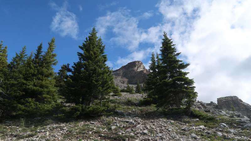
Once you left the second treeline behind you, the summit of Little Lougheed appears. Don’t let this proximity to the summit fool you however because the final 75 meters or so to the summit are very steep and the trail is covered with loose rock.
Make sure to stay to the left of the trail to avoid cliff bands and rocks tumbling down from the higher rock bands (although it is not too bad on the way up, these rubbly conditions can be quite challenging while descending). Keep working your way through the rubble to the summit, one step at a time.
Once you reach the summit ridge (about 25 meters from the actual summit), it is a walk in the park to the actual summit cairn. This final part has some minor exposed parts so be extra careful when walking the ridge.
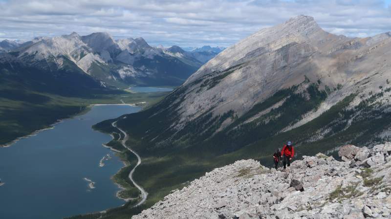
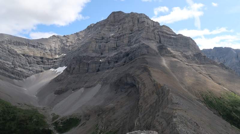
If you want to enjoy lunch on the summit (like we did), head down from the summit to a lower rocky area (about 5 meters below the summit when facing Mount Lougheed) to enjoy breathtaking views of Mount Lougheed (can be seen on the right side) and Windtower (can be seen on the far-left side). Enjoy your well-deserved summit of Little Lougheed. We reached the summit of Little Lougheed in just under two hours.
Part IV. The descent
Although we could have stayed on the summit for a while longer to enjoy the amazing views, we eventually had to follow the advice of The Alan Parsons Project when they sang “what goes up, must come down”.
We started by going back down the same way we ascended Little Lougheed. However, when we reached the boulder field, we decided to partially short-cut our way down and went down straight through the boulder field. Once you passed the boulder field, it is a stroll back to the highway and your car.
We thank Yannick for this great report, and we invite you to read yet another he submitted here, the climb of Mount Temple in the same Canadian Rockies area. Thank you for reading.
Leave a Reply