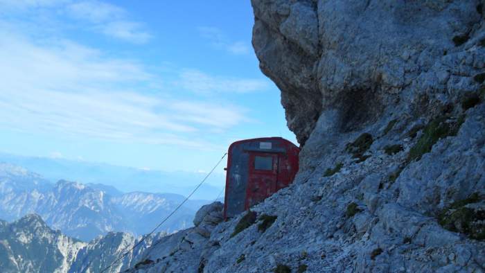
The Bivacco Suringar (Suringar refuge) is a small and typical Italian Alpine shelter on the north-west cliffs of Jof di Montasio. You will pass it if you decide to get to the summit through the Findenegg Couloir.

Where is it
- Coordinates:
– Latitude: 46° 26′ 19.8916″ N (46.43885878).
– Longitude: 13° 25′ 47.8613″ E (13,42996146). - Elevation: 2400 m.
This is a shelter, so it is always open. See its position in this Google Map:
What is it
This is a standard metal shelter, with 4 beds and foam mattresses. I do not remember seeing blankets when I was there, though, I have spotted them in a YouTube video. This is an old refuge, built in 1954, and you can feel this when you get in.
It is on a very narrow gallery high above the valley, and it is hard to understand how they come to the idea to build it in such an exposed place. If you have to go out during the night, better watch where you step, there is not much space around. The interior walls are protected by wood so probably it is less cold than some other shelters, like this Del Piero on Monte Confinale.
As far as I remember, there is no gas stove available, but I am not completely sure, if anybody knows please let me know and I shall add this information here. The space inside is rather small and it is hard to imagine that any installation of that kind would fit.
Water: There is no water streams around, these are very steep cliffs, the place is close to the summit, and water cannot be expected in such an environment. So you will have to carry it with you. But this is the north-west side of the mountain, and you can find snow at some places around even in the summer months.
Note that such passages with snow can also be a big obstacle to get there. One wrong step and you may end up half a kilometer below in the valley. I wished I had crampons when I was passing one of such places. You can see more in my text about Jof di Montasio (Montaz).
I have passed the route from the car parking below the Rifugio Brazza. So this is the south approach, described in detail in the Montasio page, please check the link above.


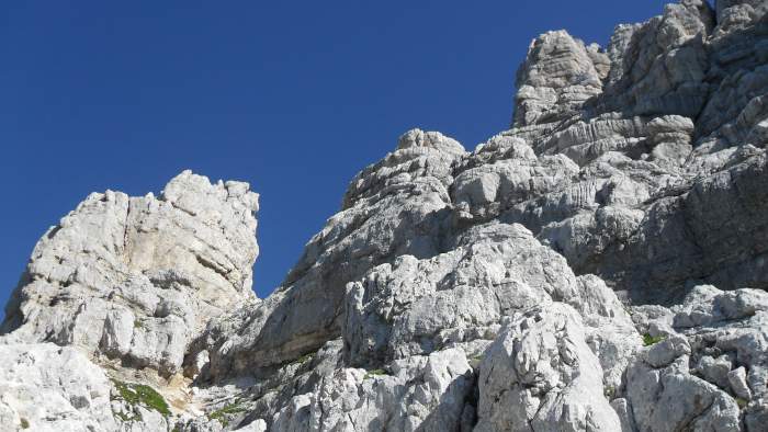
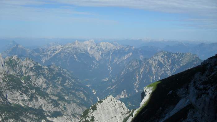
All this area is with steep walls and deep valleys and if you have problems with vertigo it is better not to go there. But if you go, you might take the ferrata equipment with you, though you can manage without it. There are a few passages with fixed cables. You can get some idea about the area if you see this short video:
Here is one longer video, and with a better visibility, so please have a look:
I climbed Jof di Montasio in 2010, but I think nothing is changed with the Bivacco Suringar. I have seen some plans for a new refuge, and some pictures are available on the Internet, but as far as I know, they did not build it yet. Note that this bivouac is in my map of shelters in Julian Alps.
So thank you for reading and good luck, take care if you go to the area. There is a comment box below so please use it in the case of questions, comments, or new information if you have it. Have a nice day.
Leave a Reply