If you would put Guajara mountain in some other environment you will have a high mountain for every respect. For example, with its 2715 m, it is higher than famous German mountain Alpspitze. If you would climb it from the sea level, somewhere from the south coast of Tenerife, this would be a long and demanding tour.
[Silvius L. Weiss – Sonata for two lutes in C-Major – II. Allegro]

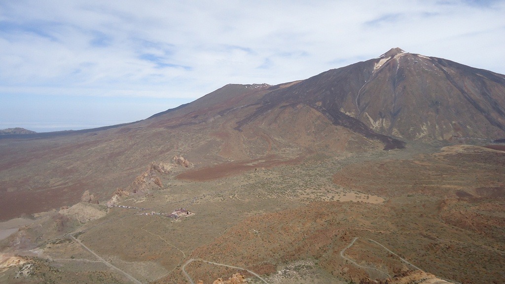
In fact, Guajara is the third highest Tenerife mountain, but it is very much overshadowed with the nearby mighty Teide which is 1000 meters higher. It is located to the south of Teide, with the following coordinates:
- Latitude: 28.21661
- Longitude: -16.61154
Two normal routes from the north start at the Parador hotel (2150 m) in the great crater (Las Canadas), so the height difference is only 565 meters.
, starting point to Guajara.")

The hotel Parador is connected with the rest of the island by very good roads from several sides, and there are regular bus routes both from the north and the south of the island. From the north, the bus line 348 connects Puerto de la Cruz with Teide area. It starts at 9:15 am, and you will be at the Parador around 11 am. The bus goes back at 4 pm, and you will have enough time to climb the height difference of 565 meters and to get to the summit of Guajara.
North routes to Guajara
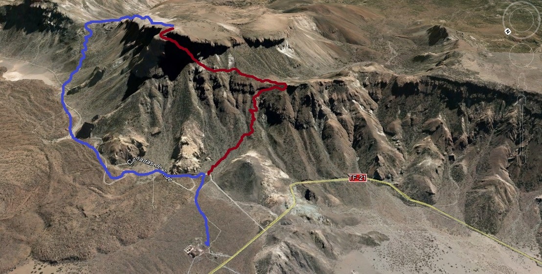
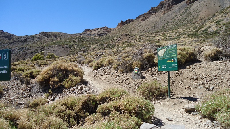
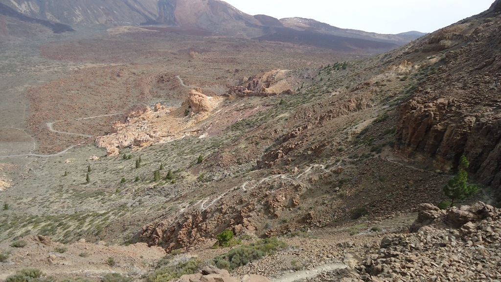
1. One of the two north routes goes over the pass Degollada de Guajara (2372), the blue line in the map above. The first part is rather flat, along a gravel road towards the east under the north wall of Guajara. After 3.7 km there is a sign (see the photo above) showing the direction to the right, towards Vilaflor and to the pass, so take this direction and soon you will get to the pass from where you will see the ocean in the south direction.
From the pass continue westwards towards the summit. This normal route is doable within 2 hours from the Parador hotel.


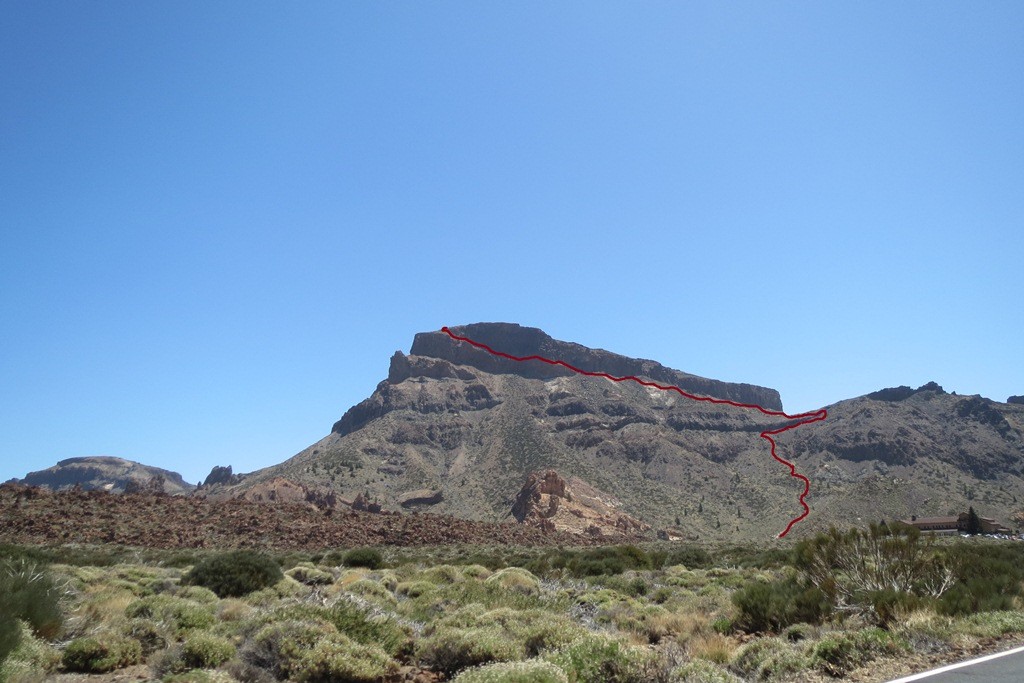
2. The second north route (over Degollada de Ucanca) splits from the gravel road very close to the Parador, and this is clearly seen although there are no formal signs for the route. The route is marked by the red line in the map given above, and also in the photo below.
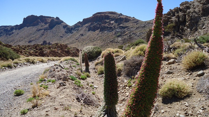
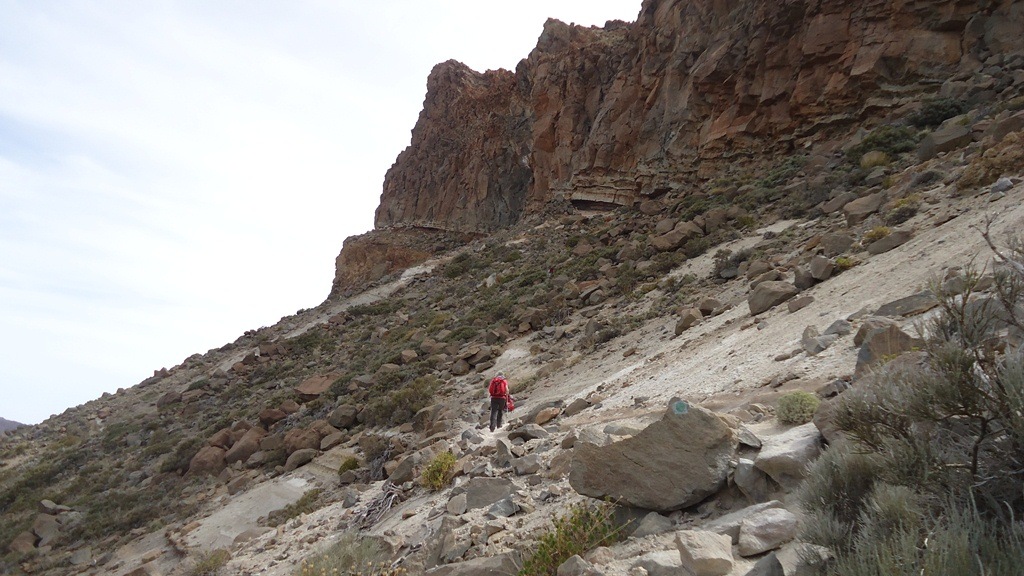
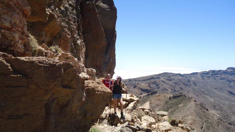
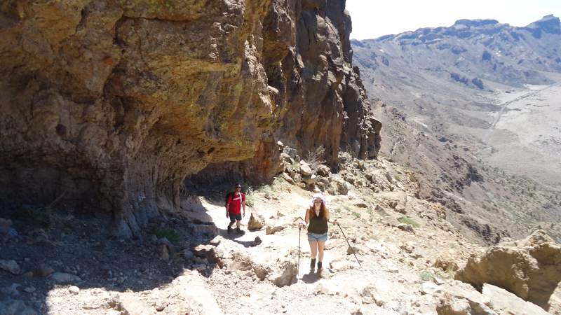
This route is shorter than the previous one, it is more direct and steeper. At some places, it is a bit exposed, but all the time it is still just a simple walk-up. You will need practically the same time to get to the summit, up to two hours. Here below are a few photos from this second route:


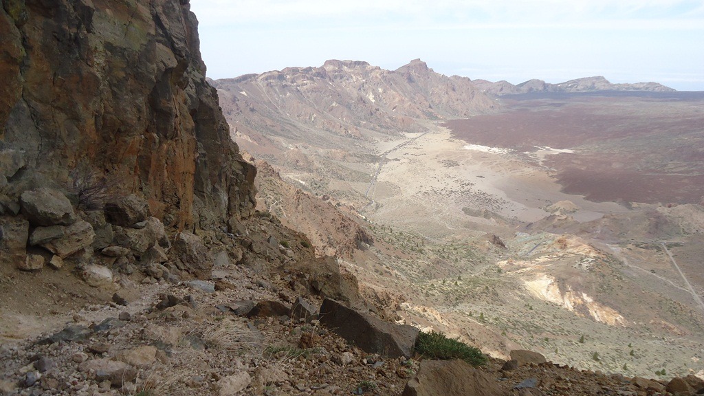
These are hiking tours in both cases, with breathtaking views over Teide massif, and you need only normal walking shoes and 2-3 liters of water in the summertime.
This is an addition, January 29, 2017, an interesting video I just received in the comment below by Philip, please have a look. This is a sunrise on Guajara, you will enjoy it, he did, no doubt about it:
My climbs to Guajara
I climbed Guajara four times. My first climb was in 2012. I started my tour at 11:15 am from the Parador hotel. I decided to go rather fast and within one hour I was already at the pass Degollada de Guajara (2372 m). From there I followed the ridge and arrived at the summit at 12:55. It was a rather hot day in June 2012, one week after I climbed Teide for the second time.

At 2 pm I descended the same way and arrived at Parador at 15:30. There were only two couples at the summit during my stay there. I carried 2.5 liters of water and used it all.
My second climb was in April 2015. This time I traversed the mountain, ascended by taking the shorter route (the red line on the map), and descended over the pass Degollada de Guajara (2372) (blue line). Surprisingly, it took me almost the same time to get to the summit as in my first climb over the longer route, 1 hour and 45 minutes.
I realized that one part of the route is in the shadow of the steep cliffs of the mountain. So if you climb before noon on a hot and sunny day, perhaps it is better to take this route as compared to the other one.
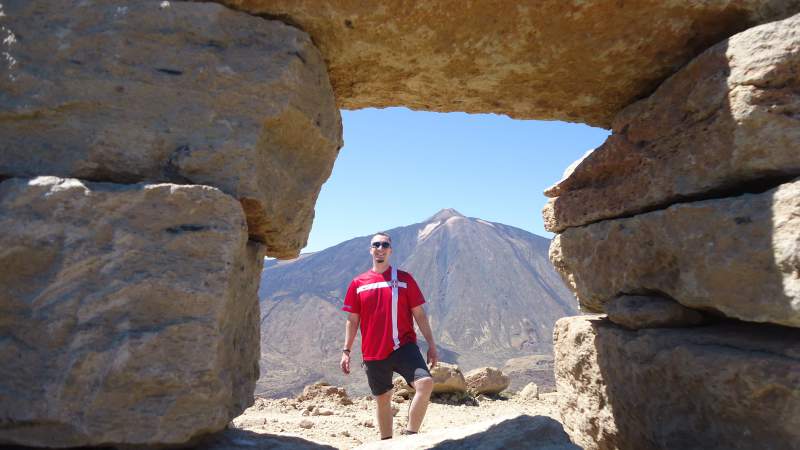
As usual, Teide was in sight all the time, but for me, it was also great to watch Pico Viejo which I climbed in February the same year. You may read about this experience here.
About my third climb, you may read in a separate post.
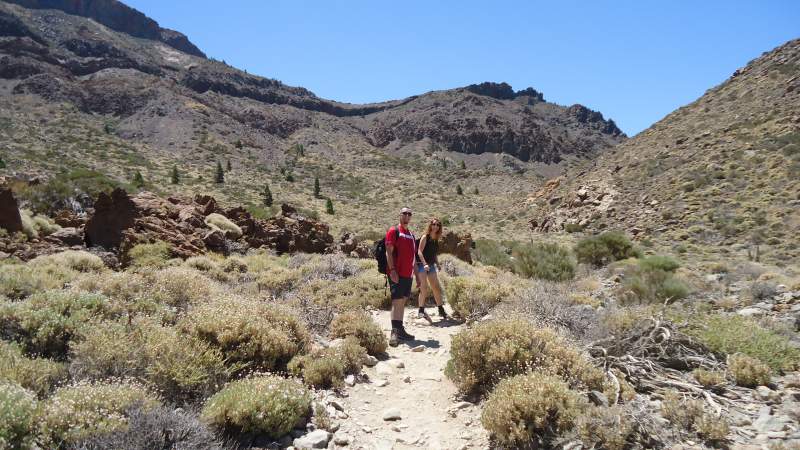
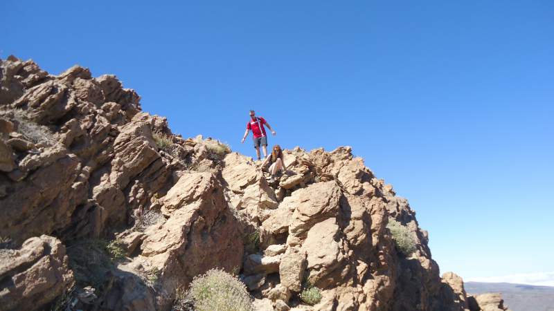
My fourth climb was with my daughter Ivana and with Iani, on August 1, 2015. We started from the hotel Parador following the route Degollada de Ucanca described above. It was a warm day, some problems with altitude (we were coming from the sea level from Santa Cruz), but we managed it. Here are a few photos from our tour.

To summarize, Guajara is not a difficult mountain if you start from the hotel Parador. Just take care of the Sun, have a hat and carry enough water in the summertime.
If you like this text please share it with others. I shall be happy to have your comments about the text and about your own experience in climbing this mountain.
Arturas says
Hi Jovo,
Thank you for great overview.
We with the family just climbed it today 🙂
I must say 2 hours to the top was out of reach for us, we made it in 2:20 and pace was quite extreme for us coming straight from the sea level.
Beautiful surroundings all way to the top.
Jovo says
Hi Arturas, so great to read your comment. The timing is not important, what matters is that you enjoyed the climb. Yes the surrounding is special. All the best to you.
David says
Thank you very much for posting such a good and descriptive account of the routes. My wife and I are going to tenerife for one week in March and have been looking for good reliable information on interesting hikes. After seeing your post we will most definitely undertake the trip to Mount Guajara by ascending the blue route and descending via the red. Many thanks once again for your excellent content.
Regards.
David
Jovo says
Great to hear from you David. I climbed Guajara 4 times and remember the first time could not locate the beginning of the red route to descend. I hope my marking of the route is clear enough. Just let me know if you need any information. Regards. Jovo
PHILIP says
Hi Jovo.
I just wanted to thank you for the information i recieved from you previously. We were in Tenerife for 10 days in January and i climbed Montana Guajara for sunrise using what you describe as the blue route. I put together a video of some short video clips and photos here https://youtu.be/xPslsQJn7z4 and there is some photos on my flickr page here https://www.flickr.com/photos/philblair/albums/72157679545193505. Again, many thanks for the information.
Philip
Jovo says
Many thanks Philip. I really appreciate your comment and love the video, so I added it in the text above, hopefully you will not mind. Some might get the same idea and enjoy the mountain as you did.
PHILIP says
No problem Jovo, I just wish I could spend more time there.
Jovo says
I was there one full year, and I miss it. I think some day I shall get back for good…
Bedo Zoli says
Hi, Jvranjes, very good descriptions… I visited the mountain recently, climbing from the Parador and folloving down the other north route. What a fantastic place to admire the environment around Teide…
Jovo says
Hi Bedo, you are right, a fantastic place in every respect. Next weekend I am taking a group to the route Parador-Pico Viejo-Teide-Montagna Blanca. I climbed it a few weeks ago solo. Thank you for visiting my site.
Prince Smith says
Hello, Jvranjes. I really enjoyed my visit to your site. This is a very good site to learn about mountains. It’s very interesting content to read. You’ve done a very good job on writing informative content on this site. Keep up the good work. Take care, Jvranjes.
Jovo says
Thank you for reading my page about Guajara mountain. Great that you find it interesting.