There are many bivouac shelter along the Trans-Lagorai Trail, always open and free to use. So can it be done by sleeping in bivouacs only? Find out in the text below.
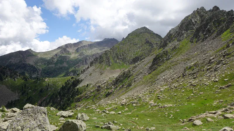
The Trans-Lagorai Trail is often described as one of the wildest long-distance hikes in the Italian Alps. Stretching across the remote Lagorai range in Trentino, the trail traverses a landscape of volcanic peaks, lonely ridgelines, alpine lakes. It covers vast stretches of wilderness where encounters with other hikers can be surprisingly rare.
Unlike many famous Alpine trekking routes, the Trans-Lagorai offers little in the way of staffed mountain huts, making it an adventure that demands careful planning and a degree of self-sufficiency.
One question that naturally arises when planning the route is whether it can be completed by moving from bivouac to bivouac each day.
On paper, the network of emergency shelters and unmanned bivouacs appears to provide a convenient chain of overnight stops.
In reality, the distances, elevation gain, terrain, and varying condition of the shelters make the answer less straightforward.
In this article, we will take a closer look at the spacing between the bivouacs, the demands of some stages, and whether a bivouac-to-bivouac itinerary is a realistic option for most hikers.
Various sources give quite different numbers regarding the length of the trail and elevation gain. If you check the route on this AllTrails map you will see 77 km mentioned. I would take this as a realistic number because two end points are at Rifugio Panarotta (1770 m) and Passo Rolle (1900 m).
But if you have a look on the map below, you realize that the trail has several different variants, and the terrain is such that you can make your own. So the length and the number of days needed for the trail can vary significantly.
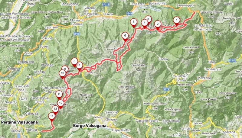
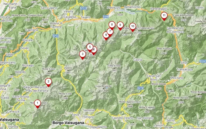
Bivouacs on the TL trail
I have pointed out 14 bivouacs in the picture above, but there are more at some distance around the trail line.
The majority of those 14 shown here are directly on the trail, and some are a bit off the route. Details for all of them are available in my map of Bivouacs in the Italian Alps and also in the map of Bivouacs in the Dolomites.
The distribution is such that you definitely do not need to use them all. This will depend on your tempo and plans.
Note that you can start the trail from any of the two ends, I have seen people walking it in both directions.
The clear gap in the middle is between Bivacco Manghenetto (number 7) and Bivacco Teatin (number 6). This is the only part where you might struggle to get to the shelter in time.
In addition to this, Bivacco Teatin is very primitive, more a cave than a bivouac and with very limited space for sleeping. This gap alone may be a good reason to have a tent with you.
On the other hand, some of the bivouacs on the route are the best equipped shelters I have ever seen. You can realize this if you check my text about Bivacco Coldose and Bivacco Paolo e Nicola.
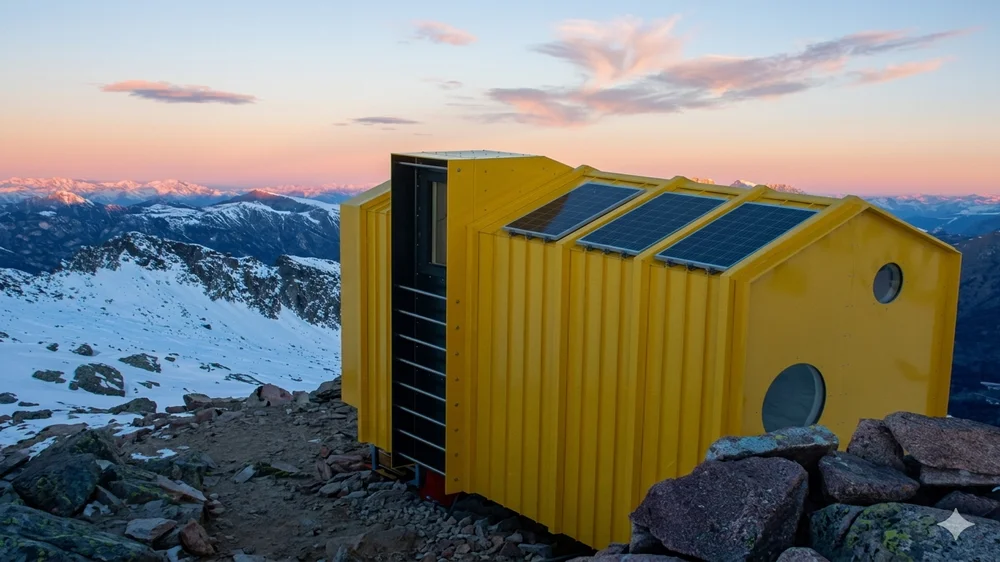
But read also about Bivacco Aldo Moro, it was completely rebuilt after my visit, and this is now an ultra-modern bivouac. For many hikers it may be too close to the end/finish point at Passo Rolle. But if you start your tour from the pass late afternoon, this is a perfect shelter for the first night on the trail.
How much can be done in one day?
This is very individual, from what I know many people walk all the way from Passo Rolle to Paolo e Nicola bivouac and sleep there. I met two of them at the bivouac who did exactly this, and they said it was hard, caught in the rain, etc.
Here are some numbers from my own experience, just to get some feeling:
- You need up to 4 hours from Passo Role to Bivacco Aldo Moro (number 1 above). This is a gradual walk up, moderate in every sense.
- At least three hours or more plan from Bivaco Aldo Moro to Bivacco Paolo e Nicola (number 2 above). This is one of the hardest sections on the trail.
- From Bivacco Paolo e Nicola (number 2) to Bivacco Coldose (number 4) you need up to 2 and a half hours. Beautiful walk with ups and downs, very mild.

Regular huts on Trans-Lagorai trail
There are six regular huts, all are shown below. Note that three are at the two ends, so you might not need them at all. For example, Rifugio Colbricon (number 1) is only half an hour walk from the main road at Passo Role.
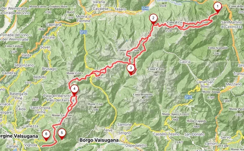
But numbers 2, 3, and 4 are, respectively, Rifugio Cauriol, Rifugio Conseria, and Rifugio Sette Selle. All three can be used to have meals and even to take an overnight rest. Here are the contact data:
- Rifugio Cauriol: 0462 836002; E-mail: info@rifugiocauriol.it
- Rifugio Conseria: +39 3495507733; E-mail: info@rifugioconseria.it
- Rifugio Sette Selle: +39-331-706-5002; E-mail: rifugiosetteselle@gmail.com
Observe also that only one road crosses the trail, this is at Passo Manghen.
Water sources
Lagorai is an area with a great number of lakes, and many of the are directly or very close to the trail.
The name Lagorai probably comes from “lago” and “aurai”. The latter in local Trentino tradition records an ancient name, Aurai, meaning something like a broad grassy area associated with water, marshes, or ponds.
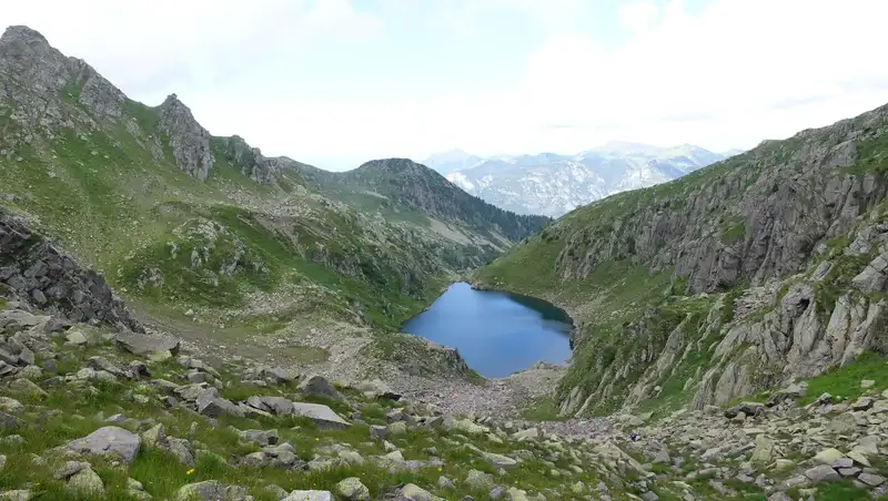
But there are also water sources directly on the trail, sometimes very close to bivouacs. The map below shows those that I was able to identify on the map. As you realize, they are perfectly distributed.
I do drink water directly from such water sources, I have seen local people doing this and I am sure this is fine.
Regarding the water from the lakes, it is always good to have a water filter or purifier. This can reduce the weight in your backpack, no need to carry lots of it. My LifeStraw in the photo weighs only 48 grams and it is 13 cm long.

About equipment
Trans-Lgorai trail requires exceptional physical fitness and complete self-sufficiency. But the trail is generally non-technical and it does not normally require via ferrata equipment, even though there are several sections protected by fixed cables and metal aids.
These cables are generally there to assist hikers on exposed or steep terrain rather than to create a true via ferrata route. Experienced mountain hikers typically traverse them without a harness and lanyard in normal summer conditions.
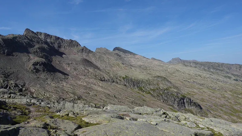
So have everything that you normally use for hiking on high elevation. You are here mostly above 2000 meters, and this means above threeline, and the ground is an igneous rock and grass, see the photo:
Early-season snow, ice, or wet rock can significantly increase the seriousness of these sections. Individual risk tolerance varies.
Some hikers carry a lightweight ferrata set for psychological comfort on exposed cable sections even when it is not strictly required. Route variants, shortcuts, or nearby side trips can occasionally lead onto terrain where ferrata equipment would be advisable.
But all in all, the route is generally considered a demanding alpine hike rather than a via ferrata. In normal summer conditions, most hikers complete the trail without a ferrata set, relying instead on sure-footedness, a head for heights, and solid mountain experience.
Making detours
When you are there and when you inspect maps, you realize that there are many routes around the TL trail. So you can make short detours to nearby huts and lakes and then switch back to the trail.
This will depend on time you have and your plans, but I must say there are so beautiful places around that it would be pity to miss them.
To understand what I mean, have a look at this beautiful place, Bivacco Cece on the lake with the same name. You have a wood burning stove inside and lots of cooking equipment. I used lake water for cooking.
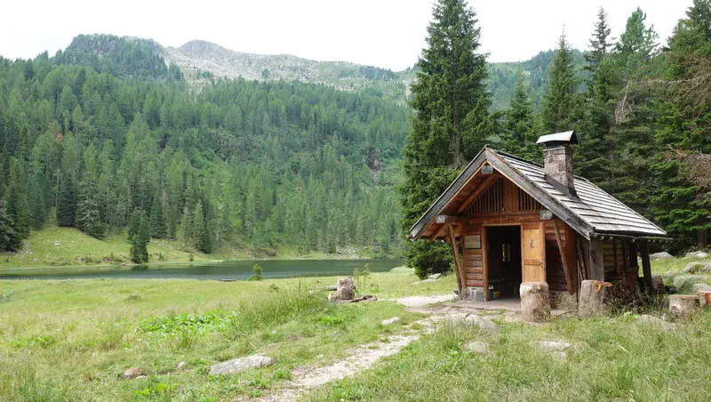
I approached this bivouac from the valley, but you can descend here from the route when you are in the section between Aldo Moro and Paolo e Nicola bivouacs. It does not matter which direction you walk on the main trail, you descend here by following one route and climb back to the trail by following another.
This is not the only place worth visiting, there is also Bivacco Fornassa Alta and Bivacco Valletta Alta close to the Passo Manghen.
You can find all these places in the Dolomites Bivouacs interactive map.
Final thoughts
So the Trans-Lagorai trail is doable as a bivouac to bivouac adventure. But the mentioned gap in the middle of the route may be the only reason for carrying a tent.
On a positive side, the tent is your emergency shelter if the weather changes quickly, this is something you cannot avoid or predict. Also, it may happen that your planned bivouac shelter is full. So have the tent with you for peace of mind if nothing else.
Thank you for reading. Please use the comment box below if you have questions or comments.
Leave a Reply