When you are in the narrow, elongated San Lucano Valley in the Dolomites, the mountains of Pale di San Lucano form a vertical wall along its northern side. Bivacco Bedin sits on top of this wall, on Prima Pala, in a spectacular location.
If you plan to visit Bivacco Bedin, you can approach it from either Pradimezzo or Col di Prà. Allow around 5 hours to reach the bivouac. The shelter has 9 beds with mattresses and a unique oval dining area with multiple windows offering spectacular views.

Quick facts
- Bivacco Margherita Bedin elevation: 2210 m (7251 ft).
- Coordinates: 46.3133294, 11.9789561.
- Route type: walk-up.
- Elevation gain from the parking area: 1370 m (4495 ft).
- Parking coordinates: 46.3395019, 11.9705983.
- Time needed to reach the bivouac from Pradimezzo parking: 5 hours.
- Beds: 9, with mattresses.
- Water: no.
- Nearest place to buy supplies: Cencenighe Agordino.
- Useful map: Marmolada – Pelmo – Civetta – Moiazza, Tabacco map number 15.
Access roads and map
The interactive map below shows the following locations:
- Marker 1: Parking area at Pradimezzo.
- Marker 2: Bivacco Margherita Bedin.
- Marker 3: Parking area at Col di Prà village in the San Lucano Valley, offering an alternative approach.
Zoom in to see more details of the route. Zoom out to see the access roads to the area.
Route description
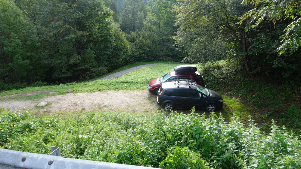
If you approach the bivouac from Pradimezzo, bear in mind that the parking area is very small and can accommodate a maximum of 3–4 cars. You can see it in my photo below.
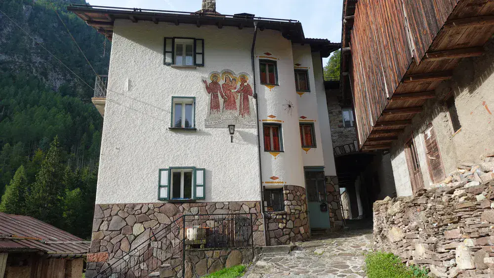
From the parking area, continue uphill along the road. There are a few houses along the way, and the last one is shown below. The route passes through the buildings here:
Soon, you will enter a dense forest, which you will remain in for the next few hours. Make sure you have a torch if you are hiking here in the late afternoon, as it gets dark quite early and finding the path can become difficult.
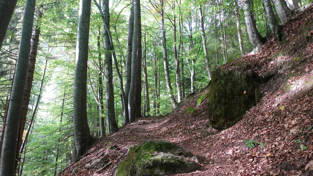
The path is moderate for most of the way and never particularly steep. There is only one section where you have to descend by at least 100 meters. A few cables are provided to help you cross the dry stream bed.
There is only one point along the route where you get a clear view of the Cencenighe Agordino area:

On the way up, you will pass two other bivouacs before reaching Bivacco Bedin.
Bivacco Malga del Torcol
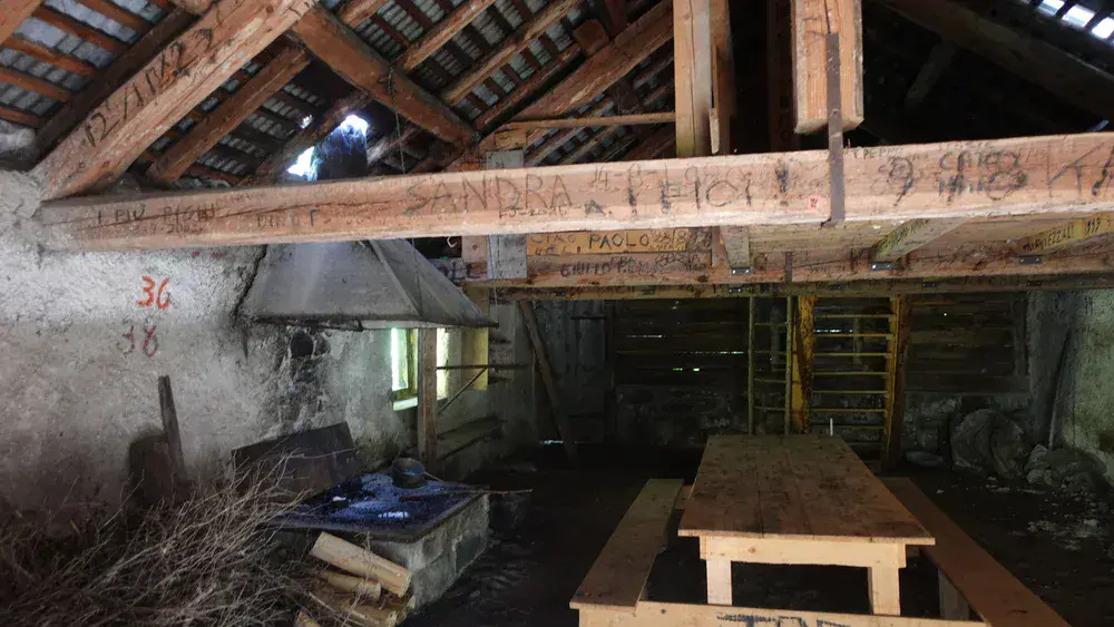
The path passes an old casera (mountain hut) that is always open and free to use. You will reach it about two hours after leaving the parking area, at an elevation of 1400 meters. It can serve as a shelter if you are crossing from the San Lucano Valley to the Cencenighe Agordino Valley.
Zoom in on the map above, and you will find this shelter along route 764 from Pradimezzo.
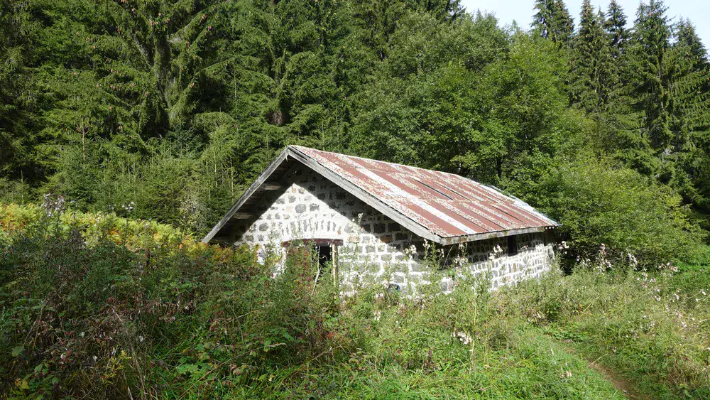
The interior is very basic, and some windows are missing. However, the roof is in good condition, so you can take shelter here during a storm. There is a fire pit, and firewood is available. A small attic above provides sleeping space for two or three people.
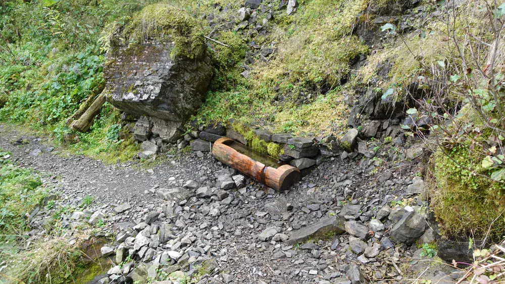
After leaving the hut, continue uphill through the forest, and you will soon reach a water source. I was there in late summer, during a dry season, yet the stream was flowing strongly. Therefore, you can probably count on this water source throughout the year, although seasonal conditions may vary.
Bivacco Malga d’Ambrosogn
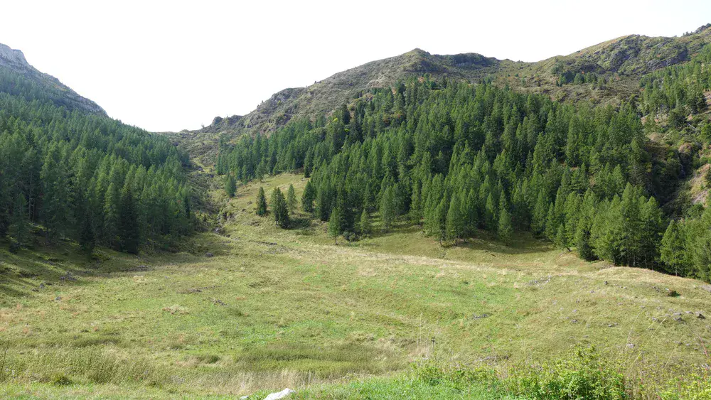
This bivouac is located in Le Larghe, a pleasant, spacious valley at a high elevation. A stream flows through the valley, as you can see in the photo below.
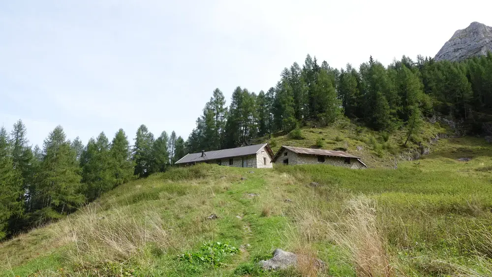
The building was once used as a summer dairy hut, but it now serves as a bivouac that is always open and free to use. The elevation here is around 1700 meters, and I reached it after three hours of hiking.
This is also where the alternative route from the San Lucano Valley joins the main route, as described further below. The alternative route crosses the pass visible on the left in the photo above.
There is water at this bivouac, and this is the last water source along the route.

Inside, there are three separate rooms. They are all very basic and rustic, but the roof is in good condition, and the windows are intact. One room has a fire pit, while another has an old wood-burning stove.

From here, the route continues through the forest for a while, but you soon emerge above the tree line, where the path becomes much steeper and more challenging.
You will now enjoy views of some of the best-known mountains in the Dolomites. The first photo shows the Marmolada group, with Marmolada Punta Penia on the right. In the middle are Cima Ombretta Orientale and Sasso Vernale. The second photo shows the Pale di San Martino group.
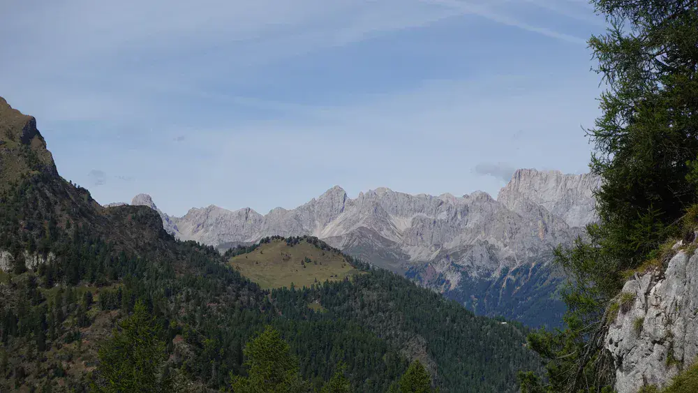
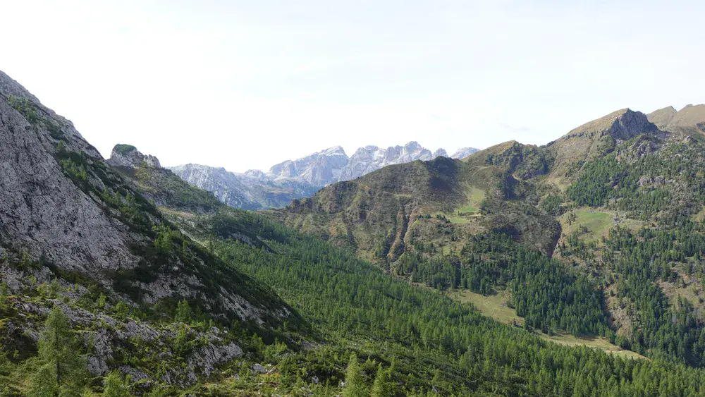
After some more climbing and sweating, you will reach the cliffs of Pale di San Lucano. Here are two photos: the first shows the San Lucano Valley, 1200 meters below, while the second shows the path running along the edge of the cliffs.
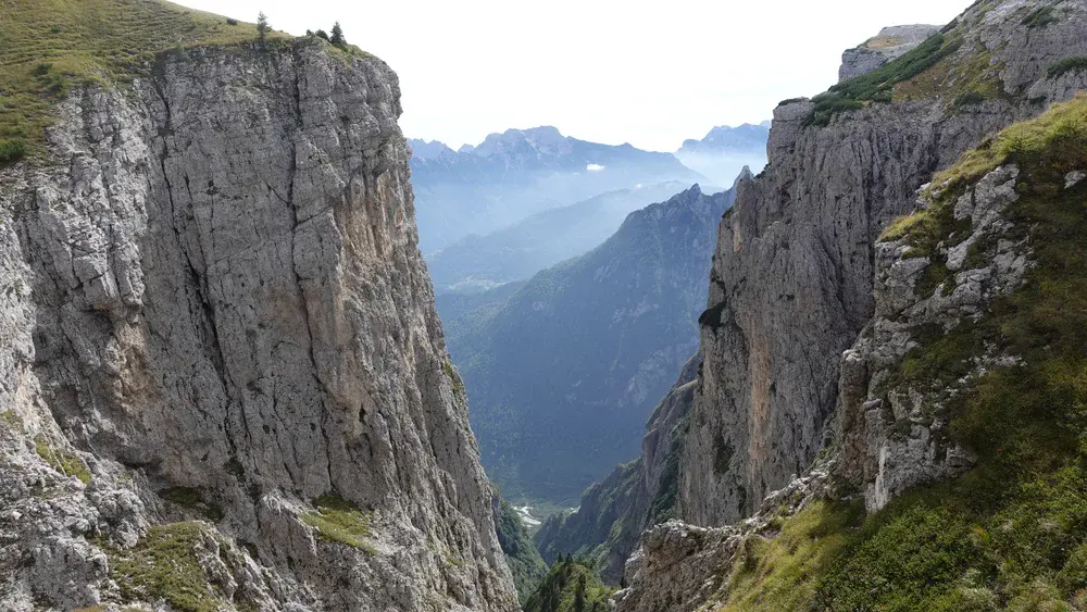

After following three bends along the cliffs, similar to the one shown above, you will finally see Bivacco Bedin in front of you. At that point, you will realize that all the effort was worth it.
The bivouac has a unique shape. It is a metal structure with a roof that differs from those of the usual Berti-style alpine bivouacs. Its front dining area is semicircular, with several windows offering fantastic views of the south-western side of Civetta, Moiazza, and Monte Agner.


From the bivouac, you can see the entire Agordo area. Here is how it looks from the cliffs above:
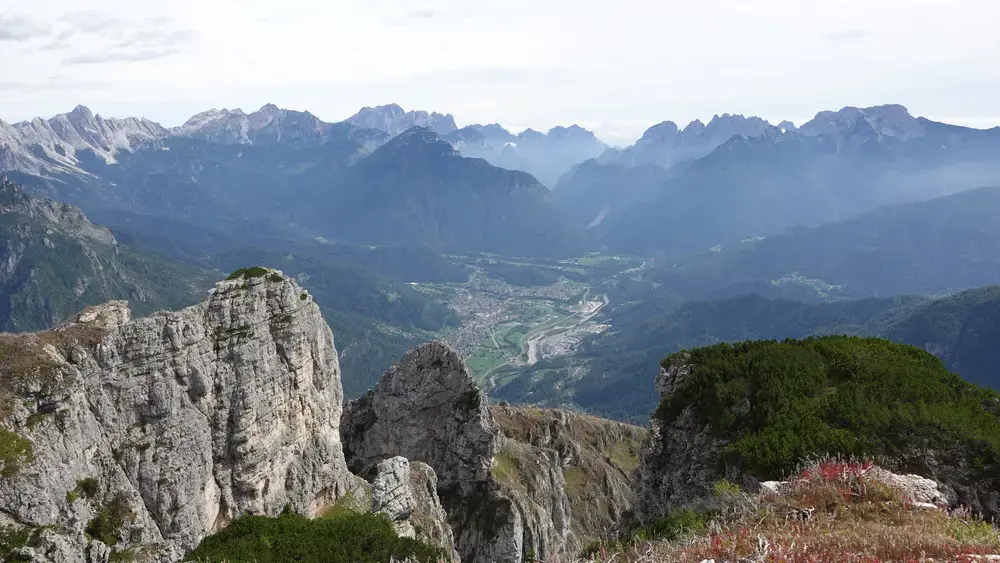
Inside, the sleeping area is typical of alpine bivouacs, with 9 beds, blankets, and good mattresses. However, the dining area is the main highlight here. Take a look at the photos for more details:
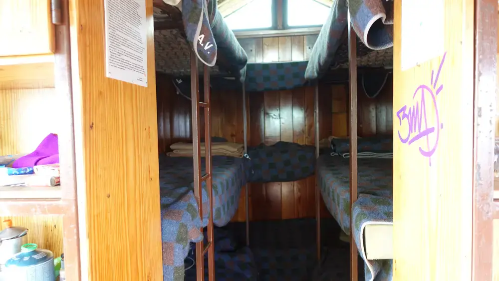
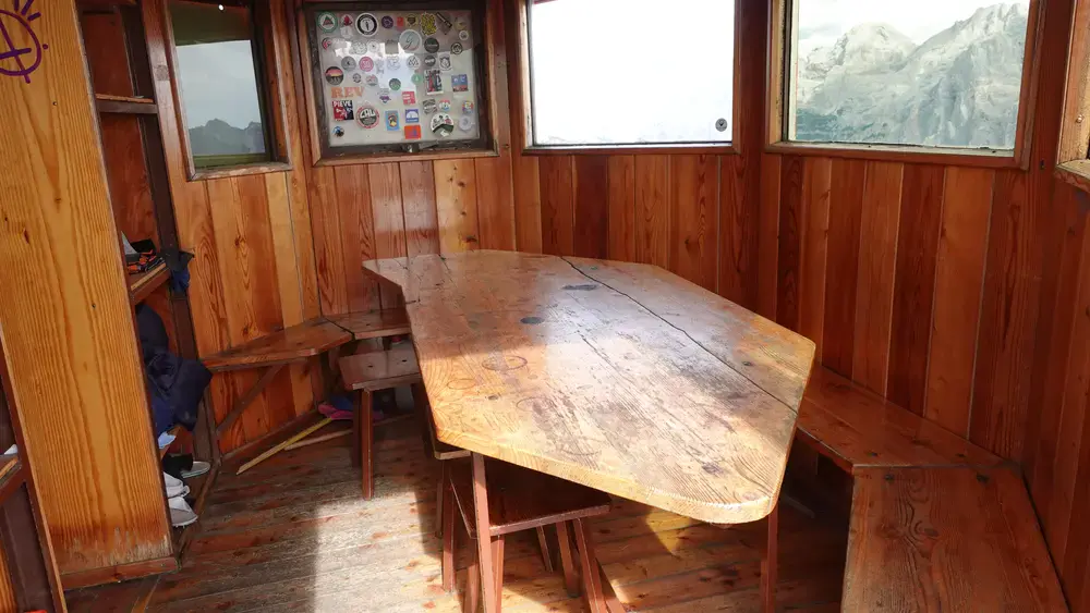

My tour
I started my hike from Pradimezzo at 9 a.m. and reached the bivouac at 2 p.m. It took me five hours, which was longer than I had expected for an elevation gain of 1370 m (4495 ft).
On the way up, I first met two Italians, followed by three young men, possibly foreigners, who had spent the night at Bivacco Bedin. They told me it had been cold and windy.
I had not planned to spend the night there, and that turned out to be a good decision. On my way back, I met three more people and then a man with his dog. It was clear that they were planning to stay overnight, so the bivouac would probably have been a little crowded.
I documented the tour in my video. Take a look:
Alternative approach
The interactive map above shows an alternative approach from the San Lucano Valley, with the trailhead at marker 3. This is the end of the road through the valley, where you will find free parking.
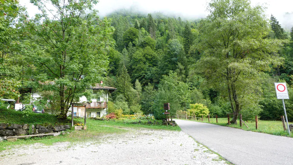
Initially, follow route 761 and then route 764. You can turn this into a multi-day tour by continuing to Bivacco Malga Malgonera, which is the best-equipped bivouac I have ever seen. It even has a hot-water shower and an indoor toilet.
From there, you can continue towards Bivacco Bedin the following day, passing two more bivouacs along the way: first Casera Gardes and then Bivacco Malga Ambrosogn, which you have already seen above. Note that water is available at both shelters.
The Ambrosogn shelter is also on the route if you start from Pradimezzo, so this is where the two routes merge.
I have hiked this alternative route only as far as Malga Malgonera, so I am not familiar with the remaining short section on the southern side of Forcella Gardes. The section between Forcella Gardes and Malga Ambrosogn is visible in the photo shown above in the subsection about the Ambrosogn bivouac.
This alternative approach is therefore very interesting and almost the same length as the route I took, described above. The elevation gain is also similar. The starting point in the San Lucano Valley is at around 880 meters, compared with 840 meters at the Pradimezzo trailhead.
Gear, water & food
This is a walk-up route, so you do not need any special equipment. Standard hiking boots or hiking shoes are sufficient. I used trekking poles and a day pack. As usual, I also carried a rain poncho, rain pants, and a rain jacket.
If you plan to spend the night at Bivacco Bedin, you will need a sleeping bag. For the other two bivouacs, you will also need a sleeping pad. These two shelters are much more basic, but you can light a fire in both, and firewood is available.
Water is available at two points along the route, so there is no need to carry large quantities from the parking area. As for food, you can find shops in the main valley, in Cencenighe Agordino and Taibon Agordino.
Conclusion
Bivacco Margherita Bedin is one of the most spectacular bivouacs in the Dolomites, both because of its unique design and its extraordinary position on the cliffs of Pale di San Lucano.
The hike from Pradimezzo is long and involves a significant elevation gain, but the changing scenery, the two rustic bivouacs along the way, and the increasingly impressive mountain views make the effort worthwhile. Once you reach the top, the panoramic views over the surrounding valleys and famous Dolomite peaks provide a perfect reward for the climb.
If you are planning a visit, remember to bring enough food, a sleeping bag if you intend to stay overnight, and a reliable light source for the forest sections. Water is available along the route, but the last source is at Bivacco Malga d’Ambrosogn, so plan accordingly.
You can approach Bivacco Bedin from either Pradimezzo or the San Lucano Valley, with the latter offering an interesting alternative for a multi-day adventure. Whichever route you choose, Bivacco Bedin is a memorable destination for hikers looking for a more remote and less conventional experience in the Dolomites.
Thank you for reading. Let me know if you have questions or comments; there is a comment section below.
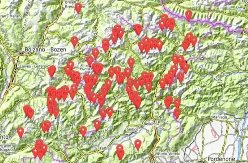
This bivouac, together with more than 140 others, is included in my interactive map available here on the site, see it below. Note that I also have a book titled Dolomites Solo, so have a look if you plan to do some mountaineering tours in the area.
Frequently Asked Questions
How long does it take to hike to Bivacco Margherita Bedin?
Most hikers need between four and five hours from the Pradimezzo parking area to cover the roughly 1370 meters of elevation gain. The path stays moderate through the forest for the first few hours then steepens once you leave the trees.
Expect similar timing from the Col di Prà trailhead in the San Lucano Valley. Start early so you still have daylight for the long forest sections on the way down.
Is drinking water available at Bivacco Bedin?
There is no reliable running water at the bivouac itself. An emergency rainwater collection tank sits outside and must be boiled before use. The last dependable stream is at Bivacco Malga d’Ambrosogn about an hour below the final climb.
In some seasons a weak trickle appears roughly twenty minutes from the shelter along the approach path but it often dries up by midsummer. Fill bottles at Ambrosogn and carry what you need for the night and the descent.
Can I stay overnight and what should I bring?
Yes the shelter is always open and free. It offers nine beds with mattresses and blankets plus a unique semicircular dining area with large windows. Bring your own sleeping bag as temperatures can drop even in summer. A headlamp is essential for the long forest approach.
The bivouac is popular so arrive early or carry a tent as backup if all beds are taken. Leave the place cleaner than you found it and pack out all rubbish.
How difficult is the route and when is the best season?
The hike is rated for experienced walkers because of the sustained elevation gain and the steeper final section along the cliffs. No technical climbing gear is required but solid fitness and steady footing matter.
Snow usually clears by late May or June and returns in October so the practical window runs from early summer through early autumn. Check recent conditions before you go as the alternative route via Forcella Gardes can be affected by past storm damage.
Leave a Reply