This round tour in the Lagorai includes three bivouacs, two lakes, and a moderate summit. It is a walk-up route that does not require special equipment. Keep reading.
Cima Bocche can be climbed from the south (Paneveggio area) or from the north, starting at Passo San Pellegrino. Allow up to 5 hours if approaching from the road in Paneveggio.
Quick facts
- Cima Bocche elevation: 2745 m (9006 ft).
- Nearest places for supplies: Predazzo.
- Summit coordinates: 46.3542158, 11.7527078.
- Route difficulty: walk-up.
- Elevation difference from the car parking: 1245 m (4085 ft).
- Parking coordinates: 46.3067647, 11.7353283.
- Time needed from the parking to the summit: 4-5 hours.
- Bivacco Redolf coordinates: 46.3463608, 11.7339053.
- Bivacco Jellici coordinates: 46.3521933, 11.7526997.
- Bivacco Val Miniera: 46.3329364, 11.7593167.
- Useful map: Pale di San Martino, Kompass, 1:25000.
About the area
Geographically and geologically, the Laghi di Lusia (and the peak above them, Cima Bocche) are often considered the northernmost extension of the Lagorai Chain. They share the same dark, volcanic porphyry rock that defines the Lagorai, rather than the pale limestone/dolomite of the nearby peaks.
Because they sit right above the San Pellegrino Pass and Moena, they are sometimes grouped with the Cima Bocche Group. However, most hiking guides treat them as the wild, “dark” gateway to the Lagorai.
Is it still in the Dolomites? Technically, yes, but with a “but.” While the Laghi di Lusia are located within the geographic region of the Dolomites, they are not part of the “Dolomites” in a strict mineralogical sense.
The area is part of the UNESCO World Heritage buffer zones, but because the rock is volcanic (porphyry) rather than sedimentary (dolostone), it looks very different: dark, rugged, and moody rather than pale and jagged.
The locals often refer to the surrounding peaks as the Fiemme Alps (Alpi di Fiemme) to distinguish this volcanic sub-range from the “Pale Mountains” nearby.
Other names for the area: If you are looking for maps or local guides, you will see this area referred to by a few different names:
- Alpe Lusia: The general name for the high alpine pasture and ski area.
- Cima Bocche Group: The specific mountain subgroup containing the lakes.
- Paneveggio-Pale di San Martino Natural Park: The lakes sit inside this famous protected park (known for the “Violin Forest“).
- Val di Fiemme / Val di Fassa border: It is the literal dividing line between these two famous valleys.
Access roads and map
Below is my interactive and zoomable map where I have added the following markers important for the tour:
- Marker 1: Car parking.
- Marker 2: Bivacco Sandro Redolf.
- Marker 3: Lago di Lusia Inferiore.
- Marker 4: Lago di Lusia Superiore.
- Marker 5: Cima Bocche summit.
- Marker 6: Bivacco Jellici.
- Marker 7: Bivacco Val Miniera.
If you zoom in, you can see lots of details regarding the route. Zoom out to see access roads to the area.
Route description
The route starts from the free parking which is on the left side just before you enter Paneveggio. Note that parking overnight is forbidden. You cannot leave the car anywhere along the road, all the way to Passo Vales and Passo Rolle. So if you plan to sleep in any of the bivouacs, you will have to leave the car in the paid parking above Paneveggio.
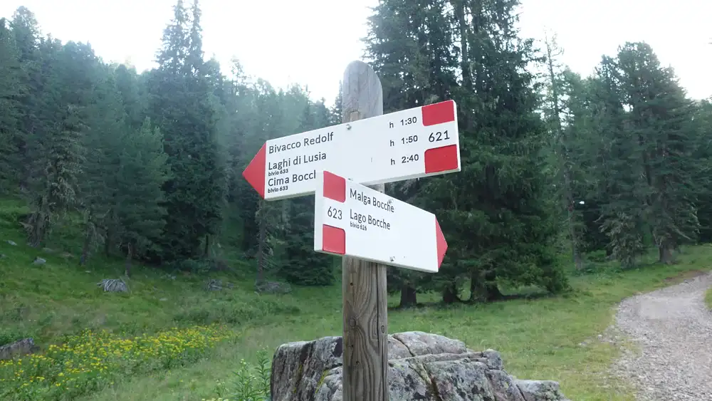
From the parking you walk first along a road that is closed to the public, and then switch to a forest path. Here is a sign to guide you there; the route is 621:
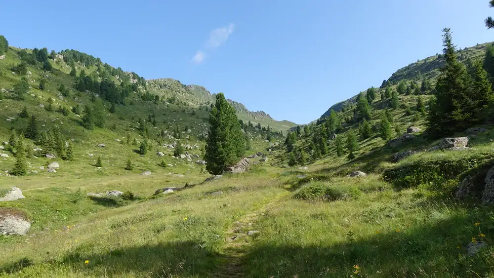
This is a very pleasant walk up and never too steep. The photos show how this looks.

When you are above the forest, the area looks as in the photo below; a water stream is on your left side. The water comes from the lakes that are not far from here.
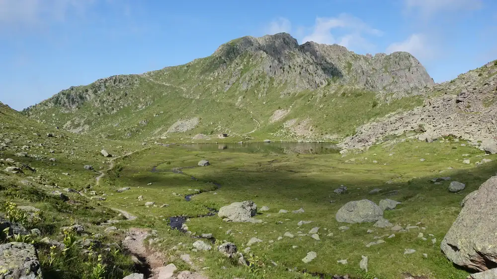
At Lago di Lusia Inferiore
The elevation at the lake is 2333 meters and from the photos you realize this is far above the treeline. Bivacco Sandro Redolf is on the west side of the lake, and there is yet another route that comes here from the west from Rifugio Passo Lusia.
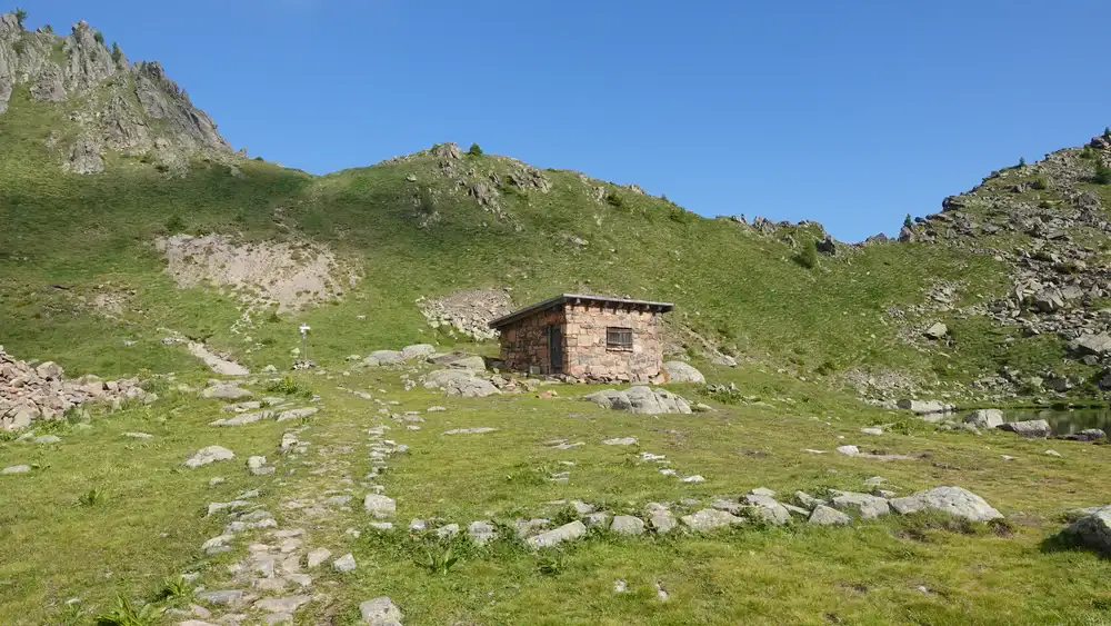
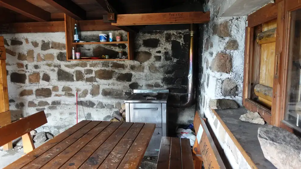
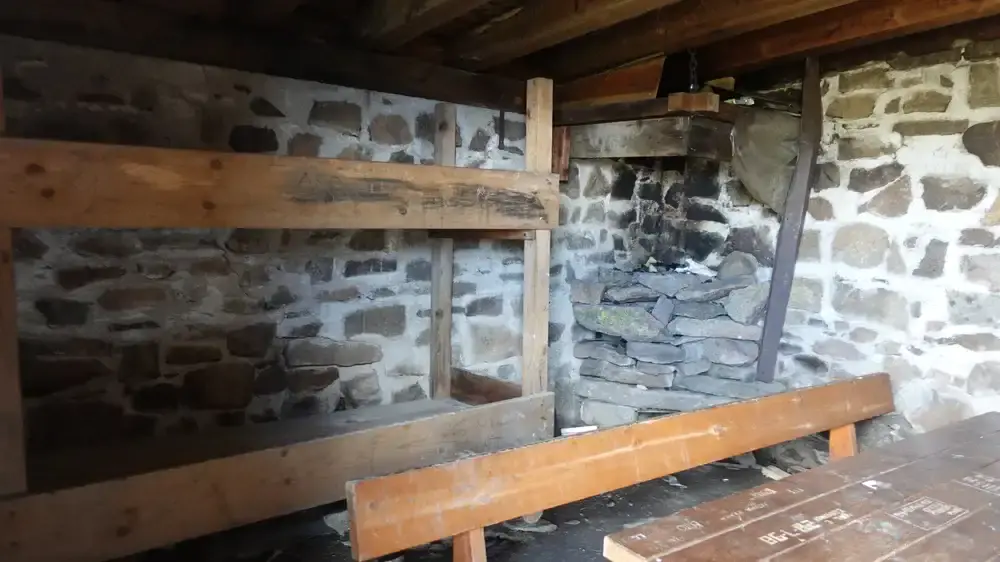
Inside the bivouac, you have a wood-burning stove, a table and benches; see the photo below. Out of the three bivouacs on the route, this is by far the best.
From Bivacco Redolf to the summit of Cima Bocche
From the bivouac you can follow the valley up in the direction of the upper lake. The route is 633 all the way to the summit.
Yet another option is to follow the ridge that you see on the right in the photos below. This is where Ferrata Gronton goes. The two routes merge at Forcella Bocche. The ferrata follows military trenches and installations for WWI, the area is full of them.
Below is my view back toward the lake and bivouac. The route up in the background goes to Rifugio Passo Lusia, and my access route is not visible; it is on the left. The ferrata goes along the ridge on the right in the photo.
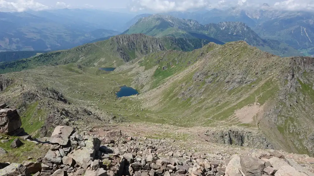
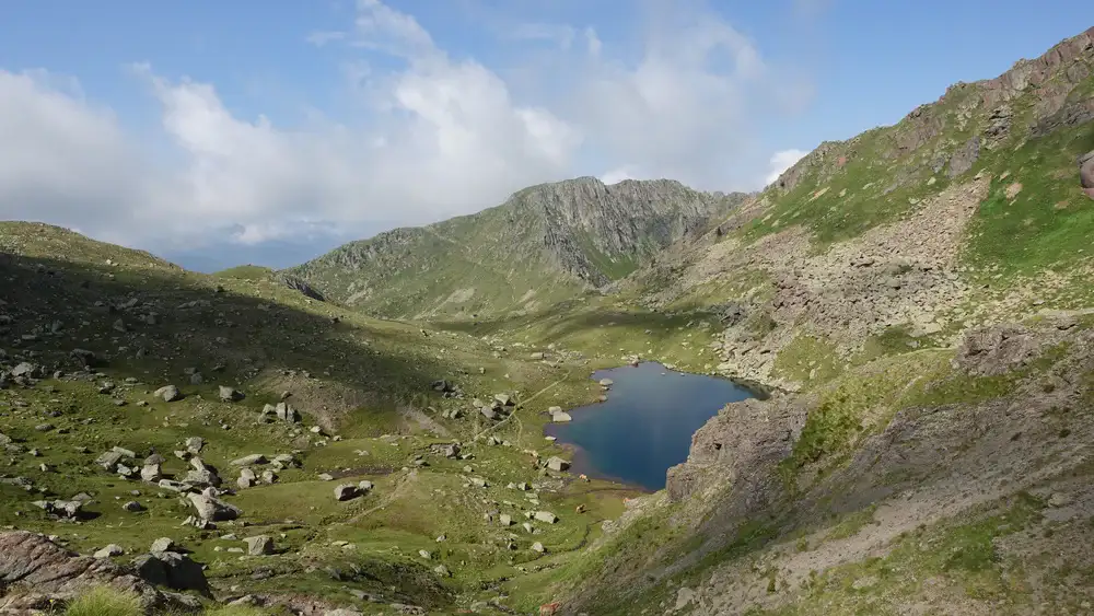
Very soon you are at the second lake and you keep going up; Cima Bocche is occasionally visible. The route climbs up to Forcella Bocche.
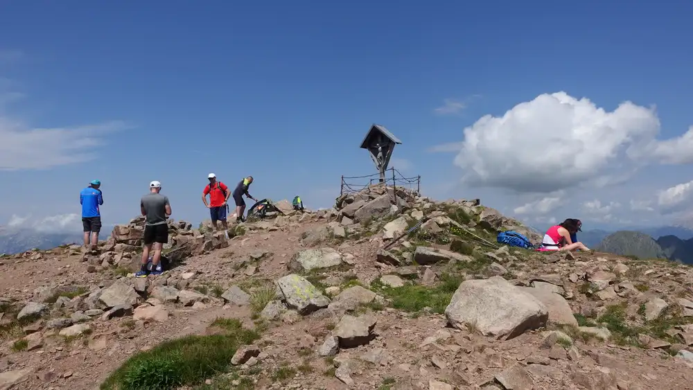
The part below the summit is much steeper but without any exposed passages. It is interesting that Cima Bocche is one meter higher than Monte Paterno, but it cannot be more different. The summit is mild and wide.
From what I have seen, the walk-up route from Passo San Pellegrino is more or less the same type as the south side route from the Paneveggio area.
Descent route; Bivacco Jellici and Bivacco Val Miniera
If you decide to make a round tour, you simply follow the ridge in the south-east direction. The route is 626 and then 623.
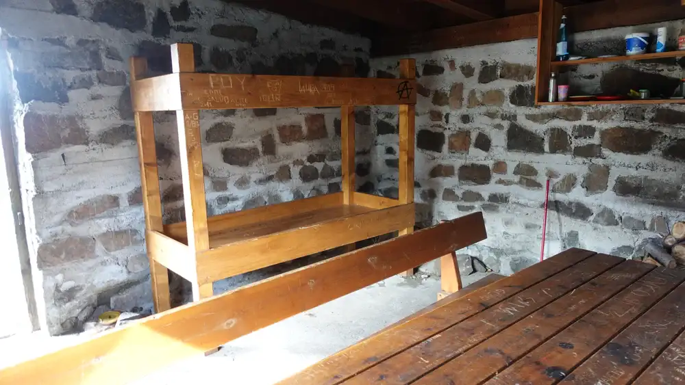
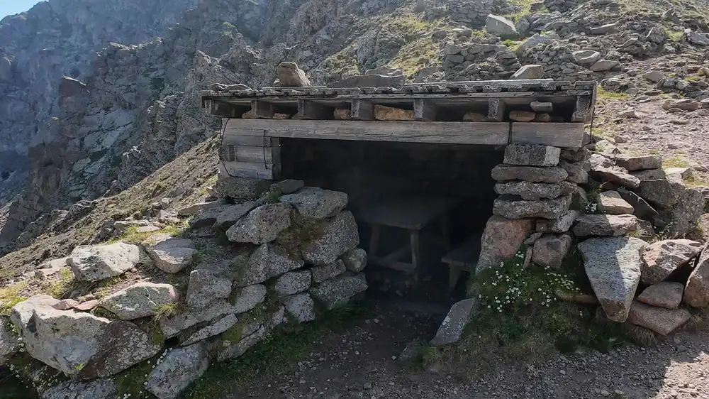
Immediately below the summit you will see Bivacco Jellici (2700 m). It is visible also from the ascent route. Here are a few photos of it:
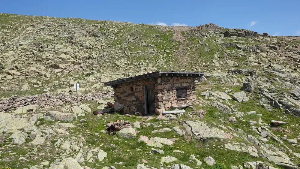
Inside, just a table with benches and simple wood platforms for sleeping, no stove. Good enough in emergency situations and if you have your sleeping bag with you:
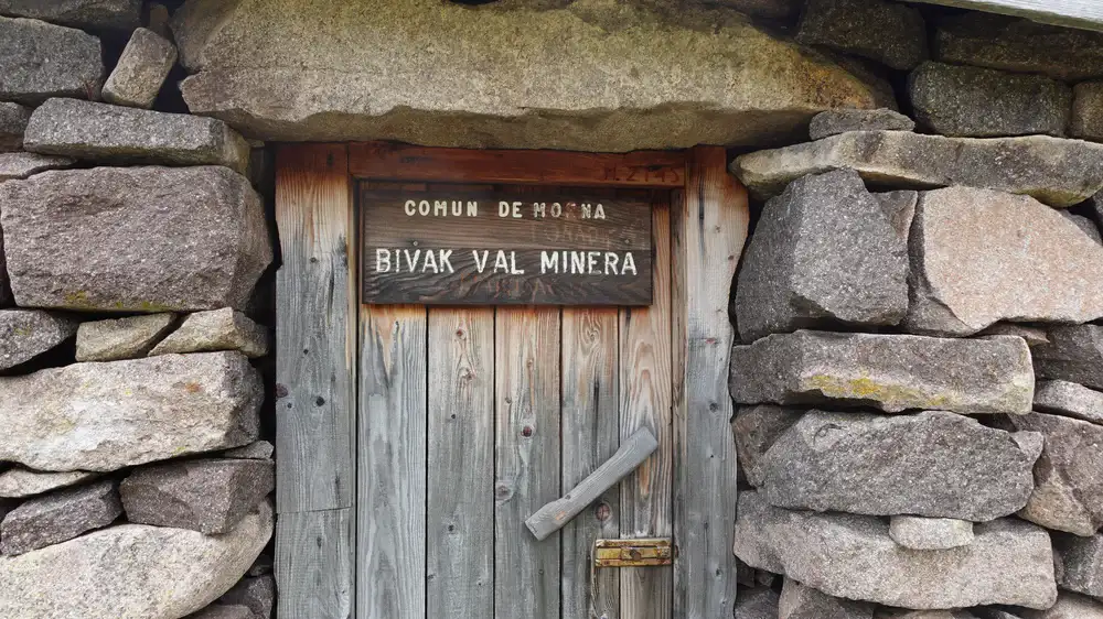
From here, you continue down the mountain and after 80 minutes or so you will have Bivacco Val Miniera (Minera) in front of you. You are at 2145 m of elevation here.
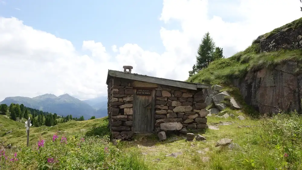
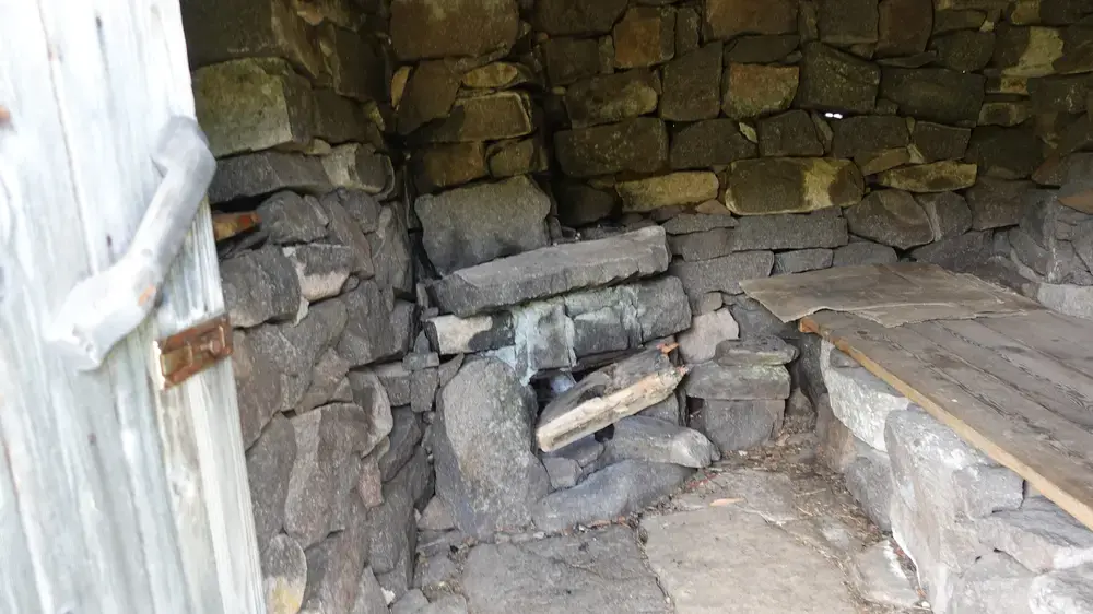
This is more basic than the previous two, and I would not stay there unless it is really necessary. The walls are just stones, no mortar used, so my guess is that mice are there and perhaps even snakes.
While writing these lines, I searched and realized that in principle there are two types of venomous species you might encounter. Though I have never seen any. They are generally shy and will only strike if stepped on or cornered.
So this is about the common European Adder (Vipera berus) that is apparently common in the Lagorai. It prefers the cool, moist environments of high-altitude meadows and rocky scree. You can identify it by the dark zigzag pattern on its back.
The other is the Asp Viper (Vipera aspis). It is typically found on sunny, dry slopes and stone walls. It has a characteristic slightly upturned snout.
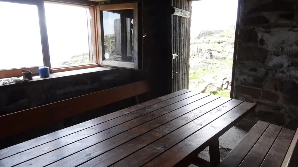
Here is my view inside of the shelter:
At this point you are still very far from the village, and there are a few paths that you can follow. Inspect the map above to see details. It does not matter which path you follow; just go down the valley and you will end up at the main road. You will be in the forest all the time.
My tour
I started from the empty parking at 7 am. The weather was simply perfect, a quiet morning with the sound of nature only, no people around all the way up to the Bivacco Redolf. I arrived there at 9.20 am.
After a short rest, I continued up in the direction of the Lago Superiore. I could see some people coming from Passo di Lusia.
I was on the summit at 12:10, so a bit more than 5 hours in total. However, I wasted quite a lot of time, almost one hour, trying to locate a bivouac that was indicated on the maps under the name Bivacco Gronton.
So from Forcella Bocche I climbed in the west direction where maps show Ferrata Gronton and Spitz del Gronton (2622 m). What I found was just a ruin, so do not count on it; there is no bivouac there.
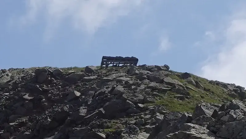
Note also that at Forcella Bocche there is a shelter indicated on maps as Bivacco Forcella Bocche, but I do not include this in my map of bivouacs in the Dolomites. You would not want to stay there in the case of storm. I am pretty sure that roof is not waterproof. See how it looks:
After a long rest on the summit, I descended as described above, and I was back at the car around 5 pm. This was a long but very pleasant tour.
All the tour is presented in my video, please have a look:
What gear to use for this tour?
For this tour you can use any hiking boots or shoes; I used Nortiv 8 boots. I had a pair of trekking poles, and my Mammut Lithium 40 backpack.
The sky was clear, but as usual, in the backpack I had a rain poncho and rain pants, plus a rain jacket. If you do not have any jacket and are not sure what to choose, think about the Mammut Crater Pro HS.
Do you want to walk this route?
If you have any mountaineering experience, you can do this tour as I did. Orientation is never a problem and the routes are marked.
However, if you want to play it safe, get in touch with some experts and guides who can help you.
Final thoughts
This circular tour is in the Lagorai range and includes three bivouacs, two alpine lakes, and Cima Bocche, a moderate summit. The route starts from the Paneveggio parking area and follows a pleasant forest path to Bivacco Redolf at Lago Inferiore. It then continues to Lago Superiore and finishes with an easy walk-up to the summit.
The descent follows the ridge to Bivacco Jellici, just below the top. From there it drops to the basic Bivacco Val Miniera and finally returns through forest trails to the road.
I completed the tour solo in one long day, in perfect weather. I met no one until reaching the summit. Despite a wrong and time-consuming detour toward the ruined Gronton site, I reached the summit in a little over five hours.
The route is well marked and clear. The dark volcanic rock gives the area a wild feel. It contrasts strongly with the pale Dolomite peaks nearby.
Thank you for reading. Let me know if you have questions or comments; there is a comment section below.
These bivouacs, together with more than 120 others, are included in my interactive map available here on the site. Note that I also have a book titled Dolomites Solo, so have a look if you plan to do some mountaineering tours in the area.
Please join us at our Facebook group Dolomites Visitors Hub.
Frequently Asked Questions
Is Cima Bocche suitable for less experienced hikers?
Cima Bocche is suitable for hikers with basic mountain experience and good fitness. The route is a walk up on marked trails with no exposed passages.
What matters most is endurance, since the elevation gain is significant and the day can be long. Weather awareness and navigation skills are still important, especially in fog.
Can the bivouacs be relied on for overnight stays?
The bivouacs on this route are emergency shelters, not staffed huts. Bivacco Redolf offers the best conditions, including a stove, while Jellici and Val Miniera are very basic.
You must carry your own sleeping gear and be prepared for cold temperatures even in summer. Availability is never guaranteed.
When is the best time of year to hike Cima Bocche?
The ideal period is from late June to early October, depending on snow conditions. Early summer may still have snow near the lakes and on the upper slopes. Autumn offers stable weather and few people but shorter daylight hours.
After the first snowfalls the route becomes unsuitable without winter equipment.
Is the area crowded compared to other Dolomites hikes?
No. Even though the area lies close to major passes, the Lagorai remains much quieter than classic Dolomite destinations. Most hikers stay near lifts and refuges, while longer tours with bivouacs see very limited traffic.
Solitude is one of the main reasons to hike here.
Leave a Reply